The best walks and hikes in Eselsburger Tal
4.5
(5067)
21,239
hikers
23
hikes
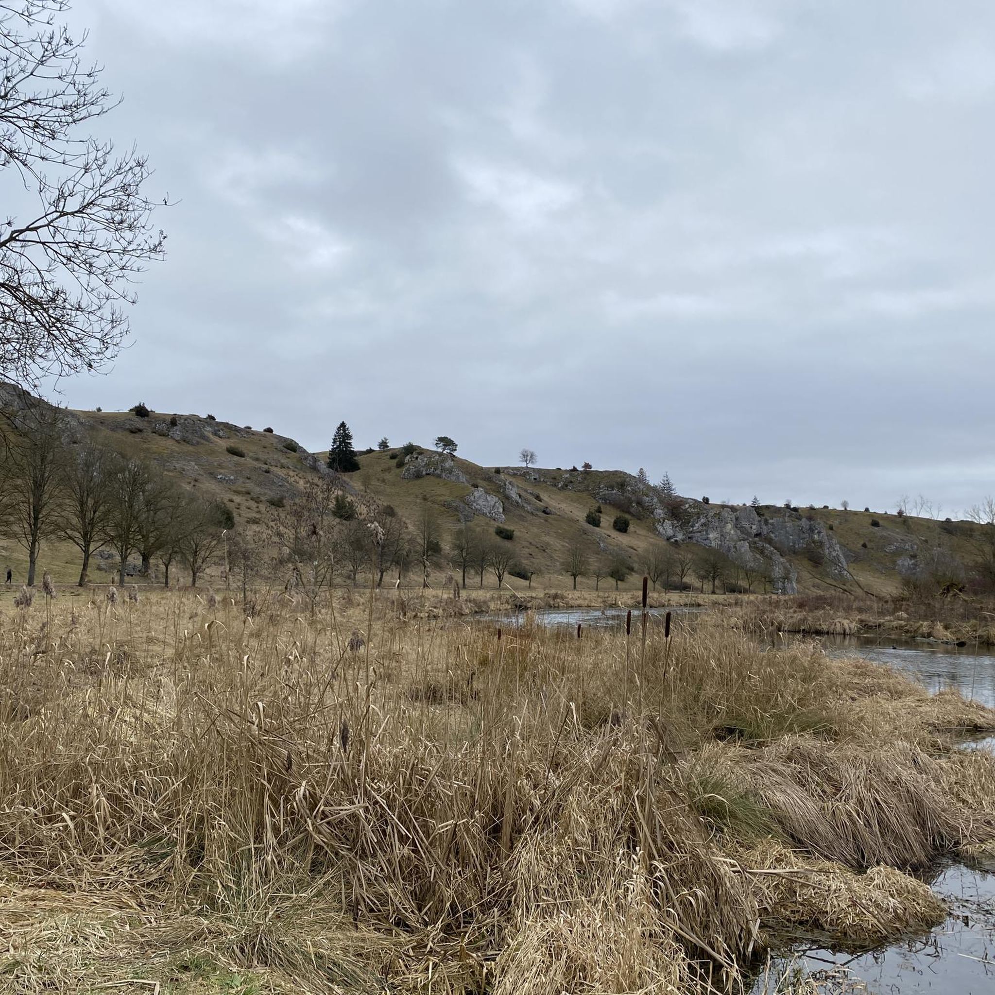
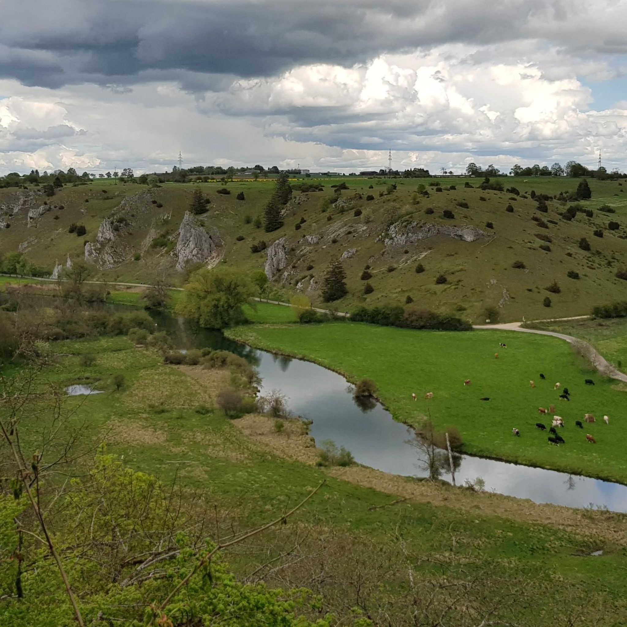
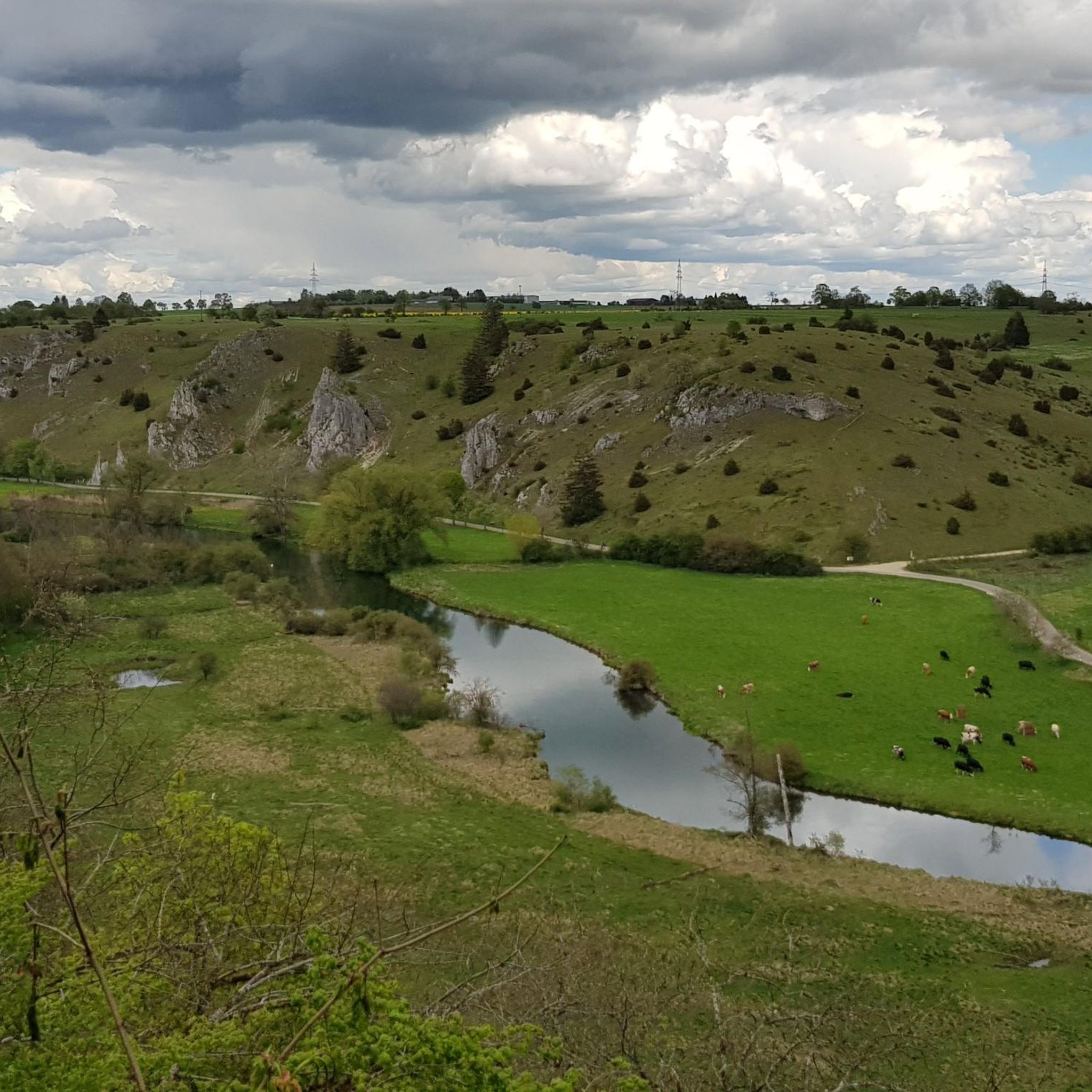
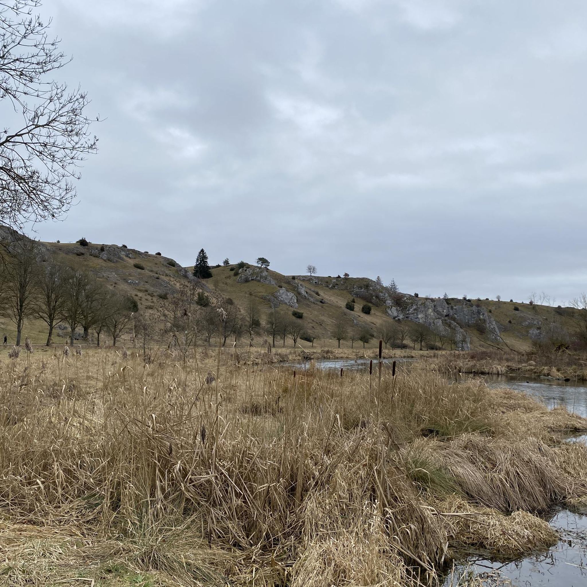
Hiking trails in Eselsburger Tal are located within a protected nature reserve in Baden-Württemberg, Germany. The region is characterized by the meandering Brenz river, which forms a significant loop around the Buigen mountain, creating varied terrain. Hikers can explore steep cliffs, lush forests, and impressive rock formations, alongside juniper heaths and wetlands. The valley offers a diverse landscape for outdoor activities.
Best hiking trails in Eselsburger Tal
- The most popular hiking route is Eselsburger Valley – Zoeppritz Trail loop from…
Last updated: October 8, 2026
4.6
(38)
146
hikers
5.35km
01:28
90m
90m
Easy hike. Great for any fitness level. Easily-accessible paths. Suitable for all skill levels.
4.4
(5)
40
hikers
Hard hike. Great for any fitness level. Sure-footedness, sturdy shoes and alpine experience required.

4.6
(17)
55
hikers
Easy hike. Great for any fitness level. Easily-accessible paths. Suitable for all skill levels.
4.5
(16)
78
hikers
Easy hike. Great for any fitness level. Easily-accessible paths. Suitable for all skill levels.
4.6
(14)
39
hikers
Hard hike. Great for any fitness level. Sure-footedness, sturdy shoes and alpine experience required.
Get access to more routes and recommendations from other explorers.
Already have an account?
Our route recommendations are based on thousands of hikes, rides, and runs completed by other people on komoot.
Start today with a free account
Your next adventure awaits.

Tips from the Community

At the top of the Buingen there is a beautiful shelter and offers a view of the wonderful Eselsburger Tal.
9
0
The Fischerfelsen or Bindsteinfelsen is an impressive sight in the Eselsburger Tal.
6
0

Although busy - lots of pedestrians, closed to cars on Sundays, the landscape is definitely worth the trip - and the slower cycling.
0
0

Striking similarity to the Fohlenhaus in the Lone Valley
1
0

the shortest route from the valley up to the Falkenstein
0
0

The absolute highlight of our tour this year!!! Idyllic nature, a very easy bike path, and plenty of rest stops (especially at the Biotal farm shop & cafe in Eselsburg).
1
0

First, a narrow path with a few steps and a few roots leads to the first obstacle: climbing over the wooden beams. This section requires a high level of surefootedness. Please do not take this path in heavy rain or snow. It's best to "only" go up and not necessarily down this section. After the wooden beams, you walk through a section secured by wooden fences. The last section with the stone steps has a securely anchored metal railing.
0
0

The small town, the nature, and the rock are worth seeing and impressive. A trip here is worthwhile.
3
0
Frequently Asked Questions
How many hiking trails are available in Eselsburger Tal?
Eselsburger Tal offers a wide variety of hiking experiences, with a total of 23 routes documented on komoot. These include 16 easy, 2 moderate, and 5 difficult trails, ensuring options for all skill levels.
What kind of terrain can I expect on hikes in Eselsburger Tal?
The terrain in Eselsburger Tal is quite diverse, characterized by the meandering Brenz River, which creates a distinctive valley. You'll encounter striking rock formations like the Stone Maidens rock formations, alongside juniper heaths, wetlands, and dense forests. Rolling hills and elevated points like Falkenstein provide spectacular views, with paths ranging from easy valley floors to more challenging ascents.
Are there any family-friendly hiking options in Eselsburger Tal?
Yes, Eselsburger Tal has several family-friendly routes. Many trails are easy and relatively short, perfect for outings with children. The region also features a nature trail along the banks of the Brenz, offering insights into local flora and fauna, and a "new castles and legends trail" around Eselsburg that brings local myths to life.
Can I bring my dog on the trails in Eselsburger Tal?
Eselsburger Tal is generally dog-friendly, with many trails suitable for walks with your canine companion. However, as it is a protected nature reserve, it's always best to keep dogs on a leash to protect wildlife and ensure a pleasant experience for all visitors. Please be mindful of local regulations.
What are some notable natural landmarks or viewpoints to see?
The valley is famous for its unique natural features. Don't miss the bizarre Stone Maidens rock formations, a protected geotop within the Swabian Alb Geopark. The Eselsburger Valley itself, with the Brenz River's unique loop around Buigen hill, offers stunning vistas. Elevated points like Falkenstein provide panoramic views of the entire area.
Are there any historical sites or ruins to explore while hiking?
Absolutely. Eselsburger Tal is rich in history. You can explore the Falkenstein Estate, which includes castle ruins, and discover traces of other old castles like Hürgenstein and Bindstein. A popular circular trail also leads around the Ebersberg castle ruins, offering scenic views and resting spots.
Are there circular routes available in Eselsburger Tal?
Yes, many of the trails in Eselsburger Tal are circular, allowing you to start and end at the same point. A popular option is the Eselsburger Valley – Zoeppritz Trail loop from Eselsburger Tal, which is an easy 5.4 km route. Another great choice is the View of Falkenstein Rock – View of the Eselsburger Valley loop from Herbrechtingen, an easy 7.2 km path offering panoramic views.
What is the best time of year to go hiking in Eselsburger Tal?
Eselsburger Tal is beautiful year-round, but spring and autumn are particularly popular. In spring, the blooming of spring snowflakes in the hillside forests between Anhausen and Falkenstein adds a magical touch. The diverse ecosystem of juniper heaths, wetlands, and dense forests offers varied terrain and beautiful vistas throughout the year, making it a great destination in any season.
Is there parking available near the hiking trails?
Yes, parking is generally available at common starting points for hikes in Eselsburger Tal. Specific parking areas can often be found near popular trailheads or attractions within the valley, making access convenient for visitors arriving by car.
What do other hikers say about the trails in Eselsburger Tal?
The hiking trails in Eselsburger Tal are highly regarded by the komoot community, boasting an average rating of 4.5 stars from over 4500 reviews. Hikers frequently praise the region's stunning natural beauty, the unique rock formations, and the well-maintained paths that cater to various fitness levels.
Are there any longer or more challenging hikes for experienced hikers?
While many trails are easy, Eselsburger Tal also offers options for more experienced hikers. For example, the Falkenstein Estate – View of Falkenstein Rock loop from Eselsburger Tal is classified as a difficult hike, covering nearly 4 km with significant elevation changes. These routes provide a greater challenge and often lead to more secluded viewpoints.
What makes Eselsburger Tal a unique hiking destination?
Eselsburger Tal stands out due to its unique combination of natural beauty and historical elements. The meandering Brenz River, the dramatic Stone Maidens rock formations, and the diverse landscapes of juniper heaths and forests create a picturesque backdrop. The presence of ancient castle ruins and the Jägersteg Bridge across the Brenz further enrich the hiking experience, offering a blend of nature and culture.
Most popular routes in Eselsburger Tal
Most popular attractions in Eselsburger Tal

Get inspired with the komoot mobile app


Explore more
Browse the best Hikes in other regions.
