The best running trails in Bunder- En Elslooërbos
4.3
(772)
40,148
runners
1,374
runs
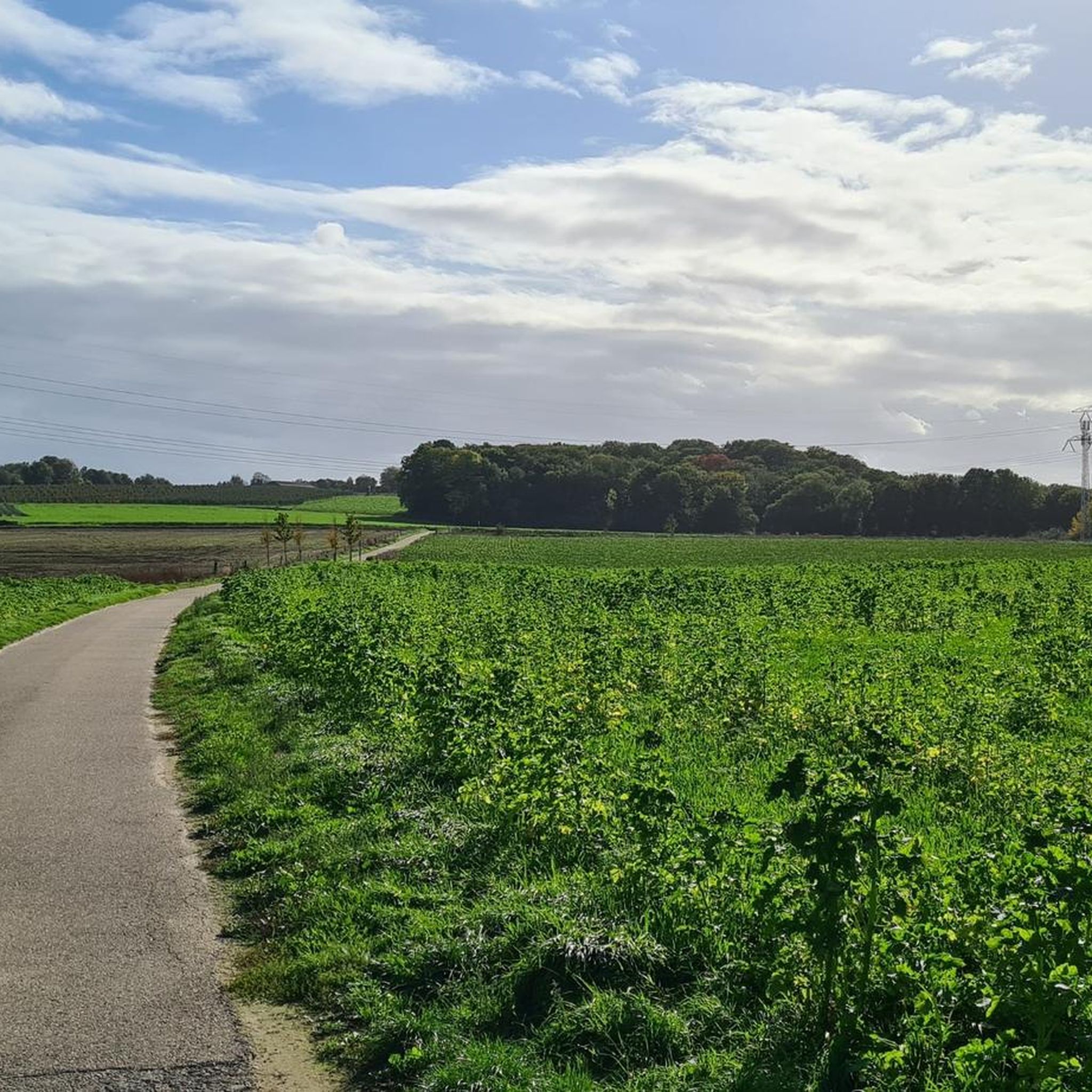
Jogging in Bunder- En Elslooërbos offers diverse natural landscapes within the South Limburg Hill Country. The region features steep hillside forests, including the Hoge and Lage Bos, providing varied elevations for challenging workouts. Numerous calcium-rich spring brooks and ancient oak-hornbeam forests characterize the terrain, creating a serene and biodiverse environment. This combination of hills, valleys, and water features ensures a varied and engaging experience for runners.
Best jogging routes in Bunder- En Elslooërbos
- The most popular jogging route is Woodhenge…
Last updated: July 4, 2026
80
runners
7.25km
00:45
40m
40m
Moderate run. Good fitness required. Mostly paved surfaces. Suitable for all skill levels.
3.0
(2)
44
runners
17.4km
01:48
40m
40m
Hard run. Very good fitness required. Mostly paved surfaces. Suitable for all skill levels.

Sign up for free
4.0
(1)
43
runners
10.6km
01:17
180m
180m
Moderate run. Good fitness required. Mostly paved surfaces. Suitable for all skill levels.
44
runners
15.0km
01:36
50m
50m
Hard run. Very good fitness required. Mostly paved surfaces. Suitable for all skill levels.
27
runners
18.4km
01:56
50m
50m
Hard run. Very good fitness required. Mostly paved surfaces. Suitable for all skill levels.
Get access to more routes and recommendations from other explorers.
Sign up for free
Already have an account?
Our route recommendations are based on thousands of hikes, rides, and runs completed by other people on komoot.
Start today with a free account
Your next adventure awaits.
Login or Signup

Tips from the Community

The parish of St. Martin was founded before or around the year 1000. It is not known when the first and second churches were built. The first church is said to have been made of wood and the second church of marl. The west tower was built in the 14th century. The Gothic choir was built in 1626. In the period 1664-1806/1820 (depending on the source), the church was used by the Roman Catholic parish of H. Martinus and the then Reformed (Protestant) community of Geul. It was also a refuge for Protestants living on the other side of the Maas in the land of Rekem. In the years 1919-1920, a part was demolished and rebuilt. The church at the time, which was demolished, would have been the third church. From this church, after a cross enlargement, only the priest's choir, which is now used as a daily chapel, and the tower remain. The new nave was rebuilt through the existing church and is based on the design of the Maastricht architect Hubert van Groenendael. This gave the church its typical cross shape.
7
0
The stables of the old moated castle Schloss Geulle, demolished in 1850, have been converted into comfortable accommodation with elegantly landscaped gardens within the moat. Guest rooms with fireplace, fully equipped kitchen, bicycles and free Wi-Fi. Numerous golf courses and excellent Michelin-starred restaurants in the surrounding area.
7
0
The Bundebrücke over the Julianakanal can be reached via a slightly winding path, which is however very easy to ride.
8
0
The castle can be visited on Saturdays from 10 am. Admission: €10,-
10
0

You can look down from various places, to Geulle aan de Maas (with its striking church) which lies between the Maas and the Julianakanaal, and of course much further. But the Penderjansknub and Snijdersberg are the “place to be” for the best view now. The view from the Snijdersberg and the Penderjansknub was apparently still much freer, according to a book with old postcards, according to an article about it on the website of the local history association Gäöl. Thus, people from the village could see the different parts: from top to bottom, but of course also the other way around! The view on the Penderjansknub was created after discussions with Staatsbosbeheer by the village community. Because without tree felling on the slope, there is no longer any view, of course – and then your village-past experience is completely gone. A little further than the Penderjansknub, at the picnic spot of Snijdersberg, you have a viewpoint. You do have to walk there, to the bench furthest from the road. Did you know: the Penderjansknup (apparently with a "p") is or was the carnival award of De Bokkerieers, the local carnival association. More at http://geulle.com/wordpress/?page_id=163
3
0

The Elsoër forest is the steepest slope forest in the Netherlands! All sorts of spring streams flow through the forest. This special ecosystem is home to rare forest plants and aquatic animals such as newts and frogs. This piece of nature is so special that it has been included as a protected area by the European Union.
4
0
In addition to pedestrian traffic, the place also serves as a passage for the fast-flowing Hemelbeek. The pedestrian path is narrow and dark, especially if you encounter oncoming traffic, it is best to be careful not to step off the path.
6
0
Besides the tribute to cycling heroes, it is also an ode to the Maasberg, the only cobblestone climb in the Netherlands which is often a prominent point in races in South Limburg.
4
0
Frequently Asked Questions
How many running routes are available in Bunder- En Elslooërbos?
Bunder- En Elslooërbos offers a vast network of over 1200 running routes. This includes a good mix of easy, moderate, and difficult trails, ensuring there's something for every fitness level.
What kind of terrain can I expect when jogging in Bunder- En Elslooërbos?
The region is characterized by diverse terrain, including steep hillside forests, particularly the Hoge and Lage Bos, which provide challenging inclines and descents. You'll also find serene paths alongside numerous calcium-rich spring brooks and through ancient oak-hornbeam forests, offering a varied and engaging experience.
Are there any family-friendly running trails in Bunder- En Elslooërbos?
Yes, the area offers several routes suitable for families. While specific 'family-friendly' routes aren't explicitly named, the presence of easy trails and diverse natural features like the Elslooërbos Nature Trails and the Forest Trail and Park Behind Elsloo Castle make for enjoyable outings with children. Look for routes marked as 'easy' for a more relaxed experience.
Can I bring my dog on the running trails in Bunder- En Elslooërbos?
Generally, dogs are welcome in Bunder- En Elslooërbos, but it's always best to keep them on a leash, especially given the rich biodiversity and presence of wildlife like the fire salamander and beaver. Always respect local signage regarding dog policies, particularly in protected areas managed by Staatsbosbeheer.
What are some interesting natural features or landmarks to see while running?
Bunder- En Elslooërbos is renowned for its 'most beautiful spring forests' in the Netherlands. You can discover numerous calcium-rich springs like the Terhagerpötje Spring and ancient oak-hornbeam forests with rare plants. Other notable sights include the Bunder and Elslooërbos rail tunnel and the challenging Slingerberg Climb.
Are there any circular running routes in the area?
Yes, many of the running paths in Bunder- En Elslooërbos are designed as circular routes, allowing you to start and finish at the same point. An example is the Maas River Near Urmond – View of the River Maas loop from Elsloo, which offers a moderate 14.6 km run.
What is the best time of year to go running in Bunder- En Elslooërbos?
The diverse flora and ancient forests make Bunder- En Elslooërbos beautiful year-round. Spring is particularly stunning with wildflowers like wood anemone and wild garlic. Autumn offers vibrant foliage. The varied terrain and shade from the forests can be beneficial during warmer months, while the challenging hills provide a good workout in cooler seasons.
Where can I park when visiting Bunder- En Elslooërbos for a run?
While specific parking locations are not detailed in the guide, the area is accessible, and parking facilities are typically available near popular entry points to natural reserves. It's advisable to check local maps or community information for designated parking areas close to your chosen starting point, such as near Elsloo or Bunde.
How can I reach Bunder- En Elslooërbos using public transport?
Bunder- En Elslooërbos is situated in the South Limburg Hill Country, with nearby towns like Bunde and Elsloo. Public transport options, such as local bus services, connect these towns to larger hubs. Check regional transport schedules for the most convenient stops near the forest entrances.
What do other runners enjoy most about the trails in Bunder- En Elslooërbos?
The running routes in Bunder- En Elslooërbos are highly rated by the komoot community, with an average score of 4.3 stars from over 700 reviews. Runners frequently praise the varied terrain, the beauty of the ancient forests, and the serene experience of running alongside the spring brooks. The challenging hills are also a highlight for those seeking a more intense workout.
Are there any less crowded running routes in Bunder- En Elslooërbos?
With over 1200 routes available, it's possible to find quieter trails, especially during off-peak hours or by exploring some of the less-trafficked paths. Consider a route like the Running loop from Snijdersberg, which offers a moderate 11.1 km experience away from the most popular starting points.
Are there any cafes or pubs near the running trails in Bunder- En Elslooërbos?
The towns bordering Bunder- En Elslooërbos, such as Bunde and Elsloo, offer various amenities including cafes and pubs where you can refuel after your run. These establishments are typically found in the village centers, a short distance from the forest edges.
Most popular routes in Bunder- En Elslooërbos
Most popular attractions in Bunder- En Elslooërbos

Get inspired with the komoot mobile app


Explore more
Browse the best Running Trails & Routes in other regions.
