The best MTB trails in Kasteeldomein Van Westmalle En Omgeving
4.3
(417)
8,909
riders
180
rides
Mountain biking in Kasteeldomein Van Westmalle En Omgeving offers a network of trails through a predominantly flat landscape. The region is characterized by extensive dense woodlands, open fields, and areas with sandy paths and gravel tracks. Elevation changes are minimal, making it suitable for riders seeking less strenuous climbs. These features provide a varied terrain for mountain bikers to explore.
Best mountain bike trails in Kasteeldomein Van Westmalle En Omgeving
- The most popular mountain bike trail is Forest Path Between…
Last updated: August 18, 2026
32
riders
Moderate mountain bike ride. Good fitness required. Suitable for all skill levels.
4.0
(3)
307
riders
45.5km
02:42
60m
60m
Hard mountain bike ride. Good fitness required. Advanced riding skills necessary. Some portions of the route may require you to push your bike.

Sign up for free
4.7
(15)
356
riders
73.3km
04:47
110m
110m
Moderate mountain bike ride. Good fitness required. Advanced riding skills necessary.
4.2
(5)
39
riders
Easy mountain bike ride. Great for any fitness level. Suitable for all skill levels.
7
riders
Moderate mountain bike ride. Great for any fitness level. Advanced riding skills necessary.
Get access to more routes and recommendations from other explorers.
Sign up for free
Already have an account?
Our route recommendations are based on thousands of hikes, rides, and runs completed by other people on komoot.
Start today with a free account
Your next adventure awaits.
Login or Signup
Popular around Kasteeldomein Van Westmalle En Omgeving
Tips from the Community

History The chapel was erected in 1626. At that time, the region was plagued by a pest epidemic. Legend has it that about 60 inhabitants of Oostmalle fled the village with the disease to the heath at Zalfen. Adriaan Mattheeusen, an inhabitant of Zalfen, who lost some of his children to the epidemic, was obliged to bury them in the heath and erected a chapel in their memory. Soon, the chapel served for funeral services, and the dead were buried in the adjacent cemetery. The chapel soon became an attraction for pilgrims. For this reason, it was enlarged in 1726 to its current appearance (see upper part in the side gable dated by means of sintered stone). The chapel is depicted on Ferraris' cabinet map (1770-1778) on a triangular plot of heath. A loop of tall trees surrounds the chapel. On Vandermaelen's map (1846-1854), the chapel is located south of the Salphen road, amidst a triangular forest plot. Description The Sint-Antonius chapel of Salphen is located south of the Salphen road, an old avenue of predominantly tall English oaks (Quercus robur), and is surrounded by tall trees (mainly Scots pine, Pinus sylvestris). It is an oriented brick chapel with a three-sided closed west facade and a lower rectangular choir under slate gable roofs (ridge parallel to the street) with a bell tower. On the east side, there are two tuit-gables on shoulder pieces with crenellations. On the north side, there are rectangular windows and a basket-arch door and a basket-arch door. The plastered and painted interior has a wooden frame with a tie beam. The furniture includes an altar from the 19th century and a painted wooden statue of Saint Anthony Abbot (late 15th or early 16th century).
0
0

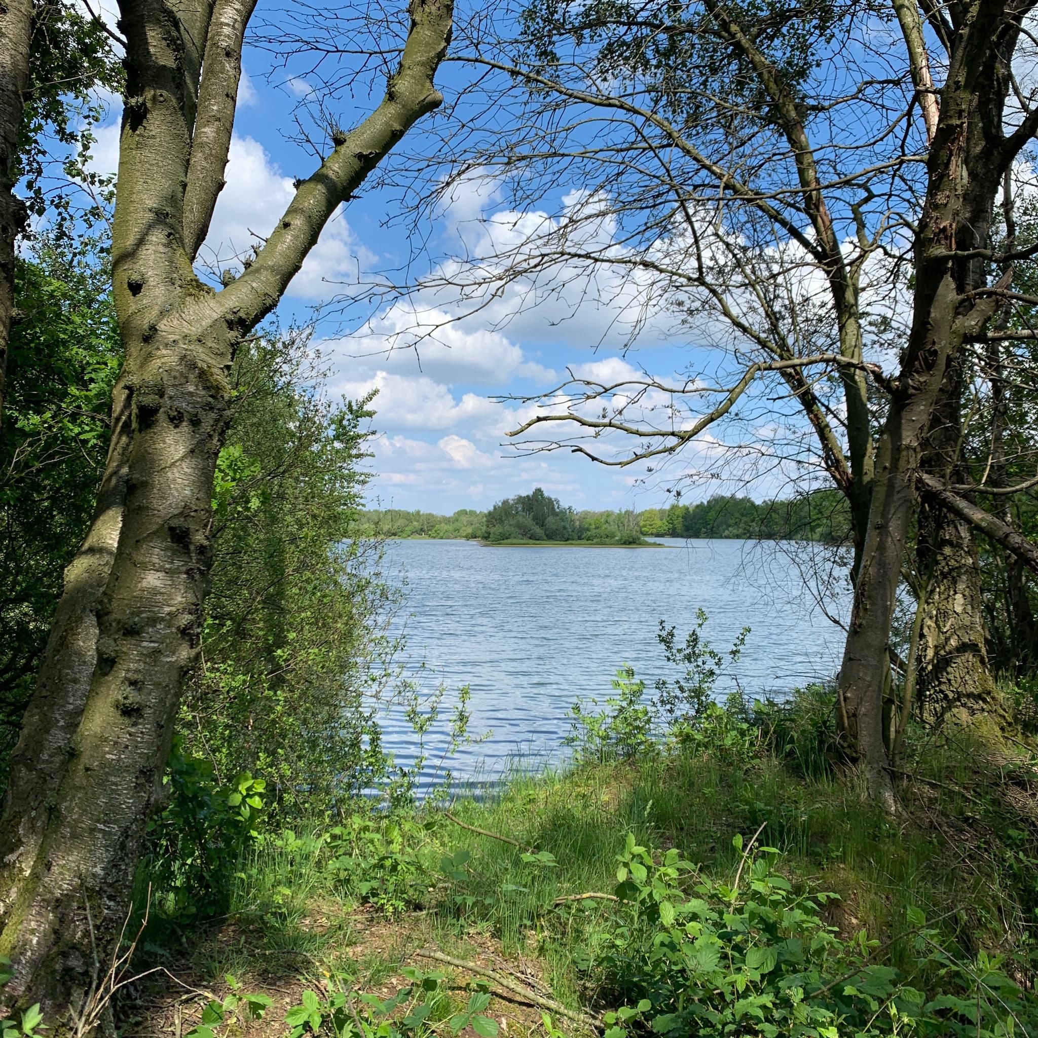
Beautiful view of the small part of the E10-plas
0
0

Very beautiful castle almost in the center of Oostmalle and yet surrounded by tranquility
0
0

Beautiful avenue with a cycle and walking path; the avenue leads towards the abbey.
0
0
Path through the forest towards the abbey and brewery of Westmalle.
0
0
Beautiful walking and cycling path through an avenue.
0
0
Wide forest path that runs alongside a small stream.
0
0
Single track through the forest near the Abbey of Westmalle
0
0
Frequently Asked Questions
How many mountain bike trails are available in Kasteeldomein Van Westmalle En Omgeving?
There are over 160 mountain bike routes in Kasteeldomein Van Westmalle En Omgeving, offering a wide variety of options for different skill levels and preferences.
What is the general difficulty level of mountain biking in Kasteeldomein Van Westmalle En Omgeving?
The region offers a mix of difficulties, with 39 easy, 105 moderate, and 22 difficult trails. The landscape is predominantly flat with minimal elevation changes, making many routes accessible, while some singletrack sections provide a challenge for experienced riders.
Are there any family-friendly mountain bike trails in the area?
Yes, the region's generally flat terrain and numerous easy routes make it suitable for families. Trails like Forest Path Between Tall Trees – Forest Path Near the Brewery loop from Westmalle, which is 15.8 miles (25.4 km) long and rated easy, are great options for a family outing.
Where can I find challenging mountain bike routes?
For more advanced riders, there are 22 difficult trails available. A notable challenging route is Zaligheden Singletrack – Short Forest Trail loop from Malle, which features demanding singletrack sections within a dense forest environment.
Are there circular mountain bike routes in Kasteeldomein Van Westmalle En Omgeving?
Yes, many of the mountain bike routes in the area are circular, allowing you to start and end at the same point. For example, the Forest Path – Sandy Path Between Pine Trees loop from Oostmalle is a difficult 42.7 km circular route.
What kind of terrain can I expect on the mountain bike trails?
The trails primarily feature extensive dense woodlands, open fields, and areas with sandy paths and gravel tracks. The landscape is predominantly flat, with minimal elevation changes, offering a varied but generally less strenuous riding experience.
What are some interesting landmarks or attractions I can see along the mountain bike trails?
While riding, you might encounter historical sites and natural features. Notable attractions include Westmalle Castle, a serene Tree chapel, and the scenic Castle Avenue. These points of interest offer a chance to pause and explore.
When is the best time of year to go mountain biking in Kasteeldomein Van Westmalle En Omgeving?
The trails are generally accessible year-round. However, spring and autumn offer pleasant temperatures and beautiful scenery. During winter, some sandy paths might become softer, but the flat terrain typically remains rideable.
Can I find places to eat or drink near the mountain bike trails?
While specific cafes directly on the trails are not listed, the region of Westmalle is known for its Trappist Abbey and brewery. You can often find establishments offering refreshments and local specialties in the towns and villages surrounding the trail network.
What do other mountain bikers enjoy most about the trails in Kasteeldomein Van Westmalle En Omgeving?
The area is highly rated by the komoot community, with an average score of 4.2 stars from over 300 reviews. Riders often praise the diverse terrain, including long gravel tracks through tall trees and challenging singletrack sections, as well as the peaceful woodland environment.
Is there parking available near the mountain bike trails?
Yes, parking is generally available in the towns and villages that serve as starting points for the trails, such as Westmalle, Malle, and Oostmalle. Specific parking information can often be found on individual route pages on komoot, like for the Kruis van Blommerschot – Gravel Track Near the Airport loop from Zoersel.
Can I reach the mountain bike trails using public transport?
While specific public transport links directly to trailheads are not detailed, the region is served by local bus networks connecting to larger towns. It's advisable to check local public transport schedules for connections to Westmalle, Malle, or Oostmalle, and then plan your route from there.
Most popular routes in Kasteeldomein Van Westmalle En Omgeving
Most popular attractions in Kasteeldomein Van Westmalle En Omgeving

Get inspired with the komoot mobile app


Explore more
Browse the best MTB trails in other regions.
