The best walks and hikes in Naturschutzgebiet Lührsbockeler Moor
4.4
(2080)
8,731
hikers
520
hikes
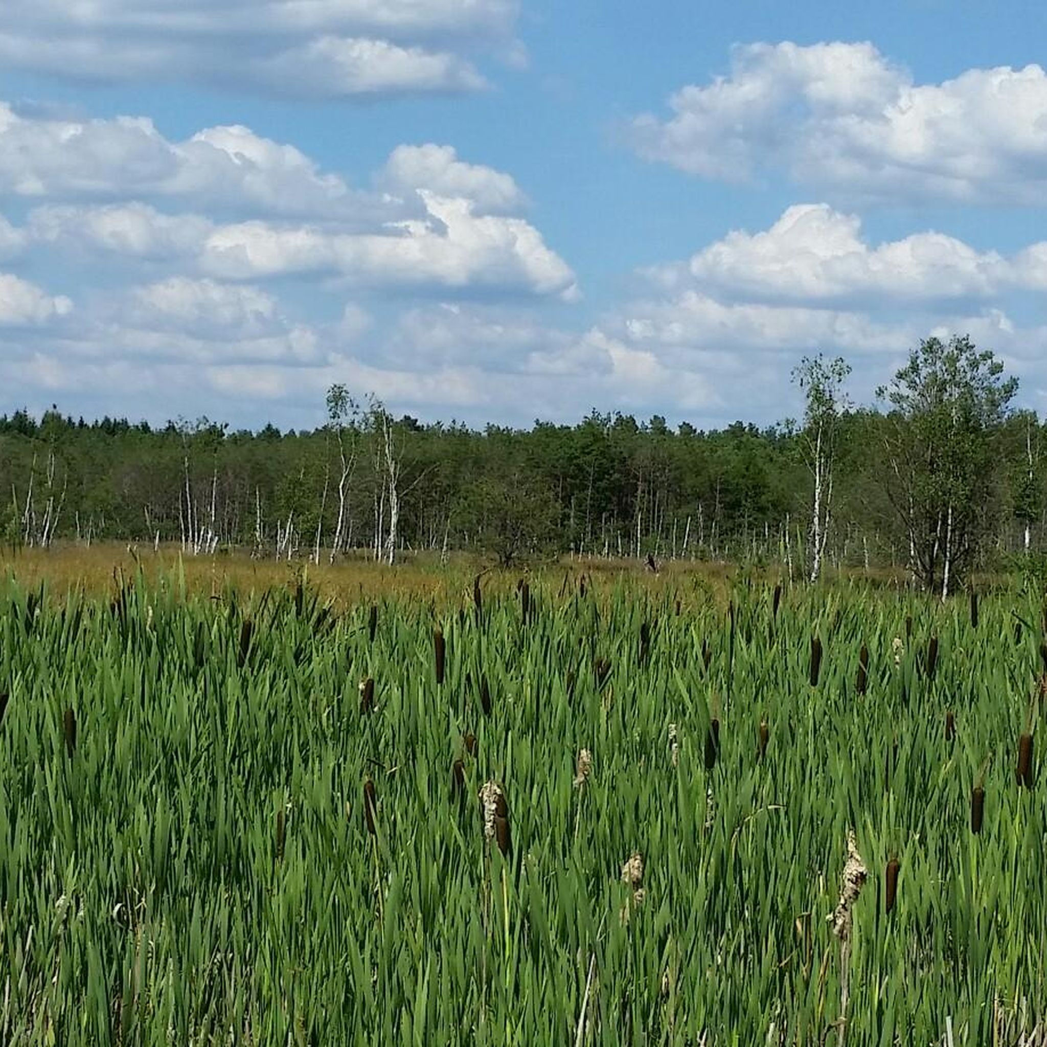
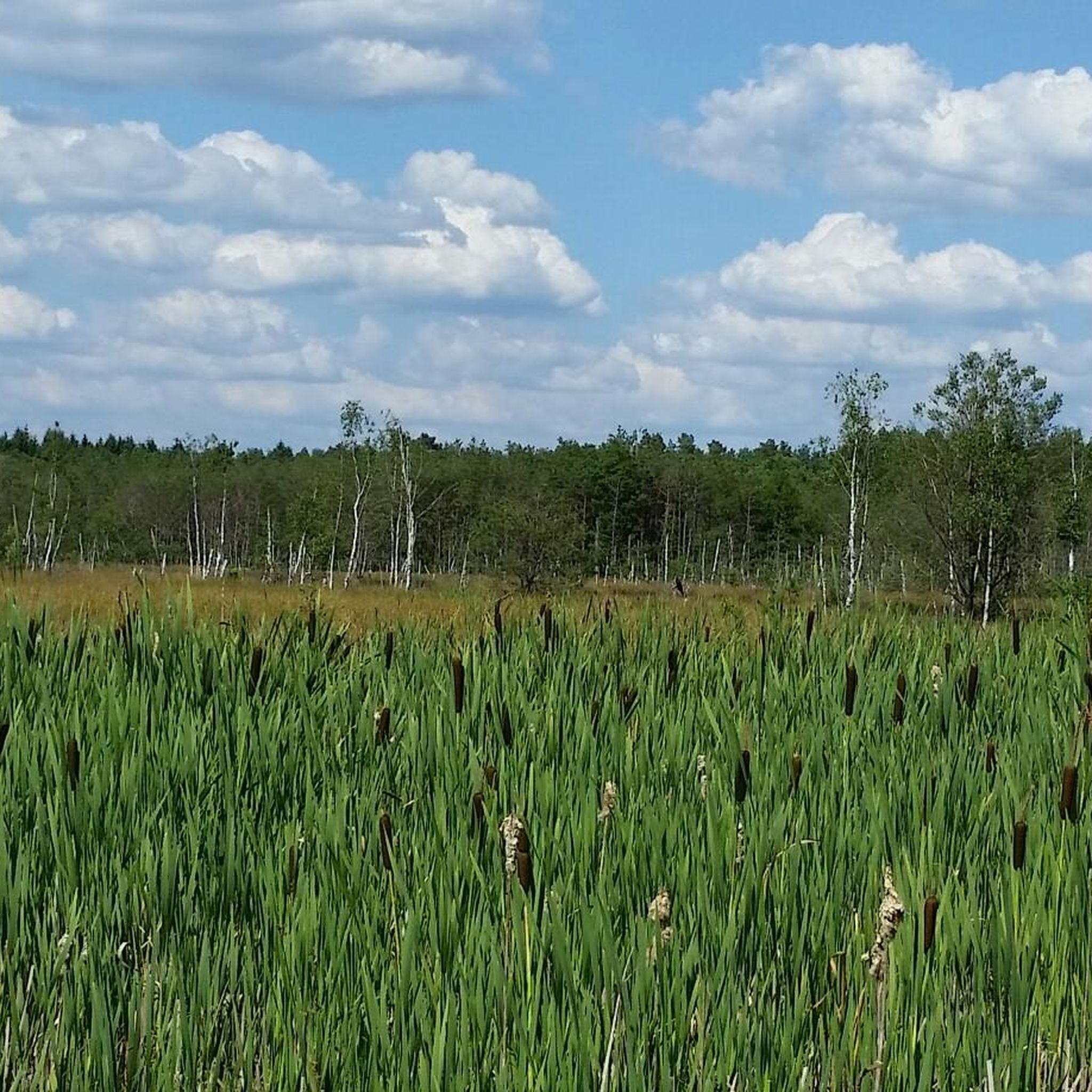
Hiking in Naturschutzgebiet Lührsbockeler Moor offers exploration of a re-wetted high moor landscape in Germany's Heidekreis district. This nature reserve features extensive dystrophic flat waters and developing high moor vegetation, including moist heaths and peat moss stands. The terrain also includes extensively grazed grasslands and wet forest areas, providing diverse natural features for hikers. These unique Lührsbockeler Moor terrain features are a result of successful renaturation efforts.
Best hiking trails in Naturschutzgebiet Lührsbockeler Moor
- The most popular hiking route is Rest Area at Wittenmoor Pond loop from Harber, a 17.6 miles (28.3 km) difficult trail that takes 7 hours 14 minutes to complete, offering an extensive exploration of the moorland.
- Another top favourite among local hikers is Rest Area at Wittenmoor Pond – St. James' Church, Wietzendorf loop from Harber, a difficult 16.0 miles (25.7 km) path. This route traverses varied landscapes, including re-wetted moor areas and surrounding natural features.
- Local hikers also love the Between forest and field – Wietze Riverside Trail loop from Lührsbockeler Moor, a 3.4 miles (5.4 km) trail leading through forest and riverside areas, often completed in about 1 hour 22 minutes.
- Hiking in Naturschutzgebiet Lührsbockeler Moor is defined by re-wetted high moor areas, dystrophic flat waters, and wet forest areas. The network offers options for different ability levels.
- The routes in Naturschutzgebiet Lührsbockeler Moor are highly rated by the komoot community with an average score of 4.5 stars from over 1500 reviews. More than 6000 hikers have used komoot to explore Naturschutzgebiet Lührsbockeler Moor's varied terrain.
Last updated: September 3, 2026
4.0
(22)
53
hikers
Hard hike. Very good fitness required. Easily-accessible paths. Suitable for all skill levels.
5.0
(4)
7
hikers
28.2km
07:10
80m
80m
Hard hike. Very good fitness required. Easily-accessible paths. Suitable for all skill levels.

Sign up for free
5.0
(1)
9
hikers
7.74km
01:59
30m
30m
Easy hike. Great for any fitness level. Easily-accessible paths. Suitable for all skill levels.
30
hikers
1.06km
00:16
0m
0m
Easy hike. Great for any fitness level. Easily-accessible paths. Suitable for all skill levels.
5.0
(1)
7
hikers
Easy hike. Great for any fitness level. Easily-accessible paths. Suitable for all skill levels.
Get access to more routes and recommendations from other explorers.
Sign up for free
Already have an account?
Our route recommendations are based on thousands of hikes, rides, and runs completed by other people on komoot.
Start today with a free account
Your next adventure awaits.
Login or Signup
Popular around Naturschutzgebiet Lührsbockeler Moor
Tips from the Community

Along the Wietze and Örtze rivers, there are 10 art stations that invite you to experience them: https://oberes-oertzetal.de/seite/754540/skulpturenweg-wasserkunst.html
1
0
Here in Wietzendorf, the 7th stage of the Heidschnuckenweg ends and the 8th begins... a sign provides an overview of the path
1
0
Along the Wietze and Örtze rivers, there are 10 art stations that invite you to experience them: https://www.oberes-oertzetal.de/seite/754540/skulpturenweg-wasserkunst.html
1
0
Pretty church... the nave is made of bricks, the tower of wood
1
0
Very old sheepfold directly on the 200-year-old spruce... The shed does not give the impression that it will last much longer
1
0
Very inconspicuous railway crossing... nothing special, also no highlight
1
0
Here, everyone should symbolically lay down a stone that symbolizes their worries...
1
0
The Wietzendorfer Ring leads 43 km around Wietzendorf... Panels repeatedly inform about life as the Wietzendorf community
1
0
Frequently Asked Questions
How many hiking trails are available in Naturschutzgebiet Lührsbockeler Moor?
There are over 500 hiking trails in Naturschutzgebiet Lührsbockeler Moor. The majority, around 360, are considered easy, with about 120 moderate and 15 difficult routes for more experienced hikers.
What kind of terrain can I expect when hiking in Lührsbockeler Moor?
The landscape is primarily defined by re-wetted high moor areas, which were historically peat extraction sites. You'll encounter extensive dystrophic flat waters, developing high moor vegetation like moist heaths with bell heather and rosemary-leaved willowherb, and peat moss stands. The northern parts also feature extensively grazed grasslands and wet forest areas, offering a diverse natural experience.
Are there any circular hiking routes in Naturschutzgebiet Lührsbockeler Moor?
Yes, many routes in the area are circular. For an extensive exploration, consider the difficult 28.3 km Rest Area at Wittenmoor Pond loop from Harber. A shorter, easy option is the 7.7 km Stone pile on Tiegener Weg – Tiegener Berg loop from Harber.
What wildlife can I spot while hiking in Lührsbockeler Moor?
Lührsbockeler Moor is known for its rich biodiversity. You might spot various bird species such as cranes, lapwings, snipes, and great grey shrikes. The moorland also supports endangered butterfly species like the moorland owlet and large blue, as well as critically endangered dragonflies like the spearhead bluet and bog hawker.
Are there any family-friendly hiking options in the nature reserve?
Yes, there are numerous easy trails suitable for families. A good option is the 5.4 km Between forest and field – Wietze Riverside Trail loop from Lührsbockeler Moor, which takes about 1 hour 22 minutes to complete. For a very short walk, the 1.0 km Topiary Bear Sculptures – Waikiki Bowl loop from Harber is also available.
What are the rules for dog walking in Naturschutzgebiet Lührsbockeler Moor?
To protect the sensitive ecosystem and wildlife, dogs must be kept on a leash at all times when hiking within Naturschutzgebiet Lührsbockeler Moor. Please ensure you stay on designated paths.
What is the best time of year to visit Lührsbockeler Moor for hiking?
The moor offers a unique experience throughout the year. Spring and summer are ideal for observing the developing moor vegetation and diverse birdlife. Autumn brings beautiful colors to the landscape. While specific winter conditions can vary, the tranquil nature of the reserve can be enjoyed in all seasons, though some paths might be wet.
What do other hikers enjoy most about the trails in Naturschutzgebiet Lührsbockeler Moor?
The trails in Naturschutzgebiet Lührsbockeler Moor are highly rated by the komoot community, with an average score of 4.5 stars from over 1500 reviews. Hikers often praise the tranquil and immersive nature experience, the unique moorland landscape, and the opportunities for wildlife observation.
Are there any notable natural features or landmarks to look out for?
The primary natural features are the re-wetted high moor areas, extensive dystrophic flat waters, and the unique moorland vegetation including bell heather, rosemary-leaved willowherb, and carnivorous intermediate sundew. The ongoing renaturation process itself is a significant aspect of the reserve, showcasing a dynamic and evolving ecosystem.
Is there parking available near the hiking trails?
While specific parking areas are not detailed in the guide, the region is accessible, and visitors typically find designated parking at trailheads or entry points to nature reserves. It's advisable to check local signage upon arrival for the most current parking information.
Can I access Naturschutzgebiet Lührsbockeler Moor using public transport?
The nature reserve is situated between Soltau and Wietzendorf. While direct public transport links into the heart of the moor might be limited, you can typically reach nearby towns like Soltau or Wietzendorf by public transport. From there, you may need to consider local bus services or a short taxi ride to reach specific trailheads.
Are there any long-distance hiking options in the area?
Yes, for those seeking longer hikes, there are challenging routes available. The Rest Area at Wittenmoor Pond – St. James' Church, Wietzendorf loop from Harber is a difficult 25.7 km path that traverses varied landscapes, including re-wetted moor areas and surrounding natural features.
Most popular routes in Naturschutzgebiet Lührsbockeler Moor

Get inspired with the komoot mobile app


Explore more
Browse the best Hikes in other regions.
