Tschirner Und Nordhalbener Ködeltal Mit Mäusbeutel
Tschirner Und Nordhalbener Ködeltal Mit Mäusbeutel
The best running trails in Tschirner Und Nordhalbener Ködeltal Mit Mäusbeutel
4.5
(65)
1,081
runners
104
runs
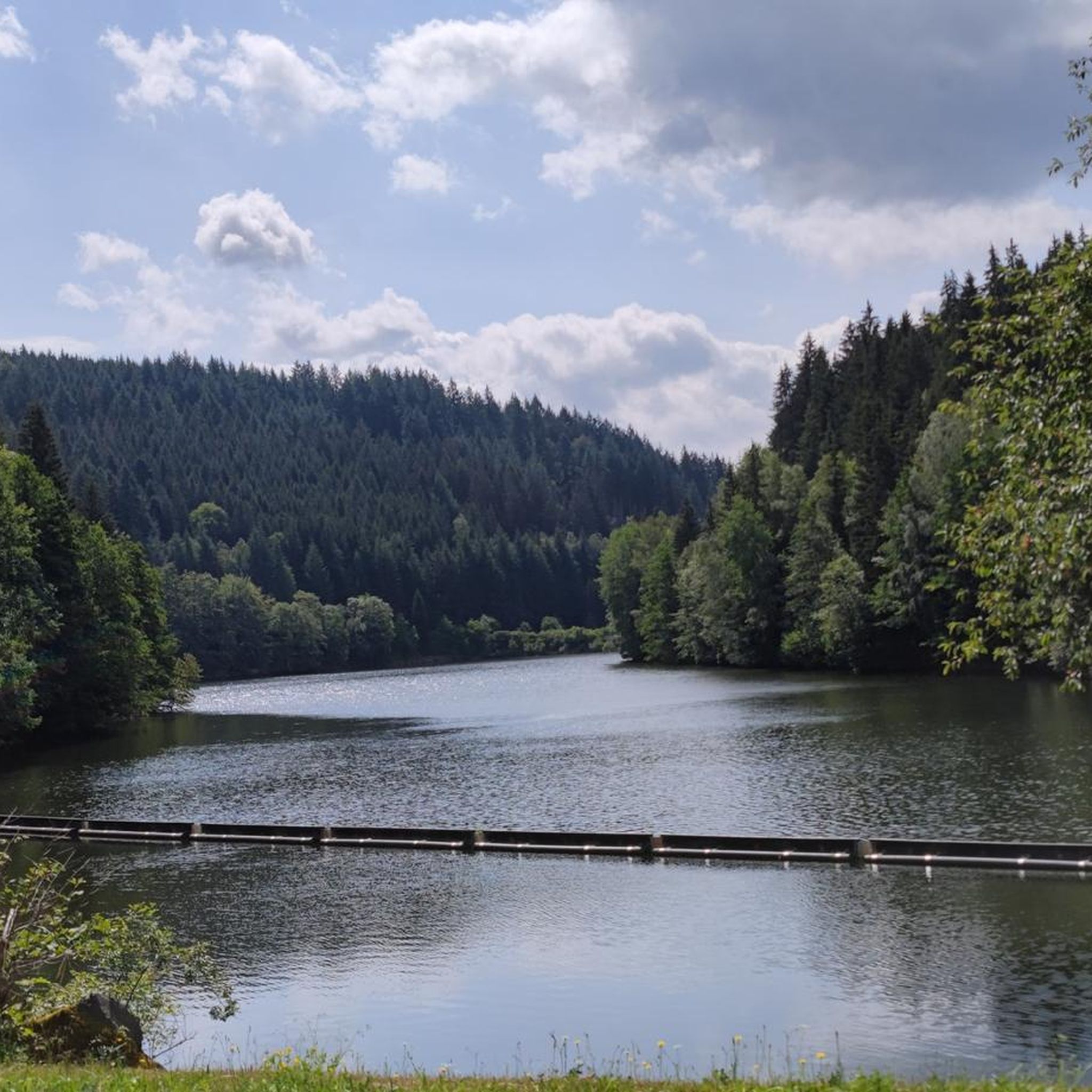
Jogging in Tschirner Und Nordhalbener Ködeltal Mit Mäusbeutel offers diverse landscapes of meadows, forests, and well-maintained paths. The region is characterized by the Ködeltalsperre, Bavaria's largest drinking water reservoir, which provides a scenic backdrop for running routes. Situated on the edge of the Frankenwald Nature Park, the area features varied terrain with easily accessible trails suitable for different fitness levels. This natural environment supports a rich biodiversity, enhancing the outdoor experience for runners.
Best jogging routes in Tschirner Und Nordhalbener…
Last updated: July 10, 2026
4
runners
13.8km
01:39
240m
240m
Moderate run. Good fitness required. Mostly paved surfaces. Suitable for all skill levels.
4
runners
Hard run. Very good fitness required. Mostly paved surfaces. Suitable for all skill levels.

Sign up for free
4.0
(1)
6
runners
9.31km
01:02
220m
220m
Moderate run. Good fitness required. Mostly paved surfaces. Suitable for all skill levels.
4.9
(17)
336
runners
11.9km
01:18
190m
190m
Hard run. Good fitness required. Sure-footedness, sturdy shoes and alpine experience required.
18
runners
Moderate run. Good fitness required. Mostly paved surfaces. Suitable for all skill levels.
Get access to more routes and recommendations from other explorers.
Sign up for free
Already have an account?
Our route recommendations are based on thousands of hikes, rides, and runs completed by other people on komoot.
Start today with a free account
Your next adventure awaits.
Login or Signup
Popular around Tschirner Und Nordhalbener Ködeltal Mit Mäusbeutel
Tips from the Community

In this building, locally sourced slate was formerly processed into roofing and wall slate tiles.
0
0

A very beautiful stone
0
3

The Three Coats of Arms Stone has an interesting history.
5
0

The oldest documented mention of Nordhalben as a castle, built in the Nortwald forest at the behest of the Bishop of Bamberg, dates back to 1154. The oldest archdeaconry register, dating from 1421, is the first to confirm a priest in Nordhalben. During the Thirty Years' War, the parish church fell into gradual disrepair. From 1707 to 1715, the church was rebuilt in the Baroque style on its current site. During the "Great Fire" of 1856, the church, except for the choir vault and the foundations of the tower, was destroyed by flames. Reconstruction began in 1858. With the addition of the side aisle and the expansion of the sacristy in 1928, the church took on its present form.
17
0
The war memorial was expanded with a new plaque on May 8, 2024, commemorating the victims of the Nazi regime in Nordhalben. Horst Mohr initiated this expansion. This addition is intended to expand the memorial's culture of remembrance and commemorate the victims of National Socialism.
17
0

A beautiful rest area at the foreshore of the Ködel Dam. Whether hiking or cycling, it's always a great place to stop.
0
0
Nice resting place at the foreshore of the Ködeltalsperre
0
0

This former slate quarry is now an industrial monument and worth a visit 🤔👍🙂
0
0
Frequently Asked Questions
How many running routes are available in Tschirner Und Nordhalbener Ködeltal Mit Mäusbeutel?
The region offers a wide selection of running routes, with over 110 trails to choose from. These include a mix of easy, moderate, and difficult options, ensuring there's something for every fitness level.
Are there easy running routes suitable for beginners or families?
Yes, there are several easy running routes perfect for beginners or families. The area features well-maintained paths through meadows and forests. For example, the Ködel Dam – Ködeltalsperre — Southern End loop from Nurn is a moderate 6.2 km route that offers a scenic experience without being overly strenuous.
What kind of terrain can I expect on the running trails in this region?
You can expect a diverse landscape featuring extensive meadows, dense forests, and well-maintained paths. The region is situated on the edge of the Frankenwald Nature Park, providing varied terrain and a beautiful natural backdrop for your runs. Many routes also feature views of the Ködeltalsperre, Bavaria's largest drinking water reservoir.
What do other runners say about the trails in Tschirner Und Nordhalbener Ködeltal Mit Mäusbeutel?
The running routes in this area are highly rated by the komoot community, with an average score of 4.7 stars from over 60 reviews. More than 1000 runners have explored the varied terrain, often praising the scenic beauty, well-kept trails, and the peaceful atmosphere of the Frankenwald Nature Park.
Are there any circular running routes around the Ködeltalsperre?
Yes, the Ködeltalsperre is a popular spot for circular routes. A scenic 11 km circular route around the dam is particularly favored by runners. The Ködel Reservoir – Trail junction loop from Nordhalben is a great moderate option that takes you through this picturesque area.
Can I bring my dog on the running trails?
Generally, dogs are welcome on many trails in the Frankenwald Nature Park, but it's always advisable to keep them on a leash, especially in areas with wildlife or near water reservoirs like the Ködeltalsperre, which is a drinking water source. Always check local signage for specific restrictions.
Where can I park my car when visiting the running trails?
Parking is generally available at common starting points for trails, especially near popular attractions like the Ködeltalsperre. Specific parking information can often be found on individual route pages on komoot or local tourism websites.
Is public transport available to reach the running routes?
While the region is primarily accessed by car, some villages and towns near the trailheads may have limited bus services. For detailed public transport options, it's best to check local transport schedules for the specific starting point of your chosen route.
What are some interesting sights or landmarks to see while running?
While running, you can encounter several interesting sights. The Tschirner Ködel Ford and the Alter Tschirner Pond offer natural beauty. You might also pass by historical sites like the Site of the Fichta Mill or the Bergloch Nordhalben cave. The Rest shelter at the Tschirner Ködel Reservoir provides a nice spot to pause.
Are there options for longer, more challenging runs?
Absolutely. For those seeking a greater challenge, there are 19 difficult routes available. An example is the Trail junction – Ködelblick loop from Mauthaus, which covers 11.9 km with significant elevation changes, offering a rewarding workout through the varied landscape.
What are the conditions like for running in winter?
In winter, the landscape transforms, offering a different experience. While some paths are suitable for winter running, the region is also known for activities like cross-country skiing and snowshoeing, indicating a well-developed trail network. Be prepared for snow and ice, and check local conditions before heading out.
Are there any places to stop for refreshments near the running routes?
While specific cafes directly on every trail might be limited, the villages and towns surrounding the Ködeltal, such as Nordhalben and Nurn, offer options for refreshments. It's a good idea to plan your route to pass through or near these settlements if you anticipate needing a break or a meal.
What is the best time of year to go running in this area?
The diverse landscapes of meadows and forests offer beautiful running conditions throughout the year. Spring and autumn provide pleasant temperatures and vibrant scenery, while summer is ideal for early morning or late afternoon runs. Even winter offers unique charm for those prepared for colder conditions and potential snow.
Most popular routes in Tschirner Und Nordhalbener Ködeltal Mit Mäusbeutel
Most popular attractions in Tschirner Und Nordhalbener Ködeltal Mit Mäusbeutel

Get inspired with the komoot mobile app


Explore more
Browse the best Running Trails & Routes in other regions.
