The best walks and hikes in Npp Prameniště Blanice
4.6
(236)
1,136
hikers
29
hikes
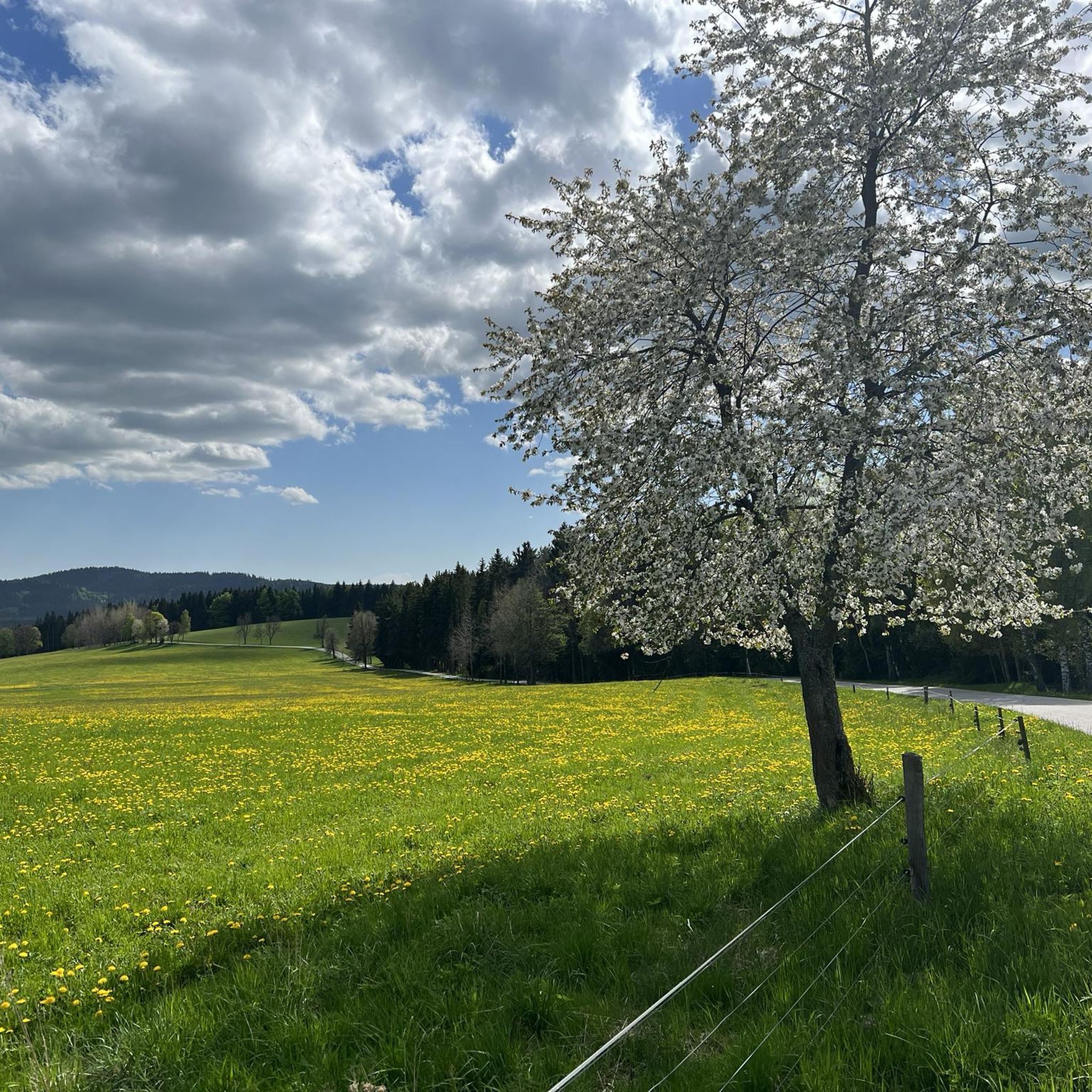
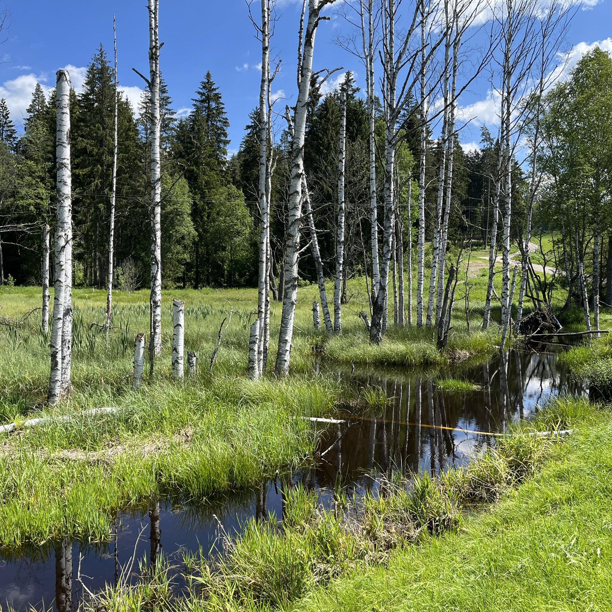
Hiking in Npp Prameniště Blanice offers trails through a unique and ecologically significant landscape in the Prachatice district of the Czech Republic. The region is characterized by the pristine headwaters of the Blanice River, extensive wetlands, and diverse spring vegetation. Situated within the broader Šumava Protected Landscape Area, the monument's altitude ranges from 810 to 1015 meters above sea level, contributing to varied terrain. This environment is vital for protected species, including the critically endangered freshwater pearl mussel.
Best hiking…
Last updated: August 25, 2026
2
hikers
10.5km
02:42
50m
50m
Moderate hike. Good fitness required. Easily-accessible paths. Suitable for all skill levels.
4.8
(4)
17
hikers
7.73km
02:10
130m
130m
Hard hike. Good fitness required. Sure-footedness, sturdy shoes and alpine experience required.

Sign up for free
12
hikers
4.55km
01:19
120m
120m
Easy hike. Great for any fitness level. Easily-accessible paths. Suitable for all skill levels.
2
hikers
9.74km
02:41
170m
170m
Moderate hike. Good fitness required. Easily-accessible paths. Suitable for all skill levels.
3
hikers
11.2km
03:10
250m
250m
Moderate hike. Good fitness required. Easily-accessible paths. Suitable for all skill levels.
Get access to more routes and recommendations from other explorers.
Sign up for free
Already have an account?
Our route recommendations are based on thousands of hikes, rides, and runs completed by other people on komoot.
Start today with a free account
Your next adventure awaits.
Login or Signup
Popular around Npp Prameniště Blanice
Tips from the Community

The founding of the place was related to the general settlement of the Bohemian Forest in the 13th and 14th centuries. New villages emerged, predominantly with a German population, often originating from the Passau region. Another important circumstance for its founding was the relocation of the "Prachatici via", a trade route from Passau to Bohemia, which later became known as the Golden Path. The first mention of the settlement in 1359 already records its German name, Wallern. It probably derives from "den waldaeren" (forest dwellers), whereby in the Bavarian dialect, 'ld' changed to 'll'. Through phonetic adaptation, the Czech name emerged, first mentioned in 1444 as Wolari. Wallern soon developed into the largest center for pack animal husbandry on the Bohemian side of the Golden Path. Due to the demand for pack animals, also for the Passau salt trade, there were thirteen innkeepers and four blacksmiths here in the 16th century. Settlers from Carinthia, Styria, and Tyrol came and built their houses in the familiar alpine style as rustic log houses. In 1871, Wallern, by then also the center of a considerable timber industry, was elevated to the status of a town. Until the founding of Czechoslovakia, Volary was inhabited almost exclusively by Germans. After the end of World War II, Czechs from the interior moved to Volary, and the established German population was almost completely expelled. During the communist era, the former town of wood transformed into a garrison town for border guards. This resulted in massive negative interventions in the townscape.
13
0
The imposing building of the former elementary school (Základní Škola or ZŠ) in Volary has been empty since 2010 and has become a lost place. The building, originally erected as a boys' civic school between 1898 and 1900 in the style of Late Historicism with elements of Neo-Renaissance, stands out as a massive stone monumental building, deliberately breaking with the rural architecture of the world-famous Wallerer wooden houses in the Alpine style. The house with originally 22 classrooms is typical of the representative imperial and royal school architecture of the late Habsburg monarchy. It was intended to demonstrate state modernity and authority. Since the departure of students from grades 1 to 5 in 2010, the striking building has stood empty and unused. The elementary school operations were consolidated in a new, more modern complex.
13
0
A historic sundial adorns the southern outer wall of the Tusset Chapel (Kaple Panny Marie na Tussetu), which belongs to the parish church of St. Catherine. The chapel, originally dedicated to St. John of Nepomuk, is now called Tusset Chapel after a miraculous image from the pilgrimage chapel "Our Lady" in the nearby village of Stožec (German: Tusset) found its new home there. Incidentally, the largest sundial in Central Europe has been located in the nearby district town of Prachatice since 1969.
10
0
On the central square of Volary, this fountain with various bubbling jets provides refreshment in the summer.
12
0
The wayside shrine at the cemetery (Kaplička u hřbitova) stands at the beginning of a tree-shaded path. The niche chapel is empty, a picture of a saint is no longer present.
8
0
In the Baroque chapel in the cemetery, there is a granite tombstone from the early 18th century. In the presbytery, there is a granite memorial stone with a memorial plaque made of Solnhofen limestone, the relief depicts the Stegbauer smelting works, which was originally located west of Volary.
8
0
The Jewish Cemetery in Volary, founded in 1945 and protected as a monument since 1963, is the final resting place for women of Jewish origin who died here as victims of the Nazi regime after an exhausting death march. The cemetery, with its white granite tombstones, offers a peaceful place of remembrance and a warning of the tragedy of the war. 95 Jewish women and girls (mainly of Polish and Hungarian nationality) and one Russian prisoner of war are buried here. The original wooden crosses were replaced in 1956 by metal triangles with the names of the victims, and later the tombstones were erected, which can still be seen here today.
9
0
The statue next to the Jewish cemetery depicts the torso of a woman. It is the work of sculptor Vojtěch Pařík. It was erected here in 1975.
8
0
Frequently Asked Questions
How many hiking trails are available in Npp Prameniště Blanice?
Npp Prameniště Blanice offers a diverse network of over 30 hiking trails. These routes cater to various fitness levels, with 13 easy, 14 moderate, and 3 difficult options available.
Are there easy hiking options suitable for families or beginners?
Yes, Npp Prameniště Blanice features 13 easy hiking routes, perfect for families and beginners. These trails allow you to experience the pristine headwaters of the Blanice River and the unique wetland environment without strenuous effort. Many routes are easily accessible and explore the tranquil natural setting.
What kind of natural features can I expect to see while hiking here?
Hiking in Npp Prameniště Blanice offers a unique opportunity to experience pristine river headwaters, extensive wetlands, and diverse spring vegetation. The area is crucial for the critically endangered freshwater pearl mussel, ensuring exceptionally clean water sources. You'll be immersed in the unspoiled nature of the broader Šumava Protected Landscape Area, with opportunities to observe specialized flora and fauna adapted to this unique ecosystem.
Are there any circular walks in Npp Prameniště Blanice?
Yes, there are several circular walks available. For example, the Hiking loop from Volary is a moderate 8.0-mile (12.8 km) path exploring the natural surroundings. Another option is the Volary Town Center loop from Volary, a 5.7-mile (9.2 km) trail that takes you through the local area.
What is the best time of year to go hiking in Npp Prameniště Blanice?
The best time to visit Npp Prameniště Blanice for hiking is generally from spring through autumn. During these seasons, the unique spring vegetation is vibrant, and the weather is most favorable for exploring the wetlands and river headwaters. The undisturbed nature of the area provides excellent opportunities for observing specialized flora and fauna.
Is Npp Prameniště Blanice suitable for dog owners?
While the region is a protected natural monument, dogs are generally welcome on trails in the broader Šumava Protected Landscape Area, which encompasses Npp Prameniště Blanice. However, it's always recommended to keep dogs on a leash to protect the sensitive ecosystem, especially given the presence of endangered species like the freshwater pearl mussel and otters. Please check local signage for specific regulations.
Are there any longer or more challenging routes for experienced hikers?
Yes, for experienced hikers seeking a greater challenge, there are 3 difficult routes available. One such option is the Christlschlager Lake – Cross with Graves loop from Blažejovice, a 4.7-mile (7.5 km) trail featuring varied terrain with moderate elevation changes. Another challenging route is the Jelení Jezírko – Viklan Balanced Rock loop from Stožec, which is a longer 24.8 km (15.4 miles) hike with significant elevation gain.
What do other hikers enjoy most about Npp Prameniště Blanice?
The area is highly rated by the komoot community, with an average score of 4.7 stars from over 200 reviews. Hikers often praise the tranquil natural setting, the pristine quality of the Blanice River headwaters, and the unique wetland environment. The opportunity to experience a carefully preserved ecosystem within the scenic Šumava region is a common highlight.
What kind of wildlife might I encounter in Npp Prameniště Blanice?
Npp Prameniště Blanice is a biodiversity hotspot, primarily protecting the critically endangered freshwater pearl mussel. Beyond this, the protected status supports other sensitive species. Hikers might encounter evidence of the European bullhead, brook lamprey, and the otter in and around the watercourses. The undisturbed nature of the area provides opportunities for observing specialized wetland flora and fauna.
Are there any routes that offer views of the wider Šumava region?
While Npp Prameniště Blanice itself focuses on the river headwaters and wetlands, some nearby routes offer broader scenic perspectives. For instance, the Moldau Floodplains – Teplá Vltava loop from Volary provides views of the wider landscape, including the Vltava River, which flows through the Šumava region.
What is the typical elevation change on trails in Npp Prameniště Blanice?
The altitude of Npp Prameniště Blanice ranges from 810 to 1015 meters above sea level, contributing to varied terrain. While many easy walks have minimal elevation changes, some routes, like the Jelení Jezírko – Viklan Balanced Rock loop from Stožec, can involve significant ascents and descents, reaching over 500 meters of elevation gain.

Get inspired with the komoot mobile app


Explore more
Browse the best Hikes in other regions.
