The best walks and hikes in Russvätars Naturreservat
4.7
(47)
199
hikers
25
hikes
Hiking in Russvätars Naturreservat offers diverse experiences across its unique landscape on Gotland. The region is characterized by layered limestone bedrock, often forming bare rock slabs or supporting sparse pine forests. Within the reserve, shallow wetlands known as Russvätarna are a notable feature, typically holding water in cooler months. The area connects to adjacent protected lands like Herrgårdsklint and Torsburgen, providing extensive opportunities for exploring coniferous forests, wetlands, and alvar landscapes.
Best hiking trails in Russvätars Naturreservat
- The most popular…
Last updated: July 8, 2026
5.0
(1)
5
hikers
Moderate hike. Good fitness required. Easily-accessible paths. Suitable for all skill levels.
5.0
(2)
5
hikers
Moderate hike. Good fitness required. Easily-accessible paths. Suitable for all skill levels.

Sign up for free
3
hikers
15.6km
03:58
40m
40m
Moderate hike. Good fitness required. Easily-accessible paths. Suitable for all skill levels.
4.4
(5)
33
hikers
4.67km
01:13
40m
40m
Easy hike. Great for any fitness level. Easily-accessible paths. Suitable for all skill levels.
6.71km
01:43
30m
30m
Easy hike. Great for any fitness level. Easily-accessible paths. Suitable for all skill levels.
Get access to more routes and recommendations from other explorers.
Sign up for free
Already have an account?
Our route recommendations are based on thousands of hikes, rides, and runs completed by other people on komoot.
Start today with a free account
Your next adventure awaits.
Login or Signup
Tips from the Community

440 million years ago, Gotland lay under the water of a tropical sea, near the equator. What stands today as mighty limestone pillars between old spruces was once a reef. The sea has eroded away the softer surroundings, leaving behind the hard substance, packed with fossils from a bygone marine era. What's special about these Raukar is their location. Not on the beach, but in the middle of the forest. Gotland is still rising out of the sea, and so the formations have moved inland from the shore over the millennia. The light falls through the branches onto the old stones, creating an atmosphere that is hard to describe.
0
0
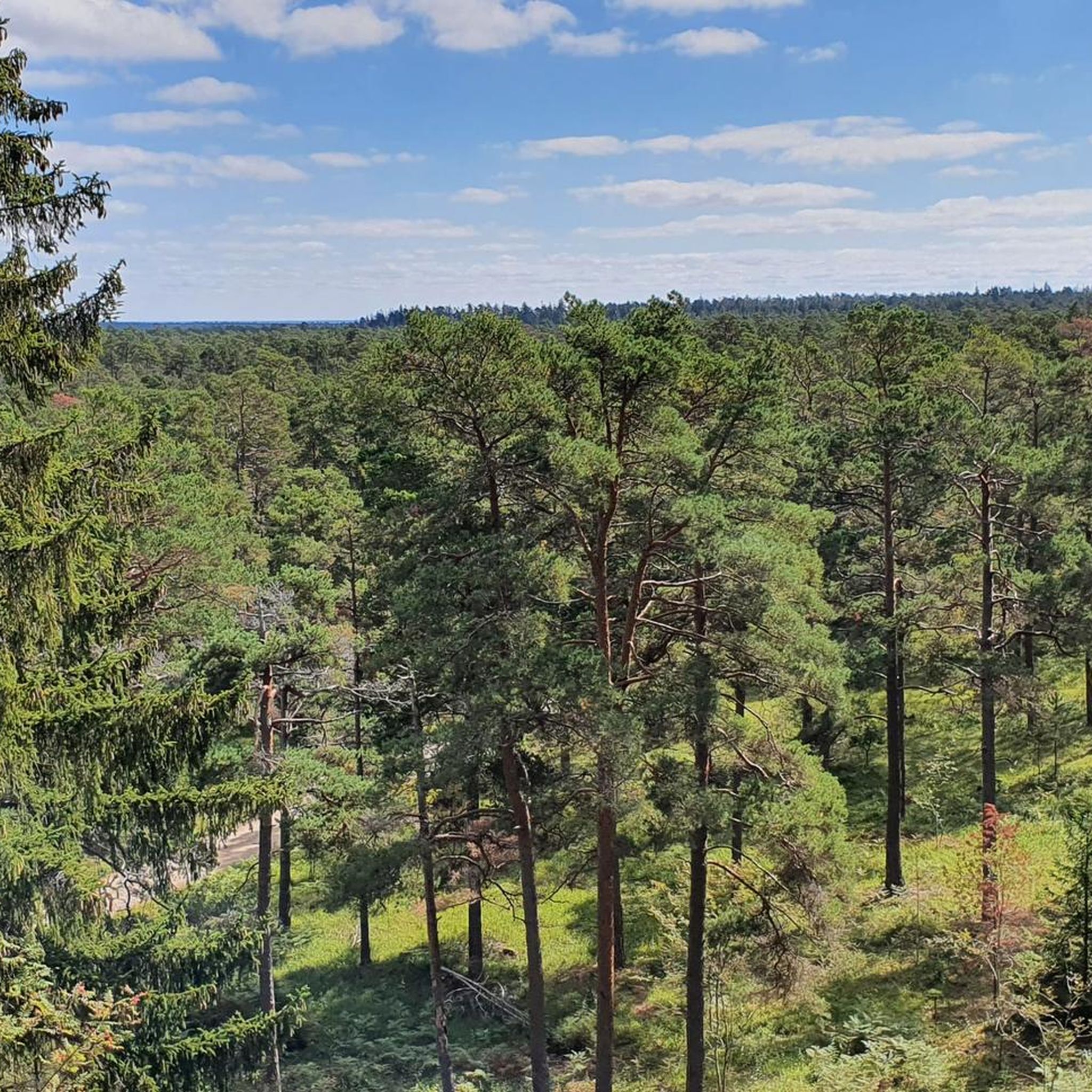
This coastal forest is one of the most impressive on Gotland. Old pines and spruces grow here on windblown sand, the ground is soft, and between the trees there is a scent of resin and sea. If you keep your eyes open, you will suddenly discover Raukar in the middle of the forest, ancient limestone formations that once stood on the beach and have been moved inland by the slow uplift of the land. The area is a nature reserve, so stay on the paths and do not take any sand or stones with you.
0
0


An incredible section of coastline, known for eye-catching limestone formations called "raukar" Some of these sea stacks reach heights of up to 6 meters.
1
0

At this junction you can find some interesting information about the fauna, flora and the caves along the trail. Take your time to embrace the scenery as well.
1
0
Linné's cave, one of several caves on the northwest side of Torsburgen's inland cliff, measures twelve meters in height and five meters in depth, accessible via a staircase along the cliff wall. The cave's name and the origin of the term "rind hole" for its roof opening remain unclear, despite Linnaeus visiting Torsburgen in 1741. During his visit, Linnaeus observed that the plateau was nearly devoid of forest due to a great fire in 1655, but it's uncertain whether he actually explored the cave named after him.
1
0

Unique flower that only grows in this area. Best seen in mid April
0
0

It's not for everyone because you have to climb a ladder. But you have a great all-round view.
0
0
Frequently Asked Questions
What kind of landscape can I expect to see while hiking in Russvätars Naturreservat?
Russvätars Naturreservat is characterized by its unique geological features, including layered limestone bedrock that often forms bare rock slabs. You'll also find sparse pine forests (hällmarkstallskog) and, in the central part, the shallow Russvätarna wetlands, which typically hold water in autumn and winter but can dry out in summer. The reserve connects to adjacent protected areas like Herrgårdsklint and Torsburgen, offering a mosaic of species-rich coniferous forests and alvar landscapes.
How many hiking trails are available in Russvätars Naturreservat?
There are over 20 hiking trails available in Russvätars Naturreservat. These routes cater to various skill levels, with 10 easy, 12 moderate, and 2 difficult options to choose from.
Are there any easy hiking trails suitable for beginners or families?
Yes, Russvätars Naturreservat offers several easy trails perfect for beginners or families. One popular option is the Naturstig - Torsburgen, an easy 4.7 km route that takes about 1 hour 13 minutes to complete. Another family-friendly choice is the Linné's Cave – Kärrmansmyr Earthworks loop from Torsburgens naturreservat, which is 4.0 km long.
When is the best time to visit Russvätars Naturreservat for hiking?
The reserve is particularly popular in spring, especially from mid-April to early May, when the Gotland pasqueflower (gotlandssippa) is in full bloom, creating vibrant displays. Autumn and winter offer a different experience, with the Russvätarna wetlands typically filled with water. Summer can be warm, and the wetlands may dry out, but the pine forests provide shade.
Are there any circular hiking routes in the area?
Yes, several circular routes are available. A well-regarded moderate option is the Herrgårdsklint Stone Wall – Herrgårdsklint Descent loop from Russvätars naturreservat, which is 8.3 km long. For an easier circular walk, consider the Folhammar Nature Reserve Loop, an easy 6.7 km trail.
What historical or cultural attractions can be found near the hiking trails?
The reserve is set within a cultural landscape with Iron Age defense history. Nearby ancient forts, such as Torsburgen (70 meters above sea level) and Herrgårdsklint (50 meters above sea level), offer fascinating historical points of interest for hikers. The Naturstig - Torsburgen trail specifically leads through forested areas and offers views of the ancient Torsburgen fort.
What do other hikers enjoy most about Russvätars Naturreservat?
The area is highly rated by the komoot community, with an average score of 4.6 stars from over 40 reviews. Hikers often praise the unique geological features, the tranquil atmosphere, and the diverse landscapes that include sparse pine forests and seasonal wetlands. The connection to other reserves like Torsburgen and Herrgårdsklint is also appreciated for extending hiking opportunities.
Are there any facilities like picnic areas or shelters in Russvätars Naturreservat?
Yes, for those looking to take a break, there is a picnic area equipped with a grill in the eastern part of the reserve. Additionally, new wind shelters have been installed at both Russvätar and the neighboring Herrgårdsklint, providing convenient resting spots during your hike.
Can I spot any unique flora or fauna while hiking here?
The reserve is renowned for its unique flora, especially the abundant Gotland pasqueflower (gotlandssippa), which blooms spectacularly from mid-April to early May. You can find its richest concentration in the southwestern part of the reserve. Other plants thriving on the rock slabs include grusslok, alvargräslök, and liten sandlilja. While not explicitly mentioned for fauna, the diverse habitats suggest opportunities for birdwatching and observing smaller wildlife.
Is Russvätars Naturreservat suitable for long-distance hiking?
Yes, Russvätars Naturreservat is part of a larger protected area that includes the adjacent Herrgårdsklint and Torsburgen nature reserves. This connection creates extensive opportunities for long walks through a mosaic of species-rich coniferous forests, wetlands, and alvar landscapes, making it suitable for longer excursions.
What is the typical terrain like on the hiking trails?
The terrain primarily features layered limestone bedrock, with many areas consisting of bare, sometimes cracked, rock slabs (hällmarker). You'll also traverse sparse, low-growing pine forests (hällmarkstallskog) and areas with slightly thicker soil where taller spruce trees grow. The presence of seasonal wetlands adds to the varied ground conditions.
Most popular routes in Russvätars Naturreservat

Get inspired with the komoot mobile app


Explore more
Browse the best Hikes in other regions.
