The best walks and hikes in Prestebakkefjella Naturreservat
4.3
(71)
251
hikers
5
hikes
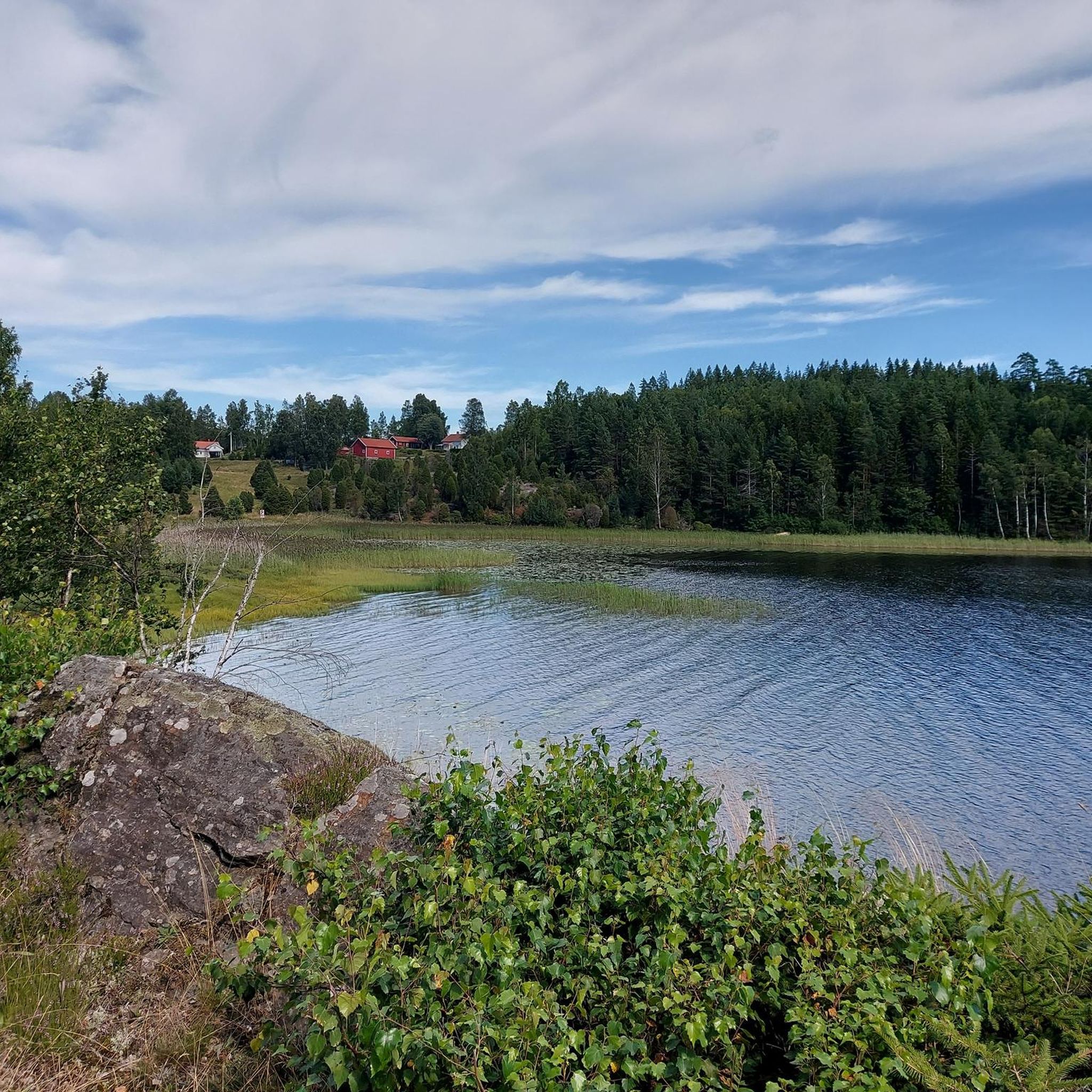
Hiking in Prestebakkefjella Naturreservat offers a varied landscape characterized by diverse forest and wetland ecosystems. The reserve features coniferous forests, tarns, watercourses, and extensive bogs, including Prestebakkemosen, Østfold's largest continuous bog area. The terrain includes moderate elevation changes, with some routes leading to viewpoints and notable natural features like the Elgåfossen Waterfall.
Best hiking trails in Prestebakkefjella Naturreservat
- The most popular hiking route is Vargbergene – Bofarhaugen loop from Torgalsbøen, a 6.9 miles (11.2 km) trail that takes 2 hours 59 minutes to complete. This moderate route explores varied forest terrain with gentle climbs.
- Another top favourite among local hikers is Old Cabin by the Waterfall – Elgåfossen Waterfall loop from Svingen, a moderate 6.0 miles (9.7 km) path. This trail offers views of the Elgåfossen Waterfall and surrounding natural landscapes.
- Local hikers also love the Ascent to Björnerödspiggen loop from Krokstrand, a 3.4 miles (5.5 km) trail leading through forest and offering an ascent to Björnerödspiggen, often completed in about 1 hour 39 minutes.
- Hiking in Prestebakkefjella Naturreservat is defined by coniferous forests, extensive bogs, and watercourses, including the Elgåfossen Waterfall. The network offers options for different ability levels, from easy paths to more challenging routes.
- The routes in Prestebakkefjella Naturreservat are highly rated by the komoot community with an average score of 4.3 stars from over 50 reviews. More than 200 hikers have used komoot to explore Prestebakkefjella Naturreservat's varied terrain.
Last updated: August 22, 2026
3
hikers
11.2km
03:00
140m
140m
Moderate hike. Good fitness required. Easily-accessible paths. Suitable for all skill levels.
4.2
(56)
170
hikers
9.68km
02:37
130m
130m
Moderate hike. Good fitness required. Easily-accessible paths. Suitable for all skill levels.

Sign up for free
4.3
(3)
13
hikers
Moderate hike. Good fitness required. Easily-accessible paths. Suitable for all skill levels.
3.0
(2)
15
hikers
Moderate hike. Good fitness required. Easily-accessible paths. Suitable for all skill levels.
4.5
(2)
10
hikers
5.48km
01:39
190m
190m
Easy hike. Great for any fitness level. Easily-accessible paths. Suitable for all skill levels.
Our route recommendations are based on thousands of hikes, rides, and runs completed by other people on komoot.
Start today with a free account
Your next adventure awaits.
Login or Signup
Popular around Prestebakkefjella Naturreservat
Tips from the Community

Behind the waterfall is a wooden bridge .. Swedish and Norwegian flags hang here
4
0
Much of it is no longer usable
5
0
Great how you can see the waterfall from here, which unfortunately has little water at the moment
2
0
Great view over the border river between Sweden and Norway
5
0
Fireplace and seating on Norwegian ground
5
0

Very big and beautiful waterfall, at the border between Sweden and Norway. There is a small parking nearby (4, 5 cars max), which is above the waterfall. There is a sign going in the forest, and in 5min we reach the water. Many viewpoints from here. Then you can cross the bridge with the 2 country flags, and go down the path along the waterfall. Also many viewpoints from there. There is another bridge at the bottom, and it's possible to go back easily to the parking, without having to climb back next to the waterfall.
2
0

The Elgåfossen separates Sweden & Norway, the bridge unites them again 😉
0
0

My landlady recommended that I go to the waterfall when the weather is bad. Then a lot of water comes down...
0
0
Frequently Asked Questions
How many hiking trails are available in Prestebakkefjella Naturreservat?
Prestebakkefjella Naturreservat offers a selection of 6 hiking routes. These range from easy paths to more moderate trails, providing options for various fitness levels.
What kind of terrain can I expect when hiking in Prestebakkefjella Naturreservat?
The reserve features a diverse landscape, including dense coniferous forests, tranquil tarns (small mountain lakes), watercourses, and extensive bog areas like Prestebakkemosen. You'll encounter varied terrain with moderate elevation changes, and some routes offer viewpoints.
Are there any waterfalls to see in Prestebakkefjella Naturreservat?
Yes, the impressive Elgåfossen Waterfall is a notable attraction within or near the reserve. It sits on the border between Sweden and Norway, and several trails offer excellent viewpoints. For example, the Old Cabin by the Waterfall – Elgåfossen Waterfall loop from Svingen provides views of the waterfall.
Are there any easy hiking trails suitable for beginners or families?
Yes, there is one easy trail in the reserve. The Ascent to Björnerödspiggen loop from Krokstrand is an easy 3.4-mile (5.5 km) route that leads through the forest and is often completed in under two hours, making it suitable for those looking for a less strenuous walk.
Can I find circular hiking routes in the reserve?
Many of the trails in Prestebakkefjella Naturreservat are designed as circular routes, allowing you to start and end at the same point. Examples include the Vargbergene – Bofarhaugen loop from Torgalsbøen and the Old Cabin by the Waterfall – Elgåfossen Waterfall loop from Svingen.
Are there good viewpoints along the trails?
Yes, several trails offer scenic viewpoints. The Elgåfossen Waterfall has multiple viewing points, and routes like the Ascent to Björnerödspiggen – View from Björnerödspiggen loop from Krokstrand specifically highlight views from Björnerödspiggen.
Is Prestebakkefjella Naturreservat dog-friendly?
Generally, dogs are welcome on trails in Norwegian nature reserves, but they must be kept on a leash, especially during nesting seasons for birds and when livestock are present. Always check local signage for specific rules within Prestebakkefjella Naturreservat to ensure a pleasant experience for everyone.
Is there parking available at the trailheads?
While specific parking information for each trailhead isn't detailed in the guide, it's common for nature reserves in Norway to have designated parking areas near popular starting points. We recommend checking the komoot tour pages for specific routes, as users often share parking details in their comments or photos.
What do other hikers enjoy the most about hiking in Prestebakkefjella Naturreservat?
The area is highly rated by the komoot community, with an average score of 4.3 stars from over 50 reviews. Hikers often praise the varied forest terrain, the tranquility of the wetlands, and the impressive Elgåfossen Waterfall. The well-maintained paths and diverse natural features are frequently highlighted.
What is the best time of year to go hiking in Prestebakkefjella Naturreservat?
The best time to visit for hiking is typically during the spring, summer, and early autumn months (May to October) when the weather is milder and the trails are clear of snow and ice. This allows for the full enjoyment of the diverse ecosystems and natural features.
Are there any longer, more challenging hikes in the reserve?
While there are no trails classified as 'difficult' in the guide, several moderate routes offer longer distances and significant elevation gain, providing a good challenge. For instance, the Ascent to Björnerödspiggen – View from Björnerödspiggen loop from Krokstrand is over 6 miles (10 km) with over 200 meters of elevation gain, taking around 3 hours to complete.
Most popular routes in Prestebakkefjella Naturreservat

Get inspired with the komoot mobile app


Explore more
Browse the best Hikes in other regions.
