The best walks and hikes in Vorma Dyrelivsfredning
4.7
(52)
576
hikers
39
hikes
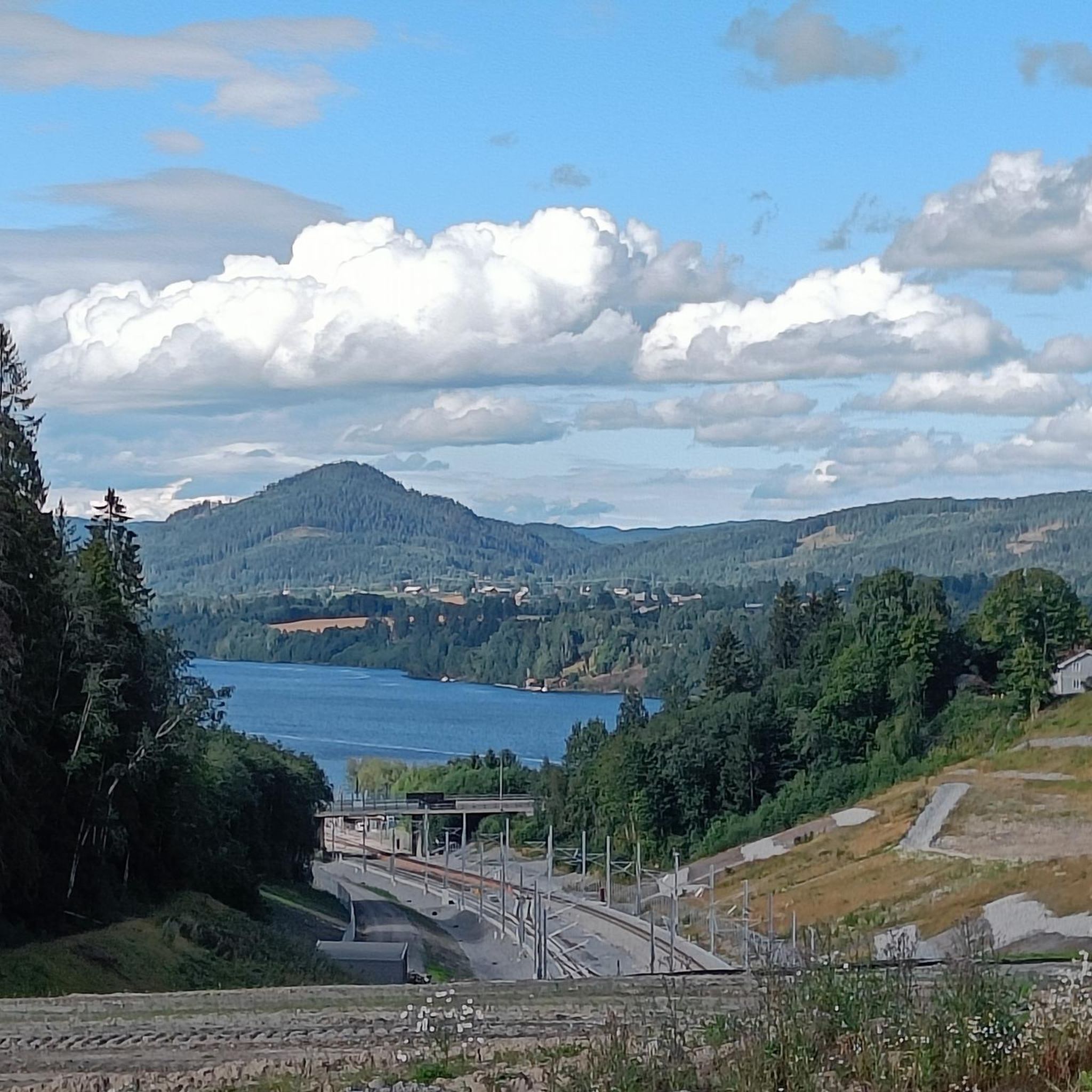
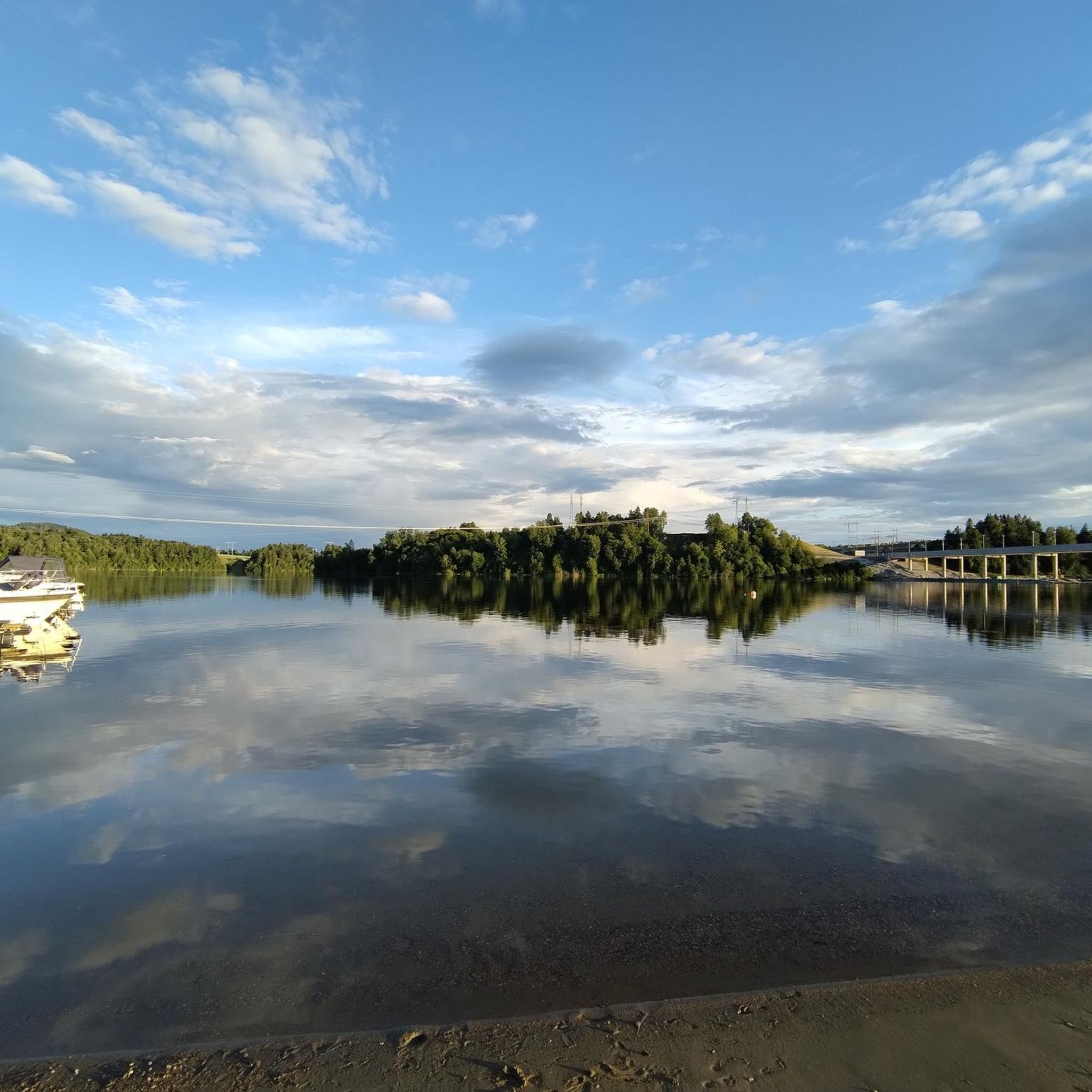
Hiking in Vorma Dyrelivsfredning offers diverse trails within a designated wildlife sanctuary. The landscape is characterized by the Vorma river and its tributaries, including Andelva, Risa, and Nessa. This area encompasses oxbow lakes and riverbanks, featuring slow-moving waters, abundant floating-leaf vegetation, and rich swamp vegetation. The terrain provides varied natural features for outdoor exploration.
Best hiking trails in Vorma Dyrelivsfredning
- The most popular hiking route is School Courtyard with Benches – Haug Pilgrims' Rest Greenhouse loop from Eidsvoll, a 6.3 miles (10.1 km) moderate trail that takes 2 hours 43 minutes to complete, featuring a moderate elevation gain.
- Another top favourite among local hikers is Eidsvoll Church loop from Eidsvoll, an easy 4.4 miles (7.1 km) path that passes by the historic Eidsvoll Church.
- Local hikers also love the Setertjernet Lake – Stone Bridge Over the Stream loop from Vorma dyrelivsfredning, a 4.5 miles (7.3 km) trail leading through natural features like Setertjernet Lake, often completed in about 1 hour 59 minutes.
- Hiking in Vorma Dyrelivsfredning is defined by the Vorma river, oxbow lakes, and diverse riverbank vegetation. The network offers options for both easy strolls and more challenging moderate trails.
- The routes in Vorma Dyrelivsfredning are highly rated by the komoot community with an average score of 4.9 stars from 33 reviews. More than 400 hikers have used komoot to explore Vorma Dyrelivsfredning's varied terrain.
Last updated: June 29, 2026
5
hikers
Moderate hike. Good fitness required. Easily-accessible paths. Suitable for all skill levels.
5
hikers
7.07km
01:56
110m
110m
Easy hike. Great for any fitness level. Easily-accessible paths. Suitable for all skill levels.

Sign up for free
4.8
(5)
35
hikers
8.62km
02:19
110m
110m
Moderate hike. Good fitness required. Easily-accessible paths. Suitable for all skill levels.
4.8
(4)
28
hikers
Easy hike. Great for any fitness level. Easily-accessible paths. Suitable for all skill levels.
6
hikers
5.05km
01:21
50m
50m
Easy hike. Great for any fitness level. Easily-accessible paths. Suitable for all skill levels.
Get access to more routes and recommendations from other explorers.
Sign up for free
Already have an account?
Our route recommendations are based on thousands of hikes, rides, and runs completed by other people on komoot.
Start today with a free account
Your next adventure awaits.
Login or Signup
Tips from the Community

A single large stone makes for a quirky bridge here. It is a big lump of stone and must have taken a bit of effort to move it here. There is a comprehensive wooden bridge right next to it now. It all makes for a quaint little setting in the middle of the woods.
0
0
Setertjernet Lake is a picturesque spread of water set in a beautiful pine forest and surrounded by a myriad of hiking trails. It is a very tranquil spot and is a popular spot for hiking and family-orientated walks.
0
0

As in a fairytale ... a small wooden hut reduced to the bare minimum and without hot water. Nevertheless, with everything you need. The highlight is the romantic and cozy greenhouse.
1
0
Beautiful church. Great stop with little extras for pilgrims
0
0
Frequently Asked Questions
How many hiking trails are there in Vorma Dyrelivsfredning?
Vorma Dyrelivsfredning offers a diverse network of over 35 hiking trails. These routes cater to various preferences, with a good mix of easy and moderate options for exploration.
Are there easy trails suitable for families or beginners?
Yes, Vorma Dyrelivsfredning has many easy trails perfect for families or those new to hiking. For example, the Eidsvoll Church loop from Eidsvoll is an easy 7.1 km path that passes by the historic Eidsvoll Church, offering a pleasant stroll.
What kind of natural features can I expect to see while hiking?
The region is characterized by the Vorma river and its tributaries, including Andelva, Risa, and Nessa. You'll encounter picturesque oxbow lakes, diverse riverbank vegetation, and slow-moving waters. Trails like the Setertjernet Lake – Stone Bridge Over the Stream loop from Vorma dyrelivsfredning will lead you through these natural highlights, including Setertjernet Lake.
Is Vorma Dyrelivsfredning a good place for birdwatching?
Absolutely. As a designated wildlife sanctuary, Vorma Dyrelivsfredning is renowned for its exceptional birdlife. The Vorma river and lower Andelva areas are crucial for many species, including Whooper Swans in winter, various ducks, and migratory wetland birds like cranes and lapwings. It's a significant breeding ground for numerous bird species.
Are there any circular hiking routes in the area?
Yes, many of the trails in Vorma Dyrelivsfredning are designed as convenient loops. For instance, the School Courtyard with Benches – Haug Pilgrims' Rest Greenhouse loop from Eidsvoll is a popular moderate circular trail, and the Haug Pilgrims' Rest Greenhouse loop from Finnbråtengrenda offers an easier circular option.
Can I bring my dog on the hiking trails?
While the region is a wildlife sanctuary, many trails are generally dog-friendly. However, it's always recommended to keep dogs on a leash to protect the local wildlife, especially during breeding seasons. Please check local signage for any specific restrictions on individual trails.
What is the best time of year to hike in Vorma Dyrelivsfredning?
The area offers unique experiences throughout the year. Spring and autumn are ideal for birdwatching due to migration. Summer provides pleasant conditions for general hiking. Even in winter, parts of the Vorma river remain ice-free, making it an important wintering ground for birds, and offering opportunities for winter walks, though conditions may vary.
Are there any historical or cultural landmarks along the trails?
Yes, some routes offer a blend of nature and history. The Eidsvoll Church loop from Eidsvoll, for example, takes you past the historic Eidsvoll Church, providing a cultural point of interest during your hike.
What do other hikers say about the trails in Vorma Dyrelivsfredning?
The trails in Vorma Dyrelivsfredning are highly regarded by the komoot community, with an average rating of 4.9 stars from over 30 reviews. Hikers often praise the well-maintained paths, the peaceful natural environment, and the opportunities to observe diverse wildlife.
Is parking available at the trailheads?
Parking availability varies by trailhead. Many popular starting points for trails, especially those near Eidsvoll or other access points, typically offer designated parking areas. It's advisable to check specific route details on komoot for parking information related to your chosen trail.
Are there any moderate hiking options for those seeking a bit more challenge?
Yes, for hikers looking for a slightly more challenging experience, there are moderate trails available. The School Courtyard with Benches – Haug Pilgrims' Rest Greenhouse loop from Eidsvoll is a 10.1 km moderate trail with a noticeable elevation gain, requiring good basic fitness.
What is the typical terrain like on the hiking trails?
The terrain in Vorma Dyrelivsfredning is generally varied, ranging from easily accessible paths along riverbanks and through open landscapes to more undulating sections with moderate elevation changes. You can expect a mix of natural surfaces, including dirt paths and potentially some gravel sections, reflecting the region's diverse natural features.
Most popular routes in Vorma Dyrelivsfredning

Get inspired with the komoot mobile app


Explore more
Browse the best Hikes in other regions.
