The best walks and hikes in Gulbergnotten Naturreservat
4.6
(126)
578
hikers
21
hikes
Hiking in Gulbergnotten Naturreservat features a mountainous terrain with prominent peaks like Gulbergnotten (541 meters) and Tofjellet (536 meters). The reserve is characterized by diverse forest ecosystems, including noble deciduous and pine forests, with some areas exhibiting old-growth characteristics. The landscape transitions from lush lowland forests to sparser mountain vegetation as elevation increases, providing varied backdrops for hiking. Trails offer a range of elevation gains across these environments.
Best hiking trails in Gulbergnotten Naturreservat
- The most popular hiking route is…
Last updated: July 5, 2026
5.0
(1)
4
hikers
4.58km
02:37
460m
460m
Moderate hike. Good fitness required. Mostly accessible paths. Sure-footedness required.
4.2
(5)
39
hikers
Easy hike. Great for any fitness level. Easily-accessible paths. Suitable for all skill levels.

Sign up for free
5.0
(2)
8
hikers
Moderate hike. Good fitness required. Easily-accessible paths. Suitable for all skill levels.
5.0
(3)
6
hikers
5.08km
02:38
420m
420m
Moderate hike. Good fitness required. Mostly accessible paths. Sure-footedness required.
5.0
(1)
7
hikers
2.75km
00:43
20m
20m
Easy hike. Great for any fitness level. Easily-accessible paths. Suitable for all skill levels.
Get access to more routes and recommendations from other explorers.
Sign up for free
Already have an account?
Our route recommendations are based on thousands of hikes, rides, and runs completed by other people on komoot.
Start today with a free account
Your next adventure awaits.
Login or Signup
Popular around Gulbergnotten Naturreservat
Tips from the Community

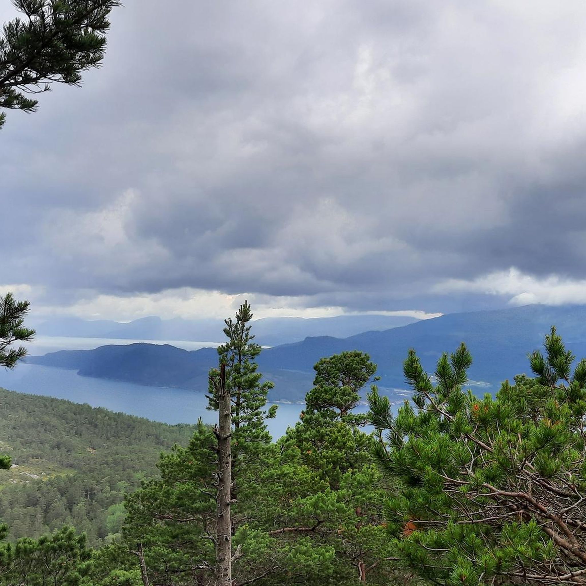
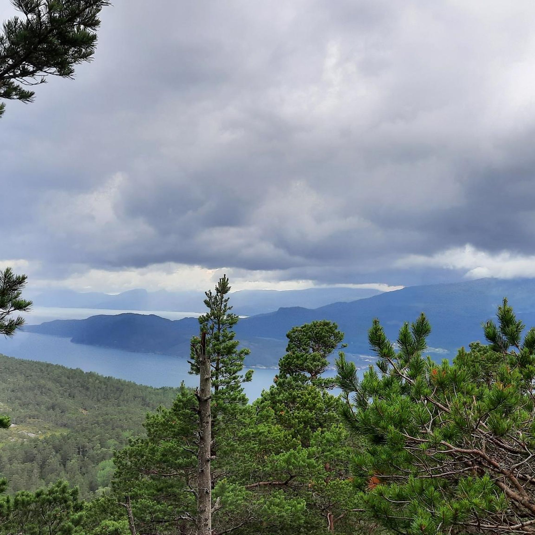
This spectacular vantage point opens up to a breathtaking panorama of a coastal village nestled along the shores of a deep blue fjord. From this high elevation, you look out over forested ridges to see dramatic, snow-dusted mountains rising sharply on the opposite side of the water under a vast, overcast Nordic sky.
0
0
Frequently Asked Questions
How many hiking trails are available in Gulbergnotten Naturreservat?
Gulbergnotten Naturreservat offers a selection of over 20 hiking routes. These trails vary in difficulty, with 6 easy, 12 moderate, and 2 difficult options, ensuring there's something for every experience level.
What kind of terrain can I expect when hiking in Gulbergnotten Naturreservat?
The reserve features a mountainous terrain with prominent peaks like Gulbergnotten (541 meters) and Tofjellet (536 meters). You'll encounter diverse forest ecosystems, from lush lowland deciduous forests to sparser mountain pine forests, some with old-growth characteristics. Trails transition from dense woodlands to more open, rugged mountain environments.
Are there any easy, family-friendly hikes in the reserve?
Yes, there are several easy hikes suitable for families. A good option is the Haugafossen – Bridge Over the River loop from Jondal, which is 4.8 km long and features scenic river sections. Another easy choice is the Bridge Over the River loop from Haugafossen kraftverk, a shorter 2.7 km path.
Are there any trails with good viewpoints of Gulbergnotten mountain?
Absolutely. The View of Gulbergnotten loop from Eidesfossen kraftstasjon is a moderate 5.1 km trail specifically known for offering excellent views of Gulbergnotten mountain itself.
What do other hikers say about the trails in Gulbergnotten Naturreservat?
The trails in Gulbergnotten Naturreservat are highly regarded by the komoot community, holding an average rating of 4.6 stars from over 120 reviews. Hikers often praise the varied terrain, from quiet woodlands to challenging mountain ascents, and the opportunity to experience the region's natural beauty.
Are there any circular hiking routes available?
Yes, many of the trails in Gulbergnotten Naturreservat are designed as loops. Examples include the easy Haugafossen – Bridge Over the River loop from Jondal, the moderate View of Gulbergnotten loop from Eidesfossen kraftstasjon, and the more challenging Tryglahaug – Skjeggafjellet loop from Hardangerfjord.
What kind of wildlife or plant life might I encounter?
The reserve is rich in biodiversity. You might spot unique plant species like clubmoss, creeping lady's tresses, lily of the valley, and common cow-wheat. The forests are also home to several woodpecker species, including the white-backed, lesser spotted, grey-headed, and European green woodpeckers.
Are there any challenging hikes for experienced trekkers?
For experienced hikers seeking a challenge, the Tryglahaug – Skjeggafjellet loop from Hardangerfjord is a difficult 8.5 km trail that leads through mountainous terrain and typically takes around 4 hours 20 minutes to complete, requiring good fitness and sure-footedness.
What are the typical durations and elevation gains for hikes in the area?
Hikes vary significantly. Easy trails can be as short as 45 minutes with minimal elevation gain, while moderate routes might take up to 3-4 hours with around 400-600 meters of ascent. Difficult trails can extend beyond 4 hours and involve over 1000 meters of elevation gain, demanding very good fitness.
Is there a trail that features a waterfall or river?
Yes, the Haugafossen – Bridge Over the River loop from Jondal is an easy route that includes scenic river sections and is named after Haugafossen, suggesting a waterfall feature integrated into the experience.
What are the highest points accessible by trail in the reserve?
The reserve's highest and most prominent peaks are Gulbergnotten (541 meters) and Tofjellet (536 meters). While a well-marked trail leads to the summit of Gulbergnotten, offering rewarding viewpoints, some sections may feature ropes in steeper parts.

Get inspired with the komoot mobile app


Explore more
Browse the best Hikes in other regions.
