The best walks and hikes in Hanangervann Og Kråkenesvann Landskapsvernområde
4.5
(202)
767
hikers
35
hikes
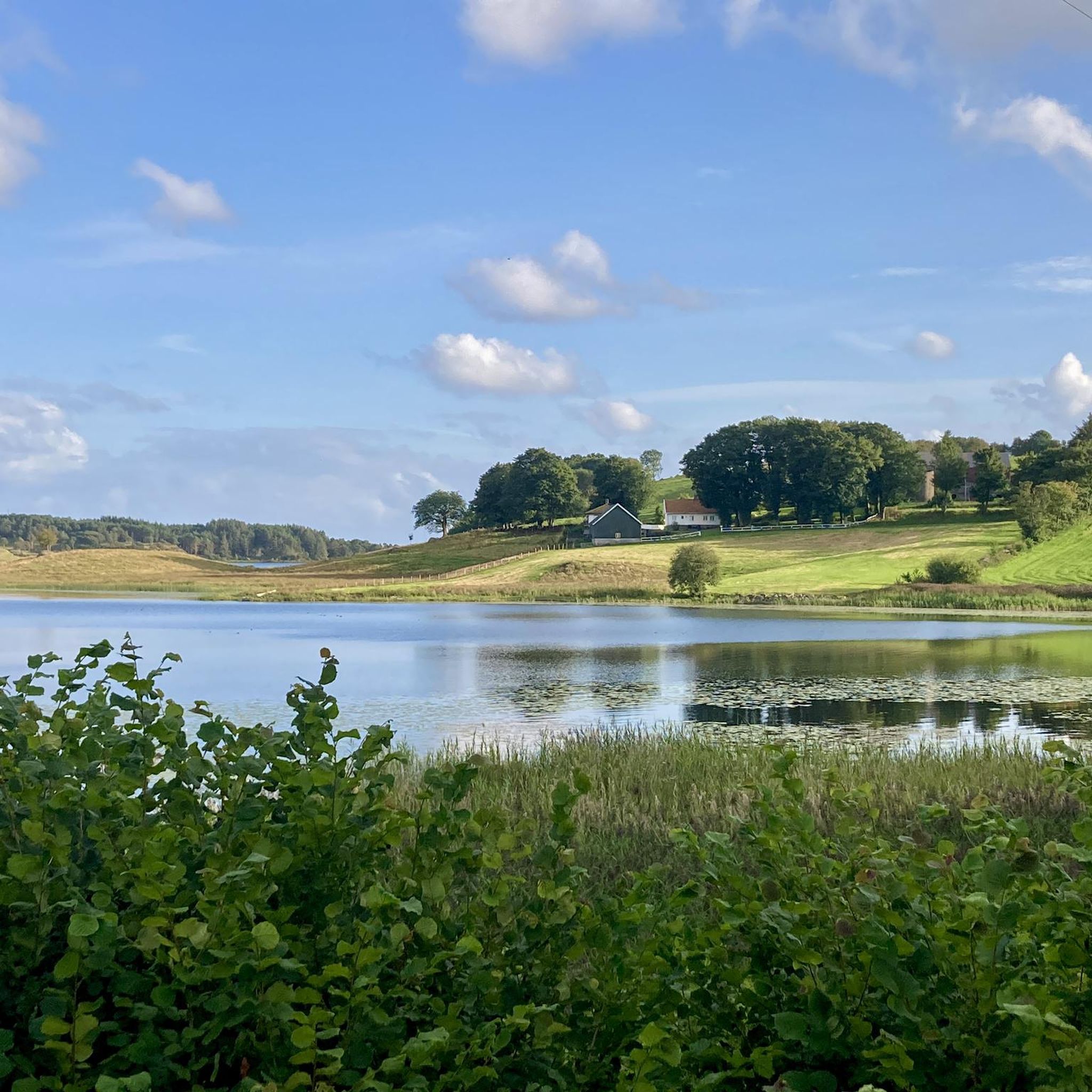
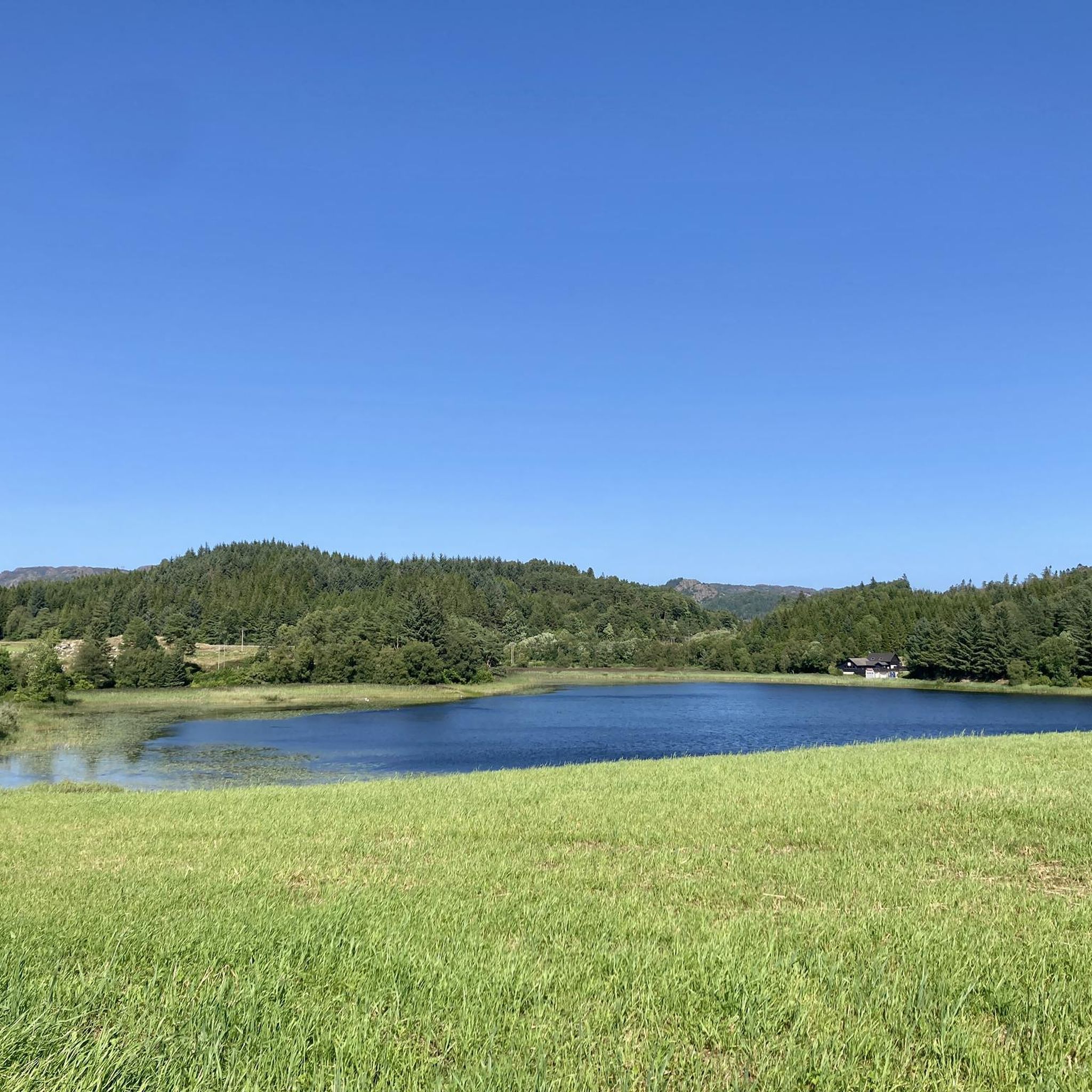
Hiking trails in Hanangervann Og Kråkenesvann Landskapsvernområde traverse a distinctive cultural landscape within the Lista wetland system in Farsund, Norway. The area is characterized by two significant lakes, Hanangervann and Kråkenesvann, which are crucial components of this internationally recognized Ramsar site. Hikers can expect to encounter a blend of natural wetlands and cultivated surroundings, offering a unique scenic backdrop. The region is known for its rich birdlife, providing opportunities for birdwatching alongside the physical activity.
Best hiking trails in Hanangervann…
Last updated: July 9, 2026
9
hikers
8.80km
02:20
90m
90m
Moderate hike. Good fitness required. Easily-accessible paths. Suitable for all skill levels.
3.0
(1)
2
hikers
Moderate hike. Good fitness required. Easily-accessible paths. Suitable for all skill levels.

Sign up for free
4.9
(22)
75
hikers
4.91km
01:15
10m
10m
Easy hike. Great for any fitness level. Easily-accessible paths. Suitable for all skill levels.
5.0
(2)
10
hikers
4.54km
01:10
20m
20m
Easy hike. Great for any fitness level. Easily-accessible paths. Suitable for all skill levels.
3.5
(2)
6
hikers
9.79km
02:29
20m
20m
Moderate hike. Good fitness required. Easily-accessible paths. Suitable for all skill levels.
Get access to more routes and recommendations from other explorers.
Sign up for free
Already have an account?
Our route recommendations are based on thousands of hikes, rides, and runs completed by other people on komoot.
Start today with a free account
Your next adventure awaits.
Login or Signup
Popular around Hanangervann Og Kråkenesvann Landskapsvernområde
Tips from the Community

... right through the forest you reach the viewpoint on a rock. From there you can see the mountains and the Helvikfjord and in the distance the North Sea ... wonderful!!!
0
0

Suitable for all bikes, including racing bikes
1
0

Experience the beautiful dune landscape up close.
0
0

Well suited for a short break.
0
0
The many small beaches along the route invite you to linger and swim. Everything is very clean, but depending on the wind, algae can spoil the fun of swimming.
0
0

The Risbakk is easy to recognize by some piles of stones and also easy to "hike"
1
0
There is a spacious beach with a dune landscape. Very nice for a beach walk.
0
0
Very nice hiking trails and always a view of the sea. Easy to reach from the parking lots at Husbysanden or Lomsesanden👏👏👏
3
0
Frequently Asked Questions
How many hiking trails are available in Hanangervann Og Kråkenesvann Landskapsvernområde?
There are over 35 hiking trails in Hanangervann Og Kråkenesvann Landskapsvernområde, offering a variety of experiences. These routes are highly rated by the komoot community, with an average score of 4.4 stars.
What types of terrain and difficulty levels can I expect on the trails?
The trails primarily feature easy to moderate difficulty levels, with 22 easy routes and 13 moderate ones. You'll traverse a distinctive cultural landscape, blending natural wetlands with cultivated surroundings, and coastal paths offering scenic views.
Are there any easy, family-friendly hiking options?
Yes, there are many easy trails suitable for families. A popular choice is the Losmesanden Beach loop from Einarsneset plantefredningsområde, an easy 3.0-mile (4.9 km) path featuring coastal scenery and beach access, perfect for a relaxed walk.
Can I find circular hiking routes in the area?
Absolutely. Many routes are designed as loops, allowing you to start and end at the same point. For example, the Farsund Marina – Farsund Harbor loop from Farsund is a moderate 5.5-mile (8.8 km) trail offering views of the marina and harbor.
What natural features or landmarks can I see while hiking?
The area is part of the Lista wetland system, a Ramsar site known for its significant birdlife. You'll encounter two crucial lakes, Hanangervann and Kråkenesvann, and a picturesque cultural landscape. For birdwatching, consider the Havika Bird Sanctuary loop from Einarsneset plantefredningsområde.
Is Hanangervann Og Kråkenesvann Landskapsvernområde suitable for dog walking?
While specific regulations for dogs within the immediate protected area should always be checked locally, the broader Farsund municipality generally welcomes dogs on trails. Many of the paths, especially the coastal and cultural landscape routes, are suitable for walks with leashed dogs.
What is the best time of year to go hiking in this region?
The region is particularly rewarding during spring and autumn due to its importance as a resting place for migratory birds. However, the cultural landscape and coastal paths offer pleasant hiking experiences throughout the warmer months. Winter hiking might be possible, but conditions would vary.
Are there any longer, more challenging routes for experienced hikers?
For those seeking a longer, more varied experience, the View of Farsund and Islands – St. Olavsvarden Viewpoint loop from Øyna is a moderate 7.1-mile (11.5 km) route with significant elevation gain, offering expansive views of Farsund and its surrounding islands.
What do other hikers say about their experiences here?
The area is highly rated by the komoot community, with an average score of 4.4 stars from over 190 reviews. Hikers often praise the unique blend of natural wetlands and cultural landscapes, the opportunities for birdwatching, and the variety of trails suitable for different fitness levels.
Where can I find parking or public transport options near the trailheads?
While specific parking details for each trailhead are best found on individual route pages, many trails, especially those starting from areas like Farsund or Einarsneset plantefredningsområde, typically have designated parking. Public transport options in the Farsund municipality may also provide access to some starting points, though this would require local inquiry.
Are there any viewpoints or scenic spots along the trails?
Yes, the region offers several scenic spots. The View of Risbakk Beach loop from Einarsneset plantefredningsområde provides coastal landscapes and views of Risbakk Beach. Additionally, the St. Olavsvarden Viewpoint offers panoramic views of Farsund and the surrounding islands.
What makes the Hanangervann Og Kråkenesvann Landskapsvernområde unique for hiking?
Its uniqueness stems from being a Ramsar wetland site, crucial for birdlife, combined with a distinctive cultural landscape. This blend provides a serene and ecologically significant environment for hiking, offering opportunities for birdwatching alongside physical activity within a picturesque setting.
Most popular routes in Hanangervann Og Kråkenesvann Landskapsvernområde

Get inspired with the komoot mobile app


Explore more
Browse the best Hikes in other regions.
