The best running trails in Jærstrendene Fuglefredningsområde
4.1
(84)
4,614
runners
253
runs
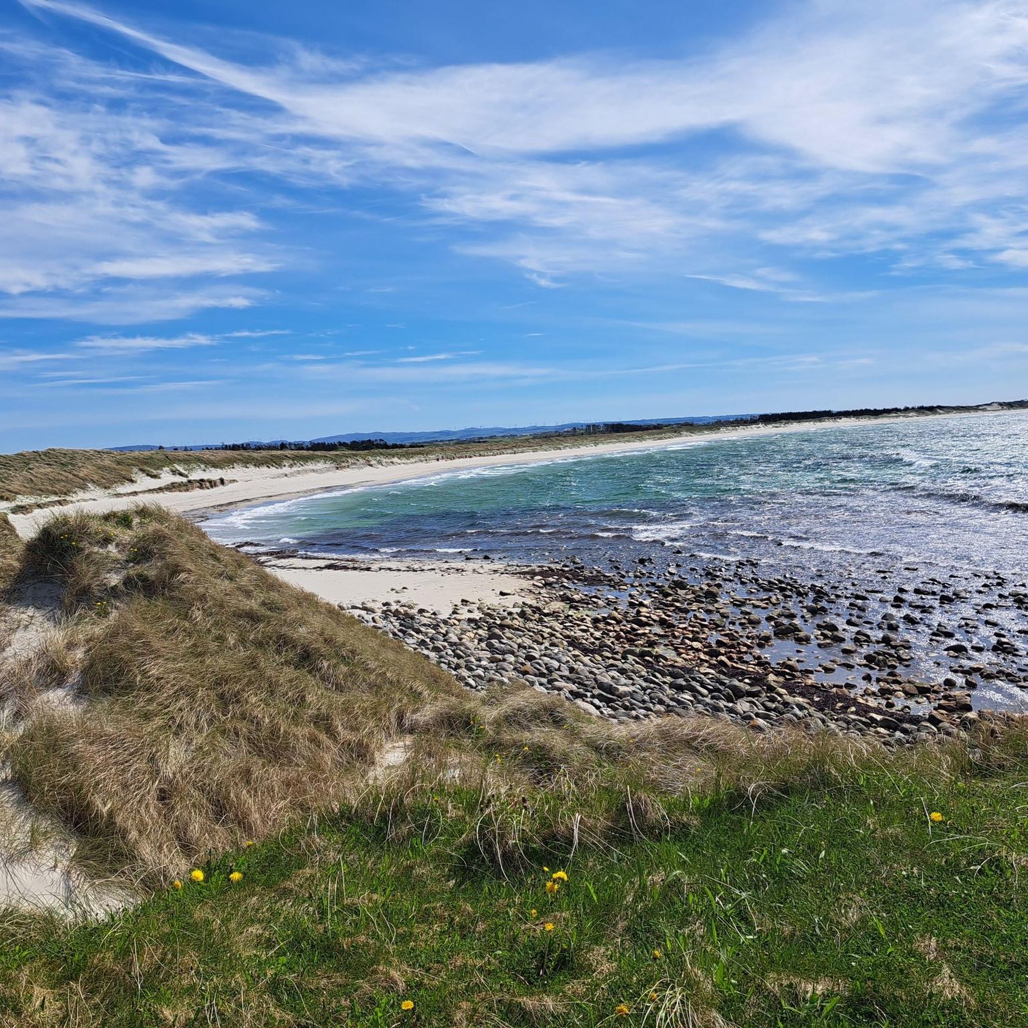
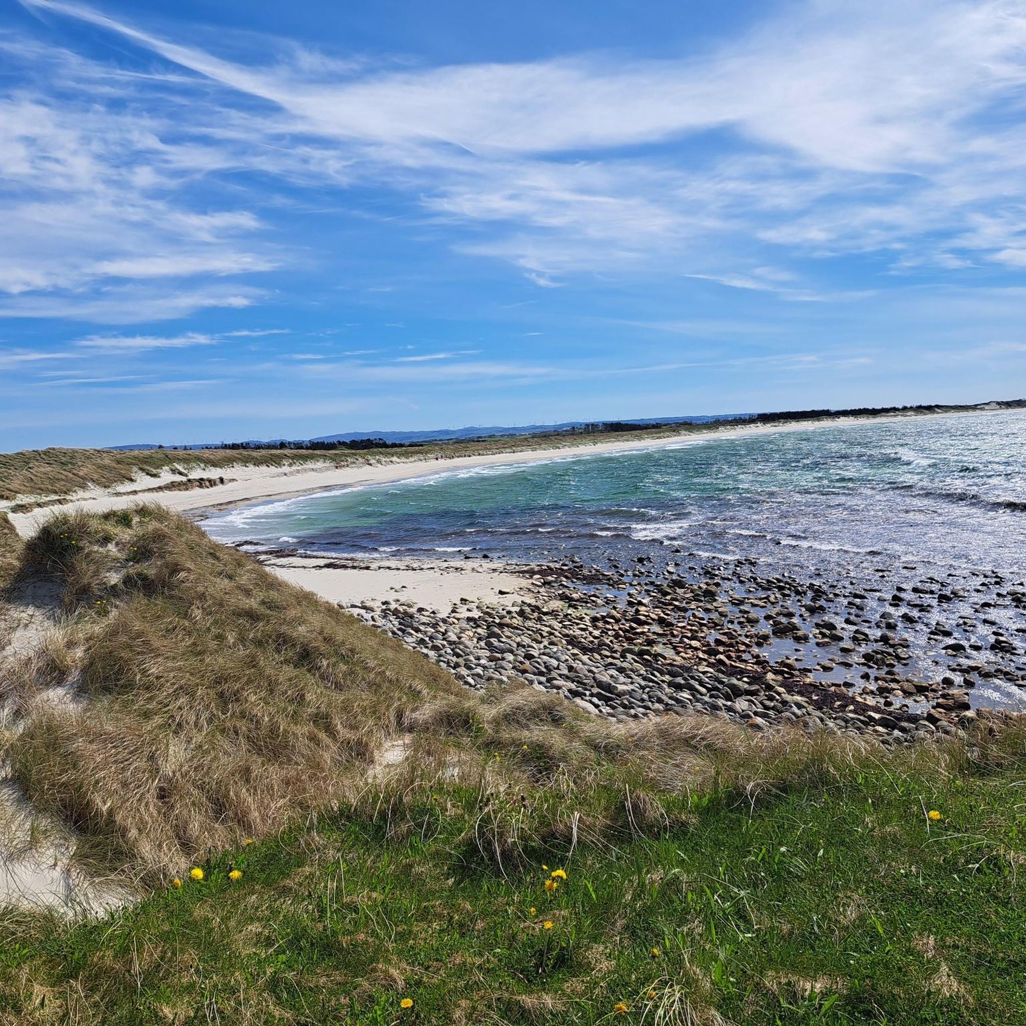
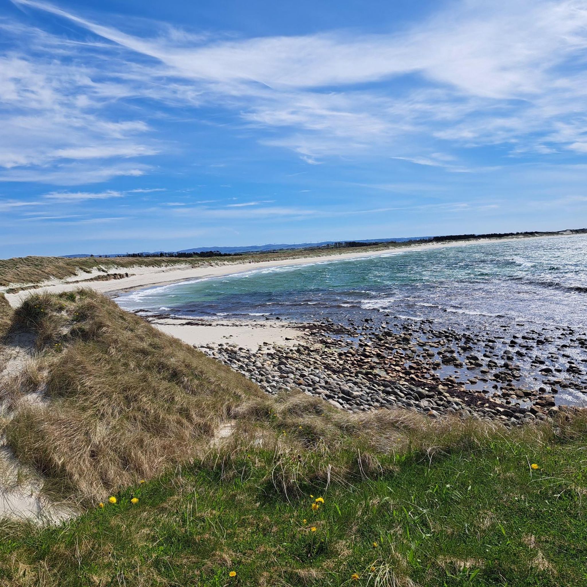
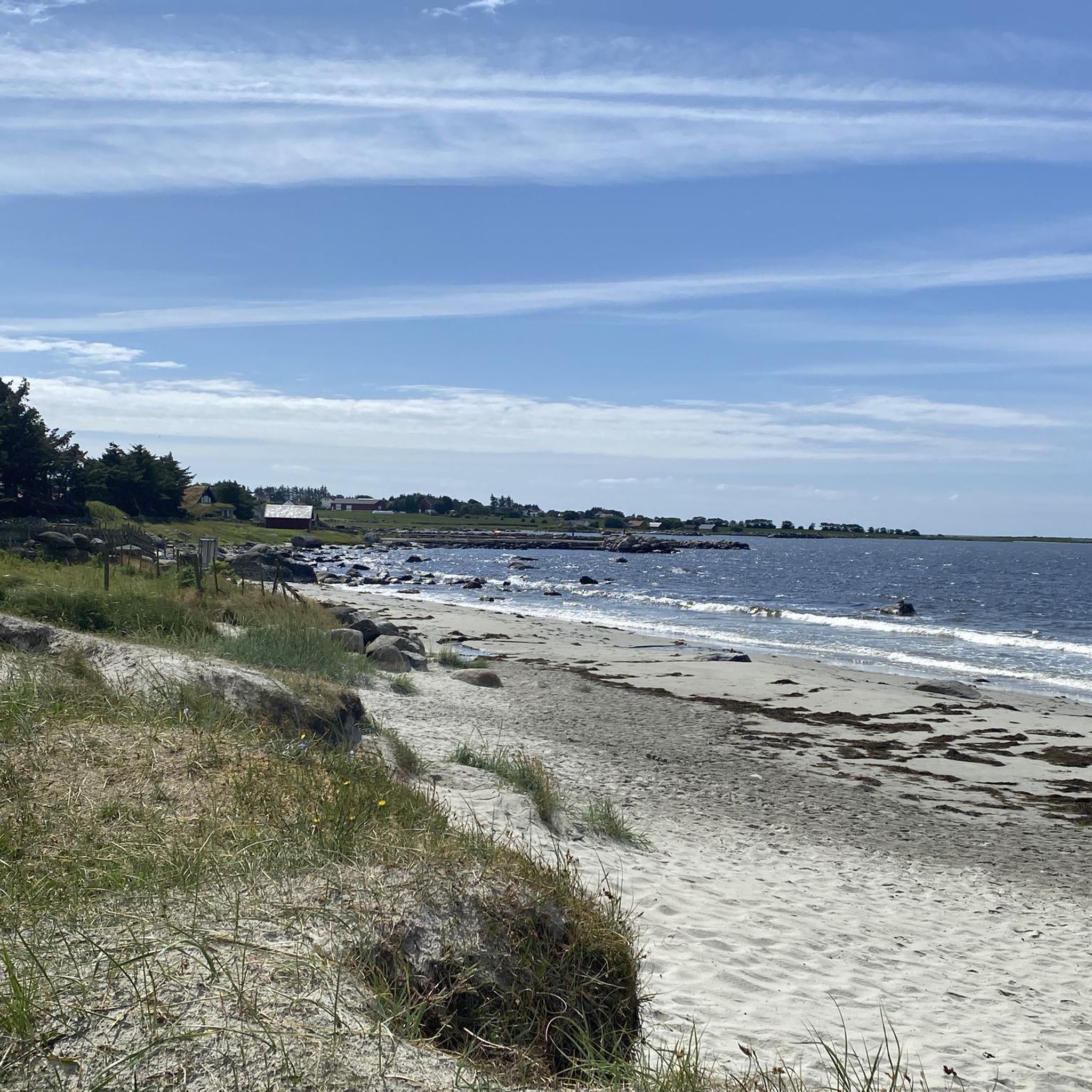
Jogging routes in Jærstrendene Fuglefredningsområde traverse a unique coastal landscape along the North Sea. The region is characterized by 70 kilometers of coastline featuring long, flat sandy beaches, interspersed with pebble and rocky sections, and impressive sand dunes. Inland, the terrain transitions to the flat, cultivated Jæren landscape. This area is also a designated bird protection zone, offering a natural backdrop for running.
Best jogging routes in Jærstrendene Fuglefredningsområde
- The most popular jogging route is Running loop from Himmel &…
Last updated: July 12, 2026
4
runners
8.33km
00:52
40m
40m
Moderate run. Good fitness required. Mostly paved surfaces. Suitable for all skill levels.
8
runners
7.80km
00:51
110m
110m
Moderate run. Good fitness required. Mostly paved surfaces. Suitable for all skill levels.

Sign up for free
5
runners
5.33km
00:34
30m
30m
Moderate run. Good fitness required. Mostly paved surfaces. Suitable for all skill levels.
2.0
(1)
71
runners
12.9km
01:23
50m
50m
Moderate run. Good fitness required. Mostly paved surfaces. Suitable for all skill levels.
3.0
(1)
38
runners
26.9km
02:53
130m
130m
Hard run. Very good fitness required. Mostly paved surfaces. Suitable for all skill levels.
Get access to more routes and recommendations from other explorers.
Sign up for free
Already have an account?
Our route recommendations are based on thousands of hikes, rides, and runs completed by other people on komoot.
Start today with a free account
Your next adventure awaits.
Login or Signup
Popular around Jærstrendene Fuglefredningsområde
Tips from the Community

For years, the Håhammaren loop trail, had missing a link to join the northern and southern parts of the trail. This bridge has been built in that purpose but alos to create a landmark and a place to gather hikers and locals. The idea was also to respect the natural site by creating something without destroying another thing.
0
0
This lovely walk along the shore passes through charming residential areas with a succession of pontoons, stone jetties, and natural spaces. It offers magnificent views of the bay all along the way.
0
0

Sunde’s peaceful coastline offers a gravel path near the water, providing unobstructed views of Hafrsfjord towards Sola. The flat terrain makes it easy to ride or walk.
0
0

Sverd i fjell 1983 to commemorate the Battle at Hafrsfjord, which took place around the year 872 AD. The monument was designed by the sculptor Fritz Røed. It is modelled on three Viking swords ds found tour at different local ocations in Norway. The swords have been placed in the bedrock.
0
0

Håhammaren Bro (bro = bridge, Håhammaren = name of the rock formation), a really stylish, relatively new-looking bridge in the middle of nature. Coming from Svert i Fjell, you can turn right shortly after onto a forest path, which leads up to a small heath or raised bog area. Go down the other side (to the left) and a little further on you'll find the large rock with the red carvings depicting Bronze Age boats. Because of the shooting range signs, you should wear bright clothing if possible; we didn't hear anything, but better safe than sorry.
0
0
Here at Hafrsfjord is the royal monument Sverd i fjell (Swords in the Rock). History tells that Harald Fairhair united Norway into a kingdom here in 872. If the tradition is correct, Harald I received the nickname Fairhair because he only had his hair and beard cut again after defeating the other rulers. The monument consists of three swords stuck in the ground, symbolizing peace, unity, and freedom. The hilts of the Viking swords are modeled after sword finds from various parts of Norway. The monument was designed by Fritz Røed (1928-2002) and inaugurated by King Olav in 1983. (Height of the middle sword = 9.2 m) Source: www.visitnorway.de Anyone interested in the history of Harald I is highly recommended to visit Avaldsnes.
0
0

Beautiful shallow water can be found here… perfect for families with small children.
0
0

Be careful with the sand on the bike path
0
0
Frequently Asked Questions
How many running routes are available in Jærstrendene Fuglefredningsområde?
There are over 260 running routes in Jærstrendene Fuglefredningsområde. These include a variety of options, with approximately 23 easy routes, over 200 moderate routes, and around 35 more challenging trails, catering to different fitness levels.
What kind of terrain can I expect on the jogging trails in Jærstrendene?
The terrain in Jærstrendene Fuglefredningsområde is quite diverse, primarily featuring long, flat sandy beaches, interspersed with pebble and rocky sections. You'll also encounter impressive sand dunes and the flat, cultivated Jæren landscape further inland. This offers a mix of soft sand, firm paths, and open coastal views.
Are there any family-friendly running paths in the area?
Yes, many of the routes in Jærstrendene are classified as easy and suitable for all fitness levels, making them ideal for families. The flat sandy beaches provide a safe and enjoyable environment for a run with children. For example, the 3.3-mile (5.3 km) Solna Ruin loop from Himmel & Hav Kurs- og Misjonssenter is a moderate option that is often completed in about 35 minutes.
Can I bring my dog on the running trails?
Yes, you can bring your dog, but it's crucial to be aware of the year-round leash requirements throughout Jærstrendene Fuglefredningsområde. This is a designated bird protection area, and keeping dogs on a leash helps protect the vulnerable birdlife and delicate ecosystem.
Are there any circular running routes in Jærstrendene Fuglefredningsområde?
Many of the running routes in the region are designed as loops, offering a convenient way to start and finish at the same point. A popular choice is the 5.2-mile (8.3 km) Running loop from Himmel & Hav Kurs- og Misjonssenter, which provides scenic coastal views.
What are some notable landmarks or points of interest I might see while running?
While running, you can encounter several interesting landmarks. The Harestad stranden loop from Tungenes fyr passes by the historic Tungenes Lighthouse. Other prominent lighthouses in the region include Kvassheim Lighthouse and Obrestad Lighthouse. You might also spot historical sites like Varhaug Old Cemetery or the World War II monument 'Hitlertennene' at Brusand.
Where can I find parking for the running routes?
Parking facilities are available at several key locations, often near visitor centers. Friluftshuset Orre, Kvassheim Lighthouse, and Tungenes Lighthouse all offer parking, along with other amenities like toilets. These serve as convenient starting points for many of the trails.
What is the best time of year to go jogging in Jærstrendene?
Jærstrendene offers a unique running experience year-round, with the 'high sky, wide horizons, and endless sea' creating a dramatic backdrop. However, be mindful of the bird breeding season from April 15 to July 31, when certain parts of the bird protection zones may have restricted access to minimize disturbance to wildlife. Always check local signage for current restrictions.
What do other runners enjoy most about jogging in Jærstrendene Fuglefredningsområde?
The running routes in Jærstrendene Fuglefredningsområde are highly rated by the komoot community, with an average score of 4.0 stars from over 50 reviews. Runners often praise the unique coastal landscape, the extensive sandy beaches perfect for long runs, and the dramatic, ever-changing scenery influenced by the weather and light.
Are there any challenging running routes for experienced runners?
Yes, for those seeking a greater challenge, there are approximately 35 difficult routes available. An example is the 16.7-mile (26.9 km) Swords in Rock Monument – Møllebukta loop from Stavanger Airport, Sola, which features more significant elevation changes and covers a longer distance, taking around 3 hours and 50 minutes to complete.
Are there any easy running routes for beginners?
Absolutely. Jærstrendene Fuglefredningsområde offers around 23 easy routes that are perfect for beginners or those looking for a relaxed run. These routes typically feature flatter terrain and shorter distances, allowing for an enjoyable introduction to running in the region's beautiful coastal environment.
What are the conservation rules I should be aware of when running?
As a designated bird protection area and Ramsar site, it's important to respect the conservation rules. This includes year-round leash requirements for dogs, and adhering to restricted access in certain bird protection zones, especially during the breeding season (April 15 to July 31). Cycling is restricted to roads and designated paths, and activities like golf or ball games are prohibited in the sand dunes to preserve the delicate ecosystem. Always stay on marked trails.
Can I reach the running trails using public transport?
While specific public transport details for every trailhead are not provided, the region's infrastructure aims to guide visitors. It's advisable to check local bus schedules or regional transport options that might connect to areas near the visitor centers or larger towns along the Jæren coastline, which often serve as access points to the trails.
Most popular routes in Jærstrendene Fuglefredningsområde
Most popular attractions in Jærstrendene Fuglefredningsområde

Get inspired with the komoot mobile app


Explore more
Browse the best Running Trails & Routes in other regions.
