The best walks and hikes in Kvitingsmorki Naturreservat
4.1
(87)
324
hikers
15
hikes
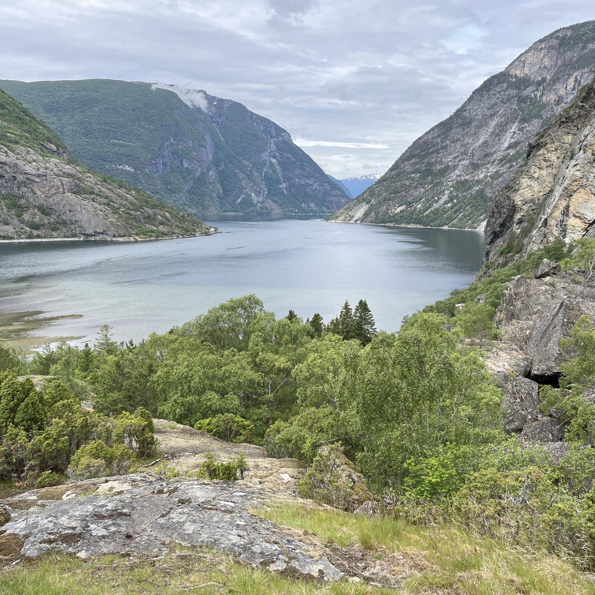
Hiking in Kvitingsmorki Naturreservat offers diverse landscapes from fjord to high mountains. The region is characterized by West Norway's highest-lying pine forests and expansive primaeval forests. Hikers will find varied terrain, including significant elevation changes and trails that incorporate waterfalls. This protected area safeguards a continuous forest environment with a rich ecosystem.
Best hiking trails in Kvitingsmorki Naturreservat
- The most popular hiking route is Waterfall Trail – Stødnarmarki Waterfall Trail loop from Hauge kyrkje, a 5.0 miles (8.0 km)…
Last updated: July 10, 2026
4.3
(6)
18
hikers
8.02km
02:54
400m
400m
Moderate hike. Good fitness required. Mostly accessible paths. Sure-footedness required.
3.0
(1)
12
hikers
Easy hike. Great for any fitness level. Easily-accessible paths. Suitable for all skill levels.

Sign up for free
4.4
(5)
34
hikers
12.2km
05:08
960m
960m
Hard hike. Very good fitness required. Easily-accessible paths. Suitable for all skill levels.
4.4
(8)
21
hikers
7.92km
03:00
510m
510m
Moderate hike. Good fitness required. Mostly accessible paths. Sure-footedness required.
4.4
(45)
148
hikers
6.23km
01:49
140m
140m
Easy hike. Great for any fitness level. Easily-accessible paths. Suitable for all skill levels.
Get access to more routes and recommendations from other explorers.
Sign up for free
Already have an account?
Our route recommendations are based on thousands of hikes, rides, and runs completed by other people on komoot.
Start today with a free account
Your next adventure awaits.
Login or Signup
Popular around Kvitingsmorki Naturreservat
Tips from the Community

If you follow this rocky path, you will be rewarded with view of impressive waterfalls.
0
0

The Storehaugen above Lærdalsøyri rises to 908 meters and is a well-known peak for hiking and trail races in the area. The summit features a wooden shelter (lavvu) and is accessible via a steep, scenic trail from Lærdalsøyri.
0
0

Take time to wander through Old Lærdalsøyri, where over 150 wooden houses from the 18th and 19th centuries line narrow streets. It’s a rare glimpse of Norway’s trading past.
1
0

The historic center of Lærdalsøyri is a charming cluster of well-preserved wooden houses from the 18th and 19th centuries. Once a vital trading post between east and west Norway, it now offers a quiet stroll through history. Its narrow streets and traditional architecture reflect the town's rich cultural heritage.
1
0
Here you can walk along the river and admire the views over the river island. The landscape changes constantly depending on the clouds and the light.
0
0

In addition to the actual town hall, this building also housed the local court.
0
0

Really useful when it's wet, as it's really slippery in places. There are a few more secured spots like this along the hiking trail.
0
0
The cabin is one of many in Norway and is open to everyone all year round. In addition to a solar system for lighting, it is a great destination for families, as there are children's toys and even books in the cabin - the view is also nice to look out over the small town. Please keep it clean and tidy.
0
1
Frequently Asked Questions
What types of hiking trails can I expect in Kvitingsmorki Naturreservat?
Kvitingsmorki Naturreservat offers a diverse range of trails, from easy paths suitable for all fitness levels to challenging routes with significant elevation gains. You'll find paths winding through West Norway's highest-lying pine forests, expansive primaeval forests, and trails featuring stunning fjord and mountain views.
Are there any easy or family-friendly hiking options in the reserve?
Yes, Kvitingsmorki Naturreservat has several easy trails. For instance, the Mjølkeflaten Cabin – Stødnarmarki Waterfall Trail loop from Lærdalsøyri is an easy 6.2 km route with a moderate elevation gain, making it a good choice for families or those seeking a less strenuous walk.
Can I find trails with waterfalls in Kvitingsmorki Naturreservat?
Absolutely. The region is known for its scenic waterfalls. A popular option is the Waterfall Trail – Stødnarmarki Waterfall Trail loop from Hauge kyrkje, an 8.0 km moderate hike that prominently features waterfalls along its path.
What are the most challenging hikes in the area?
For experienced hikers seeking a challenge, the Lærdalsøyri loop is a difficult 12.2 km trail with a significant elevation gain of 960 meters. This route offers breathtaking fjord and mountain views, demanding very good fitness and sure-footedness.
Are there any circular hiking routes available?
Yes, many trails in Kvitingsmorki Naturreservat are designed as loops. For example, the Mjølkeflaten Cabin – Waterfall loop from Hauge kyrkje is a moderate 11.1 km circular route that takes you through varied terrain and offers impressive views.
What kind of natural features and landscapes will I see while hiking?
Hikers in Kvitingsmorki Naturreservat will experience stunning fjord and mountain vistas, West Norway's highest-lying pine forests, and expansive primaeval forests. The reserve's varied habitats also support a range of wildlife, including moose, deer, reindeer, and roe deer.
Are there any notable viewpoints or landmarks to visit?
The Storehaugen peak, rising to 908 meters above Lærdalsøyri, is a popular destination offering panoramic views. It's accessible via a steep, scenic trail and features a wooden shelter at the summit. Additionally, the historic center of Lærdalsøyri, with its well-preserved 18th and 19th-century wooden houses, is a cultural attraction nearby.
What do other hikers say about Kvitingsmorki Naturreservat?
The area is highly rated by the komoot community, with an average score of 4.2 stars from over 80 reviews. Hikers often praise the diverse landscapes, the stunning fjord and mountain views, and the variety of trails suitable for different ability levels.
Is Kvitingsmorki Naturreservat suitable for dog walking?
While the reserve is a natural area, specific regulations regarding dogs can vary. It's generally advisable to keep dogs on a leash to protect wildlife and ensure a pleasant experience for all visitors. Always check local signage for any specific restrictions.
What is the best time of year to go hiking in Kvitingsmorki Naturreservat?
The best time to hike generally depends on the trail's elevation and difficulty. Summer and early autumn typically offer the most favorable conditions with milder weather and accessible trails. However, the diverse landscape means some lower-lying trails might be enjoyable in late spring or even early winter, depending on snow conditions.
Are there any trails that specifically highlight the unique forests of the region?
Many trails traverse the unique forest environments. Routes that climb from the fjord towards the mountains will take you through West Norway's highest-lying pine forests and into expansive primaeval forests, showcasing the reserve's protected natural plant life.
How long do hikes typically take in Kvitingsmorki Naturreservat?
Hike durations vary significantly based on difficulty and length. Easy hikes can be as short as two hours, while moderate trails might take up to five hours. More challenging routes, such as the Lærdalsøyri waterfall trail (7.9 km), typically take around 3 hours, while difficult routes can last over five hours.
Most popular routes in Kvitingsmorki Naturreservat

Get inspired with the komoot mobile app


Explore more
Browse the best Hikes in other regions.
