The best walks and hikes in Bleia Naturreservat
4.4
(209)
861
hikers
25
hikes
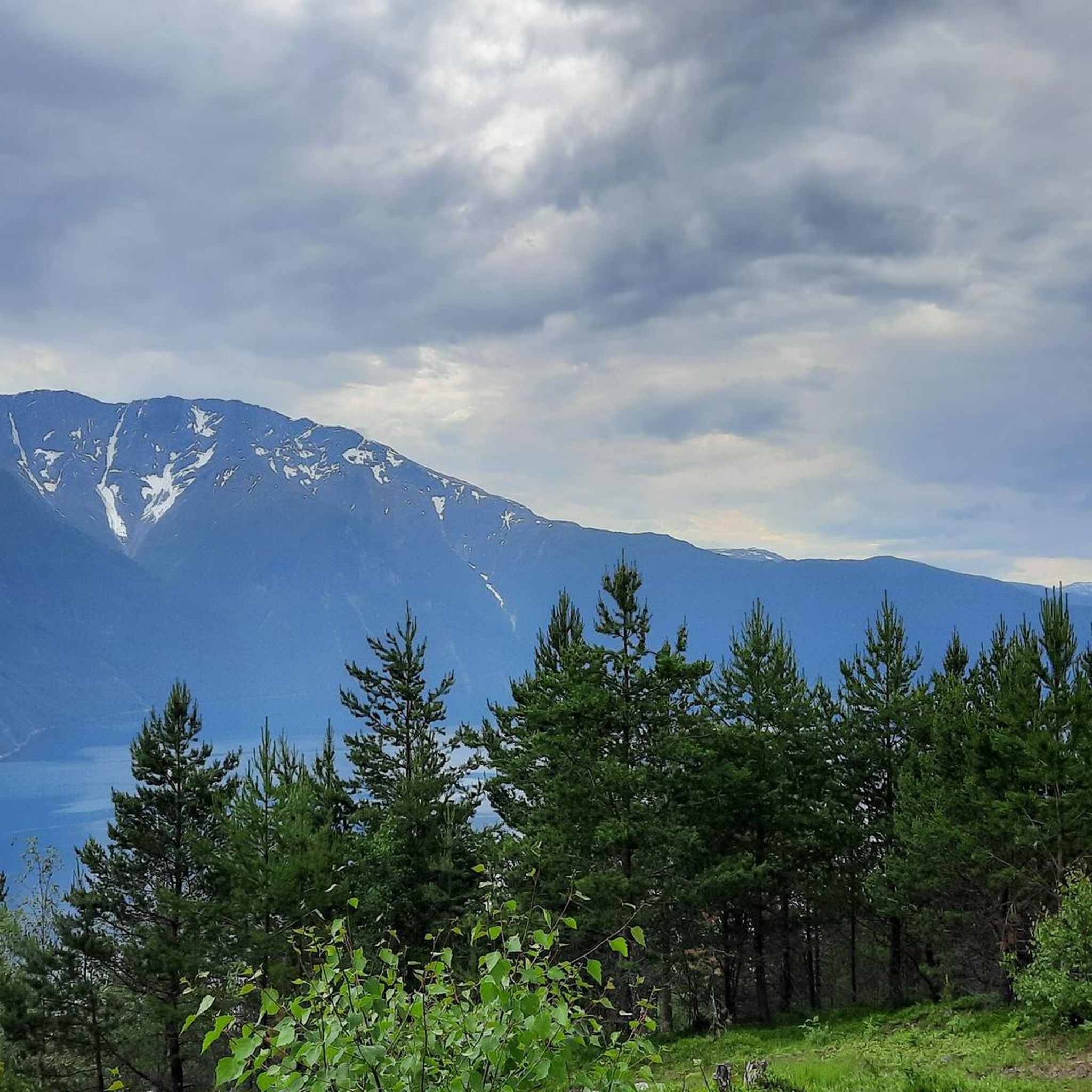
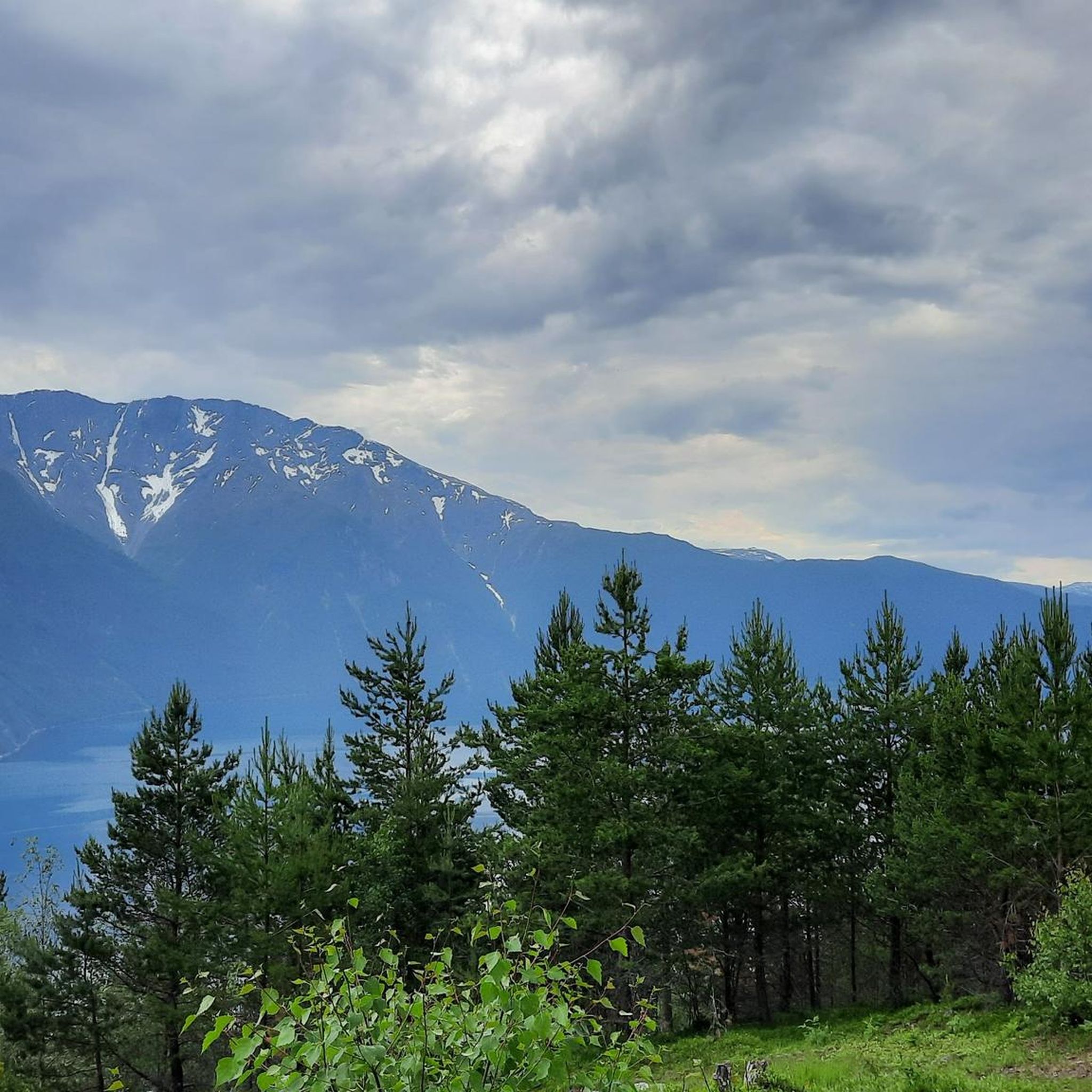
Hiking in Bleia Naturreservat offers diverse terrain within a dramatic fjord landscape, characterized by the imposing Bleia mountain rising directly from the Sognefjord. The region features steep cliffs, powerful ravines, and sharp mountain ridges, creating a rugged environment. It also protects valuable old-growth pine forests, contributing to its unique natural features.
Best hiking trails in Bleia Naturreservat
- The most popular hiking route is Kaupanger Ferry Terminal – Kaupanger Stave Church loop from Kaupanger, a 2.5 miles (4.1 km) trail…
Last updated: August 20, 2026
4.0
(1)
27
hikers
Easy hike. Great for any fitness level. Easily-accessible paths. Suitable for all skill levels.
4.0
(1)
12
hikers
3.00km
00:51
60m
60m
Easy hike. Great for any fitness level. Easily-accessible paths. Suitable for all skill levels.

Sign up for free
3.5
(2)
11
hikers
7.64km
02:07
140m
140m
Moderate hike. Good fitness required. Easily-accessible paths. Suitable for all skill levels.
4.4
(29)
109
hikers
5.18km
01:44
260m
260m
Easy hike. Great for any fitness level. Easily-accessible paths. Suitable for all skill levels.
4.3
(25)
66
hikers
9.32km
03:05
460m
460m
Moderate hike. Good fitness required. Easily-accessible paths. Suitable for all skill levels.
Get access to more routes and recommendations from other explorers.
Sign up for free
Already have an account?
Our route recommendations are based on thousands of hikes, rides, and runs completed by other people on komoot.
Start today with a free account
Your next adventure awaits.
Login or Signup
Popular around Bleia Naturreservat
Tips from the Community

Unfortunately it was closed when we were here
0
0

A remarkable stave church. It is the successor building to a previous church, which was mentioned in a document in 1183.
1
0
Pier of the car ferry Gudvangen - Kaupanger. Crossings can be booked online here: https://www.fjordtours.com/things-to-do-in-norway/car-ferries/kaupanger-gudvangen/
1
0

Here the ferry to Gudvangen starts through the Naeroyfjord.
0
0
Frequently Asked Questions
How many hiking trails are available in Bleia Naturreservat?
Bleia Naturreservat offers a diverse network of over 20 hiking trails. These routes cater to various fitness levels, ranging from easy walks to more challenging, strenuous hikes.
What kind of terrain can I expect when hiking in Bleia Naturreservat?
The terrain in Bleia Naturreservat is characterized by a dramatic fjord landscape. You'll encounter steep cliffs, powerful ravines, and sharp mountain ridges, especially around the imposing Bleia mountain. The reserve also features valuable old-growth pine forests, adding to the varied natural environment.
Are there any family-friendly hiking options in Bleia Naturreservat?
Yes, there are several family-friendly options. Many paths are easily accessible and suitable for all skill levels, typically taking up to two hours with around 1,000 feet of elevation gain. An example of an easy route is the Kaupanger Ferry Terminal loop from Kaupanger, which is about 3 km long.
What are the most challenging hikes in Bleia Naturreservat?
For experienced hikers, the most challenging routes often involve significant elevation gain and longer durations, sometimes over five hours or 3,000 feet of ascent. These strenuous trails require very good fitness, sure-footedness, sturdy shoes, and alpine experience. The hike to the summit of Bleia (1717 meters) is a particularly demanding option, offering unparalleled views.
Can I bring my dog on the hiking trails in Bleia Naturreservat?
While Bleia Naturreservat is a protected area, specific regulations regarding dogs can vary. Generally, dogs are permitted on trails but must be kept on a leash, especially during certain times of the year to protect wildlife. Always check local signage or official park information for the most current rules before your visit.
What natural features or landmarks can I see while hiking?
The most prominent natural feature is the Bleia mountain itself, rising dramatically from the Sognefjord. Hikers can also experience the unique geology of the fjord landscape, old-growth pine forests, and potentially spot rare flora like the Arctic poppy. Many trails offer stunning viewpoints over the Sognefjord, such as the Amlaholten (507 m) – View of Sognefjord loop from Amla.
What is the best time of year to go hiking in Bleia Naturreservat?
The best time for hiking in Bleia Naturreservat is typically during the warmer months, from late spring to early autumn. During this period, trails are generally free of snow, and the weather is more stable, allowing for better access and enjoyment of the diverse landscape. Always check local weather forecasts before heading out.
Are there any circular hiking routes available?
Yes, several circular routes are available, allowing you to start and end at the same point. An example of a moderate circular route is the Kaupanger Stave Church – Kaupanger Ferry Terminal loop from Kaupanger, which is about 7.2 km long and takes around 2 hours.
What do other hikers say about their experience in Bleia Naturreservat?
The hiking routes in Bleia Naturreservat are highly rated by the komoot community, with an average score of 4.6 stars from over 170 reviews. Hikers often praise the dramatic fjord views, the pristine natural environment, and the variety of trails suitable for different skill levels.
Is parking available for hikers in Bleia Naturreservat?
Parking availability can vary depending on the specific trailhead. For popular starting points like those near Kaupanger, there are often designated parking areas. It is advisable to research the specific trailhead you plan to use to confirm parking options and any potential fees.
Can I reach hiking trailheads in Bleia Naturreservat using public transport?
Public transport options to trailheads within Bleia Naturreservat are limited due to its remote nature. However, some routes, particularly those starting near Kaupanger, may be accessible via local bus services or the ferry terminal. Planning your journey in advance and checking local transport schedules is recommended.
What should I bring for a hike in Bleia Naturreservat?
Given the varied terrain and potential for changing weather, it's essential to bring appropriate gear. This includes sturdy hiking boots, layers of clothing, rain gear, sufficient water and snacks, a map or GPS device, and a first-aid kit. For more strenuous routes, alpine experience and additional safety equipment may be necessary.

Get inspired with the komoot mobile app


Explore more
Browse the best Hikes in other regions.
