The best walks and hikes in Liaberget Naturreservat
4.5
(110)
549
hikers
48
hikes
Hiking in Liaberget Naturreservat offers diverse trails across varied terrain. The reserve features accessible paths leading to destinations like Makalausfjellet, a 1,099-meter summit situated on a high plateau. Hikers can find routes ranging from easy walks to more moderate treks, often passing by small lakes that reflect the surrounding landscape. The area provides a range of hiking experiences for different fitness levels.
Best hiking trails in Liaberget Naturreservat
- The most popular hiking route is Makalausfjellet, a 3.2 miles (5.1…
Last updated: August 20, 2026
4.4
(10)
29
hikers
5.09km
01:25
100m
100m
Easy hike. Great for any fitness level. Easily-accessible paths. Suitable for all skill levels.
5
hikers
Moderate hike. Good fitness required. Easily-accessible paths. Suitable for all skill levels.

Sign up for free
2
hikers
8.57km
02:32
250m
250m
Moderate hike. Good fitness required. Easily-accessible paths. Suitable for all skill levels.
2
hikers
5.98km
01:37
80m
80m
Easy hike. Great for any fitness level. Easily-accessible paths. Suitable for all skill levels.
4.0
(1)
10
hikers
8.92km
02:33
200m
200m
Moderate hike. Good fitness required. Easily-accessible paths. Suitable for all skill levels.
Get access to more routes and recommendations from other explorers.
Sign up for free
Already have an account?
Our route recommendations are based on thousands of hikes, rides, and runs completed by other people on komoot.
Start today with a free account
Your next adventure awaits.
Login or Signup
Tips from the Community

Makalaustoppen (Makalaus) is the highest mountain in Stavadalen and is located at 1,099 meters above sea level. The summit is a popular tourist destination with a magnificent view of Stavadalen, Golsfjellet, and the mountain areas in Valdres.
0
0
The Flystøtta in Stavadalen is a memorial to two aviators who died when a plane crashed in the mountainous area near Stavadalen in Sør-Aurdal on March 9, 1949. The memorial stone was later erected to honor the deceased and keep the memory of the accident alive.
0
0

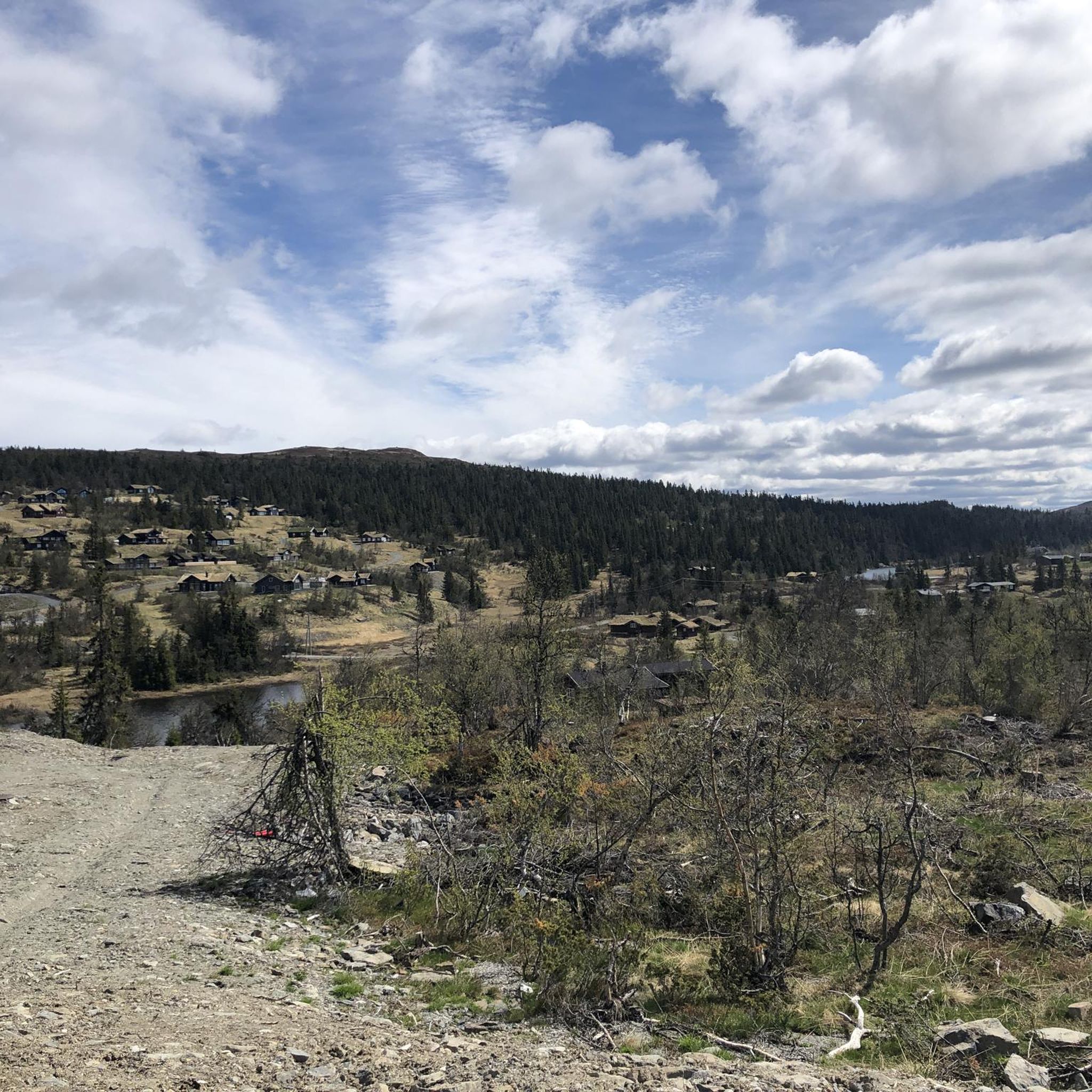
At the end of the gravel road, it widens slightly, allowing you to park your car here. From here, you can hike to the summit of Makalausfjellet, for example.
0
0
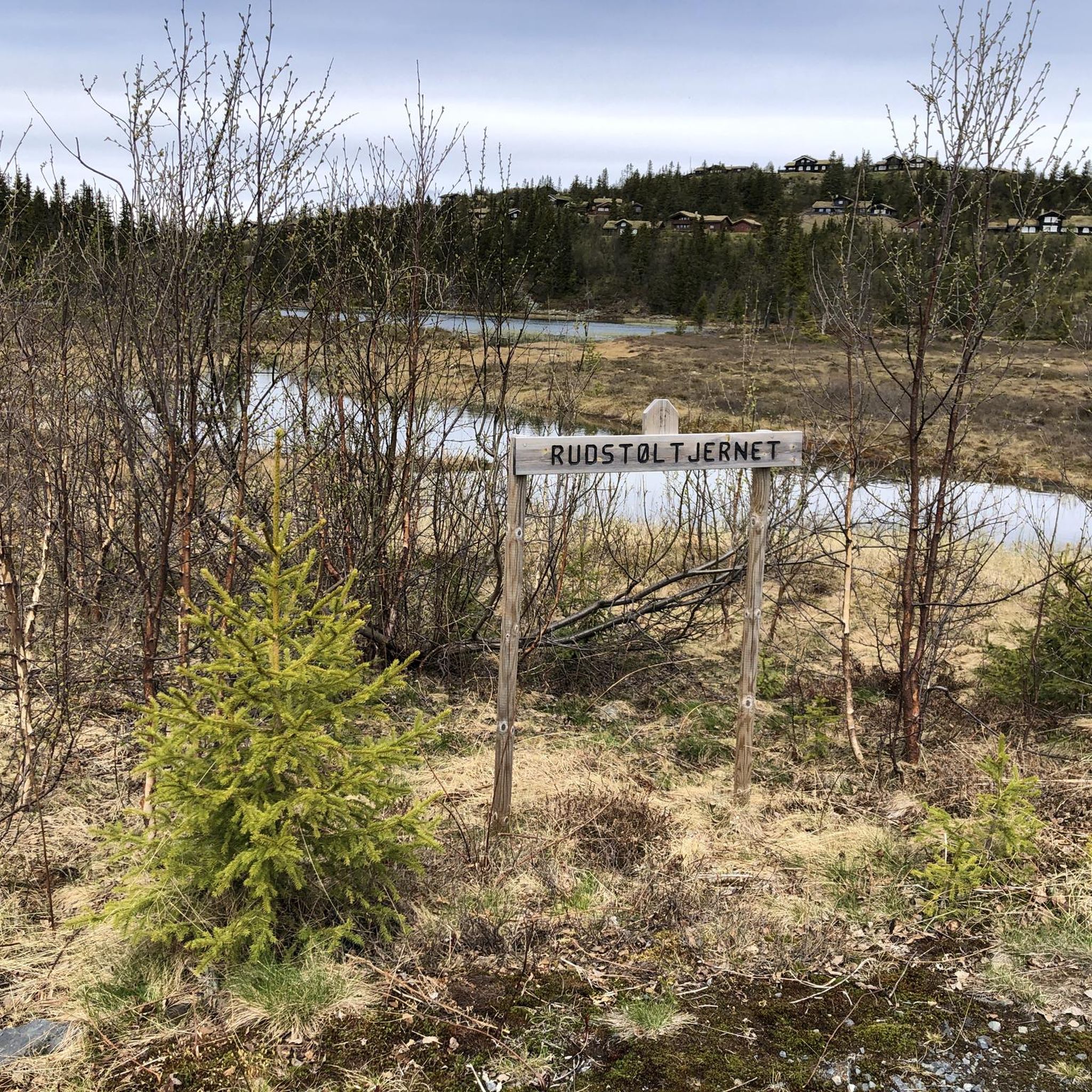
On the hiking trail up to Makalausfjellet, you will pass several small lakes. When it is windless and sunny, the surroundings are reflected in the smooth surface of the water!
0
0
Despite its height of 1,099 meters, the summit of Makalausfjellet is an easy hiking destination. The highest point is located on a high plateau, which means that only a few meters of elevation need to be overcome. Typical for Norwegian summits, a large cairn marks the destination, and a small sign also indicates that you have arrived at the right place.
0
0

Frequently Asked Questions
How many hiking trails are available in Liaberget Naturreservat?
There are nearly 50 hiking trails in Liaberget Naturreservat, offering a wide range of options for different preferences and fitness levels. Approximately half of these, 24 routes, are considered easy.
What kind of terrain can I expect on the trails in Liaberget Naturreservat?
Liaberget Naturreservat features diverse terrain, from accessible paths to more moderate treks. Many trails lead to the summit of Makalausfjellet, which is on a high plateau, meaning the elevation gain to the top is relatively small. You'll also find routes that pass by several small lakes, offering scenic reflections of the landscape.
Are there any easy hiking options suitable for beginners or families?
Yes, Liaberget Naturreservat offers many easy hiking options. For example, the Galteberget – Årdal Mountain Church loop from Danebu is an easy 6.2 km trail with minimal elevation gain, perfect for a relaxed outing. Another accessible choice is the View of Frænengen Lake – Storstølfjellet loop from Danebu, which is 6.2 km and also rated easy.
Are there any challenging hikes for experienced hikers?
While most trails are easy to moderate, there is one difficult route available for those seeking a greater challenge. The reserve's diverse terrain ensures that even experienced hikers can find satisfying treks, often involving longer distances or more significant elevation changes.
What natural features or viewpoints can I see along the hiking trails?
Hikers can enjoy several natural features and viewpoints. The summit of Makalausfjellet, at 1,099 meters, offers expansive views and is marked by a large cairn. Many trails also pass by small, serene lakes that beautifully reflect the surrounding landscape on calm days. The Galteberget – View of Frænengen Lake loop from Damtjern specifically highlights a view of Frænengen Lake.
Are there any circular hiking routes in Liaberget Naturreservat?
Yes, several circular routes are available. The Mountain Lakes Near the Summit – Hiking trail along the lakes loop from Stavadalen skisenter is a moderate 9.3 km loop that takes you past several small lakes. Another option is the Galteberget – View of Frænengen Lake loop from Damtjern, an 8.6 km loop through varied terrain.
Is Liaberget Naturreservat suitable for hiking with dogs?
Liaberget Naturreservat is generally dog-friendly, offering many trails where you can hike with your canine companion. However, it's always recommended to keep dogs on a leash, especially during nesting seasons or when livestock might be present, to protect wildlife and ensure a pleasant experience for all visitors.
What is the best time of year to visit Liaberget Naturreservat for hiking?
The best time to visit Liaberget Naturreservat for hiking is typically during the warmer months, from late spring to early autumn. During this period, the trails are usually clear of snow, and the weather is more favorable for outdoor activities, allowing you to fully appreciate the scenic lakes and summit views.
What do other hikers enjoy the most about hiking in Liaberget Naturreservat?
The area is highly rated by the komoot community, with an average score of 4.6 stars from over 90 reviews. Hikers frequently praise the diverse trails, the accessibility of the Makalausfjellet summit, and the beautiful reflections in the small lakes. Many appreciate the options available for various skill levels.
Are there facilities like parking or public transport access for the trails?
While specific details on public transport are limited, many trailheads in natural reserves typically offer parking facilities. It's advisable to check individual route descriptions on komoot for specific parking information or directions to trail starting points, such as those near Stavadalen skisenter or Damtjern.
Can I combine hiking with other outdoor activities in the reserve?
Yes, in addition to hiking, Liaberget Naturreservat is also suitable for other outdoor activities. The area's diverse landscape and trails make it a good location for cycling, mountain biking, and road cycling, allowing you to explore the region in different ways.

Get inspired with the komoot mobile app


Explore more
Browse the best Hikes in other regions.
