The best walks and hikes in Grunnfjorden Naturreservat
4.4
(258)
1,541
hikers
27
hikes
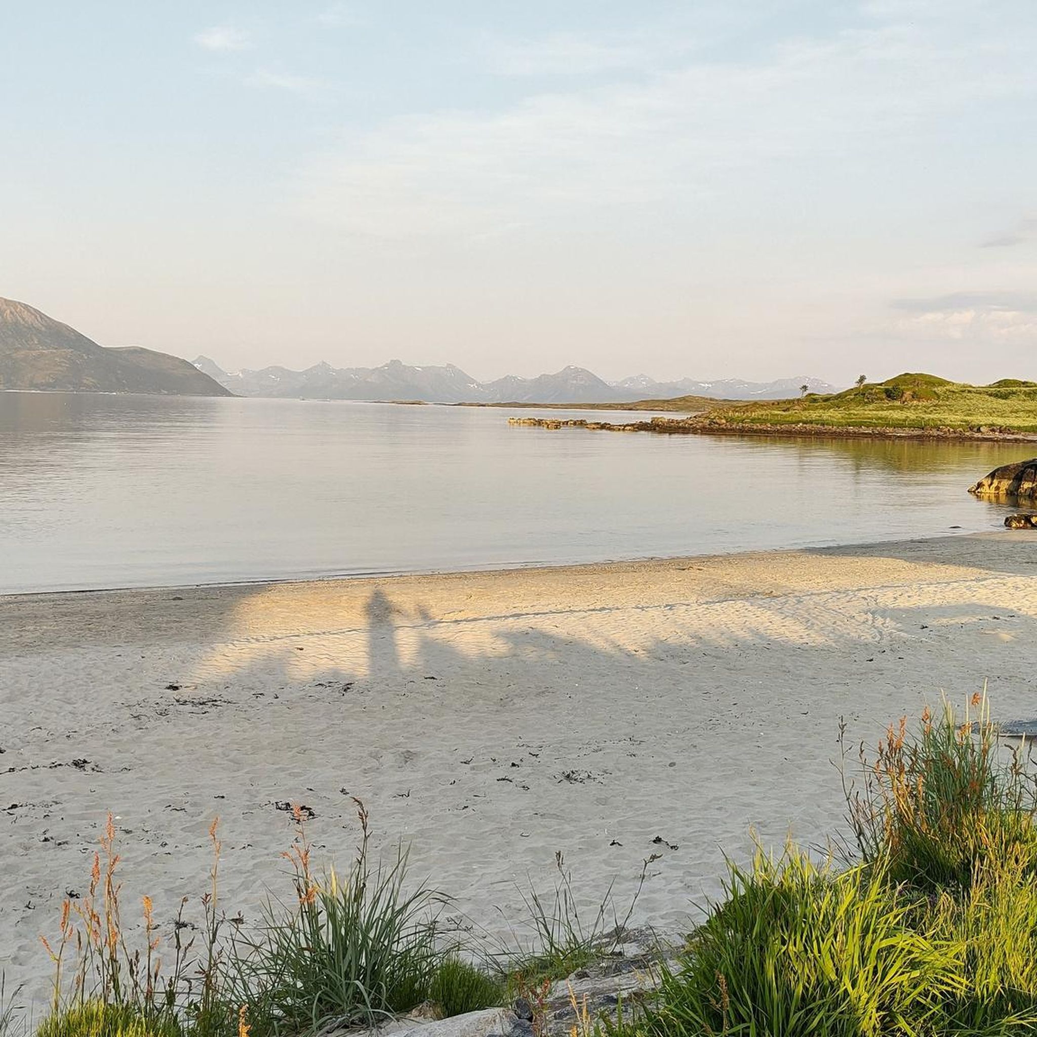
Hiking in Grunnfjorden Naturreservat offers diverse landscapes within its wetland ecosystems in Nordland, Norway. The terrain features expansive bogs, small rivers, pools, and tarns, alongside shallow beach areas with islets, skerries, tidal flats, and a brackish water lagoon. Elevated points, such as Skipet Summit, provide panoramic views over parts of Vesterålen and the North Sea. This varied topography supports a range of hiking trails suitable for different fitness levels.
Best hiking trails in Grunnfjorden Naturreservat
- The most popular hiking route is Descent to the Lighthouse – Gisloya Lighthouse loop from Gisløya, a 3.5 miles (5.6 km) trail that takes 1 hour 26 minutes to complete. This easy route leads to a small lighthouse with a shelter.
- Another top favourite among local hikers is Meltjønna loop from Myre, an easy 2.1 miles (3.4 km) path. This trail offers an accessible option through the reserve's wetland features.
- Local hikers also love the Hiking loop from Øvergård, a 1.9 miles (3.1 km) trail leading through varied terrain with a significant elevation gain, often completed in about 1 hour 30 minutes.
- Hiking in Grunnfjorden Naturreservat is defined by wetland ecosystems, coastal areas, and elevated viewpoints, offering options for easy strolls and more moderate climbs. The network provides trails for different ability levels.
- The routes in Grunnfjorden Naturreservat are highly rated by the komoot community with an average score of 4.5 stars from over 240 reviews. More than 1400 hikers have used komoot to explore Grunnfjorden Naturreservat's varied terrain.
Last updated: July 10, 2026
4.8
(19)
91
hikers
5.59km
01:26
30m
30m
Easy hike. Great for any fitness level. Easily-accessible paths. Suitable for all skill levels.
3.5
(2)
10
hikers
3.38km
00:55
50m
50m
Easy hike. Great for any fitness level. Easily-accessible paths. Suitable for all skill levels.

Sign up for free
5.0
(3)
13
hikers
3.08km
01:31
340m
340m
Moderate hike. Good fitness required. Easily-accessible paths. Suitable for all skill levels.
4.5
(13)
37
hikers
8.82km
03:23
580m
580m
Moderate hike. Good fitness required. Easily-accessible paths. Suitable for all skill levels.
5.0
(5)
38
hikers
6.90km
02:42
490m
490m
Moderate hike. Good fitness required. Easily-accessible paths. Suitable for all skill levels.
Get access to more routes and recommendations from other explorers.
Sign up for free
Already have an account?
Our route recommendations are based on thousands of hikes, rides, and runs completed by other people on komoot.
Start today with a free account
Your next adventure awaits.
Login or Signup
Popular around Grunnfjorden Naturreservat
Tips from the Community

Great panoramic summit, which can be reached from Myre with surefootedness and some effort. The view is fantastic and extends over part of Vesterålen to the North Sea 🤩
2
0
From here it is about 2.1 km and 360 m ascent to the summit of Skipet.
2
0
For those who don't want to walk any more meters than absolutely necessary, there is parking for around six cars here. The way to the Skipet is still exhausting 😅
2
0


Small lighthouse with shelter at the end of the path. Beware, there are many white-tailed eagles in this area!
2
2

Frequently Asked Questions
What types of terrain can I expect when hiking in Grunnfjorden Naturreservat?
Grunnfjorden Naturreservat features a diverse landscape, including expansive bogs dominated by peat moss, small rivers, pools, and tarns. Along the coast, you'll find shallow beach areas with islets, skerries, tidal flats, and a brackish water lagoon. Elevated points offer panoramic views. The trails vary from flat wetland paths to more significant climbs.
Are there any easy hiking trails suitable for beginners or casual walkers?
Yes, Grunnfjorden Naturreservat offers several easy trails. For instance, the Meltjønna loop from Myre is an accessible 3.4 km path that takes about 55 minutes. Another easy option is the Descent to the Lighthouse – Gisloya Lighthouse loop from Gisløya, which is 5.6 km and leads to a small lighthouse.
Are there any challenging hikes for experienced hikers in the reserve?
Yes, for those seeking a challenge, Grunnfjorden Naturreservat has more demanding routes. The reserve features 10 difficult trails. An example is the Ytterkeipen – Nonskollen loop from Alsvåg, a moderate 9.03 km hike with 580 meters of ascent, typically taking over 3 hours.
What kind of wildlife can I expect to see in Grunnfjorden Naturreservat?
The reserve is particularly significant for its wetland ecosystems, which support a rich diversity of wetland birds present throughout the year. The varied habitats, including bogs, coastal areas, and brackish lagoons, make it an important area for birdwatching.
Are there any viewpoints or scenic spots along the hiking trails?
Absolutely. Elevated points within the reserve, such as Skipet Summit, offer fantastic panoramic views. From Skipet Summit, hikers can enjoy expansive vistas over parts of Vesterålen and out to the North Sea.
Are there any circular hiking routes available in Grunnfjorden Naturreservat?
Many of the trails in Grunnfjorden Naturreservat are designed as loops, allowing you to start and end at the same point. Examples include the Hiking loop from Øvergård, a moderate 3.1 km route, and the Høydalsfjellet – Eldtinden loop from Myre kirke, a 6.65 km moderate trail.
Is Grunnfjorden Naturreservat suitable for family hikes with children?
Yes, the reserve offers several easy trails that are well-suited for families. The less strenuous, shorter loops like the Meltjønna loop from Myre provide an accessible way for families to explore the natural surroundings.
What is the best time of year to go hiking in Grunnfjorden Naturreservat?
The best time to visit Grunnfjorden Naturreservat for hiking is typically during the warmer months, from late spring through early autumn. This period offers more favorable weather conditions, making the trails more accessible and enjoyable. The wetland ecosystems are particularly vibrant during these seasons.
What do other hikers say about their experience in Grunnfjorden Naturreservat?
The komoot community highly rates the hiking experience in Grunnfjorden Naturreservat, with an average score of 4.5 stars from over 240 reviews. Hikers often praise the diverse landscapes, from wetland bogs to coastal views, and the variety of trails suitable for different fitness levels.
Are there accommodations or places to eat near Grunnfjorden Naturreservat?
While the reserve itself is a natural area, the nearby municipality of Øksnes, where Grunnfjorden Naturreservat is located, offers various amenities. You can find accommodation options and places to eat in towns like Myre and Alsvåg, which serve as good starting points for exploring the reserve.
Is there public transport access to Grunnfjorden Naturreservat?
Information on specific public transport routes directly into the reserve is limited. However, the reserve is located in Øksnes municipality, Nordland, Norway. It is advisable to check local bus schedules or consider driving to access the various trailheads, especially those further from main towns.
Are there any specific rules or permits required for hiking in the nature reserve?
As a nature reserve, Grunnfjorden Naturreservat is protected to preserve its unique ecosystems. While general hiking is usually permitted, it's always recommended to respect local regulations, stay on marked paths, and avoid disturbing wildlife or vegetation. Specific permits are not typically required for hiking, but always check for any updated local guidelines before your visit.

Get inspired with the komoot mobile app


Explore more
Browse the best Hikes in other regions.
