The best walks and hikes in Tewantin National Park
4.8
(316)
4,686
hikers
60
hikes
Hiking in Tewantin National Park features a diverse landscape of subtropical rainforests, open eucalypt forests, and wallum heathlands. The park is home to Mount Tinbeerwah, a 265-meter volcanic plug offering panoramic views. Trails often follow crystal clear creeks, pass through dense palm groves, and traverse varied forest types. This region provides a range of natural environments for outdoor exploration.
Best hiking trails in Tewantin National Park
- The most popular hiking route is Noosa Beach loop from Tewantin, a 6.6 miles (10.7 km) trail that takes 2 hours 42 minutes to complete. This moderate route offers coastal views and diverse vegetation.
- Another top favourite among local hikers is Mount Cooroora Summit loop from Pomona, an easy 3.4 miles (5.4 km) path. This trail ascends to a summit, providing expansive views of the surrounding area.
- Local hikers also love the Noosa Beach loop from Weyba Creek Bushland Reserve North, a 4.0 miles (6.5 km) trail leading through coastal forest and bushland, often completed in about 1 hour 39 minutes.
- Hiking in Tewantin National Park is defined by diverse forest ecosystems, panoramic viewpoints from hills, and paths alongside creeks. The network offers options for different ability levels, from easy strolls to moderate ascents.
- The routes in Tewantin National Park are highly rated by the komoot community with an average score of 4.7 stars from over 240 reviews. More than 4000 hikers have used komoot to explore Tewantin National Park's varied terrain.
Last updated: July 1, 2026
5.0
(1)
18
hikers
955m
00:16
20m
20m
Easy hike. Great for any fitness level. Easily-accessible paths. Suitable for all skill levels.
52
hikers
10.7km
02:42
20m
20m
Moderate hike. Good fitness required. Easily-accessible paths. Suitable for all skill levels.

Sign up for free
5.0
(2)
41
hikers
5.48km
01:56
280m
280m
Easy hike. Great for any fitness level. Easily-accessible paths. Suitable for all skill levels.
4.9
(11)
161
hikers
2.84km
01:13
250m
250m
Easy hike. Great for any fitness level. Easily-accessible paths. Suitable for all skill levels.
5.0
(1)
52
hikers
3.37km
00:51
0m
0m
Easy hike. Great for any fitness level. Easily-accessible paths. Suitable for all skill levels.
Get access to more routes and recommendations from other explorers.
Sign up for free
Already have an account?
Our route recommendations are based on thousands of hikes, rides, and runs completed by other people on komoot.
Start today with a free account
Your next adventure awaits.
Login or Signup
Tips from the Community

The Big Pelican, also known as "Old Mate," has stood tall since the 90s. It was built by the Pelican Boat Hire, looks happy, and is beloved by tourists. The area is home to many Australian pelicans, so there is a good chance to see a real pelican fishing or floating in the water as well.
0
0
Ely Park is a long, thin beachside park with grassy areas and shade from trees. There is a small sandy shore where it's easy to wade into the water, jetties, and lots of cafés and restaurants just across Gympie Terrace. There are also public toilets here right next to the Noosa River Foreshore Path.
0
0
This pedestrian bridge crosses over Noosa Waters right before it reaches the Noosa River. On the west side of the bridge sits Chaplin Park, and on the east side of the bridge sits Tewantin Noosa Lions Park, two beautiful riverside greenspaces. It's a scenic walk over the bridge, and there are lots of restaurants and hotels within walking distance.
0
0

Mount Cooroora hiking trail is a short but steep return climb rising above the town of Pomona, gaining elevation quickly over a relatively short distance. The track is well-defined but challenging, transitioning from forested path to exposed rock with chains, steps, and sections of hands-on scrambling near the summit. From the top, there are sweeping views across the Sunshine Coast hinterland, with a mix of surrounding peaks, farmland, and the coastline in the distance, especially on clear days.
0
0
The Mount Tinbeerwah Lookout Walk to the lookout point where the track terminates is short with awesome scenery. There are nice views from the open forest and low vegetation for almost the entire walk. The path is easy to follow and paved all the way to the end.
0
0
Mount Tinbeerwah lookout trackhead is also called GrabRock Meeting Point, and it has maps, a toilet, and a car park. It is a very well-maintained area of Tweantin National Park.
0
0
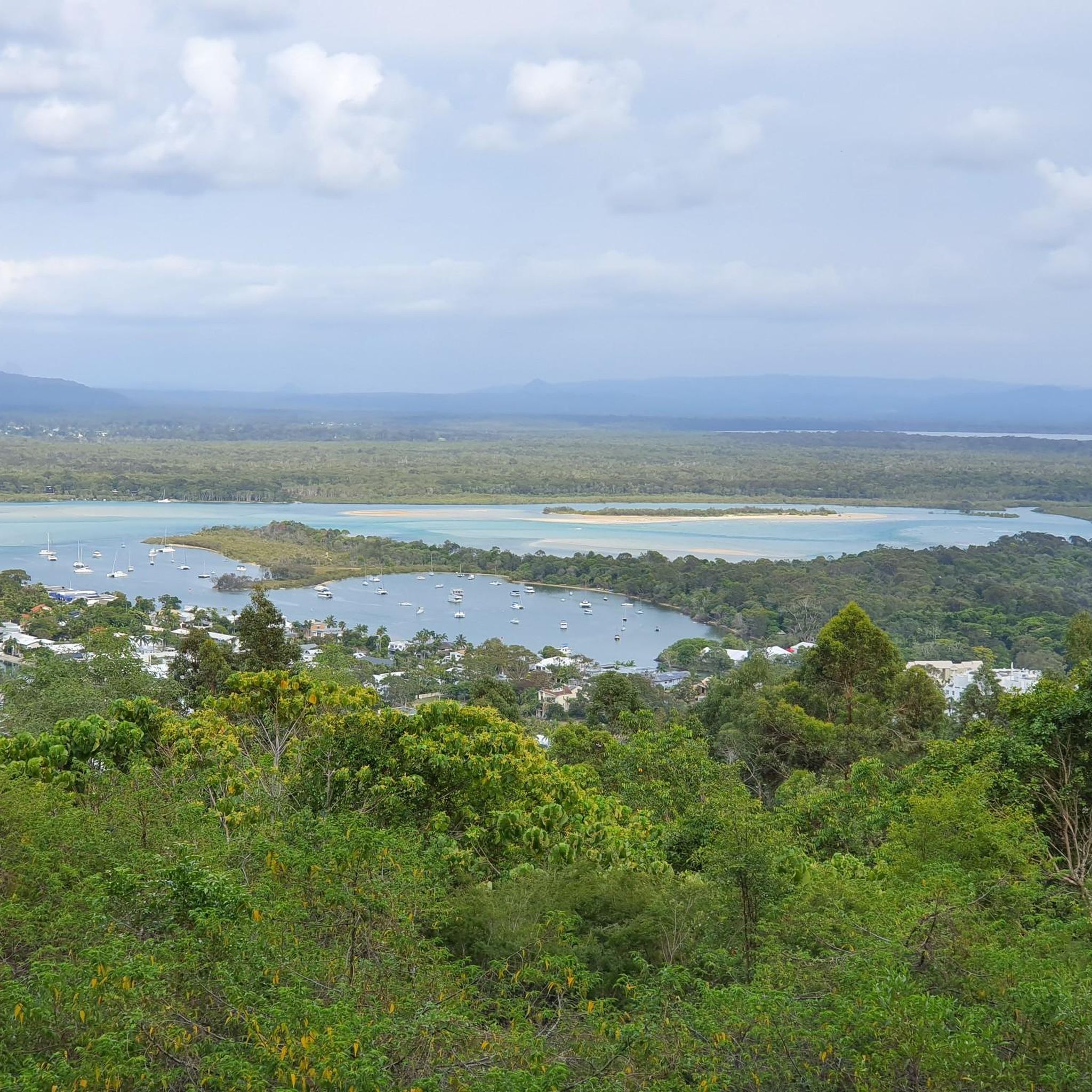
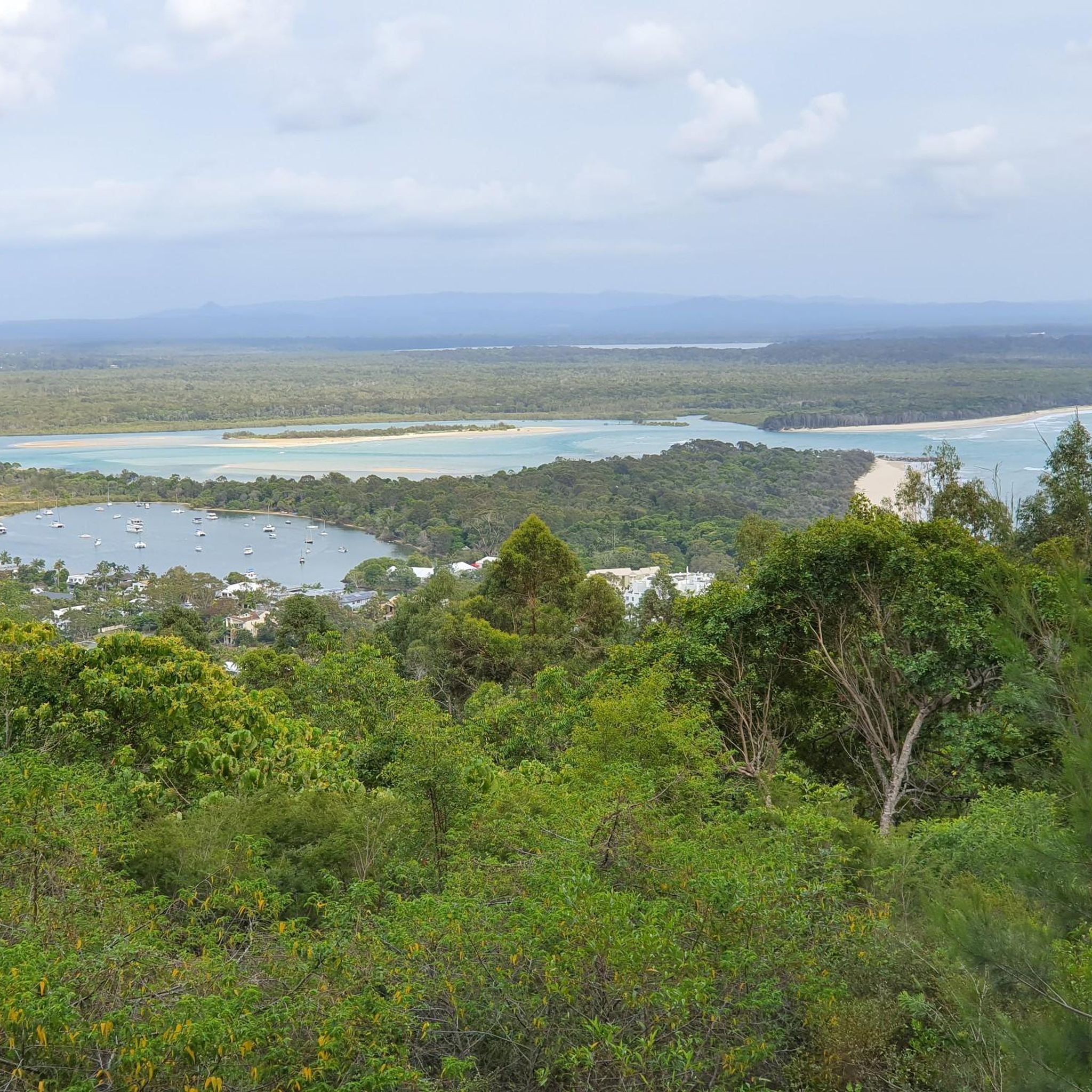
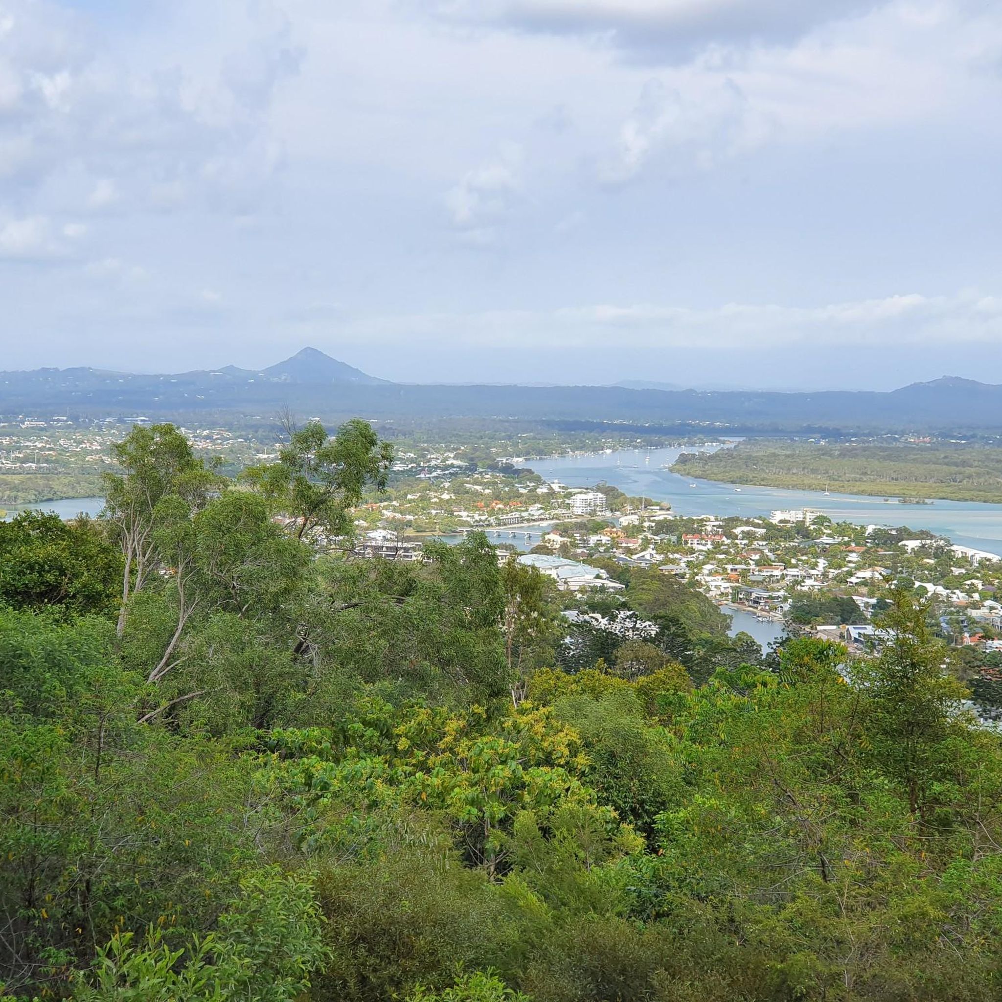
Mount Tinbeerwah Lookout gives panoramic views over the Sunshine Coast, Noosa Heads, and the Coral Sea coastline. For hot or rainy days, there's a roofed and elevated lookout tower at the summit.
0
0
This lookout above the tree line offers a breathtaking view of Pomona nestled below, along with the picturesque Sunshine Coast hinterland. From here, you can see all the way east to the coastal plain beyond Pomona and west over the rolling farmland and forested ridges that define the Mary Valley region. The park’s trails, including this walk, are cherished for their stunning panoramas and for Mount Cooroora towering above the surrounding landscape.
0
0
Frequently Asked Questions
How many hiking trails are available in Tewantin National Park?
Tewantin National Park offers a diverse network of over 50 hiking trails. These range from easy strolls through palm groves to more challenging ascents with panoramic views, catering to various fitness levels.
What kind of landscapes can I expect to see while hiking in Tewantin National Park?
The park features a rich variety of landscapes, including lush subtropical rainforests, open eucalypt forests, and remnants of wallum heathlands. You'll find crystal clear creeks, towering gum trees, shady rainforest gullies, and areas with striking Piccabeen palms.
Are there any trails suitable for families or beginners in Tewantin National Park?
Yes, Tewantin National Park has many easy trails perfect for families and beginners. For example, the initial section of the Mount Tinbeerwah Lookout track is even wheelchair and pram accessible. The Mount Cooroora Summit loop from Pomona is another easy option, offering expansive views.
Can I bring my dog on the hiking trails in Tewantin National Park?
Generally, dogs are not permitted on walking tracks within Queensland national parks to protect wildlife. It's always best to check the official Queensland Parks and Wildlife Service website for the most current regulations regarding pets in Tewantin National Park. You can find more information on their site: parks.qld.gov.au.
What are the notable natural features or viewpoints in the park?
A prominent feature is Mount Tinbeerwah, an ancient volcanic plug rising 265 meters, offering spectacular 360-degree panoramic views over the coastal lowlands, the Noosa coast, and the Sunshine Coast hinterland. The Palm Grove walk also allows you to enjoy a stroll through cabbage tree and piccabeen palm forests along Wooroi Creek.
Are there any circular hiking routes in Tewantin National Park?
Yes, the park offers several circular routes. For instance, the Secrets, Gyndier Drive, Bloodwood, and Woorioi Track Loop provides an adventure through subtropical rainforest and open eucalypt woodland. Another option is the Indy, Glider, and Secrets Loop, which traverses coastal forest and heathland.
Where can I park when visiting Tewantin National Park?
The park has designated day-use areas with parking facilities. The Wooroi and Mount Tinbeerwah day-use areas are good options, providing amenities like picnic tables and toilets, making them convenient starting points for your hike.
What wildlife might I encounter while hiking in Tewantin National Park?
Tewantin National Park is a significant refuge for native wildlife. You might spot koalas, echidnas, swamp wallabies, and lace monitors. Birdwatchers can look out for eastern whip birds, white-breasted sea eagles, and the vulnerable glossy black cockatoo.
What is the best time of year to go hiking in Tewantin National Park?
The park can be enjoyed year-round. However, the cooler, drier months from April to October are generally considered ideal for hiking, offering more comfortable temperatures and less humidity. Always check local weather forecasts before your visit.
Are there facilities like picnic areas or toilets in the park?
Yes, the Wooroi and Mount Tinbeerwah day-use areas are equipped with facilities such as picnic tables and toilets. These areas are perfect for relaxing before or after your hike, set amidst natural surroundings like coastal she-oak and bloodwood trees.
What do other hikers say about the trails in Tewantin National Park?
The trails in Tewantin National Park are highly rated by the komoot community, with an average score of 4.7 stars from over 240 reviews. Hikers often praise the diverse forest ecosystems, the breathtaking panoramic views from Mount Tinbeerwah, and the well-maintained network of trails that cater to various levels of difficulty.
Are there any trails that offer coastal views?
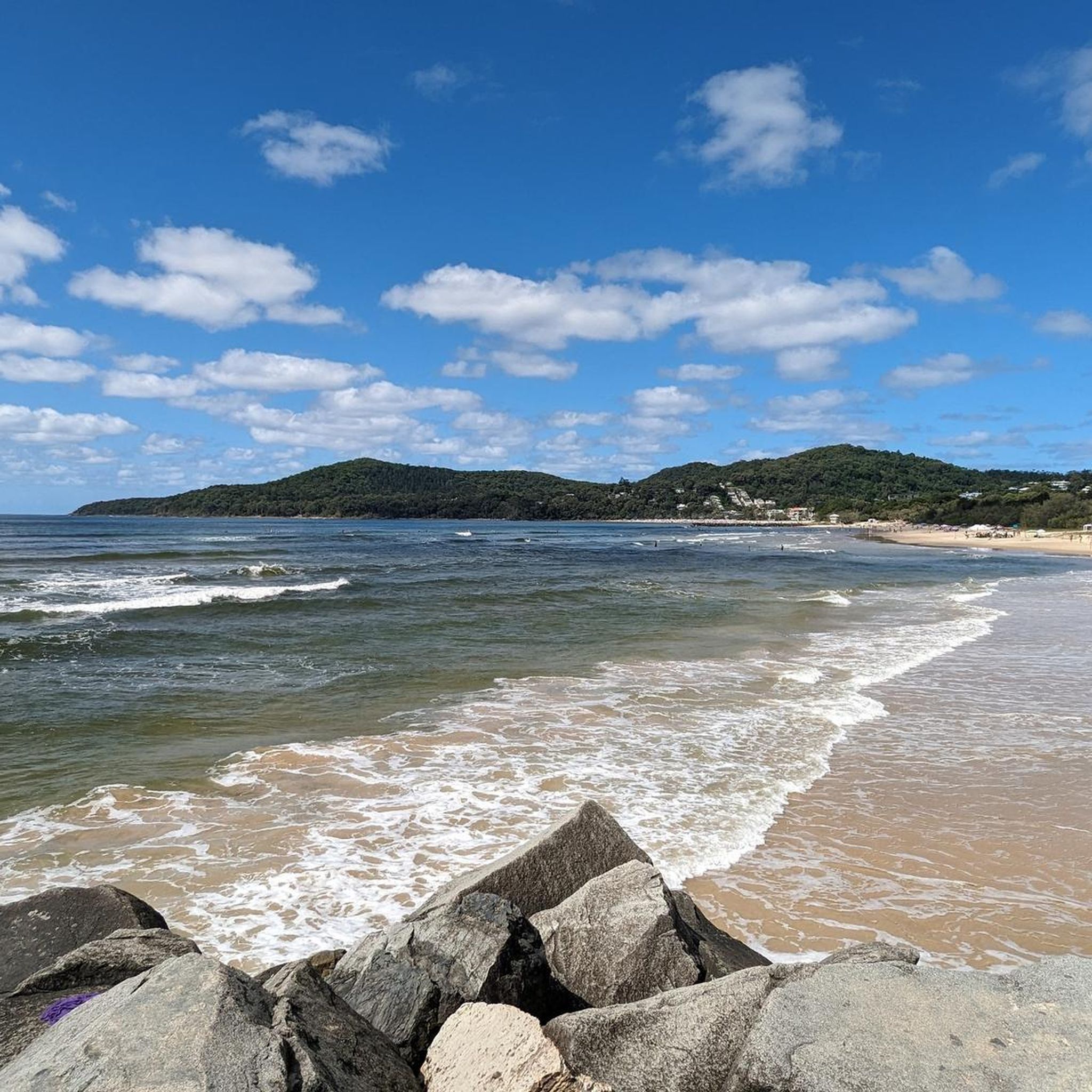
While the park itself is inland, some trails provide glimpses of the coastal lowlands and the Noosa coast from higher elevations. For a direct coastal experience, the Noosa Beach loop from Tewantin offers coastal views and diverse vegetation, connecting you to the nearby coastline.
Most popular routes in Tewantin National Park

Get inspired with the komoot mobile app


Explore more
Browse the best Hikes in other regions.
