The best walks and hikes in Torndirrup National Park
4.1
(55)
731
hikers
13
hikes
Hiking in Torndirrup National Park offers diverse trails across a landscape shaped by the Southern Ocean. The region features dramatic coastal scenery, imposing granite headlands, and pristine white sandy beaches. Hikers encounter varied terrain, including towering coastal cliffs, deep gullies, and prominent promontories along the Flinders Peninsula. The park's unique geological formations provide a range of experiences, from boardwalks to soft sand dunes and sections of smooth granite.
Best hiking trails in Torndirrup National Park
- The most popular hiking route is Bald Head Trail, an 8.3 mile (13.3 km) moderate trail that takes 4 hours 17 minutes to complete. This challenging route traces the length of the Flinders Peninsula, offering spectacular ridge walk views of the rugged coastline.
- Another top favourite among local hikers is Uredale Point Monument – Beach Track loop from Vancouver Peninsula, an easy 3.0 mile (4.8 km) path. This loop provides coastal views and access to beach areas.
- Local hikers also love the Three Anchors loop from Albany, a 6.7 mile (10.8 km) trail leading through coastal areas near Albany, often completed in about 2 hours 50 minutes.
- Hiking in Torndirrup National Park is defined by dramatic coastal scenery, imposing granite headlands, and towering coastal cliffs. The network offers options for different ability levels.
- The routes in Torndirrup National Park are highly rated by the komoot community with an average score of 3.3 stars from over 15 reviews. More than 200 hikers have used komoot to explore Torndirrup National Park's varied terrain.
Last updated: August 25, 2026
4.9
(25)
375
hikers
13.3km
04:17
550m
550m
Moderate hike. Good fitness required. Easily-accessible paths. Suitable for all skill levels.
4.8
(12)
96
hikers
4.79km
01:23
120m
120m
Easy hike. Great for any fitness level. Easily-accessible paths. Suitable for all skill levels.

Sign up for free
4.8
(12)
96
hikers
4.78km
01:23
120m
120m
Easy hike. Great for any fitness level. Easily-accessible paths. Suitable for all skill levels.
4.0
(1)
41
hikers
5.54km
01:29
60m
60m
Easy hike. Great for any fitness level. Easily-accessible paths. Suitable for all skill levels.
5
hikers
2.17km
00:35
30m
30m
Easy hike. Great for any fitness level. Easily-accessible paths. Suitable for all skill levels.
Get access to more routes and recommendations from other explorers.
Sign up for free
Already have an account?
Our route recommendations are based on thousands of hikes, rides, and runs completed by other people on komoot.
Start today with a free account
Your next adventure awaits.
Login or Signup

Tips from the Community

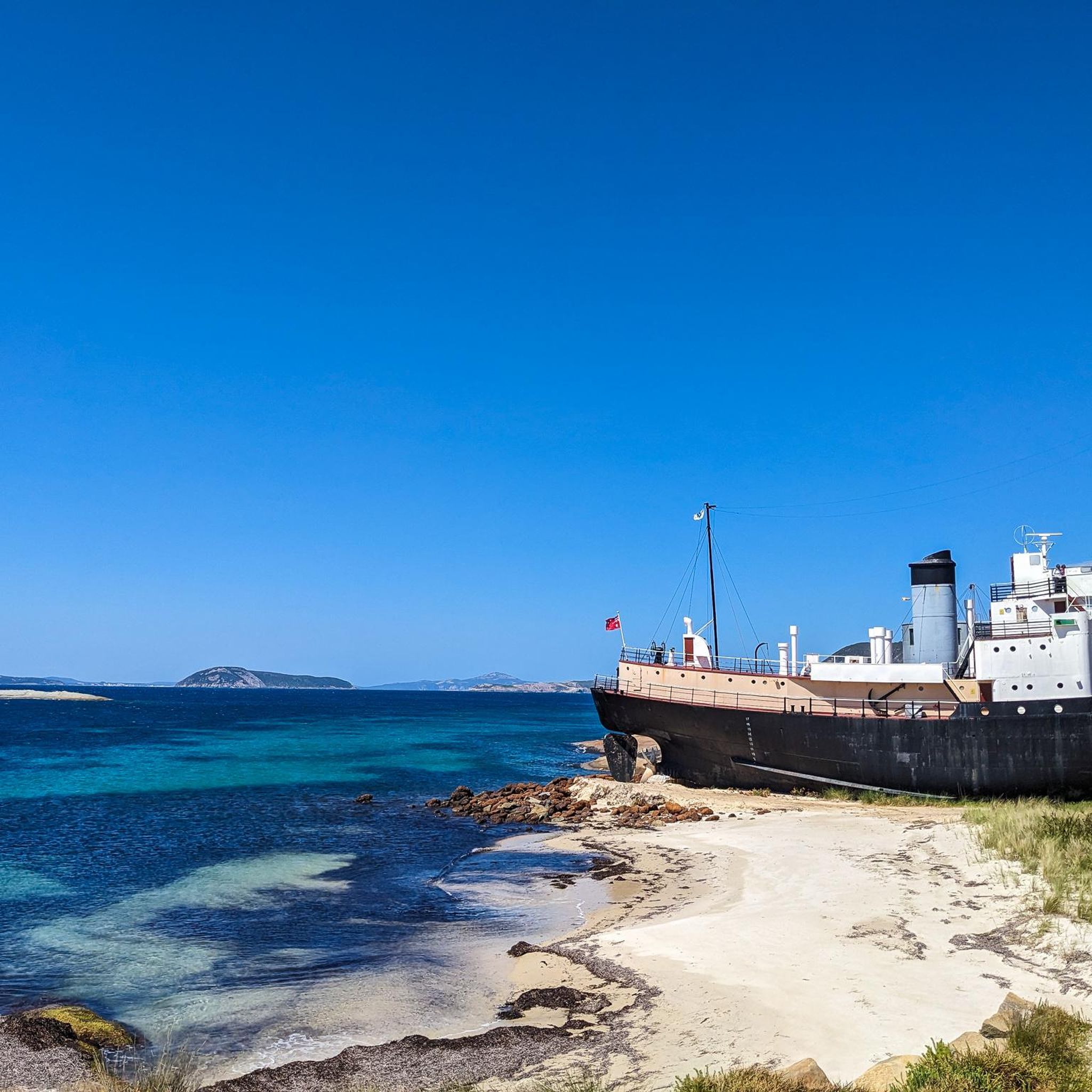
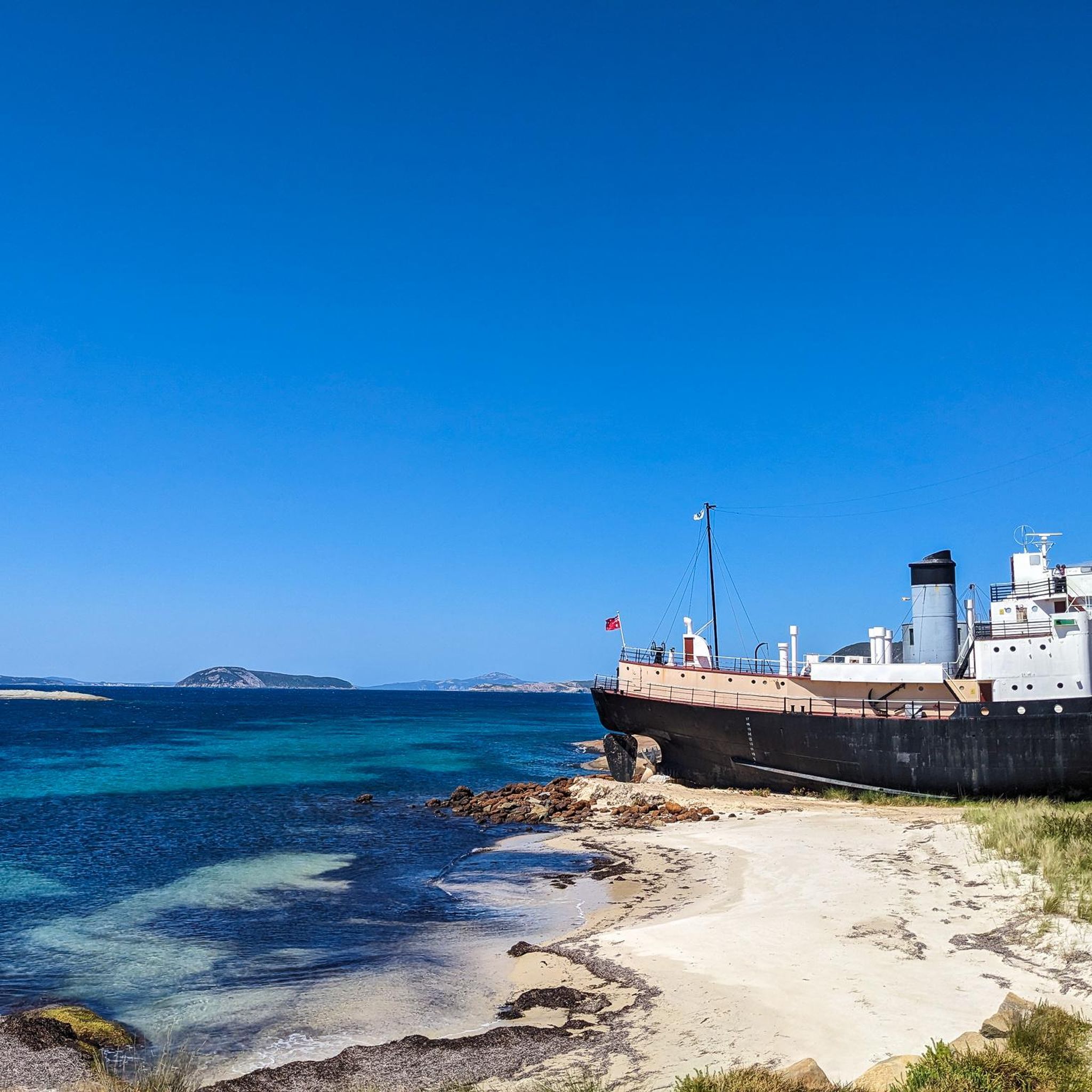
Brambles Beach has stunning blue, turquoise water, and walking on the beach here is part of the Uredale Point Heritage Trail. One thing to note is this western beach is usually covered with seaweed. The seaweed can be slippery, so bring grippy shoes. Staying on the part of the beach farther from the water's edge should reveal some more sand to walk on, but be prepared to encounter seaweed.
0
0
Uredale Point Monument is marked with a stone cairn located on the tip of the Vancouver Peninsula marking the spot where Captain George Vancouver landed in 1791. He raised the British flag and claimed the southwestern part of Australia for King George III. He named it Point Possession, and today it's officially known as Uredale Point. The marker also marks the peak of the granite dome, which is the highest natural point of Uredale Point. From here, the scenery is stunning, with 360-degree views across King George Sound, the Albany coastline, and Mount Clarenc.
1
0
Barker Bay Beach is also known as Osman’s Beach, and looks different at different times of day. When the sun is shining, the water almost glows bright neon turquoise, with brilliant white sands. This sandy stretch is impressive, stretching 700 metres north to south, making this section of the Uredale Point Heritage Trail a long beach walk. Bring sturdy shoes for the rest of the rocky trail that are easy to take off if you would like to enjoy this section of sand barefoot.
1
0

Opened in 1975, the Rotary Lookout offers panoramic views across the King George Sound and Middleton Beach. The area is known as an excellent place to spot southern right and humpback whales during their migratory period between May and November. There is a small parking area here but you can also reach the lookout via the Ellen Cove Boardwalk.
0
0
Situated above the rocks of Point King, the Ellen Cove Boardwalk traces the coastline of Princess Royal Harbour for 3 kilometres. While the views are spectacular at any time of year, visiting during the whale migration season, May through November, gives you thr opportunity to spot humpback and southern right whales swimming by just offshore.
0
0

Stretching out from Torndirrup National Park, the Flinders Peninsula forms the narrow ridgeline leading toward Bald Head. This section of the track runs along an exposed spine, with the Southern Ocean visible on both sides and steep drop-offs throughout. The terrain shifts between sand, low scrub, and rock, with constant elevation changes along the ridge. There’s little protection from wind, making this one of the most exposed and visually striking parts of the walk.
0
0
The final point of the Bald Head Trail, this rounded granite summit sits fully exposed above the Southern Ocean. From the top, you get uninterrupted views across the coastline, with steep cliffs dropping away on either side. The approach crosses bare rock and low vegetation, with uneven footing in sections. There’s no shelter here, so wind can be strong and conditions change quickly—worth allowing time to take in the views before heading back.
0
0
Located in Torndirrup National Park near Albany, this coastal track follows a narrow ridgeline out toward Bald Head, with the Southern Ocean on both sides. The terrain alternates between sandy sections, granite slabs, and uneven rock, with constant exposure to wind along the ridge. Views extend across sheer cliffs and open coastline the entire way. There’s little shelter, so conditions can change quickly—allow time for the return and bring adequate water.
0
0
Frequently Asked Questions
How many hiking trails are available in Torndirrup National Park?
Torndirrup National Park offers a diverse network of over 10 hiking trails, ranging from easy strolls to more challenging routes. These trails allow you to explore the park's dramatic coastal scenery and unique geological formations.
What kind of terrain can I expect on hikes in Torndirrup National Park?
Hikers in Torndirrup National Park will encounter varied terrain, including towering coastal cliffs, deep gullies, and prominent promontories. Trails can feature a mix of boardwalks, soft sand dunes, and steep, sometimes slippery, sections of smooth granite, reflecting the powerful forces of the Southern Ocean.
Are there any easy or accessible trails suitable for families or those with limited mobility?
Yes, Torndirrup National Park offers options for various abilities. The Stony Hill Track is a 500-meter loop trail with a 72-meter all-access concrete walkway, providing 360-degree views. Additionally, sites like The Gap & Natural Bridge have undergone upgrades to enhance accessibility, making them more family-friendly.
What are some notable landmarks or viewpoints to see while hiking in the park?
The park is home to several iconic attractions. You can witness the ocean's power at The Gap, where a viewing platform extends over the ocean, or marvel at the striking rock formation of the Natural Bridge. The Blowholes offer an impressive display of surging waves forcing air and water through rock crevices. For panoramic views, the Stony Hill Track provides 360-degree vistas of the park and ocean.
Are there any circular hiking routes in Torndirrup National Park?
Yes, there are circular routes available. For an easy coastal experience, consider the Uredale Point Monument – Beach Track loop from Vancouver Peninsula, which is about 4.8 km. Another moderate option is the Three Anchors loop from Albany, covering approximately 10.8 km through coastal areas.
What is the best time of year to go hiking in Torndirrup National Park?
Torndirrup National Park can be enjoyed year-round. During the winter months, the cliffs serve as an excellent vantage point for observing migrating whales. The diverse flora, including woolly-bush and banksias, provides interest across seasons. Always check local weather conditions before heading out, as coastal weather can change rapidly.
Can I bring my dog on the hiking trails in Torndirrup National Park?
Generally, dogs are not permitted on trails within national parks in Western Australia to protect native wildlife and natural environments. It's always best to check the official Parks and Wildlife Service website for the most current regulations regarding pets in Torndirrup National Park before your visit.
What kind of wildlife might I encounter while hiking?
Beyond the dramatic geology, Torndirrup National Park is rich in biodiversity. You might spot kangaroos, pygmy possums, and numerous seabirds. During the winter months, the cliffs offer a chance to observe migrating whales in the Southern Ocean.
Where can I park when visiting Torndirrup National Park for a hike?
Designated parking areas are available at the trailheads for popular attractions and hikes within Torndirrup National Park, such as at The Gap & Natural Bridge, the Blowholes, and the Bald Head Trail. Always use marked parking bays and be mindful of any fees or regulations.
What do other hikers enjoy most about hiking in Torndirrup National Park?
The area is highly rated by the komoot community, with an average score of 3.3 stars. Reviewers often praise the spectacular ridge walk views, the rugged coastline, and the unique geological formations like The Gap and Natural Bridge. The diverse terrain and challenging routes like the Bald Head Trail are frequently highlighted.
Are there any longer, more challenging hikes for experienced trekkers?
Yes, for experienced trekkers, the Bald Head Trail is a challenging 12.5 km return hike that traces the length of the Flinders Peninsula. It involves significant elevation changes and rewards hikers with spectacular ridge walk views. The Peak Head Trail is another rugged 4.8 km hike to the southernmost point of the park with steep sections and stunning coastal views.

Get inspired with the komoot mobile app


Explore more
Browse the best Hikes in other regions.
