The best walks and hikes in Wungong Regional Park
4.6
(14)
66
hikers
7
hikes
Hiking in Wungong Regional Park offers diverse landscapes characterized by the dramatic Wungong Gorge, which features steep slopes and seasonal waterways. The park is dominated by Jarrah and Marri forests, with significant rocky outcrops and granite formations. This terrain provides a range of hiking experiences, from well-formed tracks to more challenging, unmarked paths.
Best hiking trails in Wungong Regional Park
- The most popular hiking route is Wungong Gorge Walk circuit, a 7.9 miles (12.7 km) trail that takes 3 hours 49 minutes to complete. This moderate route explores the prominent gorge carved by the Wungong Creek.
- Another top favourite among local hikers is Honeyeater Hike loop, a moderate 5.1 miles (8.2 km) path. This trail winds through the park's characteristic Jarrah and Marri forests.
- Local hikers also love the Wright Lake Loop, a 3.1 miles (5.1 km) trail leading through varied terrain, often completed in about 1 hour 16 minutes.
- Hiking in Wungong Regional Park is defined by steep slopes, Jarrah and Marri forests, and significant rocky outcrops. The network offers options for different ability levels, from easy loops to more challenging, unmarked routes.
- The routes in Wungong Regional Park are highly rated by the komoot community with an average score of 4.6 stars from over 14 reviews. More than 60 hikers have used komoot to explore Wungong Regional Park's varied terrain.
Last updated: July 4, 2026
5.0
(6)
34
hikers
8.23km
02:16
140m
140m
Moderate hike. Good fitness required. Easily-accessible paths. Suitable for all skill levels.
5.0
(6)
32
hikers
8.15km
02:14
130m
130m
Moderate hike. Good fitness required. Easily-accessible paths. Suitable for all skill levels.

Sign up for free
10
hikers
12.7km
03:49
380m
380m
Moderate hike. Good fitness required. Easily-accessible paths. Suitable for all skill levels.
4.9
(7)
18
hikers
11.4km
03:04
140m
140m
Moderate hike. Good fitness required. Easily-accessible paths. Suitable for all skill levels.
42
hikers
5.05km
01:16
10m
10m
Easy hike. Great for any fitness level. Easily-accessible paths. Suitable for all skill levels.
Get access to more routes and recommendations from other explorers.
Sign up for free
Already have an account?
Our route recommendations are based on thousands of hikes, rides, and runs completed by other people on komoot.
Start today with a free account
Your next adventure awaits.
Login or Signup
Popular around Wungong Regional Park


Tips from the Community

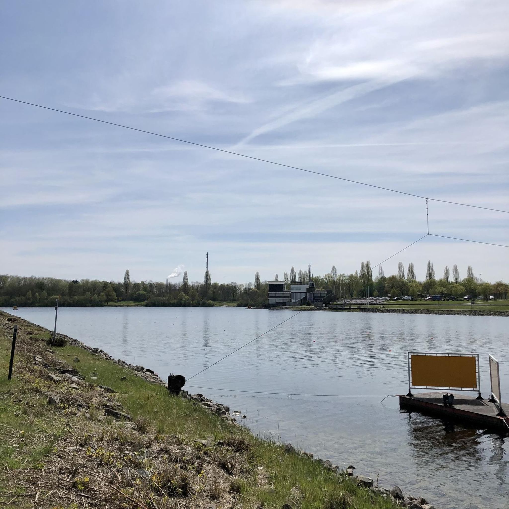
Although the lake was constructed for rowing and kayaking there is still a small swimming beach along the shore. Nearby Joe Saunders Park also has picnic and BBQ areas so you can make use of the facilities for a family day out.
0
0
This paved, shared-use path goes around the lake in a near perfect five kilometre loop. It's popular with walkers, cyclists, and runners training for races as it's easy to keep track of your distance. There is little to no shade along the pathway, so bringing your own sun protection is essential.
0
0
Wright Lake, also known as Champion Lakes. is an international standard facility built for rowing, kayaking, and dragon boat racing. The area around the lake also has swimming beaches and a loop path that's popular with walkers, runners, and cyclists.
0
0

Robin Ramble loops around 3.5 kilometres of forest through Bungendore Park's eastern side, north of the Admiral Road trailhead. The trail passes through sheoak groves and bushland, and while there are some short climbs, overall it is a a very accessible loop along a well-maintained trail.
0
0
This trailhead is the eastern access point for Bungendore Park and a short walk from the carpark along Admiral Road. There are four loop hikes that start from here. The "Cockatoo Circuit" is a short loop around the center of the park from the east, the "Spinebill Stroll" extends to the south, and the "Robin Ramble" to the north, and the longer "Honeyeater Hike" loops around the center of the park and to the north reaching the Albany Highway Trailhead.
0
0
This trailhead is the northern access point for Bungendore Park and a short walk from the carpark along Albany Highway. There are two loop hikes that start from here, the 2.3 kilometre "Whistler Walk" around the north end of the park, and the 7.7 kilometre "Honeyeater Hike", which loops around the center of the park.
0
0

Wungong Brook cuts through a granite valley beneath jarrah and marri forest. In this section, the creek is relatively narrow and forms a natural crossing point along the track, where you’ll need to step across rocks or shallow water. After heavier rainfall, water levels rise and you’re likely to get your shoes wet.
0
0
Wungong Regional Park protects a large section of bushland surrounding Wungong Brook and the steep valleys feeding into the dam catchment. The area has long been connected to water supply infrastructure, with earlier pipehead dams and later construction of Wungong Dam reshaping parts of the valley. The park also sits on Whadjuk Noongar Country, with the name “Wungong” originating from Noongar language and linked to the way the brook’s branches surround the land.
0
0
Frequently Asked Questions
What kind of hiking trails can I expect in Wungong Regional Park?
Wungong Regional Park offers a diverse range of trails, from well-formed vehicle tracks to informal bush pads and even unmarked routes for experienced hikers. The landscape is characterized by steep slopes, seasonal waterways, and significant rocky outcrops, including the dramatic Wungong Gorge. You'll hike through beautiful Jarrah and Marri forests, with vibrant wildflowers in spring.
Are there any easy or family-friendly hiking options in Wungong Regional Park?
Yes, there are easy trails suitable for families. The Wright Lake Loop is an easy 5.1 km hike with minimal elevation gain, perfect for a relaxed outing. While the park has some challenging sections, there are options for various fitness levels.
What are the best loop trails in Wungong Regional Park?
For those who enjoy circular routes, the park offers several excellent options. The Honeyeater Hike loop is a moderate 8.2 km trail, and the Wungong Gorge Walk circuit provides a longer, moderate 12.7 km experience with impressive gorge views.
Are there any challenging trails for experienced hikers?
While our guide features moderate trails, the park itself offers unmarked and partly off-track routes that involve steep, difficult terrain and scrambling. These require strong navigational skills and are best suited for experienced hikers seeking a greater challenge. The dramatic topography of Wungong Gorge provides plenty of opportunities for more strenuous exploration.
What interesting natural features or attractions can I see while hiking?
Hikers can explore the impressive Wungong Gorge with its picturesque waterfalls and natural pools, where the gorge sides rise 200 meters above the creek. You can also visit the significant Wungong Dam and climb to its wall for breathtaking views, or enjoy the Wungong Recreation Lake below. Keep an eye out for an old granite quarry and a gauging station along some trails.
What is the best time of year to hike in Wungong Regional Park?
Spring is particularly beautiful, as the Jarrah and Marri forests come alive with vibrant displays of wildflowers. However, the park offers enjoyable hiking experiences throughout the year, with cooler months being ideal for longer treks. Always check local weather conditions before heading out.
Can I spot any wildlife during my hike?
Wungong Regional Park is rich in wildlife. You might spot kangaroos, quendas, and echidnas. It's also a fantastic spot for birdwatching, with species like splendid fairy wrens and endangered cockatoos, including Baudin's, Forest Red-Tailed Black, and Carnaby's, inhabiting the area.
What do other hikers say about Wungong Regional Park?
The area is highly rated by the komoot community, with an average score of 4.6 out of 5 stars. Reviewers often praise the stunning natural scenery, the dramatic Wungong Gorge, and the diverse range of trails available for different skill levels.
Are dogs allowed on the hiking trails in Wungong Regional Park?
The specific regulations regarding dogs can vary within regional parks. It's always best to check the latest park rules and signage on-site or consult the official park management website before bringing your dog, as some areas may have restrictions to protect wildlife or sensitive ecosystems.
Where can I find parking for the hiking trails?
Parking is generally available at designated trailheads and access points within Wungong Regional Park. For example, the Admiral Road Trailhead – Robin Ramble loop starts from a known trailhead, indicating parking facilities. It's advisable to check the specific starting points of your chosen route for detailed parking information.
What should I bring for a hike in Wungong Regional Park?
Given the park's varied terrain, it's recommended to bring sturdy hiking boots, sufficient water, sun protection, and a map or GPS device, especially if you plan to explore less-marked trails. For longer hikes, snacks and appropriate layers of clothing are also advisable. Always be prepared for changing weather conditions.
Most popular routes in Wungong Regional Park

Get inspired with the komoot mobile app


Explore more
Browse the best Hikes in other regions.
