The best running trails in Mundy Regional Park
5.0
(4)
430
runners
18
runs
Jogging routes in Mundy Regional Park traverse diverse landscapes, offering an extensive network of trails for various fitness levels. The park is characterized by its varied terrain, including challenging climbs, runnable downhills, and "rollercoaster" sections. Key natural features include the spectacular Lesmurdie Falls, the tranquil Whistlepipe Gully with its small waterfalls and wildflowers, and rugged granite outcrops. Panoramic views of the Perth city skyline and the Swan Coastal Plain are visible from numerous vantage points throughout the trail network.
Best…
Last updated: November 10, 2026
5.0
(1)
53
runners
5.95km
00:47
290m
290m
Moderate run. Good fitness required. Mostly paved surfaces.
5.0
(2)
52
runners
8.11km
01:03
380m
380m
Hard run. Very good fitness required. Mostly paved surfaces.

5
runners
7.54km
00:56
250m
250m
Moderate run. Good fitness required. Mostly runnable paths. Some sure-footedness required.
3
runners
3.73km
00:28
130m
130m
Moderate run. Good fitness required. Mostly runnable paths. Some sure-footedness required.
6
runners
28.6km
03:33
610m
610m
Hard run. Very good fitness required. Mostly paved surfaces.
Get access to more routes and recommendations from other explorers.
Already have an account?
Our route recommendations are based on thousands of hikes, rides, and runs completed by other people on komoot.
Start today with a free account
Your next adventure awaits.

Tips from the Community

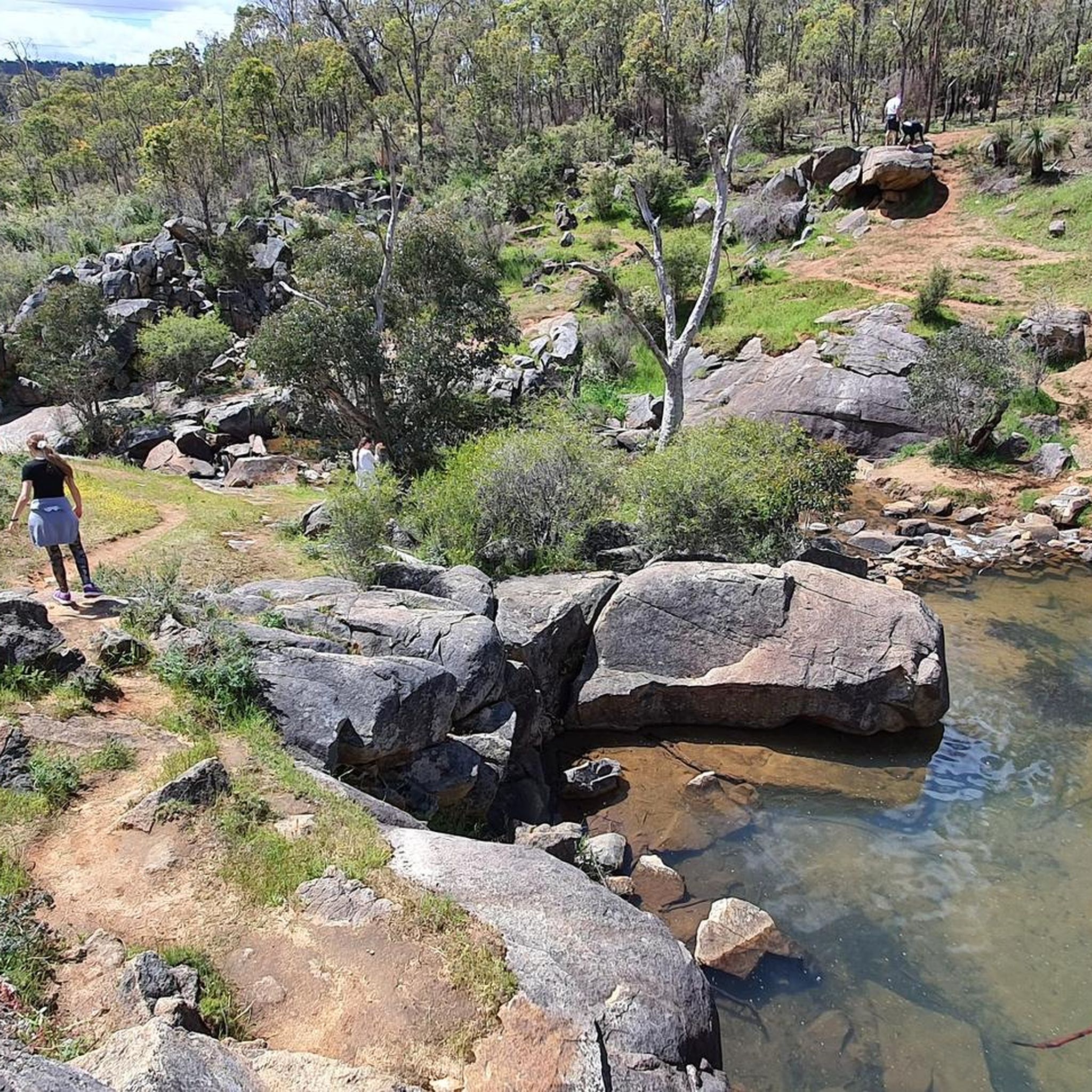
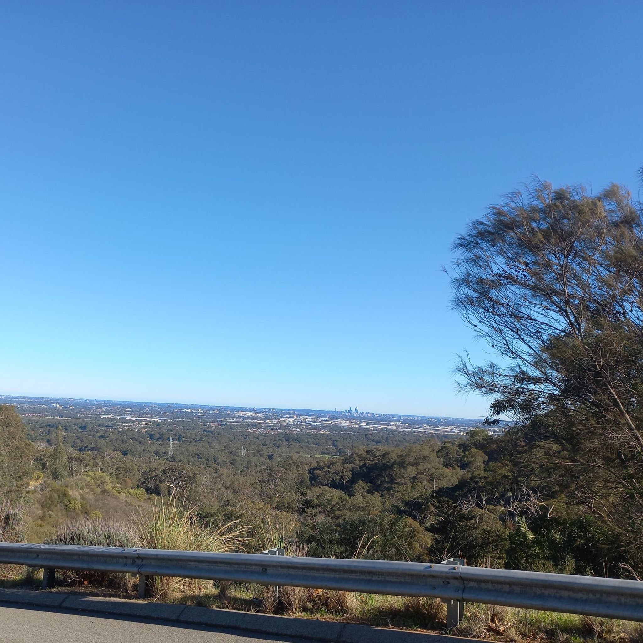
The south side of the Whistlepipe Gully Trail is slightly wider and more open than the north side track. This means you'll have more sun exposure on this side, but also more views of the landscape and city skyline in the distance. Be sure to bring plenty of water and take proper care to protect yourself from the sun.
0
0

Mundy Regional Park sits on the western edge of the Darling Scarp, about 22 kilometres east of Perth, and is known for its beautiful views across the Swan Coastal Plain. There is an extensive network of walking trails that wind through jarrah and marri forest, past granite outcrops and waterfalls, with colourful wildflowers blooming from late winter into spring. Just a short drive from the city, it’s a popular destination for walking, birdwatching and picnicking, and one of the best places to enjoy the natural landscapes of the Perth Hills.
0
0

Kalamunda Mountain Bike Park has well-maintained trails that range from beginner to advanced trails. On site there is a bike rental service called Rock and Roll Mountain Biking, and a café called Trails Hub Café that serves food as well, open from 8 am to 3 pm on Fridays, Saturdays and Sundays (closed weekdays).
0
0
Hewett's Hill Hut, sometimes also spelled Hewitt's Hut, was the first shelter built along the 1,000-kilometer Bibbulmun Track. Nestled in the Jarrah and Wandoo forests of Beelu National Park, the hut can only be reached by bushwalking. It's close to the trail's northern terminus, so this rustic, three-sided wooden timber hut often becomes southbound thru hikers' first night stop. There's a pit toilet and a rainwater catch, so treat or filter all water before drinking.
0
0
Originally built in the 1970s, this dam and pipeline are an important part of the Goldfields Water Supply. The Helena River Walk passes above the dam with short spur trails providing access to the water.
0
0
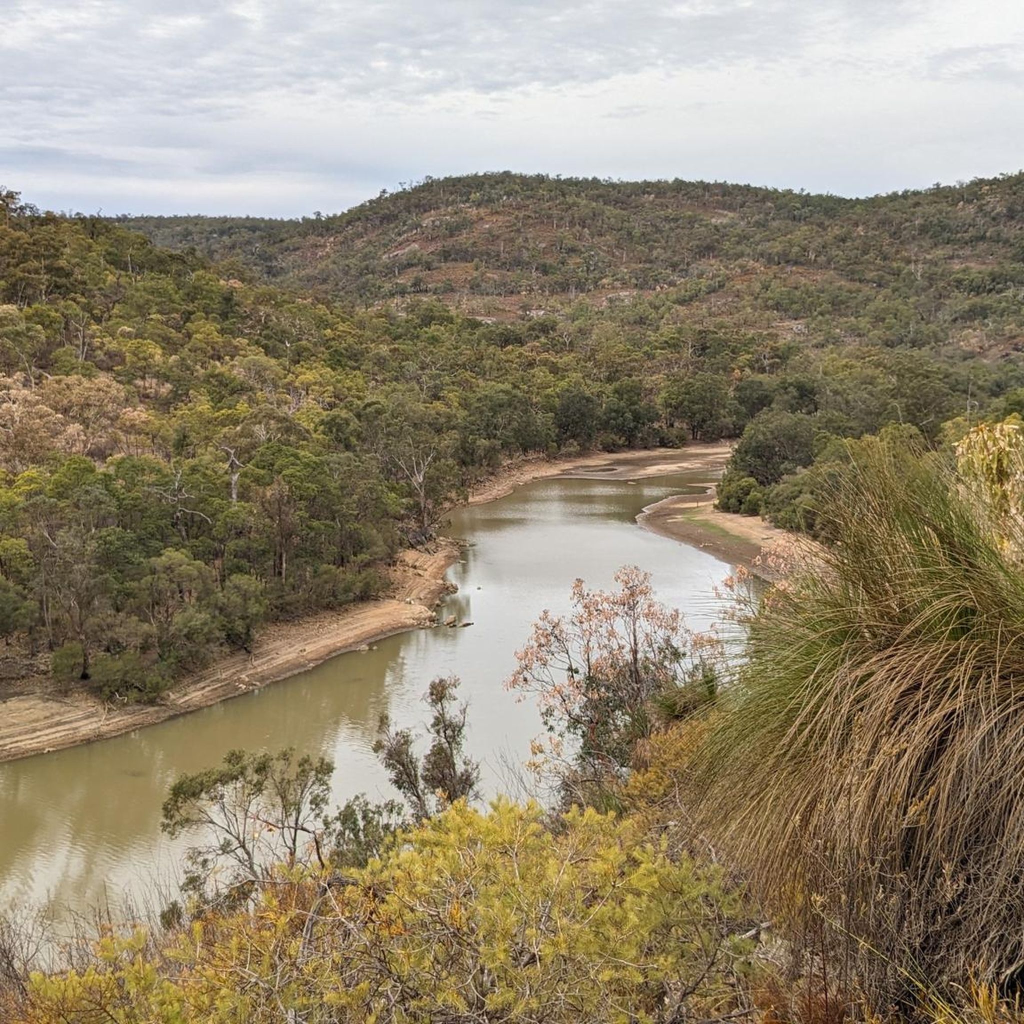
This wide track takes you through dense bushland with views over the Helen River and the Lower Helena Dam. There are many trails in the area and mobile service can be unreliable, so it's best to download your komoot maps before heading out. As always, bring plenty of water and sun protection and take extra care in summer when temperatures can soar.
0
0

The Bibbulmun Track northern terminus marks the official beginning of one of Australia’s great long-distance walks, stretching about one thousand kilometres from Kalamunda to Albany on Western Australia’s south coast. The trail is named after the Bibbulmun people of the Noongar Nation, and walkers are guided by the famous yellow Waugal trail markers representing the Rainbow Serpent from Noongar culture. Information boards, track maps, and nearby bushland trails make this a popular starting point for both day walkers and long-distance hikers.
0
0
This section of the Bibbulmun Track winds through jarrah and marri forest beside Piesse Brook on the way to Rocky Pools in Kalamunda National Park. Narrow dirt trail, rocky creek crossings, and granite outcrops give this stretch a more natural and rugged feel than many of the wider management tracks nearby. During winter and spring, flowing water, damp forest, and wildflowers make this one of the more scenic creekside sections close to Perth.
0
0
Frequently Asked Questions
What kind of terrain can I expect on running routes in Mundy Regional Park?
Jogging routes in Mundy Regional Park feature diverse landscapes, including challenging climbs, runnable downhills, and 'rollercoaster' sections. The trails are primarily natural surfaces, characteristic of the Darling Scarp country, with an elevation gain of approximately 215 meters across many routes. You'll encounter native bushland, wandoo woodlands, and granite outcrops.
Are there any running routes that feature waterfalls in Mundy Regional Park?
Yes, Mundy Regional Park is home to the spectacular Lesmurdie Falls, a 40-meter waterfall with various viewing points. The Whistlepipe Gully trail in the northern part of the park also features small waterfalls and babbling brooks, especially vibrant during wetter months. For a longer run that includes the falls, consider the Lesmurdie Falls National Park – Mundy Regional Park loop from Maida Vale.
What are some of the natural highlights or viewpoints I can enjoy while jogging in the park?
Mundy Regional Park offers picturesque vistas of the Perth city skyline, the Swan Coastal Plain, and the surrounding valley from numerous vantage points. Beyond the stunning Lesmurdie Falls, you'll also find unique geological features like granite outcrops and a rich display of native flora, including wandoo woodlands and balga grass trees. In late winter and spring, the park is particularly beautiful with wildflowers.
Are there any easy or beginner-friendly running trails in Mundy Regional Park?
While many routes feature varied terrain and elevation changes, the park does offer options for different ability levels. Komoot lists 1 easy route and 21 moderate routes out of 43 total. For a moderate option, the Brine Moran Reserve loop from Maida Vale is a popular 5.9 km trail with varied terrain.
Can I bring my dog on the jogging trails in Mundy Regional Park?
Mundy Regional Park is generally dog-friendly, but specific rules may apply to certain areas or trails, especially concerning wildlife protection. It's always best to keep dogs on a leash and ensure you clean up after them. Check local signage within the park for any specific restrictions on trails you plan to use.
Are there any circular running routes available in Mundy Regional Park?
Yes, many of the running routes in Mundy Regional Park are designed as loops, allowing you to start and finish at the same point. For example, the Mundy Regional Park loop from Maida Vale is a moderate 7.5 km circular route.
What is the best time of year to go jogging in Mundy Regional Park?
The park is enjoyable year-round, but late winter and spring (typically August to October) are particularly beautiful due to the spectacular display of wildflowers. Wetter months enhance the cascades of Lesmurdie Falls and Whistlepipe Gully. Summers can be hot, so early morning or late afternoon runs are recommended during this season.
Are there facilities like parking or public transport access for the jogging routes?
Mundy Regional Park has various access points and parking areas, such as the Lesmurdie Falls Picnic Area, which provides accessible facilities. While specific public transport options directly to trailheads might be limited, the park is located just 22 kilometers east of Perth, making it accessible by car. It's advisable to check local transport schedules if relying on public transport.
What do other runners enjoy most about jogging in Mundy Regional Park?
The running routes in Mundy Regional Park are highly rated by the komoot community, with an average score of 4.8 stars from over 6 reviews. Runners often praise the park's varied terrain, the spectacular views of the Perth city skyline, and the natural beauty of features like Lesmurdie Falls and Whistlepipe Gully. The network offers a good mix of challenges and scenic rewards.
Are there any longer, more challenging running routes for experienced runners?
Absolutely. Mundy Regional Park offers 21 difficult routes out of 43 total, catering to experienced runners seeking a challenge. An example is the Crumpet Creek Reserve – Brine Moran Reserve loop from Mundy Regional Park, a difficult 8.1 km path featuring significant elevation changes and scenic views. Another challenging option is the Foot of the Falls – Mundy Regional Park loop from Mundy Regional Park, which covers over 10 km with substantial elevation.
Is Mundy Regional Park suitable for family jogging or walks with children?
Yes, Mundy Regional Park offers diverse trails that can accommodate families. While some routes are challenging, there are gentler sections and picnic areas like Lesmurdie Falls Picnic Area that provide accessible facilities and scenic surroundings for a more relaxed experience. The varied landscapes and natural features, such as waterfalls and wildflowers, can make for an engaging outing for children.
Most popular routes in Mundy Regional Park
Most popular attractions in Mundy Regional Park

Get inspired with the komoot mobile app


Explore more
Browse the best Running Trails & Routes in other regions.
