The best road cycling routes in Bibra Lake Reserve
4.7
(64)
2,843
riders
35
rides
Road cycling in Bibra Lake Reserve offers routes through a significant basin wetland, characterized by open water, fringing paperbark swamps, and areas of banksia woodland. The terrain is generally flat, featuring a notable 6-7 kilometer dual-use concrete loop path encircling Bibra Lake itself. This area, located south of Perth, provides accessible infrastructure for road cyclists, with minimal elevation changes across its trails. The landscape features diverse habitats supporting various wildlife, making for scenic rides.
Best road cycling routes in Bibra…
Last updated: July 9, 2026
5.0
(1)
33
riders
29.3km
01:19
90m
90m
Easy road ride. Great for any fitness level. Mostly well-paved surfaces and easy to ride.
4.9
(16)
282
riders
40.1km
01:48
110m
110m
Easy road ride. Great for any fitness level. Mostly well-paved surfaces and easy to ride.

Sign up for free
5.0
(1)
103
riders
61.3km
02:33
170m
170m
Moderate road ride. Good fitness required. Some segments of this route may be unpaved and difficult to ride.
30
riders
92.7km
03:49
320m
320m
Moderate road ride. Good fitness required. Some segments of this route may be unpaved and difficult to ride.
12
riders
94.8km
04:05
220m
220m
Moderate road ride. Good fitness required. Mostly well-paved surfaces and easy to ride.
Get access to more routes and recommendations from other explorers.
Sign up for free
Already have an account?
Our route recommendations are based on thousands of hikes, rides, and runs completed by other people on komoot.
Start today with a free account
Your next adventure awaits.
Login or Signup
Popular around Bibra Lake Reserve

Tips from the Community

Windan Bridge carries traffic, cyclists, and pedestrians across the Swan River between East Perth and Burswood. Opened in 2000 as part of the Graham Farmer Freeway, the bridge includes a shared path with expansive views over the river and the city skyline. Its position beside Heirisson Island and Optus Stadium makes it a major crossing along Perth’s riverside trail network.
0
0

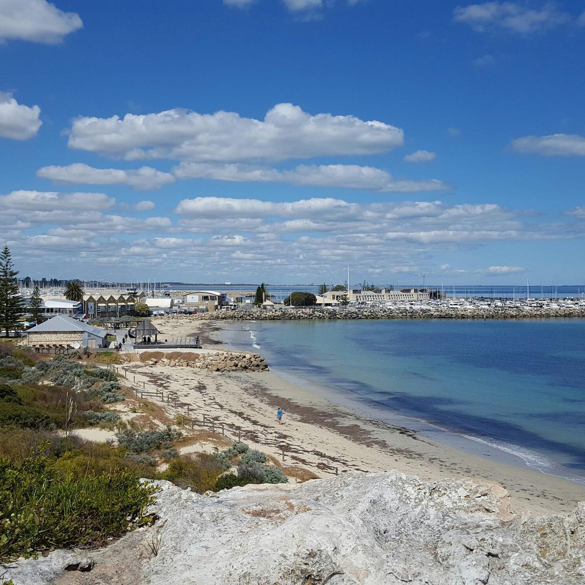
The Shelley Jetty is a wooden jetty in Shelley Beach Park that has a ladder at the end for swimmers or boaters. It has peaceful views and is just across from some public restrooms.
0
0
This large conserved greenspace is made up of forests, marshlands and a park, spanning almost 100 hectares. Fern Park sitting on its northern end with amenities like shaded picnic areas, BBQs, restrooms, and the Lo Quay River Cafe.
0
0

Matagarup Bridge spans the Swan River in Perth, linking East Perth with Optus Stadium and the Burswood Peninsula. Known for its curved, cable-supported arches, it’s a pedestrian and cycling bridge with wide paths and open views along the river. From the bridge, you can look out towards the city skyline and surrounding foreshore. It’s also used for a guided bridge climb experience.
0
0
This lookout offers expansive views across Shoalwater Islands Marine Park, where you can see Penguin Island and other small islands in the distance. From here, you can watch waves breaking over reefs and sometimes spot dolphins or seabirds moving through the bay. This viewpoint captures the coastal character that makes the Cape Peron Loop Trail such a memorable walk.
0
0
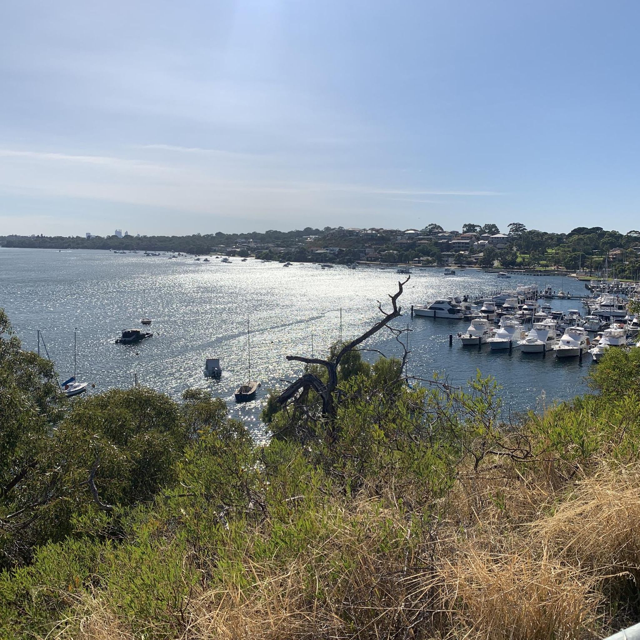
This quiet riverside viewpoint offers one of the best perspectives of the Perth skyline across the Swan River. A bench sits beside the path, making it a great place to pause and take in the cityscape rising above the water. Just below the viewpoint, a small pier extends out into the river, bringing you closer to the water and offering an even clearer look back toward the skyline.
1
0

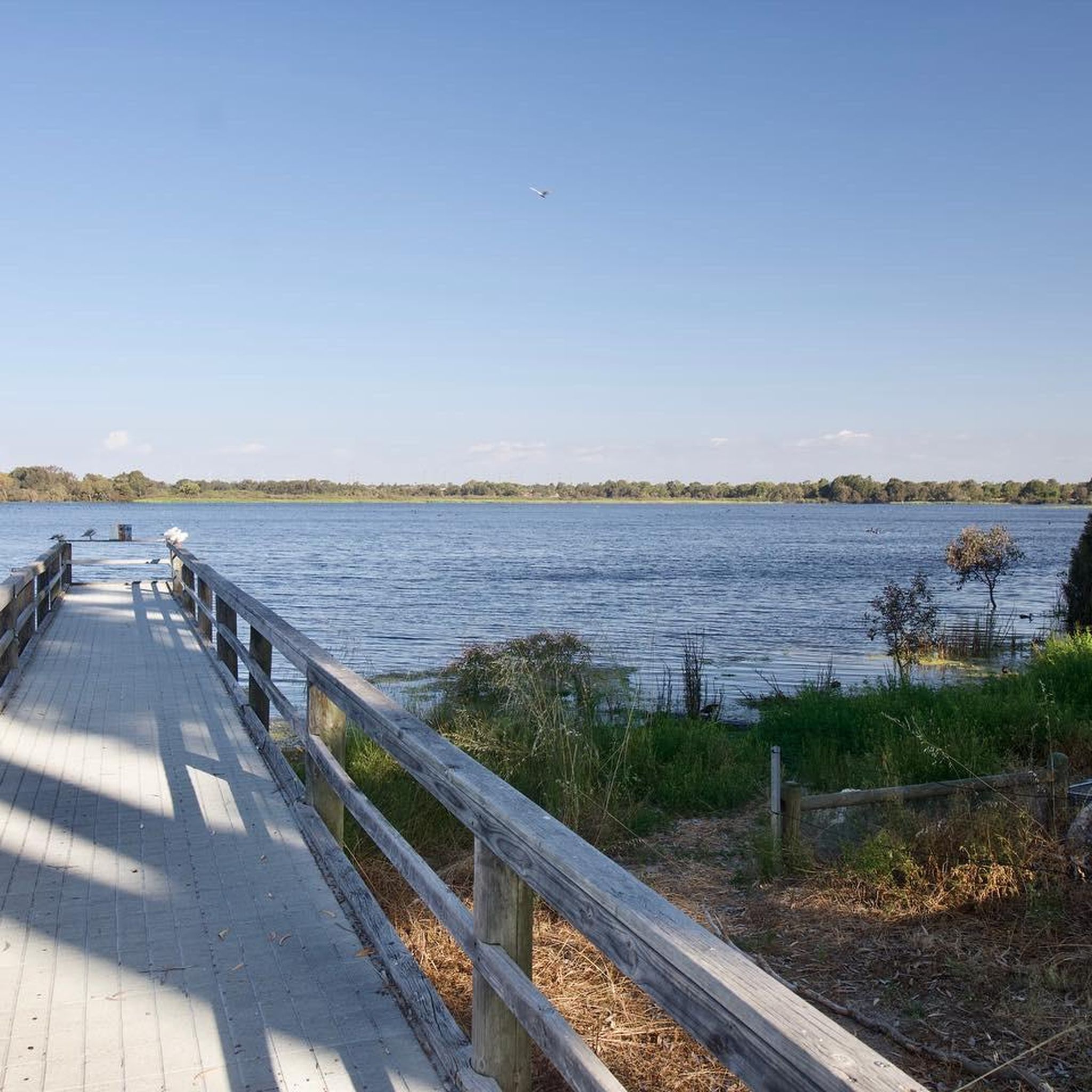
Bibra Lake Reserve is a popular park with a lot to offer, considering its small footprint. You can enjoy a walk around the lake on a paved, accessible path, take your kids to the playground which has been designed with all abilities in mind, or just enjoy the views as the sun sets over the lake.
0
0
Canning Bridge is a major road bridge that carries Canning Highway across the Canning River between the suburbs of Applecross and Como. Originally built in the 1930s, this key bridge has been rebuilt several times over the years. Under the bridge, various walking and cycling paths wind along the river, connecting several of the surrounding foreshore parklands and offering plenty of options for exploring this beautiful area.
0
0
Frequently Asked Questions
What kind of terrain can I expect when road cycling in Bibra Lake Reserve?
Bibra Lake Reserve offers generally flat terrain, making it accessible for various skill levels. The primary cycling path is a 6-kilometer dual-use concrete loop that encircles Bibra Lake, providing a smooth riding surface. You'll also find routes that extend beyond the immediate lake area, traversing through wetlands and banksia woodland.
How many road cycling routes are available in Bibra Lake Reserve?
There are over 35 road cycling routes available in Bibra Lake Reserve, catering to a range of abilities. These include 19 easy routes, 17 moderate routes, and a couple of more challenging options.
Are there any family-friendly cycling options in Bibra Lake Reserve?
Yes, the 6-kilometer dual-use concrete loop around Bibra Lake is highly suitable for families, including those with children or using wheelchairs, due to its flat and well-maintained surface. Additionally, the reserve features the Bibra Lake Regional Playground, an inclusive adventure facility perfect for all ages, making it a great destination for a family day out.
What are some notable natural features or viewpoints along the cycling routes?
The reserve is dominated by Bibra Lake itself, a large basin wetland offering serene water views, often reflecting the surrounding greenery. Cyclists can enjoy views of fringing paperbark swamps and extensive banksia woodland. The eastern shore of the lake is particularly undisturbed, providing excellent opportunities for wildlife spotting, especially over 130 bird species.
What is the best time of year to go road cycling in Bibra Lake Reserve?
Bibra Lake Reserve is enjoyable year-round, but the cooler, drier months (typically autumn to spring) are often preferred for outdoor activities in Western Australia to avoid the intense summer heat. The natural beauty of the wetlands and woodlands can be appreciated in all seasons, with abundant birdlife present throughout the year.
Is there parking available for cyclists at Bibra Lake Reserve?
Yes, Bibra Lake Reserve offers various parking facilities conveniently located around the lake, providing easy access to the cycling paths and other amenities. Specific parking areas are usually well-signposted.
What is the average difficulty of road cycling routes in the area?
The majority of road cycling routes in Bibra Lake Reserve are classified as easy or moderate. For instance, routes like Mt Henry Bridge loop from South Lake are considered easy, while longer options such as Mt Henry Bridge – Perth Water Bike Trail loop from Murdoch are moderate. There are also a couple of more difficult routes for experienced cyclists.
Are there any cultural or educational attractions near the cycling paths?
Yes, Bibra Lake Reserve is an important cultural site for the Beeliar Aboriginal people. Additionally, the Wetlands Centre, a non-profit organization dedicated to conservation, is located within the precinct, offering educational opportunities and programs like nocturnal nightstalk tours.
What do other road cyclists enjoy most about cycling in Bibra Lake Reserve?
The area is highly rated by the komoot community, with an average score of 4.7 stars from over 70 reviews. Reviewers often praise the well-maintained dual-use paths, the serene lake views, and the diverse natural environment, making it a pleasant and accessible cycling destination.
Can I access Bibra Lake Reserve using public transport?
Bibra Lake Reserve is located south of Perth and is generally accessible via public transport, with bus routes serving the surrounding suburbs. It's advisable to check local public transport schedules for the most convenient connections to the reserve.
Are there any longer road cycling routes for more experienced riders?
Yes, for more experienced riders seeking longer distances, routes like Mt Henry Bridge – View of the Canning River loop from Murdoch, spanning over 81 kilometers, or Mount Henry Bridge – Matagarup Bridge loop from Murdoch, which is over 94 kilometers, offer extended rides with moderate difficulty and varied scenery.
Are permits required for road cycling in Bibra Lake Reserve?
No, permits are generally not required for road cycling on the designated public paths within Bibra Lake Reserve. The 6-kilometer loop and connecting trails are part of a public dual-use network.
Most popular routes in Bibra Lake Reserve

Get inspired with the komoot mobile app


Explore more
Browse the best Road cycling routes in other regions.
