The best walks and hikes in Prossers Regional Reserve
4.8
(33)
324
hikers
8
hikes
Hiking trails in Prossers Regional Reserve are set within a diverse landscape characterized by mountainous terrain, river valleys, and significant natural features. The reserve features peaks such as Dido Hill (458 meters) and Lucks Hill (452 meters), offering elevated perspectives. Adjacent areas include the Prosser and Back Rivers, which carve through valleys of grassy woodland and old-growth forests. This region provides varied hiking experiences across its ecosystems.
Best hiking trails in Prossers Regional Reserve
- The most popular hiking route is…
Last updated: November 7, 2026
9
hikers
4.85km
01:13
10m
10m
Easy hike. Easily walkable paths.
5.0
(1)
5
hikers
20.5km
05:54
450m
450m
Hard hike. Very good fitness required. Easily walkable paths.

2
hikers
5.49km
01:23
10m
10m
Easy hike. Easily walkable paths.
1.12km
00:18
10m
10m
Easy hike. Easily walkable paths.
4
hikers
Easy hike. Easily walkable paths.
Get access to more routes and recommendations from other explorers.
Already have an account?
Our route recommendations are based on thousands of hikes, rides, and runs completed by other people on komoot.
Start today with a free account
Your next adventure awaits.
Popular around Prossers Regional Reserve

Tips from the Community

Hoblers Bridge Reserve sits on the banks of the North Esk River, named after the bridge that settler George Hobler built here at his own expense around 1830. The crossing gave Hobler a route from his Killafaddy property to Launceston’s markets, and over the years the riverbank became a popular local picnic spot. Today the reserve has an off-leash area where dogs can stretch their legs along the North Esk Trail, and it also hosts a weekly parkrun, a free, timed 5k event that brings local runners and walkers together.
0
0
The North Esk River flows from the highlands of northern Tasmania toward Launceston, where it joins the South Esk River to form the kanamaluka / Tamar Estuary. In its lower reaches, the river becomes tidal, flowing past wetlands on river flats that convicts drained in the 1800s to prevent flooding. This stretch of river lies on the traditional land of the Leterremairrener People, who knew it as lakekeller, and walking paths along its banks offer ideal places to pause beside the water and watch the river move through the landscape.
0
0
North Esk Trail winds along a tidal stretch of the North Esk River, following gravel paths and boardwalks through the wetlands on the edge of Launceston. Keep an eye out for bitterns and green and gold frogs along the way, and be aware that some tides still wash over the lower sections of the path. It’s a popular route with walkers, joggers, cyclists and dog walkers alike, so you’ll likely see plenty of others enjoying the trail as you make your way along the river.
0
0

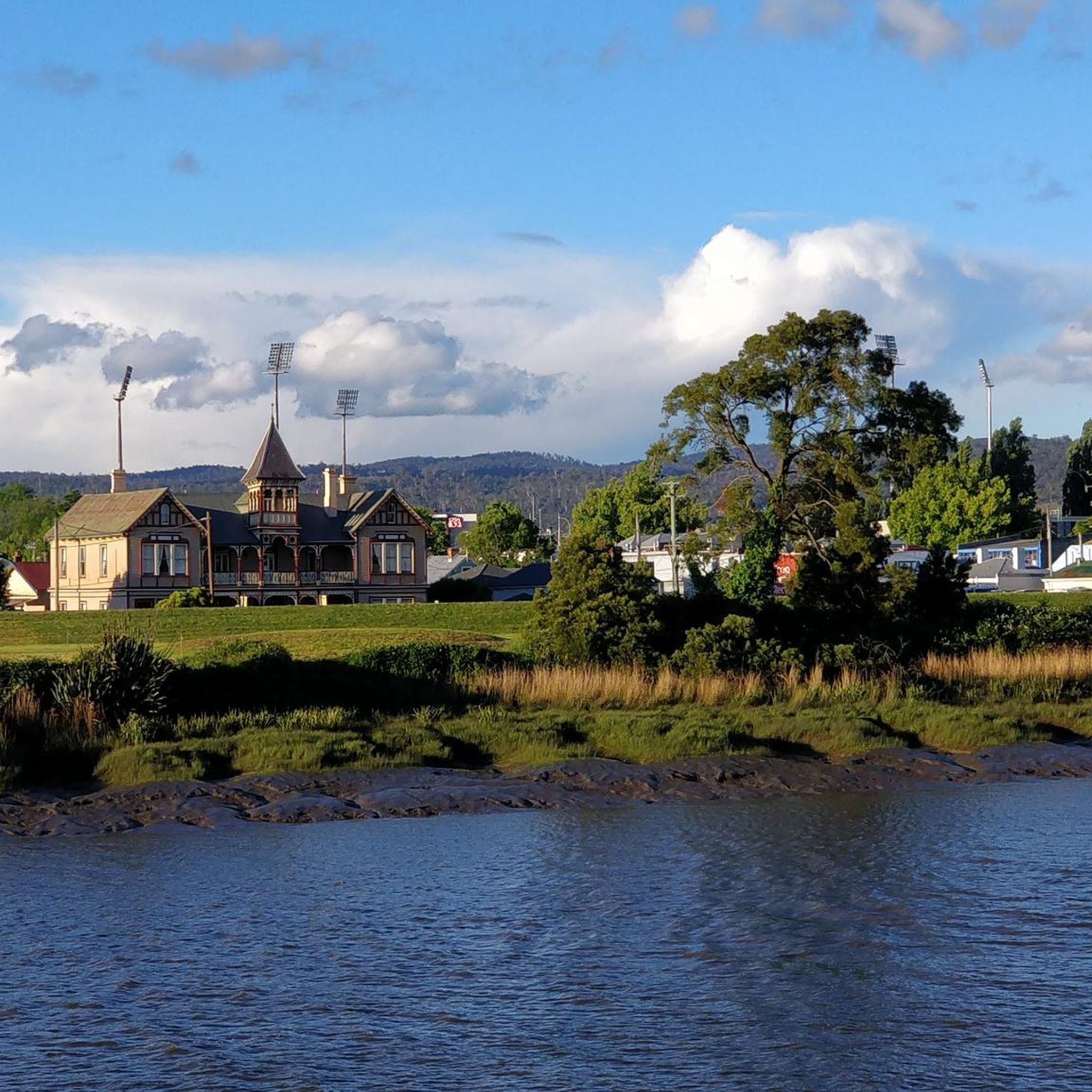
This stadium is now known for hosting AFL games but the grounds were originally converted from swampland into an oval for cricket matches. While it has previously hosted games for the Hawthorn Football Club and St Kilda Football Club it will become the official home stadium for the Tasmania Football Club when it joins the AFL in 2028.
0
0
Launceston's Heritage Forest is a perfect mix of recreation and conservation. You'll find a variety of trails, picnic areas, playgrounds, BBQs, and an off-lead dog area. The forest is also home to all 27 species of Tasmania's eucalyptus trees and native plant garden that features many of Tasmania's most iconic species.
0
0
The North Esk River runs from the foothills of Ben Nevis in Northallerton Valley down to Launceston, shifting from fast, cool mountain water to a broader urban river as it approaches the South Esk River, with which it combines to form the Tamar River. Upstream, it feels crisp and scenic, with forested valleys and clear flow, while closer to the city, you’ll find easy access points, riverside parks, and the historic building of downtown Launceston.
0
0
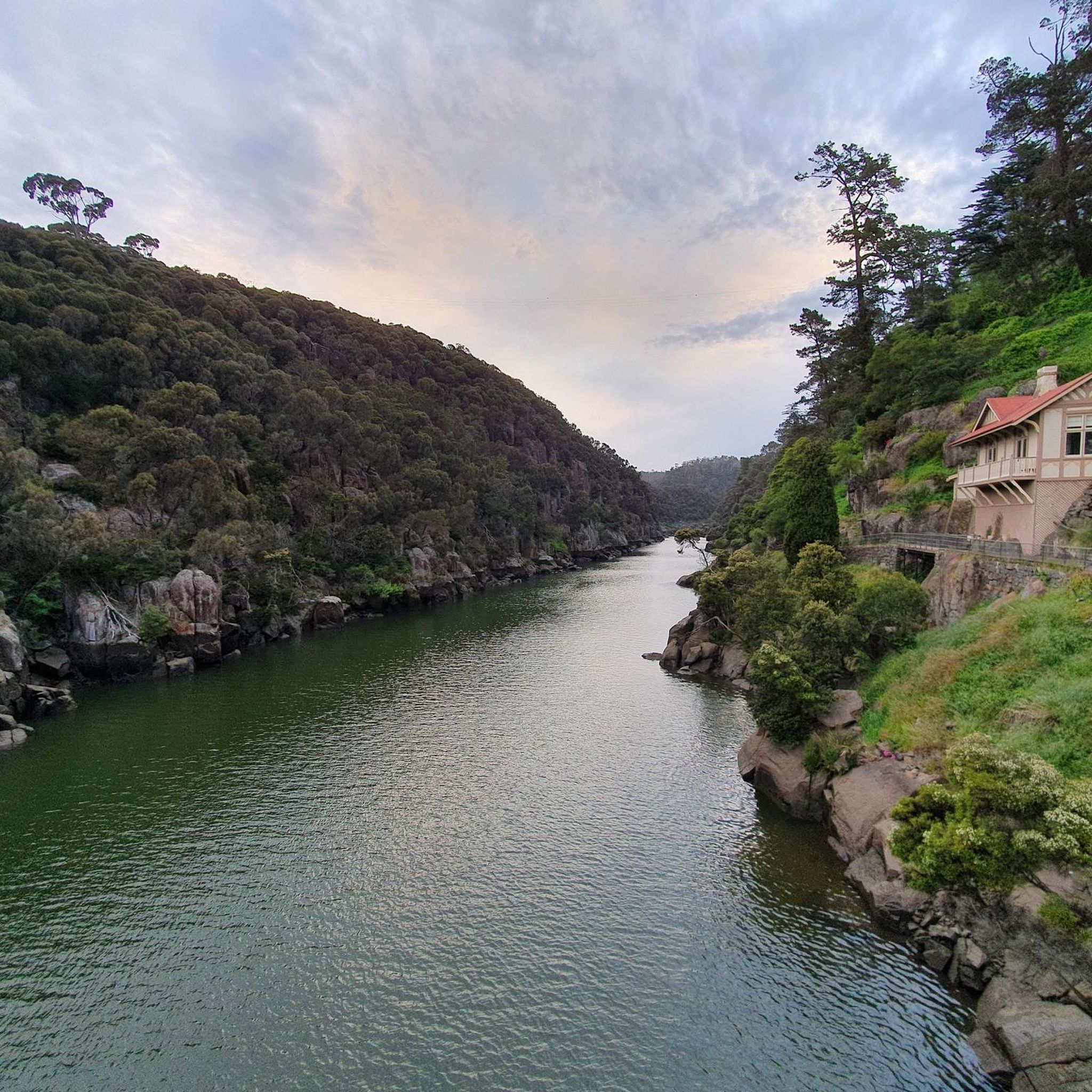
The South Esk River is Tasmania’s longest, flowing from the slopes of Ben Lomond through valleys and towns before joining the Tamar at Launceston. Along its course, it carves Cataract Gorge, feeds Lake Trevallyn, and sustains fertile farmland. Well known for its trout fishing and beautiful scenery, it connects the vast wilderness with recreation across the region.
0
0
First Basin Swimming Pool is a public outdoor pool set within Cataract Gorge, nestled along the calm waters of First Basin. Fed by river water and surrounded by lawns and rocky cliffs, it's a unique place to swim in a natural, picturesque setting. Popular in warmer months, the pool sits close to walking paths, picnic areas, and the Gorge Scenic Chairlift, making it an easy and refreshing stop within the reserve.
0
0
Frequently Asked Questions
What kind of hiking experiences can I find in the Prossers Regional Reserve area?
The Prossers Regional Reserve area offers a diverse range of hiking experiences, from gentle urban parkland strolls to more challenging mountain ascents. While the reserve itself features mountainous terrain like Dido Hill and Lucks Hill, nearby komoot routes provide options such as the Launceston City Park loop for an easy walk, or the more demanding First Basin Swimming Pool – Sentinel Lookout loop from Invermay for experienced hikers seeking significant elevation gain.
Are there family-friendly hiking options in the Prossers Regional Reserve area?
Yes, there are family-friendly options available. For a short and easy walk suitable for all ages, consider the Launceston City Park loop, which is just over 1 km long. These types of trails offer a gentle introduction to the outdoors.
What natural features or landmarks can I explore while hiking in this region?
The Prossers Regional Reserve is characterized by its mountainous terrain, including peaks like Dido Hill (458 meters) and Lucks Hill (452 meters), which offer elevated perspectives. The adjacent Prosser River Reserve features the Prosser and Back Rivers carving through valleys of grassy woodland and old-growth forests. You can also find critically endangered black gum and Oyster Bay pine in deep gullies.
What kind of wildlife can I expect to see while hiking in the Prossers Regional Reserve area?
The region is a haven for wildlife. The Prosser River Reserve, adjacent to the regional reserve, provides habitat for iconic and threatened species such as the Tasmanian devil, eastern quoll, spotted-tailed quoll, and eastern barred bandicoot. The tall old-growth forests also serve as nesting sites for the wedge-tailed eagle.
Are there any circular hiking routes available?
Yes, several circular routes are available. For a challenging option, there's the First Basin Swimming Pool – Sentinel Lookout loop from Invermay. For easier urban walks with river views, you can try the Custom House – View of the Tamar River loop from Launceston or the Custom House – Windmill Pavilion loop from Launceston.
When is the best time of year to hike in Prossers Regional Reserve?
While specific seasonal recommendations for Prossers Regional Reserve are not detailed, generally, the warmer months from spring to autumn (September to May) offer the most pleasant hiking conditions in Tasmania. However, the diverse ecosystems mean that different seasons can offer unique experiences, from vibrant spring blooms to crisp autumn foliage. Always check local weather forecasts before heading out.
What do other hikers say about the trails in the Prossers Regional Reserve area?
The routes in the Prossers Regional Reserve area are highly rated by the komoot community, with an average score of 4.6 stars from over 30 reviews. Hikers often praise the varied terrain, from urban parklands to more challenging ascents, and the opportunities to explore diverse ecosystems.
Are there any trails with water features or river views?
Yes, the region is defined by the Prosser and Back Rivers. You can find routes that offer river views, such as the Custom House – View of the Tamar River loop from Launceston. The King's Bridge – First Basin Swimming Pool loop from Launceston also features water elements.
Is there parking available for hikers accessing trails in the Prossers Regional Reserve area?
While specific parking information for Prossers Regional Reserve itself is not detailed, trails in nearby areas, such as those around Launceston, typically have designated parking areas at trailheads or nearby public parking facilities. It's advisable to check the starting point of your chosen route for specific parking instructions.
Are permits required for hiking in Prossers Regional Reserve?
Based on available information, there is no mention of specific permits required for general hiking within Prossers Regional Reserve. However, it's always good practice to check with local Tasmanian Parks and Wildlife Service for any updated regulations or specific requirements for certain areas or activities before your visit.
Can I bring my dog on hikes in Prossers Regional Reserve?
Regulations regarding dogs in Tasmanian reserves can vary. While some areas may permit dogs on leads, others, especially those protecting threatened wildlife or sensitive ecosystems like the Prosser River Reserve, may have restrictions. It is best to confirm the current dog policy with the Tasmanian Parks and Wildlife Service for Prossers Regional Reserve before planning your hike.
How long are the hikes in the Prossers Regional Reserve area?
Hikes in the area vary significantly in length. You can find short walks like the Launceston City Park loop, which is just over 1 km and takes about 18 minutes. For longer treks, the First Basin Swimming Pool – Sentinel Lookout loop from Invermay is a difficult 20.4 km trail that typically takes nearly 6 hours to complete.
Most popular routes in Prossers Regional Reserve

Get inspired with the komoot mobile app


Explore more
Browse the best Hikes in other regions.
