The best walks and hikes in Cardinia Creek Parklands Reserve
4.9
(16)
425
hikers
18
hikes
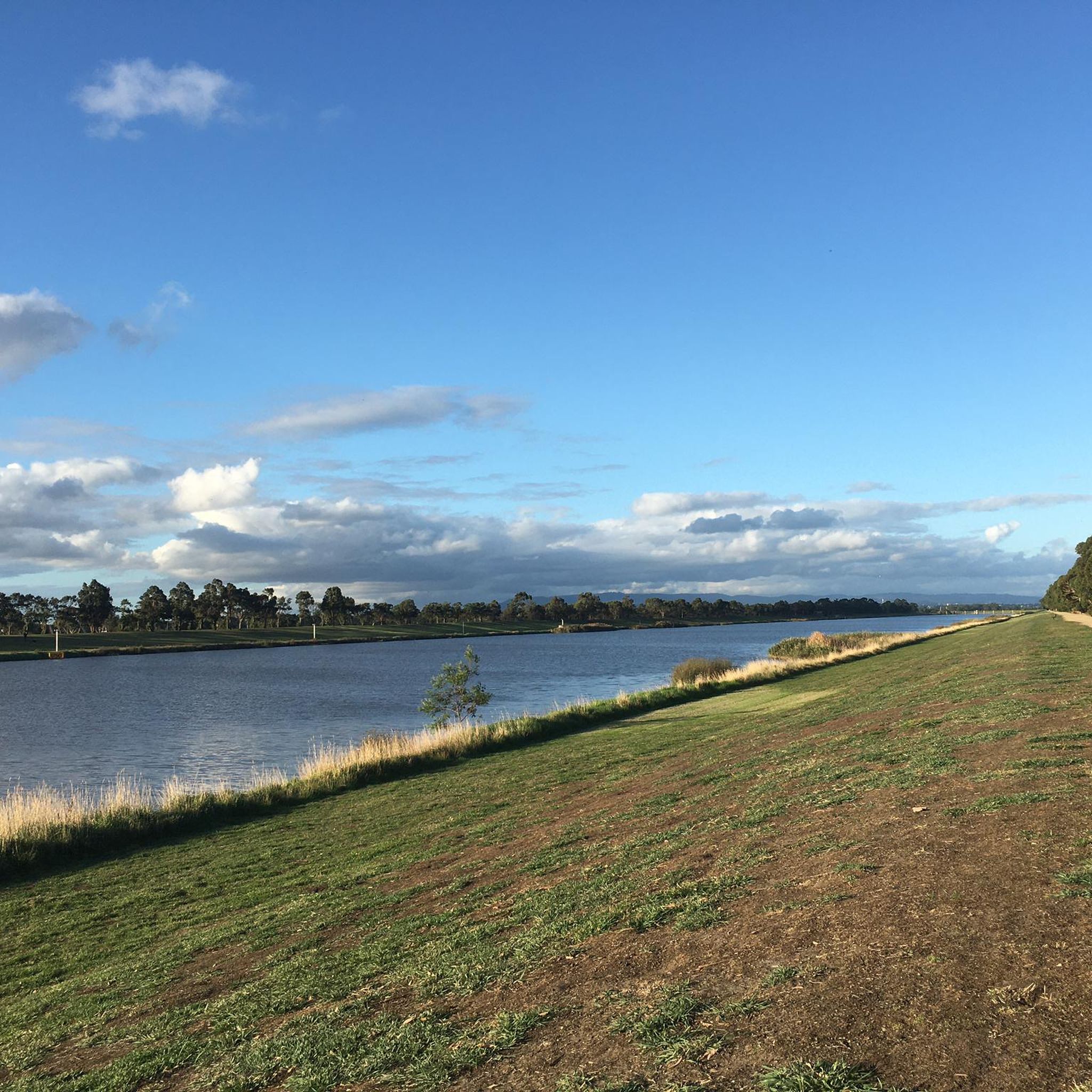
Hiking in Cardinia Creek Parklands Reserve offers an expansive natural landscape spanning over 600 hectares in Melbourne's south-east. The reserve is characterized by its semi-rural setting, featuring wetlands, farmlands, and bushland along the Cardinia Creek corridors. This area provides a vital wildlife corridor, extending from the Harkaway foothills to the open plains south of Beaconsfield. The terrain includes varied ecosystems, supporting diverse flora and fauna.
Best hiking trails in Cardinia Creek Parklands Reserve
- The most popular hiking route is Basalt Lake loop from Harkaway, an easy 2.1 miles (3.5 km) trail that takes about 57 minutes to complete. This route offers views of the Basalt Lake within the parklands.
- Another top favourite among local hikers is Basalt Lake – Anniversary Lake loop from Narre Warren, an easy 2.8 miles (4.4 km) path. This trail connects two of the park's notable lakes, providing a scenic walk through the natural environment.
- Local hikers also love the View of Lysterfield Lake – View of Lysterfield Lake loop from Lysterfield Park, a 5.8 miles (9.3 km) trail leading through varied terrain, often completed in about 2 hours 30 minutes.
- Hiking in Cardinia Creek Parklands Reserve is defined by creek corridors, wetlands, and bushland, offering a mix of natural features. The network provides options for easy to moderate ability levels, catering to various hiking preferences.
- The guide includes highly-rated routes that showcase the best of the region's landscape. More than 60 hikers have used komoot to explore Cardinia Creek Parklands Reserve's varied terrain.
Last updated: July 8, 2026
10
hikers
3.46km
00:57
60m
60m
Easy hike. Great for any fitness level. Easily-accessible paths. Suitable for all skill levels.
3.52km
00:58
60m
60m
Easy hike. Great for any fitness level. Easily-accessible paths. Suitable for all skill levels.

Sign up for free
36
hikers
4.06km
01:06
60m
60m
Easy hike. Great for any fitness level. Easily-accessible paths. Suitable for all skill levels.
5.0
(1)
18
hikers
5.21km
01:26
80m
80m
Easy hike. Great for any fitness level. Easily-accessible paths. Suitable for all skill levels.
5.65km
01:34
100m
100m
Easy hike. Great for any fitness level. Easily-accessible paths. Suitable for all skill levels.
Get access to more routes and recommendations from other explorers.
Sign up for free
Already have an account?
Our route recommendations are based on thousands of hikes, rides, and runs completed by other people on komoot.
Start today with a free account
Your next adventure awaits.
Login or Signup
Popular around Cardinia Creek Parklands Reserve

Tips from the Community

Cardinia Reservoir is one of Melbourne’s major water storages, surrounded by forested hills, open shoreline views, and long embankments stretching across the landscape. Completed in 1973, the reservoir can hold more than 280 billion litres of water and supplies a large portion of Melbourne’s drinking water. From the walking tracks and lookouts around the park, the reservoir often feels more like a huge inland lake than a city water supply.
0
0
The Dam Wall Walk follows the top of Cardinia Reservoir’s long embankment, with open water on one side and rolling forested hills on the other. The walk itself is a narrow gravel path running beside the dam access road, giving uninterrupted reservoir views for nearly the entire crossing. There's no shade on the track so make sure you bring sunscreen and plenty of water.
0
0

Climb to the Kurll Park Scenic Viewing Area and enjoy open views across surrounding parkland and suburban Melbourne. There's often a cooler breeze up here, and it is a great spot to watch a sunset or a sunrise.
0
0
The 1001 Steps Exercise Track lives up to its name and stands as a more physically demanding track, great for those seeking a workout. The track was built in a staircase style, with some actual stairs and other steeper sections of track with logs that serve sort of as stairs. The climb brings you over the suburbs below, providing rewarding views.
0
0
The Bayview Equestrian Trail is a gravel path used for horse riding but also very popular with bushwalkers and runners. The track crosses the grasslands of Bayview Park and under patches of eucalyptus trees. There are nice views of the city below.
0
0

Kangaroo Viewing Trail is a short, easy loop designed to give visitors a good chance of spotting eastern grey kangaroos grazing in the open grassland near the reservoir. The mostly sealed and gently graded path passes picnic areas and low viewpoints, making it ideal for a relaxed stroll rather than a bushwalk. It’s best to walk early in the morning or late afternoon, when wildlife is most active, and the open landscapes are at their quietest.
0
0
Messmate Trail is a relatively short track that winds through eucalypt forest and low ridgelines, typically accessed from the Crystal Brook or Kangaroo Flat picnic areas. The track forms part of several easy loop options (roughly 3–5 kilometres depending on the route) and includes gentle climbs, open grassy sections, and occasional views toward the reservoir. It’s a relaxed, family-friendly walk with well-formed paths, plenty of wildlife sightings, and also connects with the nearby Tea Tree Trail for a longer circuit.
0
0
Cardinia Park is a large recreational reserve that includes a major water storage, scenic lookouts, picnic areas, and a network of walking tracks. The park is well known for its abundant wildlife, including mobs of kangaroos and a variety of birdlife, as well as open lawns and bushland settings. There are several lookouts with panoramic views over the reservoir and surrounding hills, making it a favourite destination for nature lovers and day trips.
0
0
Frequently Asked Questions
What kind of terrain can I expect when hiking in Cardinia Creek Parklands Reserve?
Cardinia Creek Parklands Reserve features a diverse landscape, including wetlands, farmlands, and bushland along the Cardinia Creek corridors. You'll find a mix of semi-rural character and natural environments, with trails often following the creek and offering views of various ecosystems. The terrain is generally easy to moderate, making it accessible for a range of hikers.
Are there any easy hiking trails suitable for beginners or casual walkers?
Yes, the reserve offers several easy trails. For example, the Guru Nanak Lake loop from Berwick is an easy 3.8 km path. Many of the park's routes are designed for various fitness levels, with 9 out of 10 routes on komoot rated as easy.
Can I bring my dog on the trails in Cardinia Creek Parklands Reserve?
Yes, dogs are permitted on leads in most areas of Cardinia Creek Parklands Reserve. There are also designated off-leash areas in places like Manna Gum Park and Akoonah Park, providing options for your furry friends to explore.
Are there any circular routes available for hiking?
Absolutely. Many of the trails in Cardinia Creek Parklands Reserve are designed as loops, allowing you to start and end at the same point. Examples include the Basalt Lake loop from Harkaway and the Guru Nanak Lake loop from Narre Warren South, offering convenient circular walks.
What natural features or landmarks can I see along the hiking trails?
The parklands are rich in natural features. You can expect to see Cardinia Creek itself, which is a vital wildlife corridor, as well as wetlands, bushland, and lakes such as Basalt Lake, Anniversary Lake, and Guru Nanak Lake. The area is also known for its diverse flora and fauna, including various bird species, platypus, and echidnas.
Is Cardinia Creek Parklands Reserve suitable for family hikes with children?
Yes, the reserve is very family-friendly. With many easy trails and an expansive natural environment, it's a great place for families. There are also picnic areas, such as Grasmere Picnic Area, and children's nature play areas available within the parklands, making it an enjoyable outing for all ages.
How many hiking trails are available in Cardinia Creek Parklands Reserve?
There are over 10 hiking routes documented on komoot for Cardinia Creek Parklands Reserve, offering a variety of experiences for different preferences and fitness levels.
What do other hikers enjoy most about Cardinia Creek Parklands Reserve?
The area is highly rated by the komoot community, with an average score of 5.0 stars. Reviewers often praise the beautiful natural creekside experience, the diverse landscapes of wetlands and bushland, and the well-maintained trails that cater to various abilities.
Are there parking facilities available at the trailheads?
While specific parking locations for each trailhead are best checked on individual komoot tour pages, the parklands are generally well-equipped for visitors. Areas like Grasmere Picnic Area provide open parkland settings which typically include parking facilities for easy access to trails.
What is the best time of year to go hiking in Cardinia Creek Parklands Reserve?
Cardinia Creek Parklands Reserve can be enjoyed year-round. The diverse landscapes, including wetlands and bushland, offer different beauty in each season. Spring brings blooming flora, while autumn showcases vibrant colors. Even in winter, the trails provide a peaceful experience, though it's always wise to check local weather conditions before heading out.
Can I reach Cardinia Creek Parklands Reserve using public transport?
While the parklands offer a semi-rural character, they are located in Melbourne's south-east, extending from Berwick to Clyde. Public transport options may connect to nearby towns, but direct access to specific trailheads within the expansive reserve might require a combination of public transport and a short walk or taxi. It's advisable to plan your route in advance using local transport services.
Are there any longer or more challenging hikes in the reserve?
While most trails are easy, there are options for longer walks. For instance, the View of Lysterfield Lake – View of Lysterfield Lake loop from Lysterfield Park is a moderate 9.3 km trail that takes about 2 hours 30 minutes to complete, offering a more extended experience through varied terrain.
Most popular routes in Cardinia Creek Parklands Reserve

Get inspired with the komoot mobile app


Explore more
Browse the best Hikes in other regions.
