The best cycling routes in Future Sparrovale Nature Reserve
4.4
(7)
157
riders
20
rides
Touring cycling routes in Future Sparrovale Nature Reserve are located within a developing 500-hectare wetland and waterway wildlife reserve near Armstrong Creek. This area is characterized by a mix of natural and constructed wetlands, adjoining the Barwon River. The landscape supports diverse plant and animal life, with future plans to integrate cycling links with the popular Barwon River Trail.
Best touring cycling routes in Future Sparrovale Nature Reserve
- The most popular touring cycling route is Bike loop from Marshall,…
Last updated: July 8, 2026
8
riders
13.7km
00:48
30m
30m
Easy bike ride. Great for any fitness level. Mostly paved surfaces. Suitable for all skill levels.
3.0
(1)
5
riders
73.0km
04:19
390m
390m
Moderate bike ride. Good fitness required. Mostly paved surfaces. Suitable for all skill levels.

Sign up for free
19
riders
10.2km
00:36
20m
20m
Easy bike ride. Great for any fitness level. Mostly paved surfaces. Suitable for all skill levels.
5
riders
Easy bike ride. Great for any fitness level. Mostly paved surfaces. Suitable for all skill levels.
16
riders
53.4km
03:14
280m
280m
Moderate bike ride. Good fitness required. Mostly paved surfaces. Suitable for all skill levels.
Get access to more routes and recommendations from other explorers.
Sign up for free
Already have an account?
Our route recommendations are based on thousands of hikes, rides, and runs completed by other people on komoot.
Start today with a free account
Your next adventure awaits.
Login or Signup


Tips from the Community

The Barwon River flows for 160 kilometres through Victoria and is lined by trails on both sides as it flows through Geelong. The name is an anglicized version of the Aboriginal word Parwan, which means either magpie or great wide. The river is popular for walking, jogging, cycling, kayaking, and rowing. There are also many parks and reserves along its banks, so there is no shortage of ways to enjoy your time at the river.
0
0

Barwon River Trail follows the Barwon River through Geelong on more than 20 kilometres of mostly sealed paths, connecting Fyansford to South Geelong. The trail runs along both sides of the river, passing through a mix of parkland, wetlands, and open riverbanks. Along the way, it links key spots like Queens Park, Balyang Sanctuary, Belmont Common, and Buckley Falls. You’ll also pass playgrounds, picnic areas, and quieter sections of river, with multiple access points and parking throughout, and no entry fee.
0
0

This stone pillar stands before a beautiful backdrop of Point Danger Marine Sanctuary. The plaques on the pillar commemorate those who died in the Korean, Malayan Emergency, and Vietnam Wars. There are a few benches here with great, unobstructed views out to sea, along with lots of parking and toilets on the west side of the parking area.
0
0

Rippleside Park is a large coastal reserve overlooking Corio Bay, popular for its open lawns, walking paths, and relaxed seaside atmosphere. The park includes picnic and barbecue areas, a playground, and connections to the Geelong waterfront trail, making it a hub for families and outdoor recreation. Its waterfront setting and beautiful views toward the city skyline make it a lovely place to spend the day.
0
0
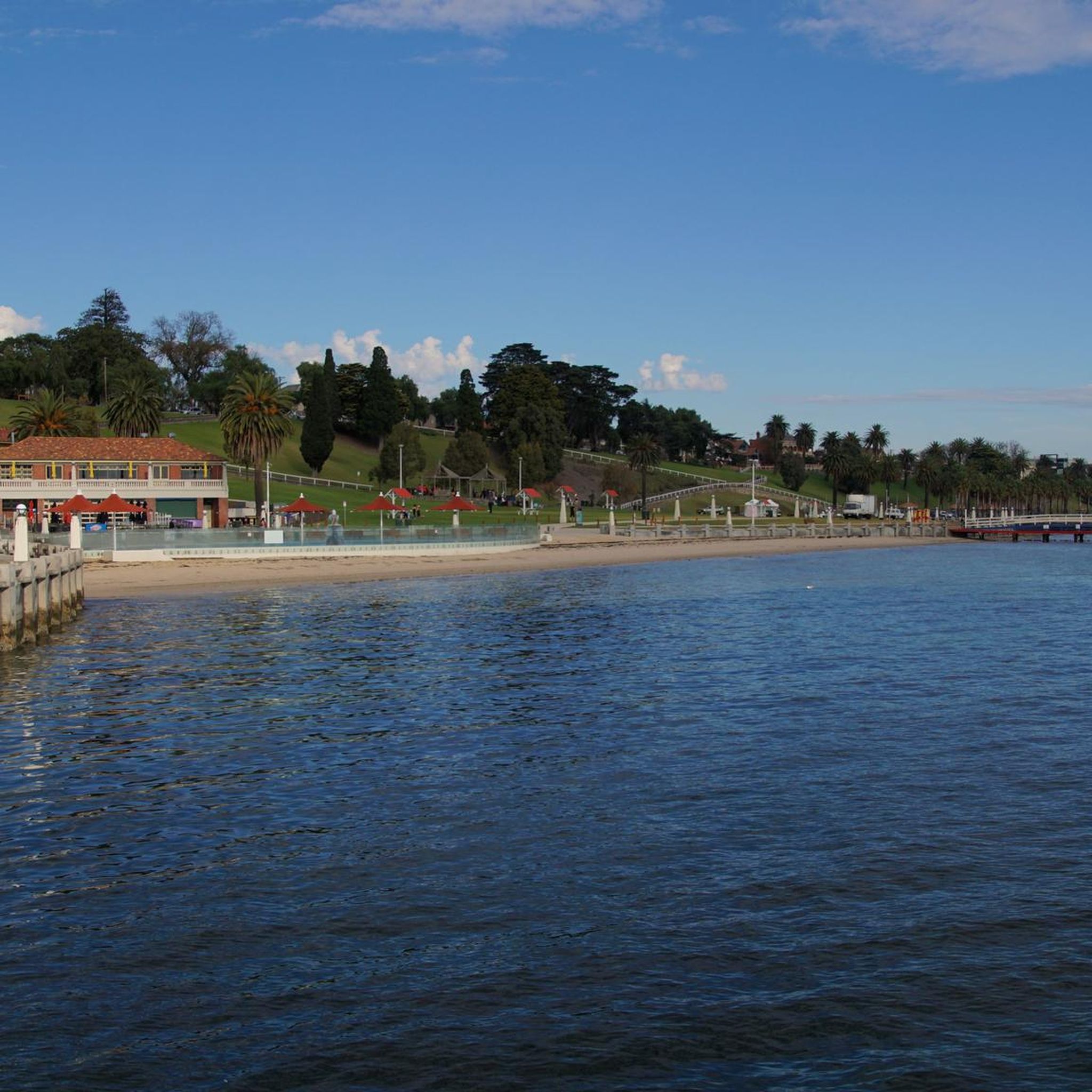
Eastern Beach sits along the sheltered waters of Corio Bay, and is a beautiful spot to unwind by the water. The foreshore is lined with a wide promenade, shaded lawns, and palm trees, making it a popular spot that's perfect for walks or picnics, or a casual day at the beach.
0
0
Barwon River Trail follows the Barwon River through Geelong on more than 20 kilometres of mostly sealed paths, connecting Fyansford to South Geelong. The trail runs along both sides of the river, passing through a mix of parkland, wetlands, and open riverbanks. Along the way, it links key spots like Queens Park, Balyang Sanctuary, Belmont Common, and Buckley Falls. You’ll also pass playgrounds, picnic areas, and quieter sections of river, with multiple access points and parking throughout, and no entry fee.
0
0
Women’s Place of Peace is a small riverside garden along the Barwon River in Geelong, created by the Reclaim the Night Collective as a quiet space for reflection. It honours survivors of sexual assault and family violence, as well as women who have worked to protect the rights and safety of women and children. The area features a series of mosaic pavers set into the ground, each with symbolic designs representing themes of strength, creation, and connection.
0
0
Stan Lewis Walk follows the Barwon River in Geelong, offering a mostly flat, shared path through open parkland and along the water’s edge. It was named in 1975 in memory of Stan Lewis, superintendent of maintenance for the Geelong Waterworks and Sewerage Trust. The track is popular for walking, running, and cycling, with regular river views and open green space.
0
0
Frequently Asked Questions
How many touring cycling routes are available in Future Sparrovale Nature Reserve?
There are nearly 30 touring cycling routes in Future Sparrovale Nature Reserve. These routes cater to various skill levels, with 11 easy and 16 moderate options.
What kind of terrain can I expect on touring cycling routes in Future Sparrovale Nature Reserve?
The routes primarily traverse wetland environments and areas adjoining the Barwon River. You'll experience a mix of natural and constructed wetlands, offering unique views of the diverse plant and animal life in this developing nature reserve.
Are there any easy touring cycling routes suitable for beginners or families?
Yes, there are 11 easy touring cycling routes. A great option for a straightforward ride is the Bike loop from Marshall, which is 8.5 miles (13.7 km) long and takes about 47 minutes to complete. Another easy choice is the Barwon River Trail – View of the Barwon River loop from Geelong, a 6.4 miles (10.2 km) trail.
Are there any longer or more challenging touring cycling routes?
For those seeking a longer ride, there are 16 moderate routes available. One notable option is the View of Torquay Surf Beach – Point Danger Monument loop from Marshall. This route spans 45.3 miles (72.9 km) and offers scenic views of Torquay Surf Beach and the Point Danger Monument.
What are the future plans for cycling infrastructure in the reserve?
The Future Sparrovale Nature Reserve has ambitious plans for cycling. Phase three of the Master Plan, scheduled for 2030-2040, includes the crucial connection of the Barwon River Trail to Geelong and an upgrade of walking tracks. These developments will significantly improve cycling links, integrating the reserve with the popular Barwon River Trail and enhancing accessibility for touring cyclists.
Are there circular touring cycling routes available?
Yes, many of the touring cycling routes in the area are loops. Examples include the Bike loop from Marshall and the Barwon River Trail – Sweet Adeline’s Café loop from Grovedale, which offers a pleasant ride with a café stop.
What wildlife can I expect to see while cycling in the reserve?
The reserve is a haven for wildlife, especially birds. Nearly 100 different bird species have been observed, including majestic brolgas, migratory shorebirds like sharp-tailed sandpipers, whiskered terns, various ducks, herons, and stilts. You might also spot numerous frogs and fish in the wetland areas.
Where can I find parking or access points for the cycling trails?
While specific parking areas within the developing reserve are still being established, many routes start from nearby towns like Marshall, Geelong, Grovedale, and Highton, where public parking is generally available. For example, the View of the Barwon River – Barwon River Trail loop from Highton begins from Highton.
Are there any cafes or facilities near the cycling routes?
Yes, some routes incorporate stops at local amenities. For instance, the Barwon River Trail – Sweet Adeline’s Café loop from Grovedale specifically mentions a café, providing an opportunity for a break and refreshments during your ride. The broader region around Geelong also offers various cafes and facilities.
What do other cyclists say about the touring routes here?
The touring cycling routes in Future Sparrovale Nature Reserve are highly rated by the komoot community, with an average score of 4.4 stars from over 20 reviews. Nearly 400 touring cyclists have used komoot to explore the varied terrain, often praising the wetland environments and riverine landscapes.
Is the Future Sparrovale Nature Reserve accessible by public transport?
The Master Plan for the reserve aims to improve connectivity, including to public transport. While direct access within the developing reserve might be limited currently, the reserve is near Armstrong Creek and adjoins the Barwon River, which is accessible from Geelong. It's advisable to check local public transport schedules for connections to areas like Marshall or Geelong, where many routes originate.
What other activities can I enjoy in Future Sparrovale Nature Reserve besides cycling?
Beyond cycling, the reserve is envisioned as a hub for nature-based experiences. You can enjoy birdwatching, picnicking, mindful strolls, and guided walks. The Master Plan also aims to increase access for water-based activities such as fishing, canoeing, and kayaking once fully established.
Most popular routes in Future Sparrovale Nature Reserve

Get inspired with the komoot mobile app


Explore more
Browse the best Cycling routes in other regions.
