
The best road cycling routes in Para Wirra Conservation Park
24
riders
1
ride
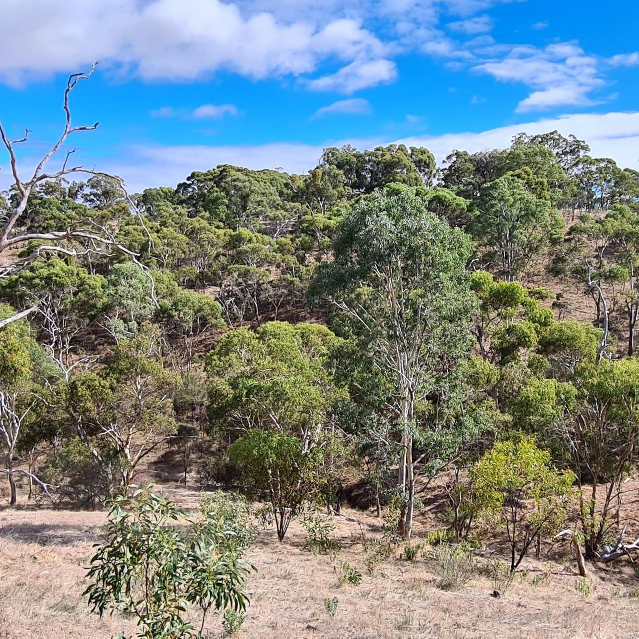
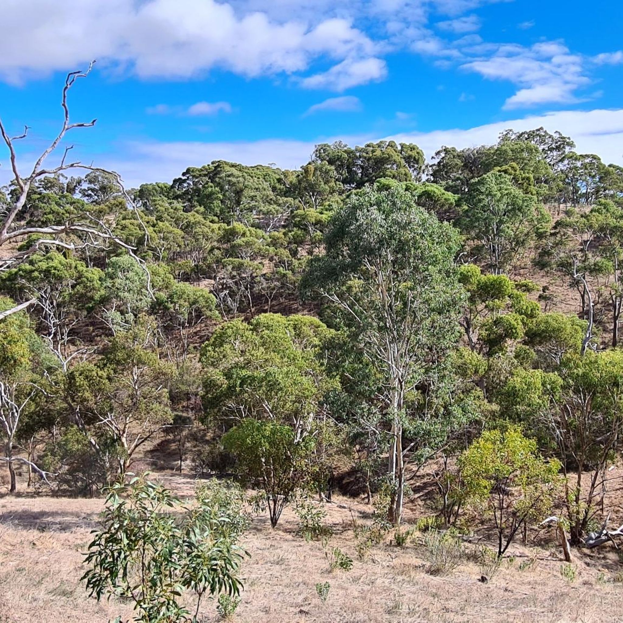
Road cycling routes in Para Wirra Conservation Park traverse a natural bushland setting characterized by diverse terrain. The park features well-paved surfaces suitable for road bikes, with routes ranging from leisurely to challenging. Cyclists encounter blue gum and long-leaf box woodlands, rocky outcrops, expansive valley views, and tranquil creeks. The elevation gains on these routes contribute to varied riding experiences.
Best road cycling routes in Para Wirra Conservation Park
- The most popular road cycling route is Warren Reservoir loop from…
Last updated: July 4, 2026
8
riders
72.2km
03:23
930m
930m
Hard road ride. Very good fitness required. Mostly well-paved surfaces and easy to ride.
10
riders
61.3km
02:53
720m
720m
Moderate road ride. Good fitness required. Mostly well-paved surfaces and easy to ride.

Sign up for free
2
riders
49.6km
02:24
710m
710m
Moderate road ride. Good fitness required. Mostly well-paved surfaces and easy to ride.
2
riders
46.6km
02:15
540m
540m
Moderate road ride. Good fitness required. Some segments of this route may be unpaved and difficult to ride.
2
riders
22.1km
01:01
260m
270m
Easy road ride. Great for any fitness level. Mostly well-paved surfaces and easy to ride.
Our route recommendations are based on thousands of hikes, rides, and runs completed by other people on komoot.
Start today with a free account
Your next adventure awaits.
Login or Signup
Popular around Para Wirra Conservation Park

Tips from the Community

Frequently Asked Questions
Are there road cycling routes suitable for beginners in Para Wirra Conservation Park?
Yes, Para Wirra Conservation Park offers routes for various fitness levels. For an easier ride, consider the Speed Descent loop from City of Playford. This route is approximately 22 km long with around 260 meters of elevation gain, making it a good option for those new to road cycling or looking for a more relaxed experience.
What kind of scenery and natural features can I expect to see while road cycling in Para Wirra Conservation Park?
Road cycling in Para Wirra Conservation Park immerses you in a natural bushland setting. You'll ride through blue gum and long-leaf box woodlands, past geologically spectacular rocky outcrops, and enjoy expansive valley views. The park also features tranquil creeks, rivers like the South Para River, and a picturesque lake, all contributing to a diverse and scenic ride.
Are there challenging road cycling routes for experienced riders?
Absolutely. Experienced road cyclists seeking a challenge will find demanding options. The Warren Reservoir loop from Williamstown is a difficult route spanning over 72 km with more than 900 meters of elevation gain, typically taking over 3 hours to complete. This route requires very good fitness.
What are some notable points of interest or landmarks along the road cycling routes?
While cycling, you can explore several points of interest. The park features lookouts such as The Knob Lookout and Devil's Nose Lookout, offering panoramic views. The historic Barossa Goldfields provide a glimpse into 19th-century mining, and the picturesque lake is a popular spot for relaxation. The Gawler View Picnic Area also offers recreational facilities.
What is the typical length and duration of road cycling routes in Para Wirra Conservation Park?
The road cycling routes in Para Wirra Conservation Park vary significantly in length and duration. You can find shorter rides like the Speed Descent loop at about 22 km, taking just over an hour. Longer, more challenging routes, such as the Warren Reservoir loop, can be over 72 km and require more than 3 hours to complete.
Are there any loop trails for road cycling in the park?
Yes, many of the road cycling routes in Para Wirra Conservation Park are designed as loops, allowing you to start and finish at the same point. Examples include the Roadbike loop from Gawler Racecourse and the Whispering Wall Picnic Area loop from Gawler Racecourse, offering convenient circular journeys through the park's diverse landscapes.
Is Para Wirra Conservation Park suitable for family road cycling outings?
Para Wirra Conservation Park offers options that can be enjoyed by families, particularly on its easier, well-paved sections. While some routes are challenging, the park's general amenities, like the Gawler View Picnic Area with its Nature Play Forest, make it a family-friendly destination. For cycling, consider shorter, less elevated routes or stick to sealed park roads where permitted.
What wildlife might I encounter while road cycling in the park?
Para Wirra Conservation Park is rich in native wildlife. Cyclists often spot kangaroos, especially during dawn and dusk. The park is home to over 100 species of birds, including emus, wattlebirds, and rainbow lorikeets. Keep an eye out for bearded dragons, sleepy lizards, short-beaked echidnas, and yellow-footed antechinus as well.
Where can I park when visiting Para Wirra Conservation Park for road cycling?
Para Wirra Conservation Park offers various parking areas for visitors. Specific parking details often depend on your chosen starting point for a route. For example, routes originating from Gawler Racecourse would typically utilize parking facilities there. It's advisable to check the specific route details on komoot for recommended parking locations.
Are there any cafes or places to get refreshments near the road cycling routes?
While Para Wirra Conservation Park itself is a natural bushland setting, the surrounding towns and areas, such as Williamstown and Gawler, offer cafes and refreshment options. It's a good idea to plan your route to pass through or near these towns if you wish to stop for food or drinks, or to bring your own supplies for a picnic within the park.
What is the best time of year to go road cycling in Para Wirra Conservation Park?
The best time for road cycling in Para Wirra Conservation Park is generally during the cooler months of spring (September-November) and autumn (March-May). During these seasons, the weather is milder, making for more comfortable riding conditions. Summer can be very hot, and while winter is cooler, some tracks might be affected by rain.
Are there any permits required for road cycling in Para Wirra Conservation Park?
Generally, no specific permits are required for recreational road cycling on designated trails and sealed park roads within Para Wirra Conservation Park. However, cycling is restricted in certain areas, such as north of the South Para River in the Barossa Goldfields and south of Humbug Scrub Road in the Mack Creek area. For the most current information on park regulations, it's always best to check the official Parks SA website: parks.sa.gov.au.

Get inspired with the komoot mobile app


Explore more
Browse the best Road cycling routes in other regions.
