The best walks and hikes in Coralinga Forest Reserve
4.7
(75)
1,063
hikers
33
hikes
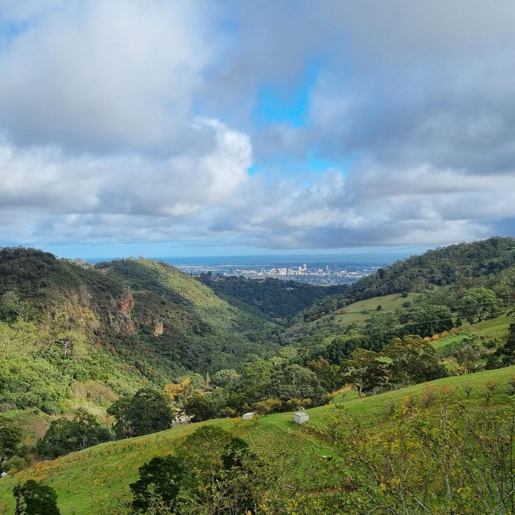
Hiking in Coralinga Forest Reserve offers routes through 933.0 acres of diverse natural features in Cherryville, Australia. The terrain includes areas with brown loamy surface soils, clay subsoils, and shattered slate fragments, with deeper yellow decomposing slate in gentler slopes. The reserve is part of the River Torrens Catchment and features a series of waterfalls, including First, Second, and Third Falls. Mount Misery, at 560 meters, marks the highest point within the reserve.
Best hiking trails in Coralinga Forest Reserve
- The most popular hiking route is View of Second Falls – View of Third Falls loop from Unnamed (No.HA29) Heritage Agreement, an 8.5 miles (13.8 km) trail that takes 4 hours 5 minutes to complete, passing by prominent waterfalls.
- Another top favourite among local hikers is View of Third Falls – Kookaburra Rock Lookout loop from Morialta Conservation Park, a moderate 4.3 miles (6.9 km) path offering scenic viewpoints including Kookaburra Rock Lookout.
- Local hikers also love the Montacute Conservation Park loop from Montacute Conservation Park, a 5.0 miles (8.0 km) trail leading through varied forest terrain, often completed in about 2 hours 30 minutes.
- Hiking in Coralinga Forest Reserve is defined by waterfalls, diverse forests, and hills, including Mount Misery. The network offers options for different ability levels, from easy paths to more challenging loops.
- The routes in Coralinga Forest Reserve are highly rated by the komoot community with an average score of 4.6 stars from over 90 reviews. More than 1000 hikers have used komoot to explore Coralinga Forest Reserve's varied terrain.
Last updated: November 17, 2026
3.0
(1)
3
hikers
8.03km
02:31
310m
310m
Moderate hike. Good fitness required. Easily walkable paths.
3
hikers
10.4km
02:57
240m
240m
Moderate hike. Good fitness required. Easily walkable paths.

4.6
(8)
39
hikers
4.34km
01:37
270m
270m
Easy hike. Easily walkable paths.
8
hikers
5.46km
01:51
290m
290m
Easy hike. Easily walkable paths.
6
hikers
4.95km
01:18
50m
50m
Easy hike. Easily walkable paths.
Get access to more routes and recommendations from other explorers.
Already have an account?
Our route recommendations are based on thousands of hikes, rides, and runs completed by other people on komoot.
Start today with a free account
Your next adventure awaits.



Tips from the Community

Black Hill Conservation Park covers 684 hectares of diverse terrain just 13 kilometres from Adelaide. There are a number of walking tracks that wind through the hills and showcase the diverse vegetation and wildlife that call the park home. The dark leafed sheoak trees give the park its name and the vibrant spring wildflowers come back each year in stunning fashion. Also, keep your eyes open and you might spot koalas, southern brown bandicoots, blue wrens, southern boobook owls, or one of the dozens of other species that are known to live in the area.
0
0
Summit Track forms part of a circuit trek to the top of Black Hill and offers an intermediate challenge, peppered with great views over the surrounding hills and onward to Adelaide. While you can take the circuit in either direction, it's generally considered easier to go anti-clockwise so you can get the steep part finished first while your legs are fresh.
0
0
Black Hill gets its name from the sheoak forests that cover the landscape and have leaves that slowly darken through the summer and turn the hills black. The summit of Black Hill stands at 467 metres and offers great views over the Adelaide Plains.
0
0

Section 5 of the Yurrebilla Trail runs between Morialta and the River Torrens, connecting the Moores, Fox Hill, Quarry, Black Hill, and Banksia tracks along the way. It passes Fox Dam and follows Montacute Road alongside Fifth Creek before entering Black Hill Conservation Park, then winds through Ambers Gully as it continues on. Most of the route is surrounded by Eucalypt woodland, home to plenty of kangaroos and koalas, with excellent views across the Adelaide Plains to the city and, further out, the Gulf of St Vincent.
0
0
Ambers Gully Track winds through a picturesque valley within Black Hill Conservation Park, crossing several small streams as it cuts through lush, green gully country. It’s a quieter, more sheltered contrast to the exposed ridge sections nearby, with a few relatively steep inclines in places. There is plenty of birdlife, kangaroos, and koalas to see, especially in the quieter stretches.
0
0
Main Ridge Track climbs from the Black Hill Conservation Park car park on Gorge Road, working its way up through stringybark forest and dense heath to the higher points of the park. It’s a genuine workout, with steep, rocky sections and shifting terrain that moves between wide gravel fire track and narrower, looser paths. Kangaroos and koalas are regularly spotted along the way, with beautiful, sweeping views back over Adelaide and the Adelaide Plains opening up as the climb progresses.
0
0
Athelstone Flour Mill is one of South Australia's oldest surviving flour mill sites and one of the earliest water-powered mills in the colony. Built by William and Charles Dinham in 1845 on the banks of the River Torrens, it helped support the province's growing agricultural industry. Today, it stands as a rare reminder of the milling heritage of that era.
0
0
River Torrens Linear Park Trail is a long, 35-kilometre shared walking and cycling route that follows the River Torrens (Karrawirra Pari) through Adelaide, connecting parks, wetlands, and riverside reserves from the hills to the coast. This section is an easy walk along the peaceful riverside corridor, where you’ll see ducks, cormorants, and other waterbirds that call this area home. Along the way, there are additional walking routes on this side and across the river if you’re looking to extend your outing.
0
0
Frequently Asked Questions
What types of landscapes can I expect to see while hiking in Coralinga Forest Reserve?
Coralinga Forest Reserve offers a diverse range of landscapes across its 933.0 acres. You'll encounter areas with brown loamy surface soils, brown-red clay subsoils, and shattered slate fragments. Gentler slopes and gullies feature deeper layers of yellow decomposing slate. The reserve is also part of the River Torrens Catchment, contributing to its varied natural environment.
Are there any notable natural features or landmarks to look out for?
Yes, the reserve is known for its series of beautiful waterfalls, including First, Second, and Third Falls, which are prominent features along several hiking routes. For those seeking elevation, Mount Misery, standing at 560 meters, marks the highest point in the reserve near its northern boundary. You can also find scenic viewpoints offering panoramic city views.
What is the overall difficulty level of hiking trails in Coralinga Forest Reserve?
Coralinga Forest Reserve offers a range of trails suitable for various fitness levels. Out of 31 total routes, there are 13 easy trails, 17 moderate trails, and 1 difficult trail. This variety ensures options for both casual walkers and more experienced hikers.
Are there any family-friendly hiking options in Coralinga Forest Reserve?
While specific family-friendly routes aren't detailed, the reserve does offer easily accessible paths among its 13 easy trails, which are generally suitable for families. These routes allow for a pleasant outdoor experience without requiring advanced hiking skills.
Are dogs allowed on the trails in Coralinga Forest Reserve?
The provided information does not specify whether dogs are permitted on the trails within Coralinga Forest Reserve. It is advisable to check local regulations or park signage before visiting with your dog.
Are there any circular walks available in Coralinga Forest Reserve?
Yes, many of the trails in Coralinga Forest Reserve are designed as loops. Popular circular routes include the View of Second Falls – View of Third Falls loop, which is 13.8 km, and the shorter View of Third Falls – Kookaburra Rock Lookout loop, spanning 6.9 km. Another option is the Montacute Conservation Park loop, an 8.0 km trail.
What do other hikers enjoy most about Coralinga Forest Reserve?
The area is highly rated by the komoot community, with an average score of 4.6 stars from over 90 reviews. Hikers often praise the diverse forests, the presence of waterfalls like First, Second, and Third Falls, and the varied terrain that includes hills and Mount Misery. The network offers options for different ability levels, from easy paths to more challenging loops.
How long do hikes typically take in Coralinga Forest Reserve?
Hiking durations vary depending on the route and your pace. For example, the View of Second Falls – View of Third Falls loop (13.8 km) typically takes around 4 hours and 5 minutes. A shorter option, the View of Third Falls – Kookaburra Rock Lookout loop (6.9 km), can be completed in about 2 hours and 10 minutes.
Is there parking available at the trailheads in Coralinga Forest Reserve?
The provided information does not detail specific parking facilities. However, as a popular hiking destination, it is generally expected that designated parking areas are available near common trailheads. It's recommended to check local signage upon arrival.
Are there any permits required for hiking in Coralinga Forest Reserve?
The provided information does not mention any specific permits required for general hiking in Coralinga Forest Reserve. However, it's always a good practice to check for any updated local regulations or park notices before your visit.
What kind of wildlife might I encounter in Coralinga Forest Reserve?
Coralinga Forest Reserve is rich in diverse flora and fauna, protecting various vegetation types such as native forest, woodland, grassy woodland, shrubland, grassland, and wetland. It is also a popular spot for birdwatching, suggesting a variety of bird species. While not explicitly detailed, you might encounter typical Australian bushland wildlife.
Are there any cafes or pubs near Coralinga Forest Reserve for post-hike refreshments?
The provided information does not specify nearby cafes or pubs directly adjacent to the reserve. Coralinga Forest Reserve is located in Cherryville, Australia, so amenities would likely be found in the surrounding towns or communities.
Most popular routes in Coralinga Forest Reserve

Get inspired with the komoot mobile app


Explore more
Browse the best Hikes in other regions.
