The best cycling routes in Coombabah Lakes Conservation Area
4.0
(36)
724
riders
40
rides
Touring cycling in Coombabah Lakes Conservation Area offers accessible routes through a diverse natural environment. The area spans over 1200 hectares, featuring flat terrain across wetlands, eucalypt forests, salt marshes, and mangrove swamps. Lake Coombabah and its estuarine systems are significant coastal wetlands, providing habitats for migratory waterbirds. The conservation area's predominantly flat tracks make it suitable for various cycling abilities.
Best touring cycling routes in Coombabah Lakes Conservation Area
- The most popular touring cycling route is View of Surfers Paradise – Surfers Paradise sign loop from Helensvale, a 52.2 miles (84.1 km) trail that takes 5 hours 1 minute to complete. This difficult route offers extensive views across the region.
- Another top favourite among local touring cyclists is Coomera River loop from Helensvale, a moderate 44.5 miles (71.6 km) path. This route follows the Coomera River, providing waterside scenery.
- Local touring cyclists also love the Velo 1 Construction Site – Daisy Hill Koala Centre loop from Central Park, a 69.3 miles (111.6 km) trail leading through varied landscapes, often completed in about 6 hours 44 minutes.
- Touring cycling in Coombabah Lakes Conservation Area is defined by flat terrain, extensive wetlands, and eucalypt forests. The network offers options for easy, moderate, and difficult routes.
- The routes in Coombabah Lakes Conservation Area are highly rated by the komoot community with an average score of 4.0 stars from more than 20 reviews. More than 600 touring cyclists have used komoot to explore Coombabah Lakes Conservation Area's varied terrain.
Last updated: July 4, 2026
11
riders
80.2km
04:48
300m
300m
Moderate bike ride. Good fitness required. Mostly paved surfaces. Suitable for all skill levels.
4
riders
71.9km
04:11
300m
300m
Moderate bike ride. Good fitness required. Mostly paved surfaces. Suitable for all skill levels.

Sign up for free
4.5
(4)
42
riders
122km
07:15
840m
840m
Hard bike ride. Very good fitness required. Mostly paved surfaces. Suitable for all skill levels.
9
riders
30.4km
01:49
160m
160m
Moderate bike ride. Good fitness required. Mostly paved surfaces. Suitable for all skill levels.
5.0
(1)
9
riders
44.6km
02:38
160m
160m
Moderate bike ride. Good fitness required. Mostly paved surfaces. Suitable for all skill levels.
Get access to more routes and recommendations from other explorers.
Sign up for free
Already have an account?
Our route recommendations are based on thousands of hikes, rides, and runs completed by other people on komoot.
Start today with a free account
Your next adventure awaits.
Login or Signup

Tips from the Community

Anzac Park sits along the Broadwater with open grass, large shade trees, and direct access to the shoreline. The park includes picnic areas, a playground, and a memorial space, with wide views across the water toward South Stradbroke Island.
0
0

Damian Leeding Memorial Park is a large, multi-use lakeside park on the northern Gold Coast, centred around Regatta Waters Lake, and is a hub for recreation and water sports. There are open grassy areas, playgrounds, picnic shelters with barbecues, fitness equipment, and facilities for activities such as rowing, kayaking, and sailing. A nearly 4-kilometre shared-use path surrounds the lake, making it a popular spot for walking, cycling, and everyday exercise.
0
0

Stretching along 36 kilometers of shoreline the Oceanway connects dozens of beaches, parks, viewpoints, and sand dunes. The shared use path invites those on foot and wheels to enjoy all that the Gold Coast has to offer at their own pace.
0
0
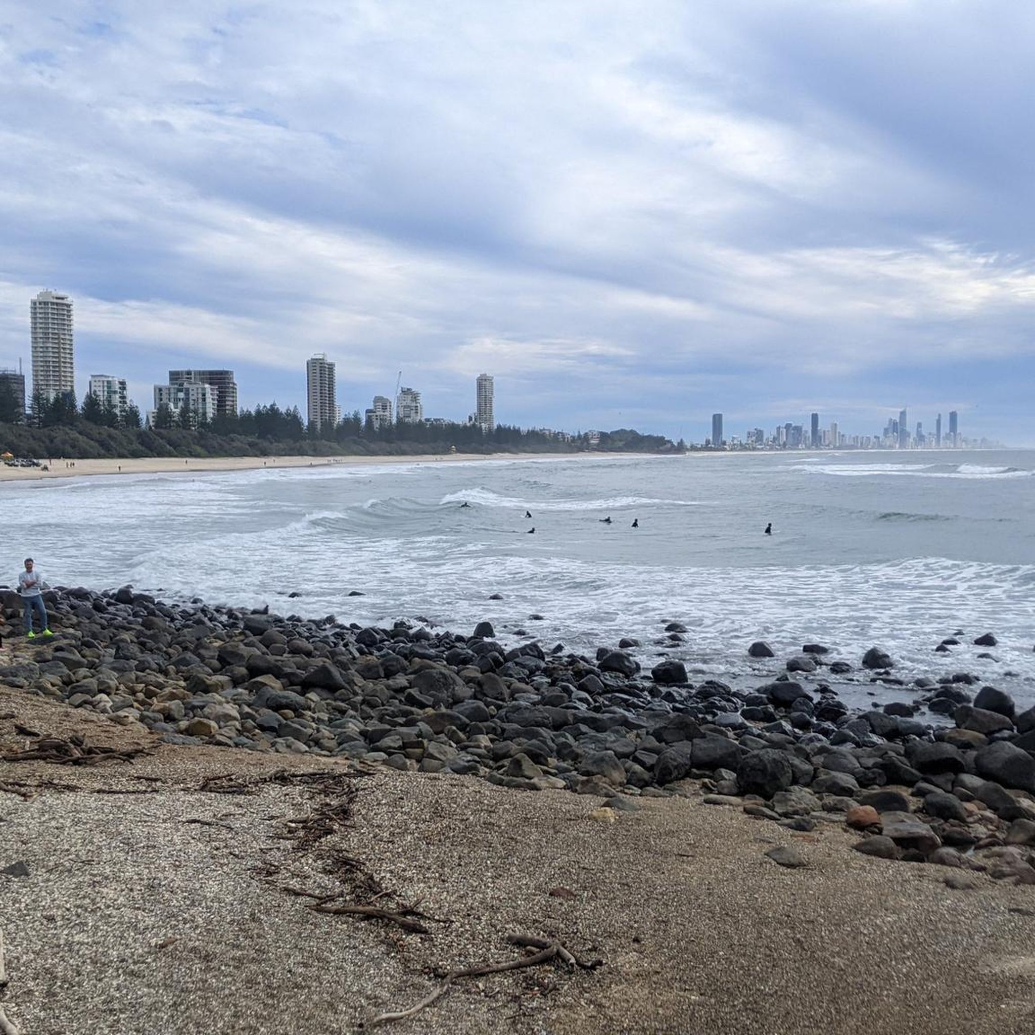
The Gold Coast Oceanway is a paved coastal path that runs parallel to the beach, linking suburbs along the shoreline. This section near Surfers Paradise follows the edge of the sand, offering uninterrupted ocean views with the skyline rising behind you. The wide, sealed path is shared by walkers, runners and cyclists, so keep left and stay aware of faster traffic. Shade is limited along exposed stretches, making early morning or late afternoon a more comfortable time to walk.
0
0
Surfers Paradise Beach is a broad stretch of sand that faces directly onto the Coral Sea, with consistent surf and wide coastal views. The beach runs alongside the high-rise skyline, creating one of the Gold Coast’s most recognisable scenes. Swimming is safest between the red and yellow flags where lifeguards patrol. Conditions can change with swell and wind, and rips are present at times.
0
0
Narrow Neck Reserve sits between Surfers Paradise and Main Beach, where the coastline opens into a broad stretch of sand backed by dunes and parkland. From Esplanade, you can see the Narrow Neck artificial reef extending into the ocean, designed to improve surf conditions and help protect the shoreline from erosion. The reserve includes open grassy areas, picnic spots and direct beach access.
0
0

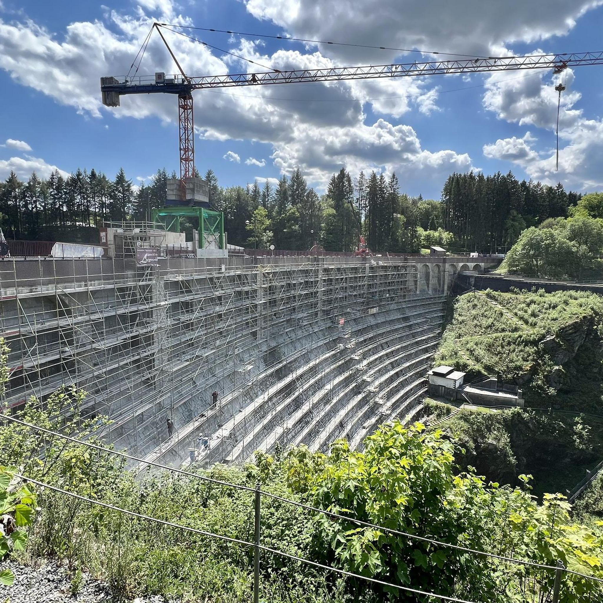
Would recommend 40psi front and back. Water available at the entrance to the cafe at the dam wall.
0
0

Frequently Asked Questions
What kind of terrain can I expect when touring cycling in Coombabah Lakes Conservation Area?
The Coombabah Lakes Conservation Area is characterized by predominantly flat terrain, making it accessible for various fitness levels. You'll encounter a mix of surfaces, including flat bitumen paths, unpaved fire trails, and gravel tracks. The trails traverse diverse landscapes such as wetlands, eucalypt forests, salt marshes, and mangrove swamps.
How many touring cycling routes are available in Coombabah Lakes Conservation Area?
There are over 50 touring cycling routes available in Coombabah Lakes Conservation Area. These routes cater to different skill levels, with 19 easy, 20 moderate, and 12 difficult options to choose from.
Are there any family-friendly touring cycling routes in Coombabah Lakes Conservation Area?
Yes, the predominantly flat terrain and extensive network of paths make Coombabah Lakes Conservation Area very suitable for family-friendly cycling. Many of the 19 easy routes are ideal for families, allowing for leisurely exploration of the diverse landscapes.
Can I spot wildlife while cycling in Coombabah Lakes Conservation Area?
Absolutely! The area is a significant wildlife hotspot. Cyclists often spot kangaroos grazing in grasslands, and it's home to approximately 150 koalas. Over 200 bird species, including migratory waterbirds, can be observed, especially from bird hides located along some trails. The diverse habitats support a rich array of flora and fauna.
What are some notable natural features or landmarks to look out for on a touring cycle?
While cycling, you can explore the expansive wetlands, dense eucalypt forests, and intricate mangrove swamps. The 'Broadwalk' is a 4.5-kilometre track offering stunning wetland views, and winding boardwalks, like the Melaleuca Boardwalk, provide unique perspectives of the mangrove habitats. Lake Coombabah itself is a protected fish habitat and part of the Southern Moreton Bay Marine Park.
Are there any circular touring cycling routes in the area?
Yes, many of the routes in Coombabah Lakes Conservation Area are designed as loops, allowing you to start and finish at the same point. For example, the Koala loop from Labrador is an easy 28.3 km circular route, perfect for a shorter ride.
What is the best time of year to go touring cycling in Coombabah Lakes Conservation Area?
The Gold Coast generally enjoys a subtropical climate. While cycling is possible year-round, the cooler, drier months from autumn to spring (roughly March to November) are often preferred for outdoor activities like touring cycling, offering more comfortable temperatures for longer rides.
What do other touring cyclists enjoy most about Coombabah Lakes Conservation Area?
The area is highly rated by the komoot community, with an average score of 4.0 stars from nearly 30 reviews. Reviewers often praise the flat, accessible trails, the abundant wildlife spotting opportunities, and the tranquil atmosphere of its diverse wetlands and forests.
Are dogs allowed on the touring cycling trails in Coombabah Lakes Conservation Area?
While the conservation area is a natural habitat, specific rules regarding dogs can vary. It's always best to check the official Gold Coast City Council website for the most current regulations on pets in the Coombabah Lakes Conservation Area to ensure compliance and protect the local wildlife: goldcoast.qld.gov.au.
Are there any challenging touring cycling routes for experienced riders?
Yes, for more experienced touring cyclists, there are 12 difficult routes available. An example is the Velo 1 Construction Site – Daisy Hill Koala Centre loop from Central Park, a challenging 111.6 km trail that leads through varied landscapes.
How can I get to Coombabah Lakes Conservation Area using public transport?
The Coombabah Lakes Conservation Area is accessible via public transport, with bus routes serving areas around the Gold Coast. You can plan your journey using local transport services to reach entry points to the conservation area. It's advisable to check TransLink's website for up-to-date bus schedules and routes that connect to the vicinity of the park.
Is there parking available for cyclists at Coombabah Lakes Conservation Area?
Yes, there are designated parking areas at various entry points to the Coombabah Lakes Conservation Area, making it convenient for cyclists to park their vehicles and access the trails. Specific parking locations can often be found on local council maps or park information boards.
Most popular routes in Coombabah Lakes Conservation Area

Get inspired with the komoot mobile app


Explore more
Browse the best Cycling routes in other regions.
