The best road cycling routes in Whites Hill Reserve
4.6
(126)
6,398
riders
51
rides
Road cycling routes in Whites Hill Reserve, located in Queensland, feature a blend of urban fringe roads and paths that explore natural parkland. The area is characterized by gentle hills and varied terrain, providing options for different skill levels. The primary designated area for road cycling within the reserve is the Boundary Road Bikeway, situated on its western edge. The region includes open eucalypt forest and dry rainforest remnants.
Best road cycling routes in Whites Hill Reserve
- The most popular…
Last updated: July 5, 2026
4.3
(3)
87
riders
17.4km
00:58
120m
120m
Easy road ride. Great for any fitness level. Mostly well-paved surfaces and easy to ride.
4.8
(10)
36
riders
19.1km
01:02
100m
100m
Easy road ride. Great for any fitness level. Mostly well-paved surfaces and easy to ride.

Sign up for free
5.0
(2)
71
riders
75.7km
03:29
350m
350m
Moderate road ride. Good fitness required. Mostly well-paved surfaces and easy to ride.
15
riders
138km
06:40
1,040m
1,040m
Hard road ride. Very good fitness required. Mostly well-paved surfaces and easy to ride.
7
riders
152km
06:39
1,120m
1,120m
Hard road ride. Very good fitness required. Mostly well-paved surfaces and easy to ride.
Get access to more routes and recommendations from other explorers.
Sign up for free
Already have an account?
Our route recommendations are based on thousands of hikes, rides, and runs completed by other people on komoot.
Start today with a free account
Your next adventure awaits.
Login or Signup
Popular around Whites Hill Reserve

Tips from the Community

The Minnippi Wetlands Circuit loops around a series of lagoons and restored wetland habitat, with wide sealed paths that make for an easy walk or ride. The route stays mostly level and passes reed-lined water edges, open grassland, and scattered shaded sections where you’ll often spot ducks, ibis, egrets, and other waterbirds feeding around the shallows. There are benches, picnic areas, toilets, and parking nearby, making it an easy one for a relaxed lap without needing to venture far from the city.
0
0
The Minnippi Wetlands add a quieter, more natural side to the parklands, with shallow lagoons, reed-lined edges, and pockets of restored habitat attracting plenty of birdlife. The wetlands were designed as part of a broader environmental rehabilitation project linked to Bulimba Creek, helping improve stormwater quality while creating habitat for aquatic species and migratory birds. Early mornings are especially good here, when the water is still and you’ll often spot ducks, ibis, egrets, and other waterbirds moving through the lagoons.
0
0
Bulimba Creek forms one of Brisbane’s major urban wildlife corridors, flowing through wetlands, bushland remnants, and freshwater swamplands before eventually reaching the Brisbane River. Around Minnippi Parklands, the creek helps support a surprisingly diverse ecosystem within the suburbs, with waterbirds, wetland vegetation, microbats, and even squirrel gliders recorded in the area. Restoration work along the creek corridor has helped improve habitat around the lagoons and riparian zones, giving this stretch a much more natural feel than you’d expect so close to the city.
0
0

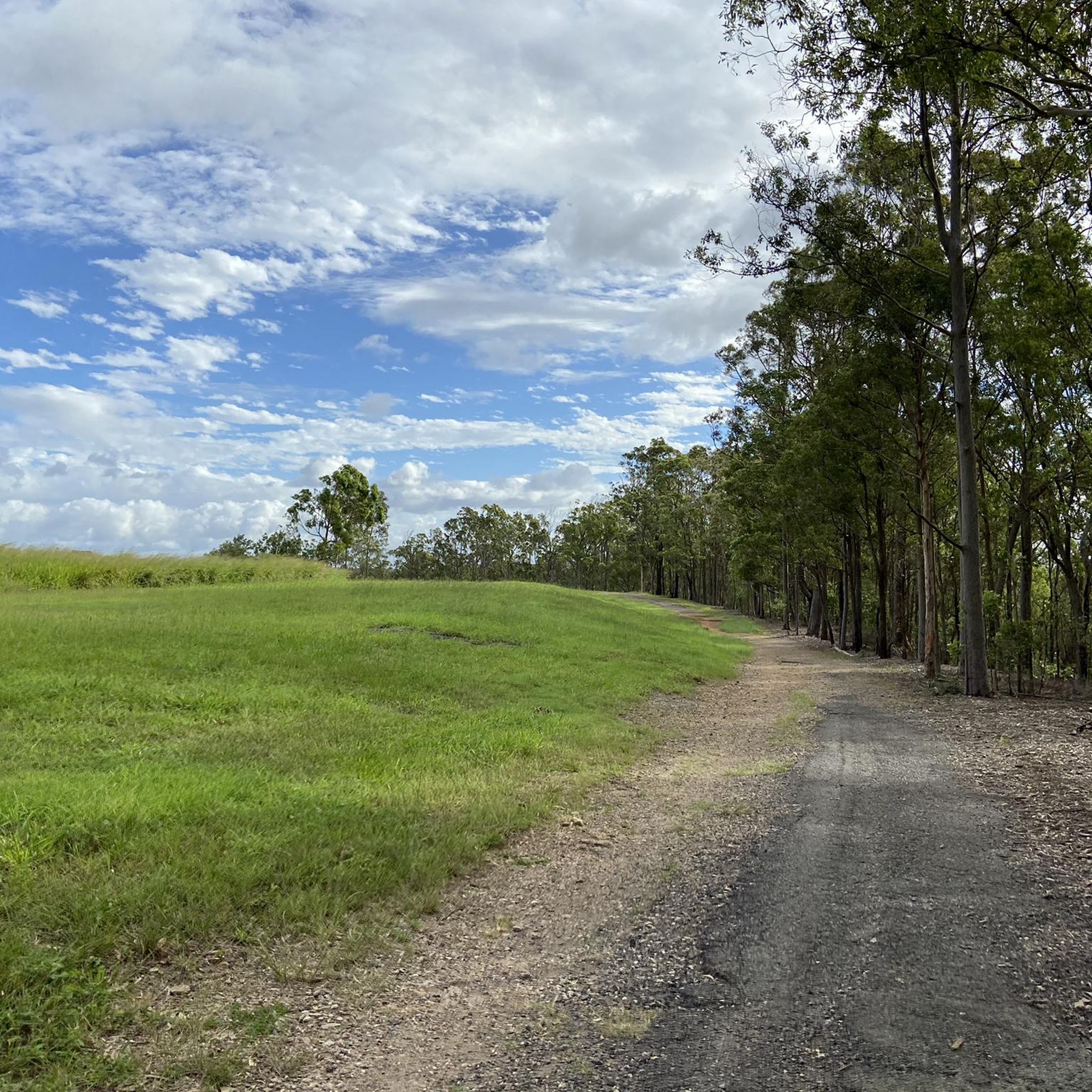
Samford Conservation Park is a beautiful bushland reserve near the rural township of Samford Valley northwest of Brisbane. The park protects eucalypt forest and creek habitats that support native wildlife, including wallabies, koalas, and a variety of bird species, while also preserving part of the area’s natural catchment. There is a network of walking and cycling tracks and fire trails throughout the grounds, where you can explore the park’s ridgelines and gullies, making it an ideal location for quiet nature-based recreation close to the city.
0
0
The South Bank Grand Arbour is a long, beautiful vine-covered walkway running through South Bank Parklands along the Brisbane River. The steel pergola structure stretches for about one kilometre and is draped with bougainvillea, creating a colourful shaded path for walking and cycling. Lined with gardens, seating and nearby cafés, it forms one of the central pedestrian corridors through the South Bank precinct.
0
0
Goodwill Bridge is a pedestrian and cycle bridge spanning the Brisbane River between South Bank and Gardens Point. From the centre of the bridge, you get open views along the river toward the city skyline, with high-rise towers reflecting off the water below. The bridge sits slightly elevated above river level, giving you a clear view of boats passing beneath and the CBD rising beyond. It’s a popular crossing, so keep left and stay aware of cyclists as you pause to take in the view.
0
0
Opened in 2001, the Goodwill Bridge is a pedestrian and cycle crossing over the Brisbane River linking South Bank with the city near the Botanic Gardens. Its sleek, cable-stayed design and gentle curves make it a popular, traffic-free route with expansive river and skyline views. The bridge also hosts small lookout bays and often features public art and lighting displays during city events.
0
0

Whilst this highlight is already named Moreton Bay Cycleway, this location is actually the Gateway Bridge. Every Brisbane cyclist should take this challenge (a long but medium steep climb with a magnificent reward at the top) at least once
0
0
Frequently Asked Questions
How many road cycling routes are available in Whites Hill Reserve?
Whites Hill Reserve offers a diverse network of over 50 road cycling routes. These routes cater to various skill levels, from easy rides to more challenging excursions.
Are there easy road cycling routes suitable for beginners in Whites Hill Reserve?
Yes, Whites Hill Reserve has a good selection of easy routes perfect for beginners. For example, the Muzz Criterium Track – Disc Golf Park loop from Carina is an easy 11.6-mile (18.6 km) path known for its smooth surfaces, ideal for those new to road cycling.
What are the typical distances for road cycling routes in Whites Hill Reserve?
Route distances in Whites Hill Reserve vary significantly. You can find shorter loops, such as the Goodwill Bridge loop from Holland Park West at 10.7 miles (17.2 km), up to much longer rides like the Goodwill Bridge – Hornibrook Bridge loop from Norman Park, which covers approximately 86 miles (138.8 km).
Are there any challenging road cycling routes for advanced riders?
Absolutely. For experienced road cyclists seeking a challenge, routes like the Goodwill Bridge – Hornibrook Bridge loop from Norman Park offer a difficult rating, spanning over 86 miles (138.8 km) with significant elevation changes, providing a demanding ride.
Where can I find parking for road cycling routes in Whites Hill Reserve?
Parking is generally available at various access points around Whites Hill Reserve and the surrounding suburbs. Many routes, such as those starting from Carina or Holland Park West, have convenient street parking or designated car parks nearby, making it easy to begin your ride.
Are there family-friendly road cycling options in the area?
While specific 'family-friendly' routes are not explicitly designated, many of the easier, flatter sections and dedicated paths, like parts of the Muzz Criterium Track – Disc Golf Park loop, can be suitable for families with older children or those comfortable with road cycling. Always check the route details for elevation and traffic conditions.
What is the best time of year to go road cycling in Whites Hill Reserve?
Given Queensland's subtropical climate, the cooler, drier months from April to October are generally ideal for road cycling in Whites Hill Reserve. Winters are mild, offering pleasant temperatures, while summers can be hot and humid, making early morning rides preferable during those months.
Are there any loop trails for road cycling in Whites Hill Reserve?
Yes, many of the road cycling routes in Whites Hill Reserve are designed as loops, allowing you to start and finish at the same point. Examples include the popular Goodwill Bridge loop from Holland Park West and the Roadbike loop from Carina Heights.
What do other road cyclists enjoy most about road cycling in Whites Hill Reserve?
The area is highly rated by the komoot community, with an average score of 4.7 stars. Reviewers often praise the blend of urban fringe roads and paths exploring natural parkland, the varied terrain suitable for different skill levels, and the incorporation of local landmarks and green spaces.
Are there any scenic viewpoints or notable landmarks along the road cycling routes?
Many routes in and around Whites Hill Reserve offer scenic views as they traverse suburban landscapes and natural areas. The Goodwill Bridge loop from Holland Park West, for instance, features a scenic bridge crossing, providing picturesque views of the city and river. Longer routes often incorporate various bridges and riverfront sections with notable cityscapes.
Can I access these road cycling routes using public transport?
Whites Hill Reserve is located within Brisbane's urban fringe, making many starting points accessible via public transport, particularly bus services. It's advisable to check TransLink's website for specific bus routes and stops that align with your chosen starting point.
Are there cafes or refreshment stops along the routes?
As the routes often pass through or near suburban areas, you'll find various cafes, bakeries, and convenience stores in the surrounding neighborhoods of Carina, Holland Park West, and Norman Park. These provide ample opportunities for refreshment stops during your ride.
Most popular routes in Whites Hill Reserve

Get inspired with the komoot mobile app


Explore more
Browse the best Road cycling routes in other regions.
