The best MTB trails in North Lakes Environmental Reserve
17
riders
3
rides
Mountain biking in North Lakes Environmental Reserve offers a network of trails primarily characterized by flat to gently rolling terrain, making it suitable for various skill levels. The region features a mix of coastal paths, river systems, and nature reserves, providing diverse scenery for riders. The routes often traverse alongside waterways like the North Pine River and through areas like the Chelsea Street Nature Reserve, with minimal elevation changes.
Best mountain bike trails in North Lakes Environmental Reserve
- The most popular mountain bike trail is Bee Gees Way – HMAS Gayundah Shipwreck loop from Mango Hill East, a 20.1 miles (32.3 km) trail that takes 1 hour 46 minutes to complete, offering views of coastal areas and local landmarks.
- Another top favourite among local mountain bikers is WF Roberts Reserve – Chelsea Street Nature Reserve loop from Kippa-Ring, an easy 18.2 miles (29.3 km) path. This route winds through natural reserves and offers a peaceful riding experience.
- Local mountain bikers also love the North Pine River – Mungarra Reserve loop from Lawnton, a 22.2 miles (35.7 km) trail leading through riverine landscapes and reserves, often completed in about 2 hours 39 minutes.
- Mountain biking in North Lakes Environmental Reserve is defined by coastal paths, river systems, and nature reserves. The network offers options for easy and moderate ability levels.
- The routes in North Lakes Environmental Reserve are highly rated by the komoot community with an average score of 5.0 stars from 1 review. More than 20 mountain bikers have used komoot to explore North Lakes Environmental Reserve's varied terrain.
Last updated: July 4, 2026
2
riders
32.3km
01:45
100m
100m
Easy mountain bike ride. Great for any fitness level. Suitable for all skill levels.
4
riders
29.8km
01:35
140m
140m
Easy mountain bike ride. Great for any fitness level. Suitable for all skill levels.

Sign up for free
8
riders
25.6km
01:24
110m
110m
Easy mountain bike ride. Great for any fitness level. Suitable for all skill levels.
3
riders
35.5km
02:38
360m
360m
Moderate mountain bike ride. Good fitness required. Advanced riding skills necessary.
Our route recommendations are based on thousands of hikes, rides, and runs completed by other people on komoot.
Start today with a free account
Your next adventure awaits.
Login or Signup

Tips from the Community

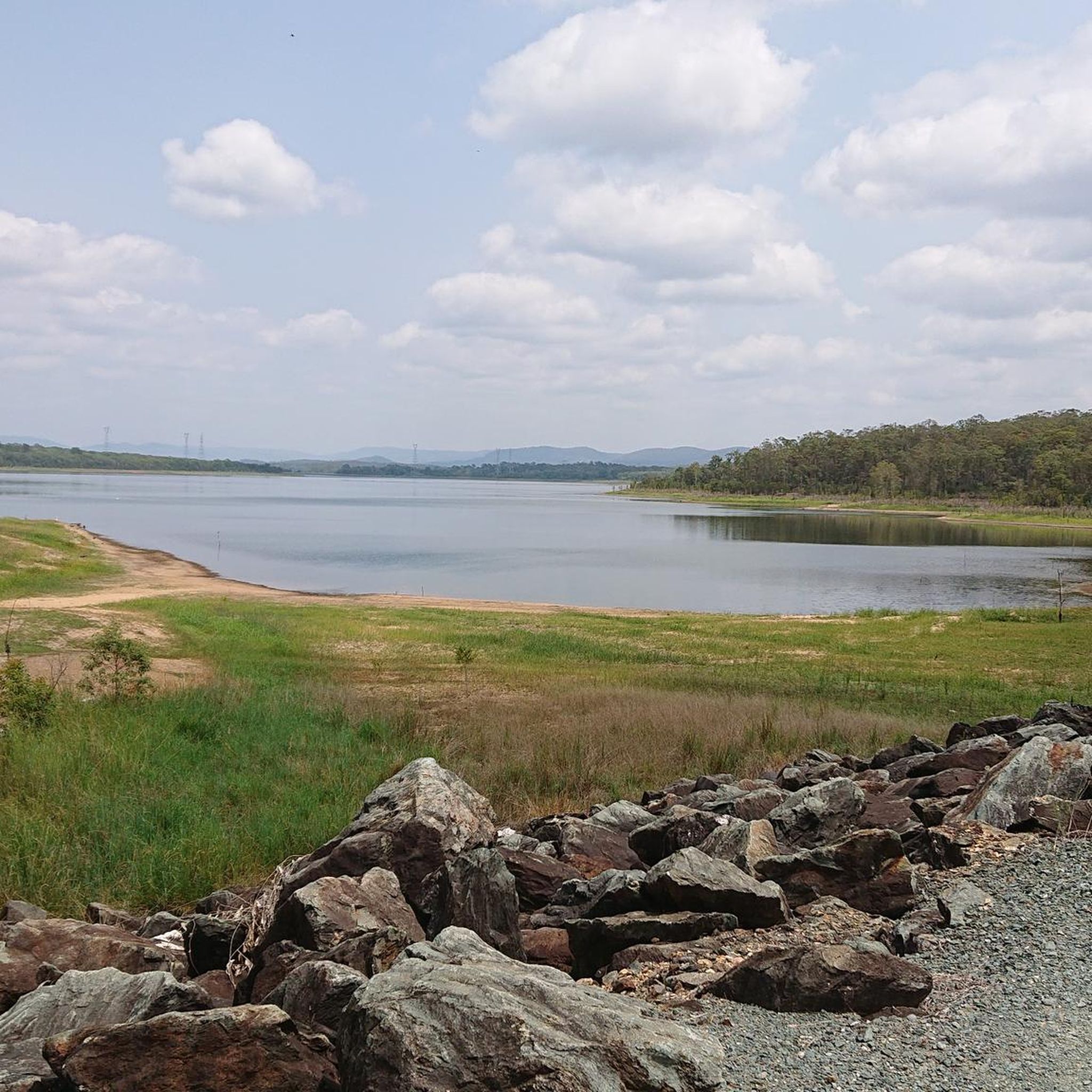
Set on a quiet arm of Lake Samsonvale, Forgan Cove is a designated launch point for paddle craft of all kinds. In addition to paddle sports the small park is also great for BBQs & picnics, fishing from the shoreline, and heading out on the walking tracks to explore the nearby bushland.
0
0
Forgan Park, on the shores of Lake Samsonvale, is a great place for a relaxing picnic, fishing from the shoreline, or going for a walk to nearby Bullocky Rest.
0
0

Sweeney Reserve is a lovely riverside park on the banks of the North Pine River, with open lawns, large shade trees, and peaceful walking paths. As you explore, you’ll find grassy picnic areas and beautiful views of the river, with the old Brisbane–Gympie crossing nearby adding a sense of local history to the landscape. Whether you stop for a peaceful walk or a picnic by the water, it’s an easy place to enjoy both nature and a peek into Petrie’s past.
0
0
The North Pine River winds through Petrie, with calm, slow-moving stretches of water, mangrove-lined edges, and wide riverbanks that support local birdlife and native vegetation. As you follow the river, you’ll find a mix of shaded parkland and open views, with several benches along the way, perfect for a place to stop to watch the river drift by.
0
0
Mungarra Reserve sits along the North Pine River with plenty of open green space, lagoons, and easy walking paths in a relaxed riverside setting. As you explore, you’ll pass shaded picnic areas, grassy riverbanks, and quiet pockets of bush that make it easy to slow down and enjoy the outdoors. Whether you stop for a walk, birdwatching, or simply a break by the water, it's a peaceful place to spend time in nature.
0
0

The Gayundah was one of Queensland’s first naval vessels, built in England and commissioned in 1884 for the Queensland Maritime Defence Force. It later became HMAS Gayundah after Federation, served into the First World War period, and was eventually sold for civilian use before being beached below the Woody Point cliffs in 1958 as a breakwater. Today, the rusting remains are a distinctive foreshore landmark and a reminder of Queensland’s short-lived colonial navy.
0
0
The Moreton Bay Cycleway is the easy, scenic link between Woody Point and Redcliffe Jetty, following the foreshore with sealed shared paths and constant views across the bay. This stretch is ideal on foot as well as by bike, with beaches, parks, picnic areas, toilets, and plenty of places to stop along the way. It can get busy with walkers, cyclists, runners, and families, so keep left and watch for passing bikes, especially near the busier waterfront sections.
0
0
Located on the Redcliffe Peninsula in Woody Point, this beach sits along a sheltered stretch of Moreton Bay, with calm, shallow water and wide tidal flats exposed at low tide. The foreshore includes picnic areas, trees, and a jetty, with the shared path running directly alongside the water. Conditions are generally quiet compared to busier nearby beaches, though surfaces can be muddy near the shoreline at low tide.
0
0
Frequently Asked Questions
What is the typical difficulty level of mountain bike trails in North Lakes Environmental Reserve?
The mountain bike trails in North Lakes Environmental Reserve are predominantly easy, with some moderate options. The terrain is generally flat to gently rolling, making it suitable for a wide range of riders, including beginners. There are no difficult trails listed in this guide.
How many mountain bike trails are available in North Lakes Environmental Reserve?
There are at least 4 mountain bike trails detailed in this guide for North Lakes Environmental Reserve. These routes offer diverse scenery, from coastal paths to river systems and nature reserves.
Are there any family-friendly mountain bike trails in North Lakes Environmental Reserve?
Yes, all the trails listed in this guide are rated as easy or moderate, making them suitable for families. The generally flat to gently rolling terrain and scenic paths through nature reserves and along waterways provide an enjoyable experience for various skill levels. For example, the WF Roberts Reserve – Chelsea Street Nature Reserve loop from Kippa-Ring is an easy option that winds through natural reserves.
What is the best season for mountain biking in North Lakes Environmental Reserve?
North Lakes Environmental Reserve is located in a region with a subtropical climate, meaning mountain biking is generally enjoyable year-round. However, the cooler, drier months from April to October are often preferred to avoid the higher humidity and potential for summer storms. Always check local weather forecasts before heading out.
Are there mountain bike trails that form a loop in North Lakes Environmental Reserve?
Yes, many of the mountain bike routes in North Lakes Environmental Reserve are designed as loops. For instance, the popular Bee Gees Way – HMAS Gayundah Shipwreck loop from Mango Hill East and the North Pine River – Mungarra Reserve loop from Lawnton are both circular routes, offering convenient starting and ending points.
What kind of scenery can I expect on the mountain bike trails?
The trails in North Lakes Environmental Reserve offer diverse scenery, including coastal paths, river systems, and natural reserves. You can expect to ride alongside waterways like the North Pine River and through areas such as the Chelsea Street Nature Reserve, providing a mix of natural landscapes and local landmarks.
What do other mountain bikers enjoy most about mountain biking in North Lakes Environmental Reserve?
The area is highly rated by the komoot community, with an average score of 5.0 stars. Riders often praise the varied terrain that includes coastal paths and riverine landscapes, as well as the suitability of the trails for different skill levels, particularly the easy and moderate options.
How long do the mountain bike trails typically take to complete?
The duration of the mountain bike trails varies depending on the route and your pace. For example, the Bee Gees Way – HMAS Gayundah Shipwreck loop from Mango Hill East is approximately 20.1 miles (32.3 km) and typically takes around 1 hour 46 minutes, while the North Pine River – Mungarra Reserve loop from Lawnton, at 22.2 miles (35.7 km), usually takes about 2 hours 39 minutes.
Are there any less crowded mountain bike trails in the reserve?
While specific crowd levels can vary, routes that venture further into the nature reserves, such as the WF Roberts Reserve – Chelsea Street Nature Reserve loop from Kippa-Ring, might offer a more peaceful riding experience compared to those closer to more populated coastal areas. Exploring during off-peak hours or weekdays can also help avoid busier times.
What should I wear for mountain biking in North Lakes Environmental Reserve?
Given the subtropical climate, lightweight, breathable cycling apparel is recommended. Sun protection, including sunscreen, sunglasses, and a hat (worn under your helmet), is essential. Always wear a helmet, and consider padded shorts for comfort on longer rides. Bring sufficient water, especially during warmer months.
Are there any specific landmarks or points of interest along the trails?
Some routes pass by notable local landmarks. For instance, the Bee Gees Way – HMAS Gayundah Shipwreck loop from Mango Hill East offers views of coastal areas and includes the HMAS Gayundah Shipwreck. Other trails traverse through significant natural areas like the Chelsea Street Nature Reserve and along the North Pine River.
Is there parking available near the mountain bike trails?
Yes, routes typically start from locations with accessible parking. For example, trails originating from Mango Hill East, Kippa-Ring, Redcliffe, Woody Point, or Lawnton generally have parking facilities nearby, making it convenient to access the trailheads.
Most popular routes in North Lakes Environmental Reserve

Get inspired with the komoot mobile app


Explore more
Browse the best MTB trails in other regions.
