The best road cycling routes in Munmorah State Conservation Area
4.8
(4)
190
riders
7
rides
Road cycling routes in Munmorah State Conservation Area feature sealed roads that traverse diverse landscapes. The area offers coastal views, tranquil bays, and the serene Lake Munmorah. Cyclists can experience varied terrain, including heath, woodlands, and coastal sections. The park's network of roads provides accessible conditions for road bikes.
Best road cycling routes in Munmorah State Conservation Area
- The most popular road cycling route is Norah Head Lighthouse loop from Budgewoi Lake, a 20.4 miles (32.9 km) trail that…
Last updated: July 4, 2026
8
riders
34.7km
01:40
190m
190m
Easy road ride. Great for any fitness level. Mostly well-paved surfaces and easy to ride.
15
riders
45.1km
02:11
210m
210m
Moderate road ride. Good fitness required. Mostly well-paved surfaces and easy to ride.

Sign up for free
4.8
(4)
78
riders
53.1km
02:07
210m
210m
Moderate road ride. Good fitness required. Mostly well-paved surfaces and easy to ride.
54
riders
52.4km
02:24
290m
290m
Moderate road ride. Good fitness required. Mostly well-paved surfaces and easy to ride.
8
riders
29.3km
01:15
160m
160m
Easy road ride. Great for any fitness level. Mostly well-paved surfaces and easy to ride.
Get access to more routes and recommendations from other explorers.
Sign up for free
Already have an account?
Our route recommendations are based on thousands of hikes, rides, and runs completed by other people on komoot.
Start today with a free account
Your next adventure awaits.
Login or Signup
Popular around Munmorah State Conservation Area
Tips from the Community

Warners Bay Foreshore follows the edge of Lake Macquarie with wide shared paths, parks, cafés, and long stretches of open water views along the lakeside. The flat waterfront route is popular for walking and cycling, especially around sunset when the light reflects across the lake and sailing boats move through the bay. Picnic areas, playgrounds, public art, and plenty of benches line the foreshore, making it an easy place to slow down between longer walking sections.
0
0
Sky Pig is one of the most recognisable sculptures along the Warner's Bay Foreshore, perched beside the lake with open water views behind it. Created by artist Guan Wei as part of the Creative Lake Sculpture Trail, the bronze flying pig was designed to bring a sense of fun and good luck to the waterfront walk. It’s an easy landmark to spot along the shared foreshore path and has become one of the most photographed artworks around Lake Macquarie.
0
0
Located on the eastern shore of Lake Macquarie, Eleebana Lions Park is a lakeside reserve connecting into the waterfront shared path toward Warners Bay and Speers Point. The park includes picnic shelters, barbecues, toilets, and direct lake access, with Red Bluff Boardwalk beginning nearby.
0
0
Lake Macquarie is the largest coastal saltwater lake in Australia, forming a broad, open water body surrounded by suburbs, parkland, and small inlets. From the shoreline, views stretch across long distances of water, often with boats, jetties, and changing light reflecting off the surface. It makes for a beautiful, breezy walk.
1
0
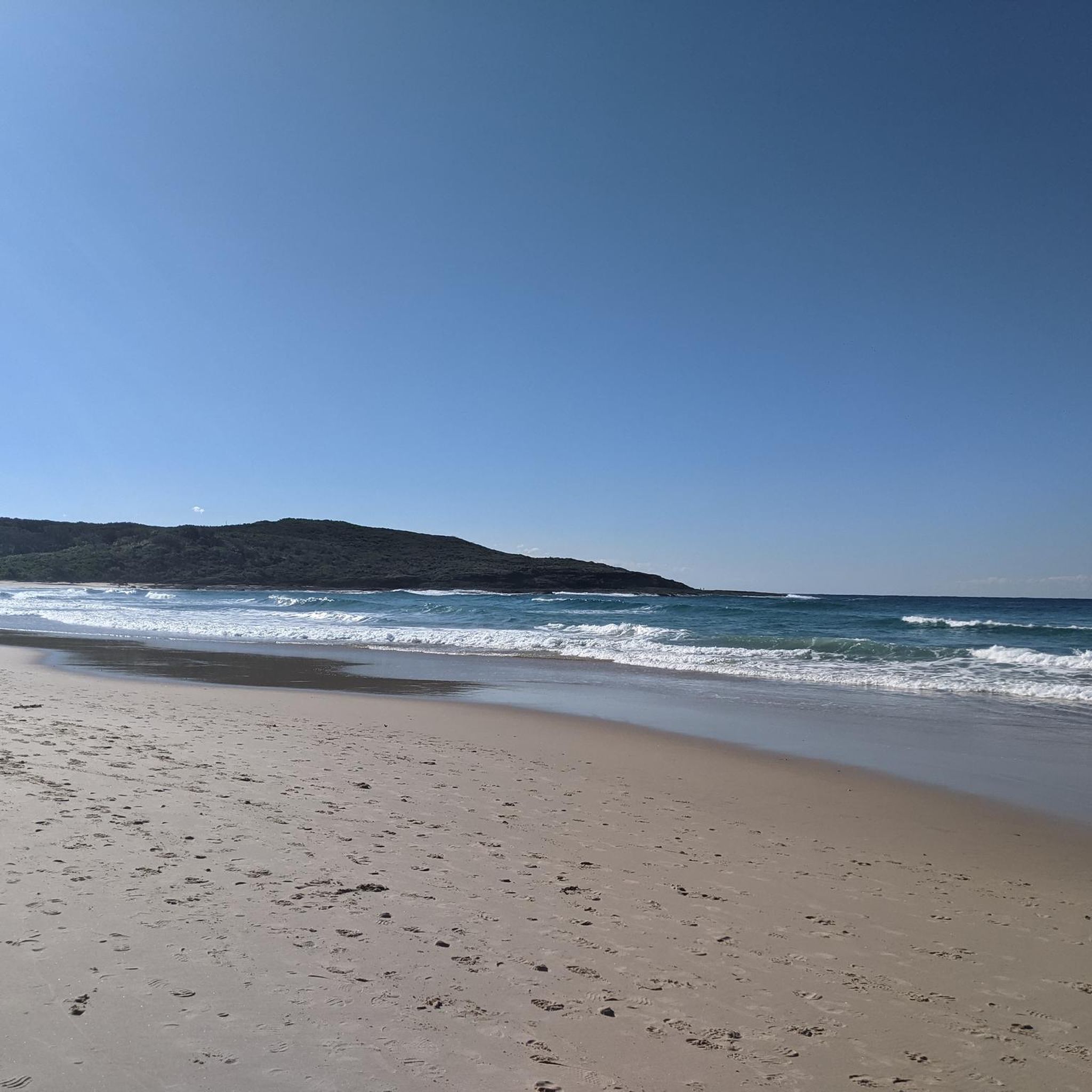
Terrigal Beach stretches along the coastline with a wide sandy shoreline and consistent surf, backed by a promenade of cafés and shops. It’s one of the main beaches on the Central Coast, so there’s usually a steady mix of swimmers, surfers, and people walking along the sand. Lifeguards patrol during peak times, and conditions can vary depending on the swell.
0
0

The Former Belmont Railway Station serves as the terminus for the Fernleigh Track. Here are remnants of the old train tracks, a station platform, and a commemorative sign. This railway was converted into the Fernleigh Track, a rail trail that makes good use of the old corridor. Here you will also find the library and a little food stand to fuel up before or after your adventure.
0
0

A cycleway leads along the whole lake and providers regular expansive views
0
0

Frequently Asked Questions
What kind of terrain can I expect when road cycling in Munmorah State Conservation Area?
Road cycling in Munmorah State Conservation Area primarily features sealed roads. You'll encounter diverse landscapes, from scenic coastal routes with breathtaking ocean views to areas encompassing heath, woodlands, and serene lakeside paths around Lake Munmorah. While generally accessible for road bikes, some routes may include gentle inclines as you traverse the hilly country.
Are there any easy road cycling routes suitable for beginners or families?
Yes, Munmorah State Conservation Area offers several easy road cycling routes. For instance, the Norah Head Lighthouse loop from Budgewoi Lake is an easy 32.9 km trail. Another accessible option is the Norah Head Lighthouse loop from Canton Beach, which is 29.3 km and also rated easy. These routes provide smooth conditions and scenic views without significant climbs, making them suitable for a relaxed ride.
Where can I find scenic lookouts or points of interest along the road cycling routes?
The area is rich with scenic viewpoints. You can enjoy superb ocean views from Wybung Lookout and Snapper Point Lookout, which make for picturesque stops. Coastal features like Frazer Beach, Birdie Beach, and Moonee Beach also offer dazzling ocean vistas. During the appropriate season, you might even spot migrating whales from the park's headlands.
Are there any longer or more challenging road cycling routes in the area?
While most routes are easy to moderate, some offer longer distances. The The Entrance Bridge – Tuggerah Lake loop from Canton Beach is a moderate 53.1 km trail, often completed in about 2 hours 7 minutes. Another moderate option is the Wamberal Lagoon – Ventura Avenue Reserve loop from Canton Beach, covering 47.8 km with some elevation gain, providing a good workout.
What is the best time of year to go road cycling in Munmorah State Conservation Area?
The Munmorah State Conservation Area is enjoyable for road cycling year-round. However, for comfortable temperatures and clear skies, spring (September to November) and autumn (March to May) are often ideal. During these seasons, you can also observe migrating whales from the coastal headlands.
Are there places to stop for refreshments or picnics along the routes?
Yes, the park provides convenient rest stops. You'll find picnic areas at Elizabeth Bay, Tea Tree, and Palms Picnic Areas, which are perfect for a break and a snack. While there are no cafes directly within the conservation area, nearby towns offer options for refreshments before or after your ride.
Can I access the road cycling routes using public transport?
Public transport access directly into Munmorah State Conservation Area can be limited. It's generally recommended to drive to the park's entry points or nearby towns and then cycle from there. For detailed public transport information, it's best to check local transport schedules for services to the Central Coast region.
Is there parking available for road cyclists at the trailheads?
Yes, Munmorah State Conservation Area is accessible by 2WD vehicles, and there are designated parking areas within the park. Look for parking at popular spots like Elizabeth Bay, Tea Tree, and Palms Picnic Areas, or near the various coastal access points. Always check signage for any specific parking regulations.
What do other road cyclists enjoy most about cycling in Munmorah State Conservation Area?
The area is highly rated by the komoot community, with an average score of 4.9 stars. Reviewers often praise the diverse scenery, from stunning coastal views and tranquil bays to the serene Lake Munmorah. The well-maintained sealed roads and variety of routes, including easy and moderate options, are also frequently highlighted as key attractions.
Are there any circular road cycling routes available?
Many of the road cycling routes in Munmorah State Conservation Area are designed as loops, offering a convenient way to explore without retracing your path. Examples include the Matey's Coffee Van – Lake Macquarie loop from Swansea and the Norah Head Lighthouse loop from Budgewoi Lake, allowing you to start and finish at the same point.
What kind of wildlife might I encounter while cycling?
Munmorah State Conservation Area is home to diverse fauna. While cycling, you might spot numerous bird species, including white-breasted sea-eagles and sooty oystercatchers, especially along the coast. Mammals such as ring-tailed possums and swamp wallabies also inhabit the park, offering opportunities for wildlife spotting, particularly in the quieter woodland sections.
Are there any permits required for road cycling in Munmorah State Conservation Area?
Generally, no specific permits are required for road cycling on the sealed roads within Munmorah State Conservation Area. However, it's always a good idea to check the official NSW National Parks and Wildlife Service website for the most current information regarding park entry fees or any specific regulations that might apply to certain areas or activities. You can find more details at nsw.gov.au.
Most popular routes in Munmorah State Conservation Area

Get inspired with the komoot mobile app


Explore more
Browse the best Road cycling routes in other regions.
