The best road cycling routes in Googong Foreshores
5.0
(5)
133
riders
11
rides
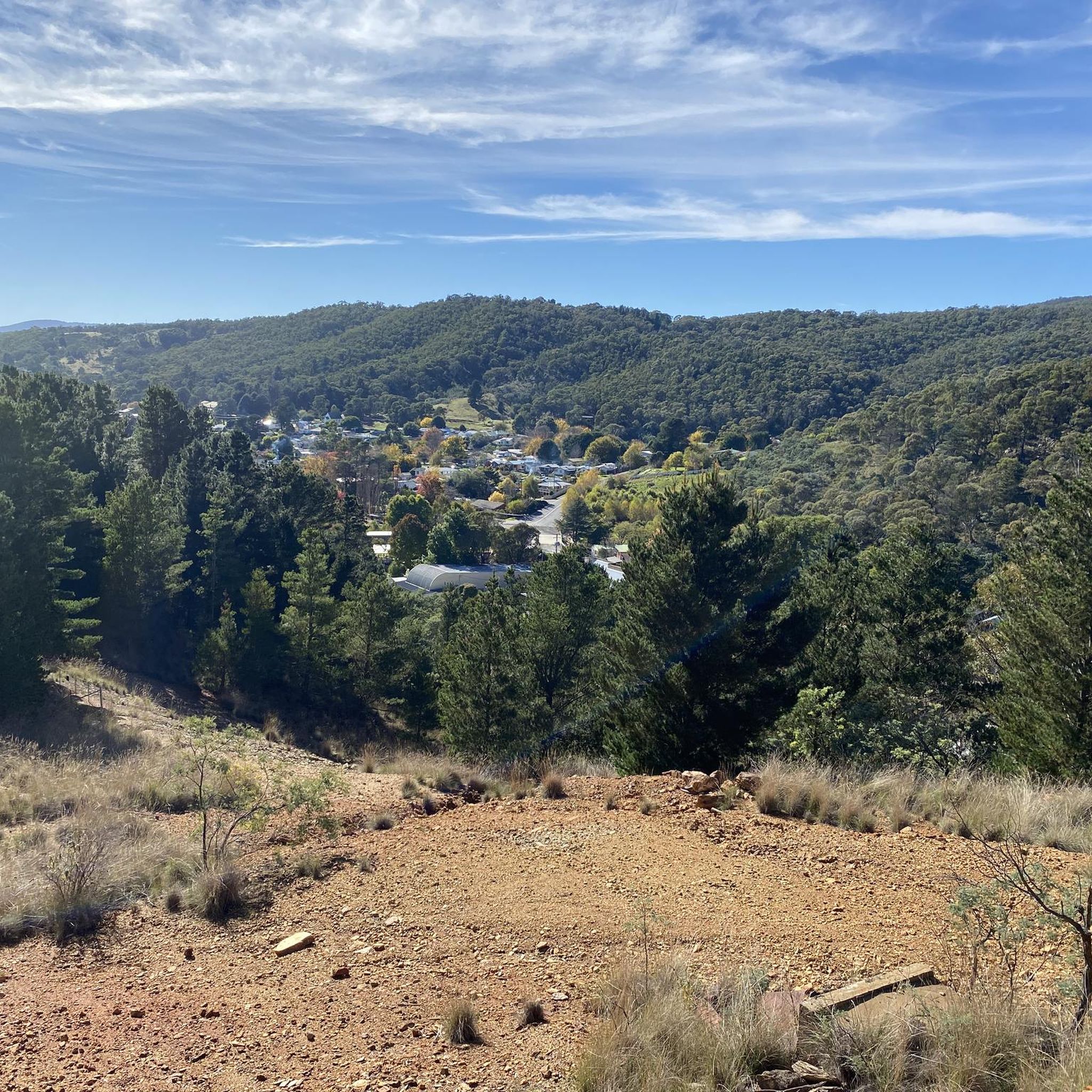
Road cycling routes in Googong Foreshores traverse a diverse landscape located south of Queanbeyan, serving as a water catchment and wildlife refuge. The area is defined by the prominent Googong Dam and Reservoir, offering scenic views across the water and the Queanbeyan Escarpment. Cyclists encounter undulating terrain, including woodlands, open forests, and grasslands, with some challenging climbs. The management trails are mostly well-paved, providing a suitable surface for road cycling.
Best road cycling routes in Googong Foreshores
- The most popular road cycling route is The Climb loop from Googong, a 15.5 miles (24.9 km) trail that takes 1 hour 24 minutes to complete. This route features significant elevation gain through varied terrain.
- Another top favourite among local road cyclists is Queanbeyan Showground Entrance loop from Queanbeyan, an easy 10.0 miles (16.1 km) path. This route offers a gentler ride with views of the surrounding area.
- Local road cyclists also love the View of Telstra Tower – View of Cotter Dam loop from Queanbeyan, a 63.0 miles (101.4 km) trail leading through diverse landscapes, often completed in about 4 hours 58 minutes.
- Road cycling in Googong Foreshores is defined by the Googong Dam, the Queanbeyan River, and varied woodlands and grasslands. The network offers options for different ability levels, from easy rides to more challenging routes.
- The routes in Googong Foreshores are highly rated by the komoot community with an average score of 5.0 stars from 5 reviews. More than 100 road cyclists have used komoot to explore Googong Foreshores's varied terrain.
Last updated: July 5, 2026
13
riders
33.7km
01:53
600m
600m
Moderate road ride. Good fitness required. Mostly well-paved surfaces and easy to ride.
10
riders
Moderate road ride. Good fitness required. Some segments of this route may be unpaved and difficult to ride.

Sign up for free
4
riders
Easy road ride. Great for any fitness level. Mostly well-paved surfaces and easy to ride.
5.0
(1)
38
riders
43.3km
01:50
200m
200m
Easy road ride. Great for any fitness level. Mostly well-paved surfaces and easy to ride.
21
riders
105km
05:06
1,060m
1,060m
Hard road ride. Very good fitness required. Some segments of this route may be unpaved and difficult to ride.
Get access to more routes and recommendations from other explorers.
Sign up for free
Already have an account?
Our route recommendations are based on thousands of hikes, rides, and runs completed by other people on komoot.
Start today with a free account
Your next adventure awaits.
Login or Signup
Popular around Googong Foreshores

Tips from the Community

This large waterfront park has a lot to see. From the large car park there is a restaurants, like the Water's Edge Canberra and Portrait Cafe, and a huge mowed lawn and public restrooms. There is history to read up on like the Women's Reconciliation Place Artwork, and Commonwealth Place. There is a waterfront jetty and paved path and so much more!
0
0
On the north shore of Kings Park sits the Australian Merchant Navy Memorial, honouring the Australian Merchant Navy's deployment in World War I and World War II. The monument was created by Daryl Jackson Alastair Swayn.
0
0

The Commonwealth Bridge is the major road crossing over Lake Burley Griffin, carrying six lanes of traffic plus a shared foot and cycle path between Canberra’s city centre and the Parliamentary Zone. It is an integral element of the lake’s heritage landscape, with beautiful views across the Molonglo River. The river runs roughly 115 kilometres from the Great Dividing Range through New South Wales into the Australian Capital Territory, where the Scrivener Dam impounds its waters to form Lake Burley Griffin. Historically rich in native fish and culturally important to local Aboriginal peoples, the river continues beyond Canberra to join the Murrumbidgee River as part of the larger Murray–Darling basin.
0
0
Canberra Peace Park is a beautiful memorial garden along Lake Burley Griffin in Canberra’s Parliamentary Triangle, near the National Library of Australia. The park was created during the United Nations International Year of Peace in 1986 and formally dedicated in 1990 as a place for reflection and commitment to peace. Its central monument features the word “Peace” inscribed in the official languages of the United Nations and the Ngunnawal language, set within formal gardens overlooking the lake formed by the Molonglo River.
0
0
In 1964, the Molonglo River was dammed, creating this wetland. Today, these 260 hectares of land, forest, and waterways are protected. Within this park are the Kells Swamp Loop, Woodland Walk, and Billabong Walk. Keep your eyes peeled for platypuses, rakali, and micro-bats, and from the bird blind, you may see a few of the 200 bird species that visit this wetland every year.
0
0

A lovely spot to stop for a break or picnic and enjoy the beauty of Lake Burley Griffin.
0
0

Best enjoyed downhill towards Majura Park - unless you like a long gradual climb.
0
0

Frequently Asked Questions
How many road cycling routes are available in Googong Foreshores?
Googong Foreshores offers a diverse selection of 11 road cycling routes. These routes cater to various skill levels, from easy rides to more challenging options with significant elevation gains.
What kind of terrain can I expect on road cycling routes in Googong Foreshores?
The terrain in Googong Foreshores is quite varied and undulating. Cyclists will encounter a mix of woodlands, open forests, and grasslands. While the management trails are mostly well-paved, some routes feature challenging climbs, providing a good workout for experienced riders.
Are there road cycling routes suitable for beginners or families in Googong Foreshores?
Yes, Googong Foreshores has routes suitable for those seeking a gentler ride. For example, the Queanbeyan Showground Entrance loop from Queanbeyan is an easy 10.0-mile path offering a more relaxed experience with scenic views.
Where can I find challenging road cycling routes in Googong Foreshores?
For cyclists looking for a challenge, routes with significant elevation gain are available. The The Climb loop from Googong is a popular moderate route, while the View of Telstra Tower – View of Cotter Dam loop from Queanbeyan offers a difficult, longer ride through diverse landscapes.
What natural features or landmarks can I see while road cycling in Googong Foreshores?
Road cycling routes often provide scenic views of the prominent Googong Dam and Reservoir, as well as the Queanbeyan Escarpment. You might also encounter sections along the Queanbeyan River. A significant natural landmark in the southern part of the Foreshores is the London Bridge Arch, a unique limestone formation.
Are there any loop road cycling routes in Googong Foreshores?
Yes, many of the road cycling routes in Googong Foreshores are designed as loops, allowing you to start and finish at the same point. Examples include Dairy Flat Bridge – Majura Parkway Cycle Path loop from Queanbeyan and Mount Ainslie Lookout – Canberra National Arboretum loop from Queanbeyan, offering varied distances and scenery.
What is the best time of year to go road cycling in Googong Foreshores?
Googong Foreshores can be enjoyed year-round, but spring and autumn generally offer the most pleasant conditions for road cycling, with milder temperatures and beautiful scenery. Summer can be hot, so early morning rides are recommended, while winter rides require appropriate layering.
Where can I park when visiting Googong Foreshores for road cycling?
Parking is available at various access points to Googong Foreshores. There are designated picnic areas at both the northern (Googong Dam) and southern (London Bridge, Tin Hut) ends of the Foreshores, which typically offer parking facilities for visitors.
Can I expect to see wildlife during my road cycling trip in Googong Foreshores?
Googong Foreshores is a wildlife refuge, so it's common to encounter native plants and animals. Cyclists might spot various bird species, including raptors like the Peregrine Falcon and Wedge-tailed Eagle, as well as other local fauna, especially during quieter times of the day.
Are there facilities like picnic areas or toilets available along the routes?
Yes, Googong Foreshores provides convenient facilities for visitors. Numerous picnic areas equipped with barbecues and toilets are available at both the northern (Googong Dam) and southern (London Bridge, Tin Hut) ends of the Foreshores, making them ideal rest stops during your ride.
What do other road cyclists enjoy the most about road cycling in Googong Foreshores?
The area is highly rated by the komoot community, with an average score of 5.0 stars from 5 reviews. Reviewers often praise the diverse and scenic landscapes, the well-maintained management trails, and the variety of routes that cater to different fitness levels.
Most popular routes in Googong Foreshores

Get inspired with the komoot mobile app


Explore more
Browse the best Road cycling routes in other regions.
