The best road cycling routes in Mount Mugga Mugga Nature Reserve
4.4
(78)
3,701
riders
110
rides
Road cycling routes in Mount Mugga Mugga Nature Reserve traverse a diverse landscape characterized by critically endangered Yellow Box–Blakely's Red Gum Grassy Woodland and varied terrain. The reserve offers panoramic views over the Woden and Jerrabomberra valleys from its 812-meter peak. While primarily restricted to management trails and the Centenary Trail, these routes can include technical sections with loose rocks and short, steep climbs, particularly near the old quarry. The area connects to a broader network of trails within the…
Last updated: July 5, 2026
6
riders
68.2km
03:17
690m
690m
Moderate road ride. Good fitness required. Mostly well-paved surfaces and easy to ride.
68
riders
88.3km
04:25
1,110m
1,110m
Hard road ride. Very good fitness required. Mostly well-paved surfaces and easy to ride.

Sign up for free
17
riders
108km
04:38
650m
650m
Moderate road ride. Good fitness required. Mostly well-paved surfaces and easy to ride.
20
riders
53.7km
02:26
380m
380m
Moderate road ride. Good fitness required. Mostly well-paved surfaces and easy to ride.
8
riders
20.1km
00:55
150m
150m
Easy road ride. Great for any fitness level. Mostly well-paved surfaces and easy to ride.
Get access to more routes and recommendations from other explorers.
Sign up for free
Already have an account?
Our route recommendations are based on thousands of hikes, rides, and runs completed by other people on komoot.
Start today with a free account
Your next adventure awaits.
Login or Signup


Tips from the Community

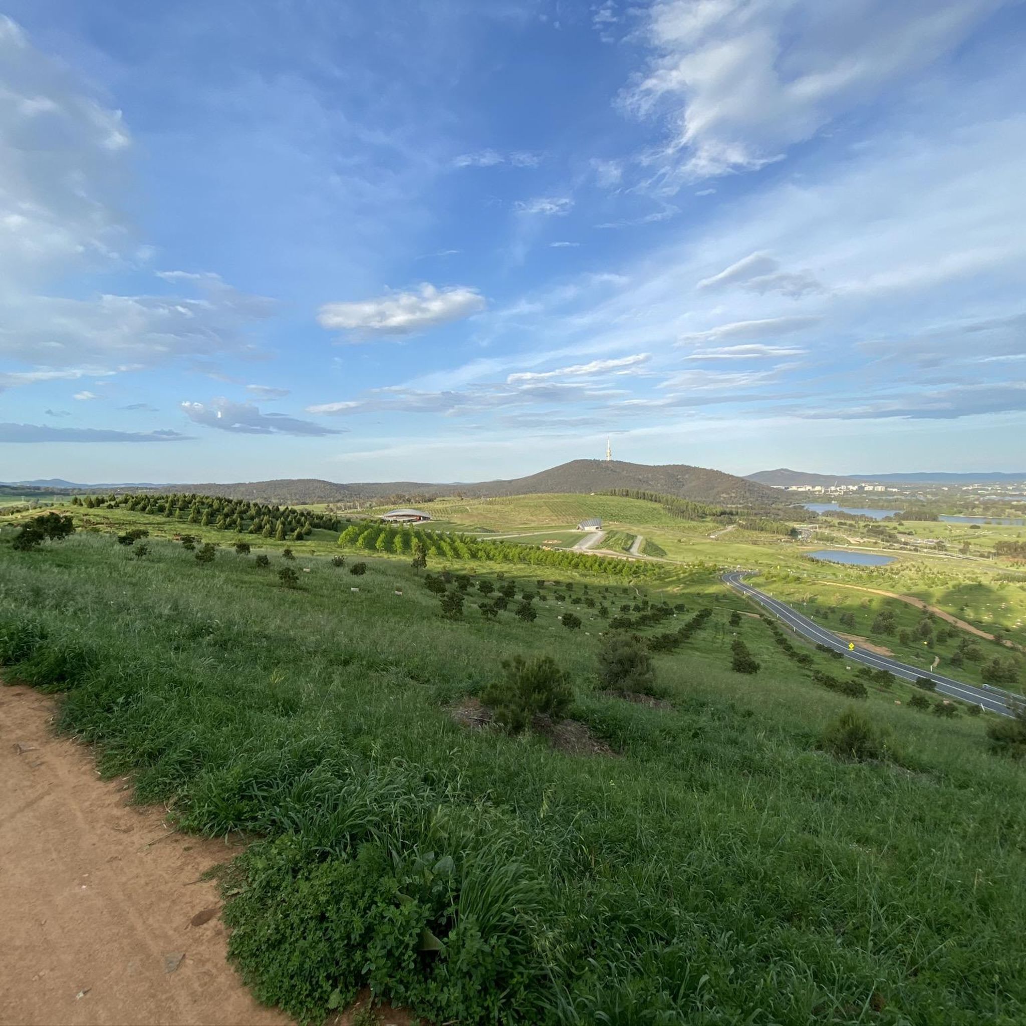
Mount Ainslie Nature Reserve covers 637 hectares of native bushland on Canberra's northeast edge, adjacent to Mount Majura Nature Reserve. There is a network of shared trails that wind through eucalypt forest, leading to beautiful views of Lake Burley Griffin and the city from the summit. Aside from the popular trails, the reserve also protects critically endangered grassy woodlands and diverse habitats that support threatened birds, rare plants, and native wildlife.
0
0

This large waterfront park has a lot to see. From the large car park there is a restaurants, like the Water's Edge Canberra and Portrait Cafe, and a huge mowed lawn and public restrooms. There is history to read up on like the Women's Reconciliation Place Artwork, and Commonwealth Place. There is a waterfront jetty and paved path and so much more!
0
0
On the north shore of Kings Park sits the Australian Merchant Navy Memorial, honouring the Australian Merchant Navy's deployment in World War I and World War II. The monument was created by Daryl Jackson Alastair Swayn.
0
0
The Commonwealth Bridge is the major road crossing over Lake Burley Griffin, carrying six lanes of traffic plus a shared foot and cycle path between Canberra’s city centre and the Parliamentary Zone. It is an integral element of the lake’s heritage landscape, with beautiful views across the Molonglo River. The river runs roughly 115 kilometres from the Great Dividing Range through New South Wales into the Australian Capital Territory, where the Scrivener Dam impounds its waters to form Lake Burley Griffin. Historically rich in native fish and culturally important to local Aboriginal peoples, the river continues beyond Canberra to join the Murrumbidgee River as part of the larger Murray–Darling basin.
0
0
Canberra Peace Park is a beautiful memorial garden along Lake Burley Griffin in Canberra’s Parliamentary Triangle, near the National Library of Australia. The park was created during the United Nations International Year of Peace in 1986 and formally dedicated in 1990 as a place for reflection and commitment to peace. Its central monument features the word “Peace” inscribed in the official languages of the United Nations and the Ngunnawal language, set within formal gardens overlooking the lake formed by the Molonglo River.
0
0
In 1964, the Molonglo River was dammed, creating this wetland. Today, these 260 hectares of land, forest, and waterways are protected. Within this park are the Kells Swamp Loop, Woodland Walk, and Billabong Walk. Keep your eyes peeled for platypuses, rakali, and micro-bats, and from the bird blind, you may see a few of the 200 bird species that visit this wetland every year.
0
0

Built in honour of all Australians who have died as a result of war, this museum, memorial, and archive consists of five buildings and a sculpture garden. The museum is open every day aside from Christmas and the site hosts commemoration services on ANZAC and Remembrance Days.
0
0

A lovely spot to stop for a break or picnic and enjoy the beauty of Lake Burley Griffin.
0
0
Frequently Asked Questions
How many road cycling routes are available in Mount Mugga Mugga Nature Reserve?
There are over 100 road cycling routes in Mount Mugga Mugga Nature Reserve, offering a wide range of options for different skill levels. You'll find approximately 58 easy routes, 55 moderate routes, and 5 more challenging options.
What is the terrain like for road cycling in Mount Mugga Mugga Nature Reserve?
The terrain within Mount Mugga Mugga Nature Reserve is quite varied. While some sections are suitable for road cycling, be aware that routes can include more technical parts with loose rocks and short, steep climbs, especially near the old quarry. These characteristics offer a more challenging and engaging ride compared to typical paved roads.
What natural features and viewpoints can I expect to see while road cycling?
Road cyclists are rewarded with panoramic views over the Woden and Jerrabomberra valleys from various points, as Mount Mugga Mugga stands at 812 meters. The reserve also protects a unique Yellow Box–Blakely's Red Gum Grassy Woodland ecosystem, providing a picturesque backdrop. You might also encounter the historical old quarry and early 20th-century plantings.
Can I see wildlife while cycling in Mount Mugga Mugga Nature Reserve?
Yes, the reserve is a significant wildlife habitat. The woodland supports a variety of birds, including threatened species like the Diamond Firetail and Hooded Robin. Kangaroos are a common sight, and you might even spot Wedge-tailed Eagles nesting on the eastern slopes.
Are there road cycling routes suitable for beginners in Mount Mugga Mugga Nature Reserve?
Yes, there are numerous routes suitable for beginners. For instance, the View of Telstra Tower – Warrina Inlet Bridge loop from Garran is an easy 13.3-mile (21.5 km) trail that offers city views and is often completed in about an hour. There are approximately 58 easy routes in total.
Are there challenging road cycling routes in Mount Mugga Mugga Nature Reserve?
Yes, for those seeking a challenge, the reserve offers routes with varied terrain, including technical sections and steep climbs. An example of a moderate route is the Australian Parliament House – National Carillon loop from Garran, which is 43.0 miles (69.2 km) long with significant elevation changes. There are 5 difficult routes and 55 moderate routes available.
What do other road cyclists enjoy the most about road cycling in Mount Mugga Mugga Nature Reserve?
The area is highly rated by the komoot community, with an average score of 4.5 stars from over 70 reviews. Reviewers often praise the diverse landscapes, panoramic viewpoints, and the significant woodland ecosystems. Many appreciate the connectivity to a broader network of trails within the South Canberra ridges, allowing for extensive off-road cycling.
Are there circular road cycling routes available?
Yes, many of the road cycling routes in and around Mount Mugga Mugga Nature Reserve are designed as loops. For example, the Australian War Memorial – Warrina Inlet Bridge loop from District of Woden Valley is a popular moderate 33.3-mile (53.6 km) circular path.
What is the best time of year to go road cycling in Mount Mugga Mugga Nature Reserve?
While specific seasonal advice isn't provided, it's generally recommended to be aware of bushfire alerts, especially during hotter, drier months. Always carry water and a mobile phone. Cleaning your outdoor gear is also advised to prevent the spread of weeds and disease, suggesting that conditions can vary.
Does Mount Mugga Mugga Nature Reserve connect to other cycling trails?
Yes, the reserve acts as a vital recreational trail network, linking with other nature reserves like Red Hill and Isaacs Ridge. It's also integrated with the broader South Canberra ridges, allowing for hours of off-road cycling without needing to leave the city. The Centenary Trail also passes through the reserve.
Are there any historical or cultural sites to note while cycling?
Mount Mugga Mugga Nature Reserve is located on Ngunnawal Country and protects several known Aboriginal heritage sites, including stone artifact scatters, highlighting a deep cultural connection to the land. Additionally, an old quarry, which historically provided material for early Canberra's construction, is a notable feature.
Most popular routes in Mount Mugga Mugga Nature Reserve

Get inspired with the komoot mobile app


Explore more
Browse the best Road cycling routes in other regions.
