The best walks and hikes in Puellaro
4.7
(15)
153
hikers
8
hikes
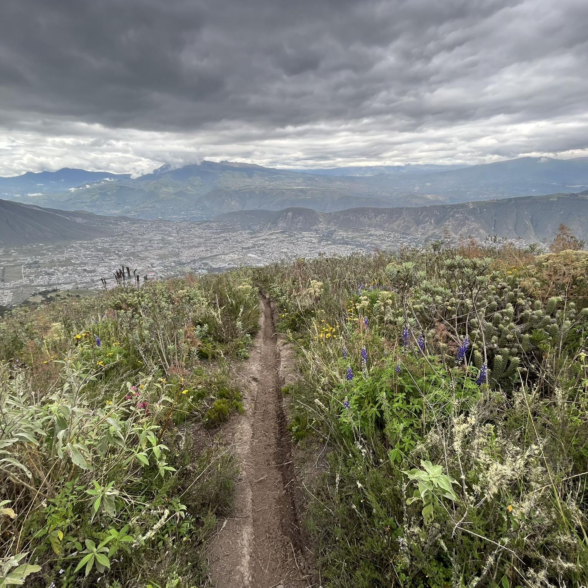
Hiking in Puellaro offers diverse terrain, from high-altitude lagoons to fertile valleys and dry forests. The region is characterized by the dramatic Andean Cordillera, featuring prominent viewpoints like Cerro La Luz and the complex of Lagunas de Mojanda. Puellaro also serves as a gateway to the "Ruta Escondida," providing access to varied ecosystems and agricultural landscapes. These features create a range of hiking opportunities across different elevations.
Best hiking trails in Puellaro
- The most popular hiking route is Fuja Fuja…
Last updated: July 11, 2026
4.8
(6)
79
hikers
3.64km
01:56
460m
460m
Moderate hike. Good fitness required. Easily-accessible paths. Suitable for all skill levels.
16
hikers
Moderate hike. Good fitness required. Easily-accessible paths. Suitable for all skill levels.

Sign up for free
12
hikers
5.42km
02:32
480m
480m
Hard hike. Good fitness required. Sure-footedness, sturdy shoes and alpine experience required.
5.0
(2)
4
hikers
19.3km
06:48
980m
980m
Hard hike. Very good fitness required. Sure-footedness, sturdy shoes and alpine experience required.
5.0
(1)
3
hikers
15.4km
05:25
810m
810m
Hard hike. Very good fitness required. Easily-accessible paths. Suitable for all skill levels.
Get access to more routes and recommendations from other explorers.
Sign up for free
Already have an account?
Our route recommendations are based on thousands of hikes, rides, and runs completed by other people on komoot.
Start today with a free account
Your next adventure awaits.
Login or Signup
Popular around Puellaro
Tips from the Community


From this panoramic point (about 4,000 meters above sea level) you can observe the three lagoons that form the Lagunas de Mojanda complex: Caricocha lagoon, Huarmicocha lagoon and Chiriacu lagoon. The climb on the dirt road to get here is challenging but the ride on the dark volcanic sand is an unforgettable experience.
1
0
The Lagunas de Mojanda is a complex of three lagoons that formed within the cone of an inactive stratovolcano. The first lagoon, the largest is called Laguna Caricocha. The road to reach the lagoon from Otavalo is very steep and cobbled, but the view and tranquility are worth the effort.
0
0
Nice excursion to a total of 3 lagoons. It takes about 45 minutes by taxi from Otavalo, the road is uneven cobblestone and very winding. Arrived at the lagoon you can hike on the Fuya Fuya, the hiking trails are not labeled but well trodden. When it rains, it can quickly get very muddy. We didn't go all the way to the top because the top was cloudy. The ascent should be feasible in less than 2 hours.
0
0

We were in the Pululahua crater and did a round trip over the Lulumbamba. The tour started at Casa l'Amore, where we had also stayed. At first a kind of sunken path led us into the valley, then we went continuously uphill on a rather overgrown path. We once missed a crucial and not immediately recognizable junction - that's the detour on the map, so you can save it - and once you get to the pass, not much is missing to the "summit" of Lulumbamba. Unfortunately, this summit is quite disappointing. On the one hand, you have to overcome a barbed wire fence to even reach it, and on the other hand, the view is largely overgrown. So we descended again and followed the high path, which offers beautiful views from the crater and into the crater. So this way was worth it! The descent into the crater was then comparable to the ascent on narrow and quite overgrown paths that stretched a little longer. You should plan 6 hours for the whole hike, preferably a little more.
1
0
Nice round tour with a wonderful view of the crater. Difficulty: easy to medium for experienced walkers. I recommend to climb up the Domo via the steeper way (left) and go down via the easy way.
2
0
Frequently Asked Questions
How many hiking trails are available in Puellaro?
Puellaro offers a selection of 8 hiking trails, catering to various preferences and skill levels. These routes explore the region's diverse landscapes, from high-altitude lagoons to fertile valleys.
What are the different difficulty levels for hiking trails in Puellaro?
The hiking trails in Puellaro range in difficulty. You'll find 1 easy route, 4 moderate routes, and 3 difficult routes. This variety ensures options for both casual walkers and experienced trekkers, with terrain varying from gentle paths to challenging ascents in the Andean Cordillera.
Which trails offer the best views or lead to notable landmarks in Puellaro?
For breathtaking views, consider trails around the Laguna Grande de Mojanda and the other Mojanda Lakes, which are at approximately 4,000 meters above sea level. The area around Scenic viewpoint Lagunas de Mojanda offers panoramic vistas. Additionally, routes like View of Pululahua Crater – Pululahua Dome loop from Riding Horses - Paseo a Caballo provide unique perspectives of the Pululahua Crater and the Pululahua Dome.
Are there any family-friendly hiking options in Puellaro?
While many trails in Puellaro involve significant elevation changes, there is 1 easy route available. For families, it's advisable to choose routes with less strenuous climbs and shorter distances. The fertile agricultural lands and viewpoints like Cerro La Luz offer pleasant, less demanding walking opportunities, though specific family-friendly marked trails might be limited.
Can I bring my dog on the hiking trails in Puellaro?
Puellaro's natural environment, with its open spaces and diverse landscapes, can be suitable for hiking with dogs. However, specific regulations regarding pets on trails, especially in protected areas like the Mojanda Lakes, may vary. It's always recommended to keep dogs on a leash and ensure they are well-behaved, especially around wildlife and other hikers.
What is the best time of year to hike in Puellaro?
Puellaro's climate is influenced by its Andean location. While specific seasonal weather patterns can vary, the region is known for its dry forest areas. Trails around the Mojanda Lakes can be muddy when it rains, so drier periods might be preferable for high-altitude treks. Generally, the dry season (typically June to September) offers more stable weather conditions for hiking.
Are there any circular hiking routes in Puellaro?
Yes, several circular routes are available. For example, the Fuja Fuja Peak – Fuya Fuya loop from Mojanda Lakes is a popular circular trail exploring the high-altitude Mojanda Lakes area. Another option is the Fuya Fuya – Laguna Grande de Mojanda loop from camping, which also offers a circular experience in the high Andean landscape.
What kind of terrain can I expect on Puellaro's hiking trails?
Puellaro's hiking trails feature diverse terrain. You can expect everything from challenging dirt roads and volcanic sand around the Mojanda Lakes to paths through dry forests and fertile agricultural lands. The Andean Cordillera provides varied elevations, with some routes involving significant ascents and descents.
What do other hikers enjoy the most about hiking in Puellaro?
The komoot community highly rates hiking in Puellaro, with an average score of 4.9 stars from 15 reviews. Hikers often praise the dramatic Andean scenery, the unique high-altitude lagoons, and the diverse ecosystems encountered along the trails. The sense of exploring the 'Ruta Escondida' and its cultural richness is also a highlight.
Are there any easy hiking trails for beginners in Puellaro?
Yes, there is 1 easy hiking route available in Puellaro. These trails are generally shorter and have less elevation gain, making them suitable for beginners or those looking for a more relaxed walk. The fertile valleys and areas around Cerro La Luz offer gentler paths for those new to hiking.
Is parking available at the trailheads in Puellaro?
While specific parking information for every trailhead is not always detailed, areas like the Mojanda Lakes and Cerro La Luz are known to have spaces for visitors. Given Puellaro's rural nature, roadside parking near trail access points is often possible, but it's always advisable to park responsibly and consider local conditions.
What are the highest points reached on Puellaro's hiking trails?
Many trails in Puellaro reach significant altitudes, particularly those around the Mojanda Lakes, which are located at approximately 4,000 meters above sea level. Ascents to peaks like Fuya Fuya, near Laguna Grande de Mojanda, can take hikers to rewarding viewpoints high in the Andes.
Most popular routes in Puellaro
Most popular attractions in Puellaro

Get inspired with the komoot mobile app


Explore more
Browse the best Hikes in other regions.
