The best walks and hikes in San Rafael
4.5
(21)
180
hikers
12
hikes
Hiking in San Rafael offers diverse landscapes, from glimmering hills and tall palm trees to waterfront views of San Pablo Bay. The region features a variety of terrain, including steep trails, oak-bay woodlands, savannas, grasslands, and salt marshes. Hikers can find routes with waterfalls and views of Mount Tamalpais and Mount Burdell. This area provides a range of natural environments for exploration.
Best hiking trails in San Rafael
- The most popular hiking route is Fuja Fuja Peak – Fuya Fuya…
Last updated: June 27, 2026
4.8
(6)
79
hikers
3.64km
01:56
460m
460m
Moderate hike. Good fitness required. Easily-accessible paths. Suitable for all skill levels.
4.0
(4)
34
hikers
6.82km
01:57
140m
140m
Easy hike. Great for any fitness level. Easily-accessible paths. Suitable for all skill levels.

Sign up for free
4.3
(3)
11
hikers
9.67km
02:56
310m
310m
Moderate hike. Good fitness required. Easily-accessible paths. Suitable for all skill levels.
4.7
(3)
15
hikers
12.4km
03:40
330m
330m
Moderate hike. Good fitness required. Easily-accessible paths. Suitable for all skill levels.
12
hikers
5.42km
02:32
480m
480m
Hard hike. Good fitness required. Sure-footedness, sturdy shoes and alpine experience required.
Get access to more routes and recommendations from other explorers.
Sign up for free
Already have an account?
Our route recommendations are based on thousands of hikes, rides, and runs completed by other people on komoot.
Start today with a free account
Your next adventure awaits.
Login or Signup
Popular around San Rafael


Tips from the Community

Look for a sacred place with beautifully landscaped hiking trails. At the top you can crawl through narrow caves and discover other smaller waterfalls. Entrance fees are required.
2
0
Behind the figures at the parking lot there is a sales area of the local indigenous people, where you can also have a drink.
2
0
These are new sculptures that probably belong to the local soccer field and playground across the street. A bench invites you to rest.
2
0
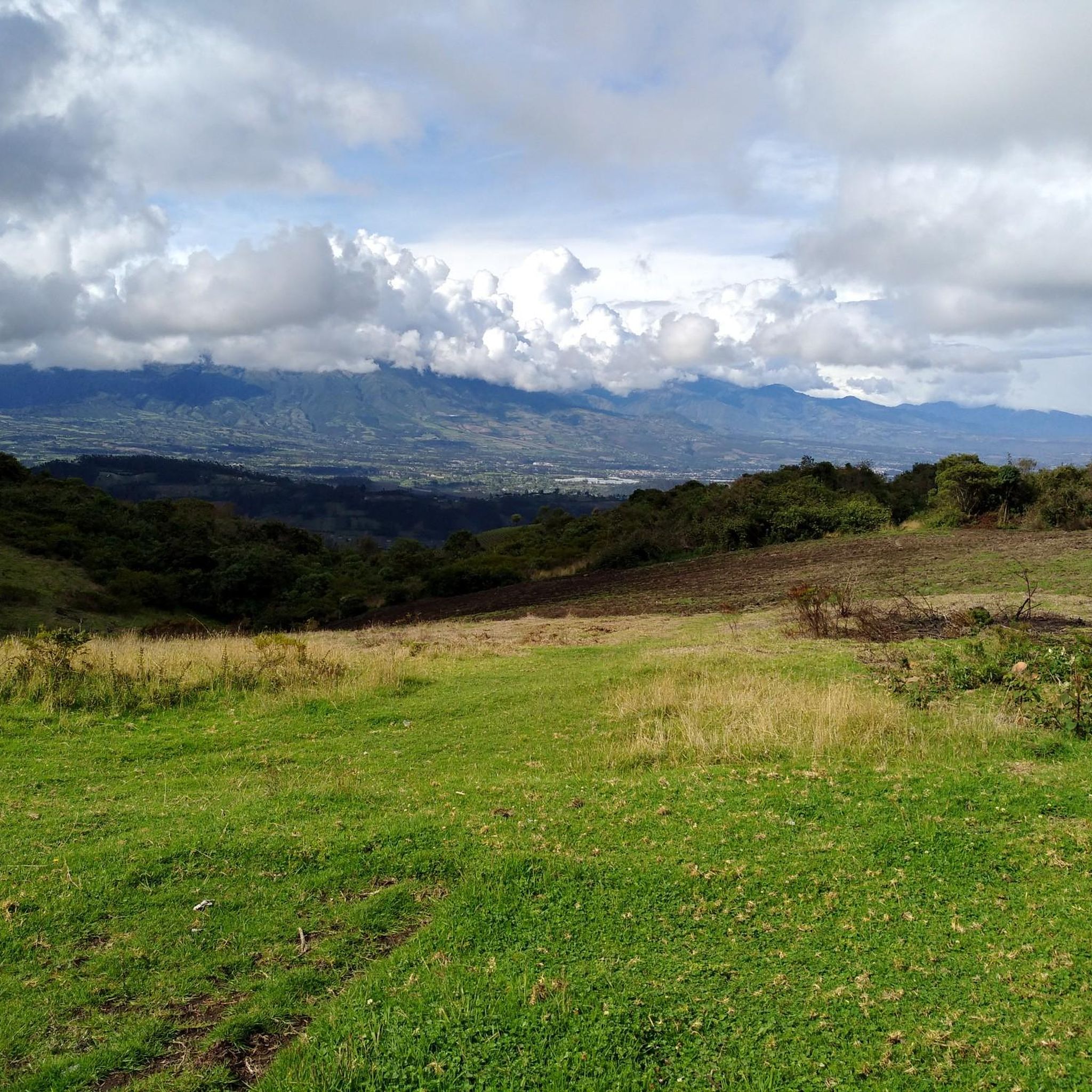
El Lechero is a viewpoint whose tree at the top of the hill is considered sacred. Although unknown to many people, this tranquil spot offers beautiful views of the surrounding area. Located in Otavalo, Ecuador near Condor Park. El Lechero, Otavalo's sacred tree, is part of local mythology and is believed to house the soul of a cursed lover who fell in love with a boy from a rival family. And then it was transformed into nearby Lake San Pablo. From the El Lechero viewpoint you can see Lake San Pablo, the Fuya Fuya Mountains, the Cotacachi Volcanoes, Imbabura and a great view of the city of Otavalo. The place where the tree stands is considered a sacred place with healing powers by local people. There are indigenous Otavaleños who perform many purification rituals and spiritual ceremonies. El Lechero is a place open to the public, where you can not only take beautiful photos, but also have picnics. To get there, you'll have to walk a steep 5km or so from Otavalo or hire a taxi for around $4 each way. There is no transport at the top. Ask the driver to wait if he doesn't want to go back. Source: https://www.planetandes.com/es/ecuador/andes/imbabura/otavalo/el-lechero-arbol-sagrado-otavalo/
2
0
Lake San Pablo or Imbacocha, Spanish Lago San Pablo, Kichwa: Impakucha ("Lake of the Andean Climbing Catfish": impa "Andean Climbing Catfish", kucha "lake") is located in the province of Imbabura in northern Ecuador, at 2,660 m above sea level, below the Imbabura volcano, has a water surface of about 1.8 km² and is of volcanic origin. Source: https://de.wikipedia.org/wiki/Lago_San_Pablo You can take boats across the lake. There are a few stalls at the departure point.
0
0

Park Linear or Park of the Dinosaurs.
0
0
Guitar and German shepherd can be found among other things in the figures.
0
0
Frequently Asked Questions
How many hiking trails are available in San Rafael?
San Rafael offers a diverse network of over 10 hiking trails, catering to various skill levels. You'll find everything from easy walks around lakes to challenging ascents with significant elevation gain.
What kind of landscapes can I expect to see while hiking in San Rafael?
Hiking in San Rafael provides a rich variety of landscapes. You can explore glimmering hills, tall palm trees, and enjoy breathtaking waterfront views of San Pablo Bay. The region also features oak-bay woodlands, savannas, grasslands, and salt marshes, offering diverse natural environments.
Are there any trails with waterfalls in San Rafael?
Yes, you can find trails that feature waterfalls. For example, the Marinwood Open Space offers trails like Blackstone Canyon Trail, which includes waterfalls. Additionally, the Peguche Waterfall – Natural Swimming Pool loop from Otavalo is a popular route that highlights a beautiful waterfall.
What are some easy hiking options suitable for families or beginners?
For an easier experience, consider the Natural Swimming Pool – Peguche Waterfall loop from Otavalo, which is rated as easy. The China Camp State Park also offers several easy to moderate trails, such as the Bay View Trail and Shoreline Trail Loop, which are great for observing wildlife and enjoying waterfront views.
Where can I find trails with great views of the surrounding area?
Many trails in San Rafael offer stunning vistas. Marinwood Open Space provides killer views of Mount Tamalpais, Mount Burdell, and the Bay waters. The Gold Hill Fire Road Trail also climbs San Pedro Mountain, offering panoramic views of San Rafael and Marin County. For dramatic views of the entire San Francisco Bay Area, Mount Tamalpais State Park is easily accessible from San Rafael.
Are there any historical or cultural sites accessible via hiking trails?
Yes, China Camp State Park offers the China Camp Village Trail, which winds through the remnants of a 19th-century Chinese shrimp-fishing village and includes a museum, providing historical insights alongside your hike.
What do other hikers enjoy most about the trails in San Rafael?
The trails in San Rafael are highly rated by the komoot community, with an average score of 4.6 stars from over 20 reviews. Hikers often praise the diverse landscapes, from waterfront paths to challenging ascents, and the opportunity to experience abundant wildlife and vibrant wildflowers.
Can I find trails that are good for spotting wildflowers?
Absolutely! The Terra Linda Sleepy Hollow Ridge is particularly known for its paradise-like fields of wildflowers. Marinwood Open Space also features abundant wildflowers, especially in spring, alongside madrone trees and shady oaks.
Are there any notable natural attractions or landmarks to see near the hiking routes?
Yes, several natural attractions are close to the hiking routes. You can visit the beautiful Peguche Waterfall, explore the serene Laguna Grande de Mojanda, or enjoy the views from El Lechero Sacred Tree and Viewpoint.
Are there any loop trails available for hiking?
Yes, many trails in San Rafael are designed as loops. A popular option is the 2.7-mile loop around Phoenix Lake, combining the Bill Williams Trail, Gertrude Orr Trail, and Phoenix Lake Trail. Another example is the Plaza de los Ponchos Market – Peguche Waterfall loop from Otavalo, which offers a longer circular experience.
What kind of wildlife might I encounter on the trails?
San Rafael's diverse ecosystems support a variety of wildlife. In China Camp State Park, you might spot turkeys, deer, lizards, and various birds. The Terra Linda Sleepy Hollow Ridge is known for butterflies and golden-eyed eagles, enhancing your hiking experience.
Are there any challenging hikes for experienced trekkers?
For those seeking a more challenging adventure, Marinwood Open Space offers steep trails like Blackstone Canyon Trail, Queenstone Fire Road, and Valleystone. The Fuya Fuya – Laguna Grande de Mojanda loop from camping is also rated as difficult, featuring significant elevation gain.
Most popular routes in San Rafael
Most popular attractions in San Rafael

Get inspired with the komoot mobile app


Explore more
Browse the best Hikes in other regions.
