The best walks and hikes in San Juan De Pastocalle
4.1
(7)
111
hikers
3
hikes
Hiking in San Juan De Pastocalle, Ecuador, offers diverse and striking natural landscapes within the Cotopaxi province. The region is characterized by its proximity to the majestic Illinizas volcanoes and the broader Reserva Ecológica Los Illinizas, featuring high-altitude paramo, dense Polylepis forests, and varied terrain. These landmarks and natural features provide a range of experiences for adventurers seeking challenging volcanic ascents or scenic trails through unique ecosystems.
Best hiking trails in San Juan de Pastocalle
- The most popular hiking route…
Last updated: July 2, 2026
4.8
(4)
90
hikers
14.2km
05:30
1,020m
1,020m
Hard hike. Very good fitness required. Easily-accessible paths. Suitable for all skill levels.
4.0
(1)
10
hikers
10.2km
04:02
760m
760m
Moderate hike. Good fitness required. Easily-accessible paths. Suitable for all skill levels.

Sign up for free
7
hikers
6.05km
02:25
440m
440m
Moderate hike. Good fitness required. Mostly accessible paths. Sure-footedness required.
3.5
(2)
5
hikers
5.03km
01:25
100m
100m
Easy hike. Great for any fitness level. Easily-accessible paths. Suitable for all skill levels.
Our route recommendations are based on thousands of hikes, rides, and runs completed by other people on komoot.
Start today with a free account
Your next adventure awaits.
Login or Signup
Popular around San Juan De Pastocalle
Tips from the Community

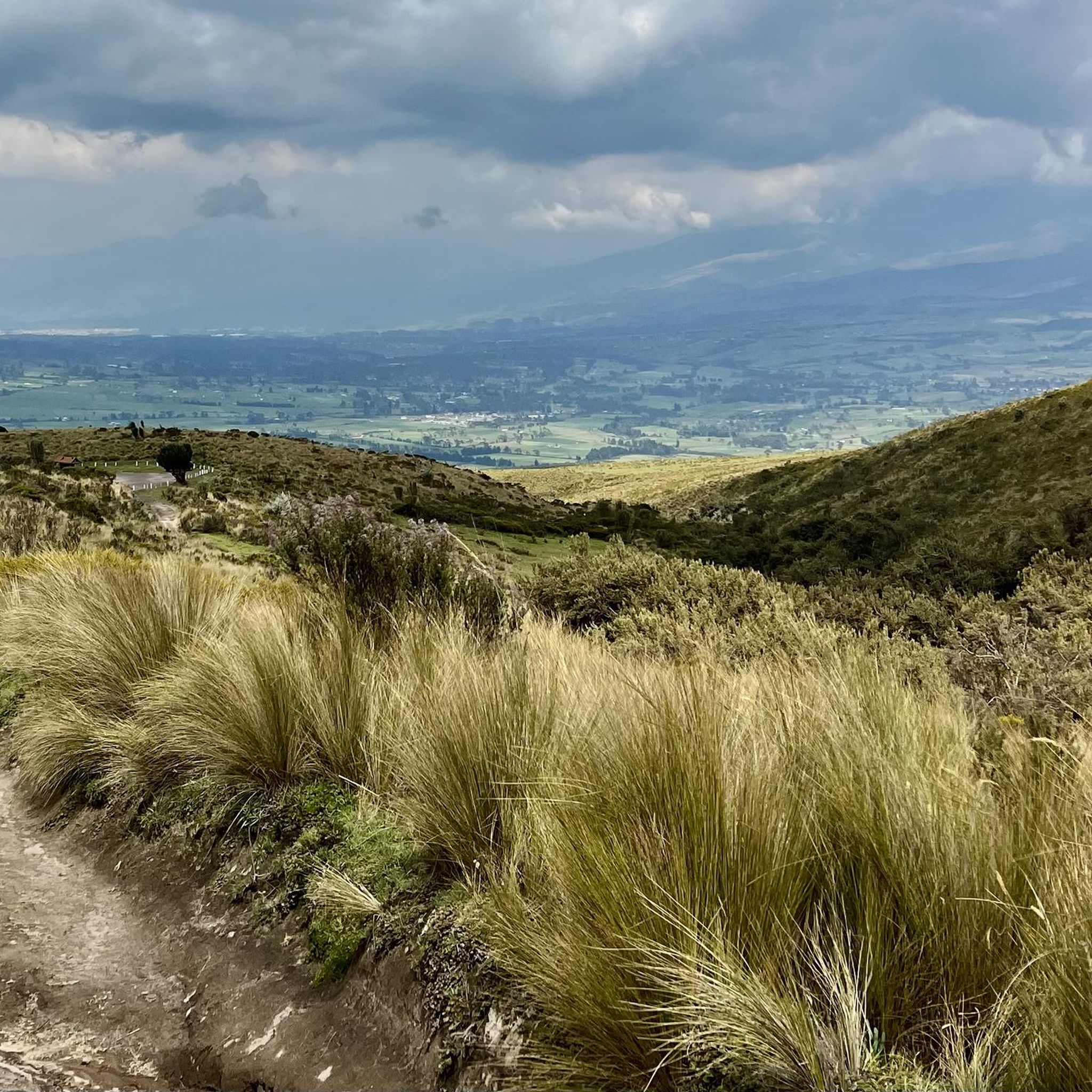
The arduous ascent to the Illinizas is rewarded by a wide view over the lowlands. With a bit of luck and a clear view, the surrounding volcanoes are clearly visible. Antisana and Chimborazo in the distance, but very close to Cotopaxi with its frequently wafting plume of smoke. Very beautiful as well as impressive.
0
0
Views of the valley are always great. The higher up you are, the better. Here, on a clear day, you can refine the view of the valley by observing the surrounding volcanoes.
0
0

We went from El Chaupi to the Corazón. Our ascent began at the entrance to the Reserva, where we left the car. Then we followed the dirt road to the marked junction of the path to Corazón. From now on we went on muddy paths through the Paramo up to a ridge that led us directly to the summit. This path climbs very steeply in places. One point, a rather exposed rock transition, is a bit daring to cross, but almost everyone can master it with concentration and the use of hands. However, normal dogs have problems here. The point is about 30 minutes from the summit. After overcoming this passage, it goes on with easy scrambling to the summit. If several people are on the move, a helmet is a good idea because of the risk of stones being kicked. I have now been to the Corazón twice and unfortunately, despite the early start (ascent from 6:30 a.m.), the weather never allowed me a clear view of the summit. The photos of the Ilinizas, the Cotopaxi, Ruminahui, Sincholagua and even the Antisana were only possible at the beginning of the hike. The ascent to the summit took about 4 hours. We had taken a few breaks.
1
0
Frequently Asked Questions
How many hiking trails are available in San Juan De Pastocalle?
San Juan De Pastocalle offers a selection of 3 curated hiking routes on komoot, catering to various skill levels. These trails are highly rated by the komoot community, with an average score of 4.1 stars.
What are the different difficulty levels for hiking in San Juan De Pastocalle?
The hiking trails in San Juan De Pastocalle range from easy to difficult. You can find 1 easy route, 1 moderate route, and 1 difficult route, ensuring options for different experience levels.
Are there any easy hiking routes suitable for beginners?
Yes, for beginners or those seeking a less strenuous walk, the Hiking loop from El Boliche is an easy option. This route covers 5 km with minimal elevation gain, making it a good choice for a relaxed outing.
What natural features and landmarks can I expect to see while hiking?
Hikers in San Juan De Pastocalle can explore diverse landscapes including high-altitude paramo, unique Polylepis forests, and volcanic peaks. Notable landmarks and viewpoints include the majestic Nevado Illinizas, the Reserva Ecológica Los Illinizas, and the Corazón Summit. You might also encounter the 'magic forest' of Polylepis trees and the stunning View of Illiniza Sur and Illiniza Norte.
Are there any challenging hikes for experienced mountaineers?
Yes, for experienced hikers, the region offers challenging ascents. The Corazón Summit loop from Quebrada Ingacorral is classified as difficult, covering 14.2 km with over 1000 meters of elevation gain. The Nevado Illinizas itself presents complicated paths and extremely low temperatures, suitable for very experienced climbers.
Can I find circular hiking routes in San Juan De Pastocalle?
Yes, all the featured routes in San Juan De Pastocalle are circular. Examples include the Corazón Summit loop from Quebrada Ingacorral, the Corazón Summit loop from Chaupi, and the Hiking loop from La Virgen, 3900m.ü.M.
What kind of wildlife might I encounter on the trails?
The Reserva Ecológica Los Illinizas is rich in biodiversity. Hikers might spot various wildlife such as rabbits, deer, weasels, and skunks. The area is also home to numerous bird species, including wiragchuros and hummingbirds, especially around areas like Laguna de los Patos.
What is the best time of year to go hiking in San Juan De Pastocalle?
Ecuador's climate near the equator means less seasonal variation. However, the dry season (typically June to September) often offers clearer skies and more stable weather conditions, which are ideal for high-altitude hiking and enjoying panoramic views. Always be prepared for sudden weather changes in mountainous terrain.
Are there family-friendly hiking options?
While many trails involve significant elevation, the Hiking loop from El Boliche is an easy route that could be suitable for families looking for a shorter, less demanding walk. Always consider the altitude and physical condition of all family members.
Is San Juan De Pastocalle suitable for dog-friendly hikes?
The general policy for dog access in protected areas like the Reserva Ecológica Los Illinizas can vary. It's advisable to check with local park authorities or guides regarding specific regulations for bringing dogs on trails within the reserve to ensure compliance and safety for your pet and local wildlife.
What should I consider regarding parking or public transport for trail access?
Access to trailheads often requires private transport or a 4x4 vehicle, especially for more remote areas like Cunuyacu Hot Springs or Laguna de los Patos due to difficult terrain. Public transport options might be limited, so planning your logistics for getting to and from the starting points is crucial.
Are permits required for hiking in the area?
For certain areas within the Reserva Ecológica Los Illinizas, especially for higher peaks or specific zones, permits or registration might be required. It's recommended to inquire with the local park administration or a certified guide before embarking on your hike, particularly for challenging ascents like Nevado Illinizas.
How long do hikes typically take in San Juan De Pastocalle?
Hike durations vary significantly based on difficulty and distance. For example, the easy Hiking loop from El Boliche takes around 1 hour 25 minutes, while the moderate Hiking loop from La Virgen, 3900m.ü.M is about 2 hours 25 minutes. More challenging routes like the Corazón Summit loop from Quebrada Ingacorral can take over 5 hours.
What should I wear for hiking in this region?
Given the high-altitude terrain and potential for varying weather, it's essential to dress in layers. Include warm clothing, waterproof and windproof outer layers, sturdy hiking boots, a hat, gloves, and sun protection. Even on sunny days, temperatures can drop quickly, and conditions can change rapidly.
What do other hikers say about their experience in San Juan De Pastocalle?
The hiking experience in San Juan De Pastocalle is highly rated by the komoot community, with an average score of 4.1 stars from over 5 reviews. Hikers often praise the stunning volcanic landscapes, the unique Polylepis forests, and the challenging yet rewarding summit ascents.
Most popular routes in San Juan De Pastocalle
Most popular attractions in San Juan De Pastocalle

Get inspired with the komoot mobile app


Explore more
Browse the best Hikes in other regions.
