The best road cycling routes in Azogues
3.7
(3)
156
riders
3
rides
Road cycling in Azogues, situated in the Andean region of Ecuador at 2500 meters altitude, offers diverse landscapes and challenging terrain. The area is characterized by mountainous topography, featuring significant ascents and descents suitable for varied skill levels. Cyclists encounter a mix of paved surfaces and elevated viewpoints, providing panoramic vistas. Protected forests and rocky formations like Cojitambo Hill contribute to the region's distinct cycling environment.
Best road cycling routes in Azogues
- The most popular road cycling route is La…
Last updated: July 12, 2026
56
riders
51.5km
02:48
960m
970m
Hard road ride. Very good fitness required. Mostly well-paved surfaces and easy to ride.
40
riders
91.8km
04:59
1,250m
1,250m
Hard road ride. Very good fitness required. Some segments of this route may be unpaved and difficult to ride.

Sign up for free
5.0
(1)
27
riders
63.4km
03:20
1,170m
1,170m
Hard road ride. Very good fitness required. Mostly well-paved surfaces and easy to ride.
20
riders
43.8km
02:03
560m
560m
Moderate road ride. Good fitness required. Mostly well-paved surfaces and easy to ride.
1.0
(1)
7
riders
39.2km
01:48
360m
360m
Moderate road ride. Good fitness required. Some segments of this route may be unpaved and difficult to ride.
Our route recommendations are based on thousands of hikes, rides, and runs completed by other people on komoot.
Start today with a free account
Your next adventure awaits.
Login or Signup
Popular around Azogues
Tips from the Community


Cuenca, with its almost 700,000 inhabitants, is the third largest city in Ecuador. It is located at an altitude of 2,500 meters above sea level, within a basin surrounded by gentle hills (hills that reach altitudes even above 3,000 metres). The city is an extraordinary combination of Andean and European culture. It offers everything you need for a regenerating break from the pedals. Don't miss the Pumapungo anthropological museum: it helps you learn more about Ecuadorian traditions and culture.
1
0
Frequently Asked Questions
What is the general difficulty level of road cycling routes in Azogues?
Road cycling in Azogues is characterized by mountainous terrain with significant ascents and descents. The routes in this guide range from moderate to difficult, with elevation gains typically between 360 meters and over 1,100 meters. For example, the La Raya Sur – Vista a Deleg loop from Azogues is a difficult route with over 1,160 meters of elevation gain.
Are there any road cycling routes suitable for beginners in Azogues?
While Azogues is known for its challenging Andean terrain, there are moderate options available. Routes like the Swing With a View of Gualaceo loop from Paute offer a more manageable elevation gain of around 360 meters, making them suitable for cyclists with good basic fitness looking for a less strenuous ride compared to the most difficult routes.
What kind of landscapes and natural features can I expect to see while cycling in Azogues?
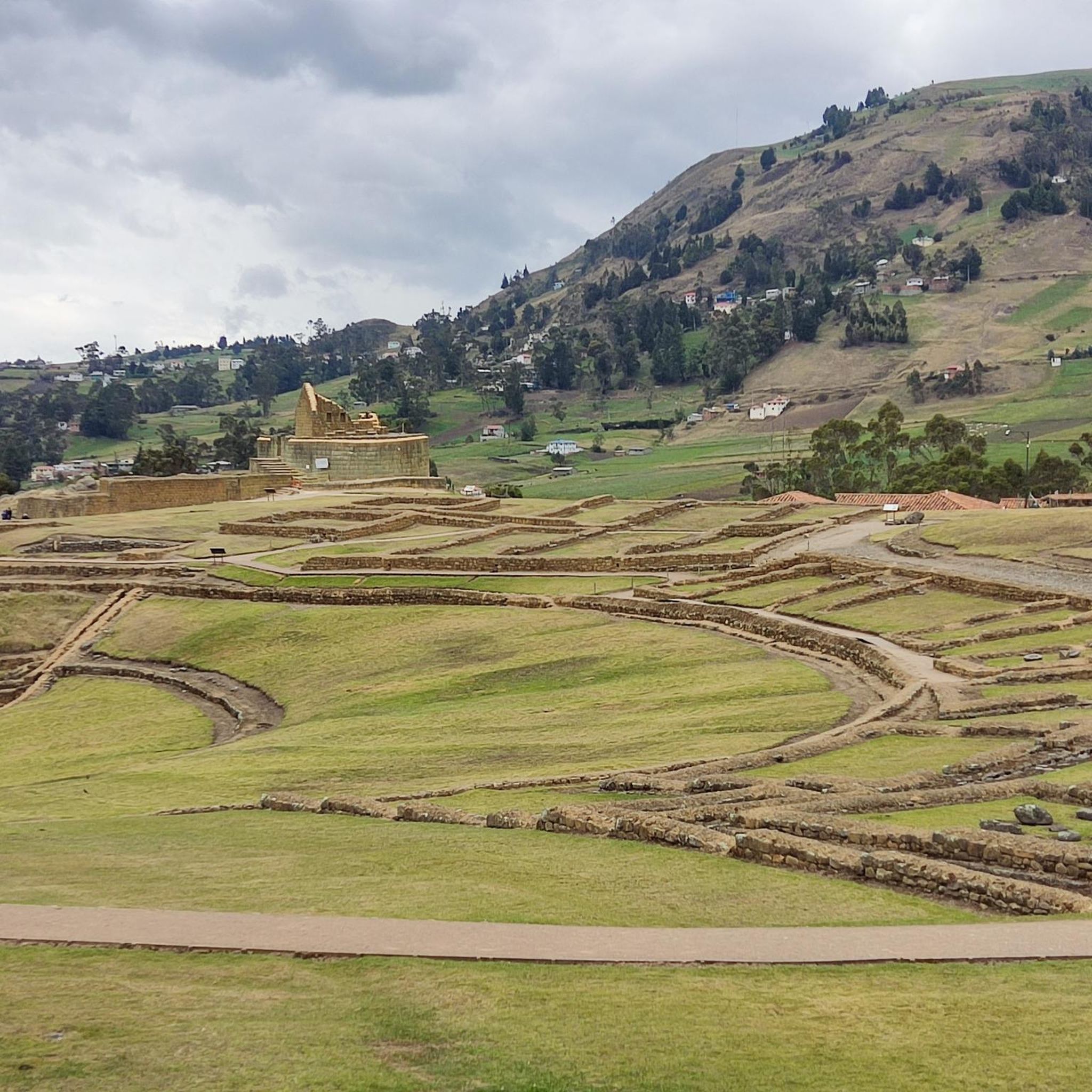
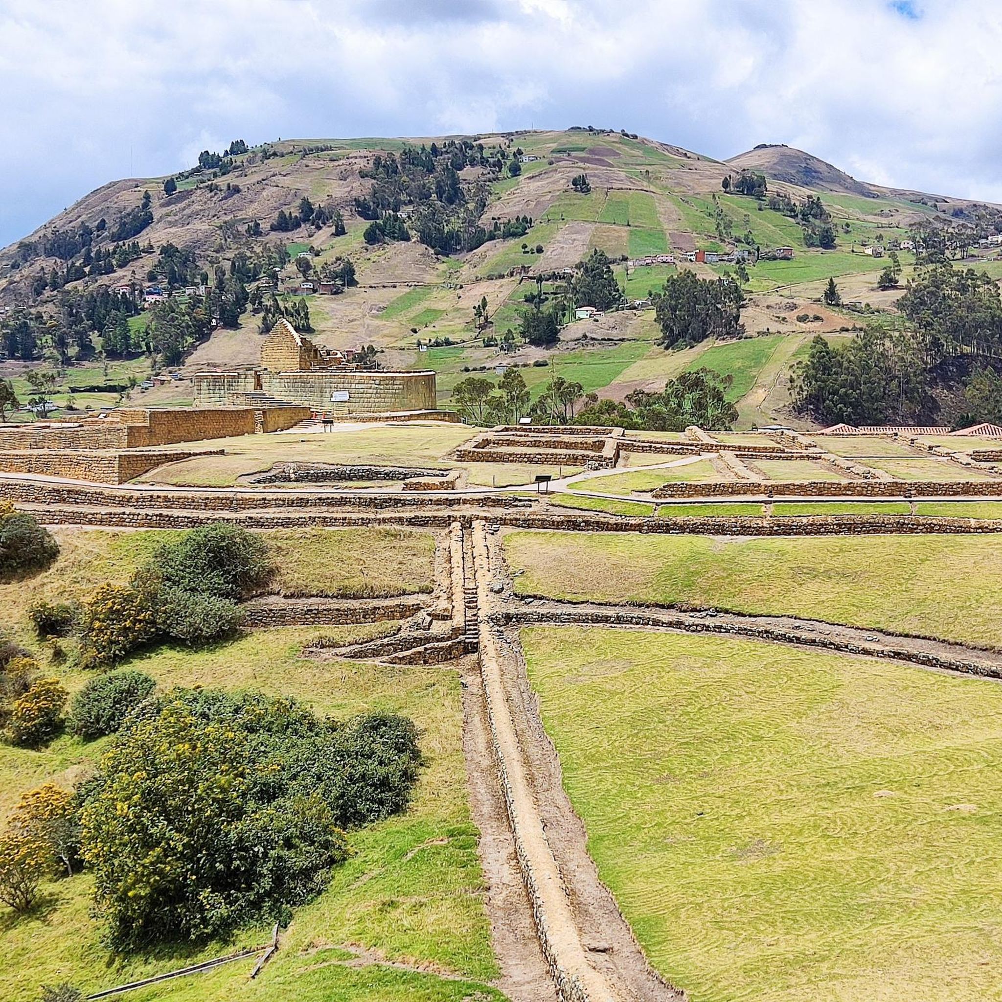
Azogues, known as the 'City of the viewpoints,' offers breathtaking Andean scenery. You'll encounter diverse landscapes, including mountainous environments, rivers, and elevated spots providing panoramic vistas. The region also features protected forests like Cubilan and Rumicruz, and rocky formations such as Cojitambo Hill, which add to the visual appeal of your ride.
Are there any specific landmarks or viewpoints along the road cycling routes?
Yes, many routes offer stunning viewpoints due to Azogues' topography. While specific named viewpoints aren't always on every route, the entire region is dotted with elevated spots. Cojitambo Hill is a prominent rocky formation and a major highlight, often visible or accessible from routes in the area, offering both natural beauty and archaeological interest.
When is the best time of year to go road cycling in Azogues?
Azogues is located in the Andean region, which generally experiences a consistent climate year-round, though with distinct wet and dry seasons. For road cycling, the drier months typically offer more predictable weather and clearer skies, enhancing the enjoyment of the panoramic views. It's always advisable to check local weather forecasts before heading out.
Is parking available near the starting points of road cycling routes in Azogues?
While specific designated cycling parking areas are not detailed, Azogues is a city with various access points to its surrounding routes. Depending on your chosen starting point, you can often find parking in nearby towns or villages. For routes starting from places like Llacao Bajo or Paute, local parking options would be available.
Can I use public transport to reach the road cycling routes with my bike?
Public transport options for carrying bikes can vary in Azogues and the wider Ecuadorian Andes. While inter-city buses might accommodate bikes for a fee or if space allows, local transport within smaller towns might be less equipped. It's recommended to inquire directly with local transport providers regarding their bike policies before planning your trip.
Are there any family-friendly road cycling routes in Azogues?
Given the mountainous and often challenging terrain of Azogues, most road cycling routes listed in this guide are geared towards cyclists with at least moderate experience and fitness. While there are no specifically designated 'easy' routes, families with older, experienced cycling members might find the moderate routes, such as the Roadbike loop from La Esperanza, more approachable due to its shorter distance and moderate elevation.
What do other road cyclists enjoy most about road cycling in Azogues?
The komoot community highly rates road cycling in Azogues, with an average score of 4.1 stars. Cyclists often praise the challenging climbs, the rewarding panoramic views from elevated points, and the diverse Andean landscapes that make each ride a unique experience. The sense of accomplishment after tackling significant elevation gains is a common highlight.
Are there any circular road cycling routes available in Azogues?
Yes, many of the road cycling routes in Azogues are designed as loops, allowing you to start and finish in the same location. Examples include the challenging Guabizhun – Guabizhun Norte loop from Llacao Bajo and the moderate Swing With a View of Gualaceo loop from Llacao Bajo, providing convenient options for exploration.
What is the longest road cycling route featured in this guide for Azogues?
The longest road cycling route in this guide is the La Raya Sur – Vista a Deleg loop from Azogues, covering a distance of 63.4 kilometers (39.4 miles). This difficult route presents a significant challenge with over 1,160 meters of elevation gain.
Can I bring my dog on the road cycling routes in Azogues?
Road cycling routes are generally on paved roads and shared with vehicle traffic, making them less suitable for dogs, especially off-leash. While some protected natural areas in Azogues might have specific trails where dogs are permitted, it's generally not recommended to bring dogs on road cycling routes for safety reasons.
Most popular routes in Azogues

Get inspired with the komoot mobile app


Explore more
Browse the best Road cycling routes in other regions.
