The best walks and hikes in San Rafael
4.4
(28)
342
hikers
11
hikes
Hiking in San Rafael offers diverse terrain, characterized by varied landscapes including hills and woodlands. The region provides a range of trails suitable for different skill levels. Hikers can explore paths with varying elevations and natural features.
Best hiking trails in San Rafael
- The most popular hiking route is Haunted Tree – Cabeza de Vaca Trail Viewpoint loop from Corralillo, a 10.6 miles (17.1 km) trail that takes 5 hours 50 minutes to complete. This difficult route features significant…
Last updated: July 2, 2026
5.0
(5)
124
hikers
17.1km
05:50
780m
780m
Hard hike. Very good fitness required. Mostly accessible paths. Sure-footedness required.
4.9
(8)
78
hikers
6.96km
02:30
320m
320m
Moderate hike. Good fitness required. Mostly accessible paths. Sure-footedness required.

Sign up for free
4.2
(5)
57
hikers
Moderate hike. Good fitness required. Mostly accessible paths. Sure-footedness required.
4.2
(5)
54
hikers
Moderate hike. Great for any fitness level. Mostly accessible paths. Sure-footedness required.
13
hikers
5.65km
01:53
250m
250m
Moderate hike. Great for any fitness level. Mostly accessible paths. Sure-footedness required.
Get access to more routes and recommendations from other explorers.
Sign up for free
Already have an account?
Our route recommendations are based on thousands of hikes, rides, and runs completed by other people on komoot.
Start today with a free account
Your next adventure awaits.
Login or Signup



Tips from the Community

To get here, you can enter Prusia Park and walk along the Cabeza de Vaca Trail, but you'll have to pay a toll to use the access route through Finca Hacienda Retes. Alternatively, you can exit the park through the main entrance and take the first turn on the right onto an asphalt road, also paying a toll. Continue up a steep hill and you'll reach the Cabeza de Vaca Trail again.
0
0
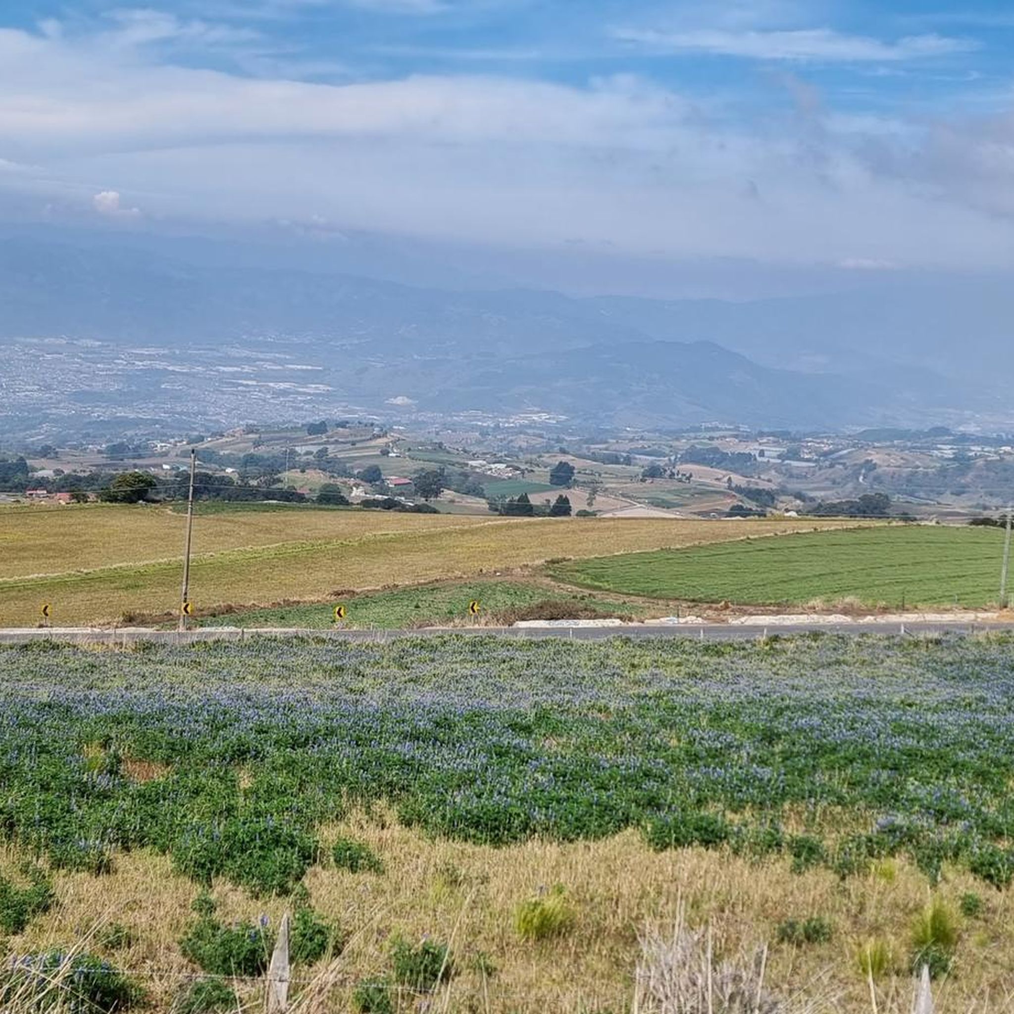
This trail offers spectacular views of Cartago province. Please note that to continue inside the park, you must return along this same trail.
0
0
If you plan to use either of these two trails, keep in mind that you must return along the same route. A few years ago, you could enter and exit the park using these trails, but currently, you can only exit through Cabeza de Vaca. However, you will have to pay a toll of ¢1,000 ($2) for the Hacienda Retes farm. It should be noted that at least on this occasion, we were offered "free" coffee or sweet water.
0
0

Access requires online reservation. Access is possible until 1 p.m., so it makes sense to hike the Prusia sector in the morning and then visit the Irazu volcano.
0
0
Frequently Asked Questions
What are the typical difficulty levels for hiking trails in San Rafael?
San Rafael offers a range of hiking trails suitable for various skill levels. You'll find easy paths perfect for a leisurely stroll, moderate routes with balanced ascents, and more challenging trails featuring significant elevation gain. The komoot community has mapped 11 routes, including 3 easy, 7 moderate, and 1 difficult option.
Are there family-friendly hiking options in San Rafael?
Yes, San Rafael provides several family-friendly hiking opportunities. Parks like China Camp State Park offer flat shoreline paths and easy trails suitable for all ages. Many of the city parks and pathways, such as Adrian Rosal Park or Lagoon Park, also provide accessible outdoor options for families.
Can I bring my dog on hikes in San Rafael?
Many open space preserves and parks in Marin County, including those near San Rafael, are dog-friendly, though rules can vary. It's always best to check specific park regulations before heading out, as some areas may require dogs to be on leash or restrict access to certain trails. Generally, you'll find plenty of trails where your canine companion is welcome.
Where can I find the most scenic views while hiking in San Rafael?
For breathtaking vistas, consider trails in China Camp State Park, which offer views of San Pablo Bay and marshlands. A short drive away, Mount Tamalpais provides unparalleled views of the Marin County landscape, the Pacific Ocean, and even the San Francisco skyline on clear days. Marinwood Open Space also boasts killer views of Mount Tamalpais, Mount Burdell, and the Bay waters from Napa to the Richmond-San Rafael bridge.
Are there any hikes with waterfalls in San Rafael?
Yes, the Marinwood Open Space is known for its challenging trails, such as Blackstone Canyon Trail, where hikers can enjoy seasonal waterfalls, especially after rainfall. This area also features wildflowers, madrone trees, and shady oaks.
Are there any circular hiking routes in San Rafael?
Many of the trails in San Rafael and the surrounding open space preserves are designed as loops or can be combined to form circular routes. For example, the komoot community enjoys the Los Abuelos Viewpoint – Haunted Tree loop from Parquecito, a moderate 7.0 km path, and the Haunted Tree – Los Abuelos Viewpoint loop from Parque Nacional Volcán Irazu, Sector Prusia, a 5.5 km trail.
What kind of natural features and wildlife can I expect to see on San Rafael trails?
San Rafael's diverse landscapes offer a rich natural experience. You can expect to see glimmering hills, tall palm trees, and varied Northern California environments like oak-bay woodlands, savannas, grasslands, and salt marshes. Wildlife sightings may include deer, foxes, and a variety of birds, especially in areas like China Camp State Park and the various open space preserves.
Is parking available at San Rafael trailheads?
Yes, most major parks and open space preserves in and around San Rafael, such as China Camp State Park and Mount Tamalpais, offer designated parking areas at their trailheads. For smaller city parks or less formal access points, street parking may be available. It's advisable to check specific park websites for parking information and any potential fees.
What do other hikers enjoy the most about hiking in San Rafael?
The area is highly rated by the komoot community, with an average score of 4.6 stars from over 20 reviews. Hikers often praise the diverse terrain, ranging from bay views to forested hills, and the variety of trails that cater to different ability levels. The opportunity to explore natural beauty and varied landscapes is a consistent highlight.
What are some notable landmarks or points of interest to explore near San Rafael's hiking trails?
Beyond the trails themselves, you can explore the historic Chinese shrimp-fishing village within China Camp State Park, which includes a museum. The region is also rich in natural landmarks, with Mount Tamalpais offering iconic views. For more local attractions, you might consider visiting the Basilica of Our Lady of the Angels or the Cathedral of Cartago, which are significant cultural sites.
What is the best time of year to go hiking in San Rafael?
Marin County, where San Rafael is located, boasts weather that allows for year-round enjoyment of outdoor recreation. While hiking is possible throughout the year, spring and fall often offer the most pleasant temperatures and vibrant scenery, with wildflowers blooming in spring. Winter can bring lush green landscapes and seasonal waterfalls, while summer is generally warm and sunny, ideal for early morning or late afternoon hikes.
Are there any long-distance or challenging hikes in the San Rafael area?
For those seeking a challenge, San Rafael offers more demanding routes. The Haunted Tree – Cabeza de Vaca Trail Viewpoint loop from Corralillo is a difficult 17.1 km trail with significant elevation gain, taking nearly 6 hours to complete. Additionally, sections of the extensive Bay Area Ridge Trail pass near San Rafael, providing options for longer, more strenuous adventures.
Most popular attractions in San Rafael

Get inspired with the komoot mobile app


Explore more
Browse the best Hikes in other regions.
