
The best MTB trails in La Tigra
21
riders
3
rides
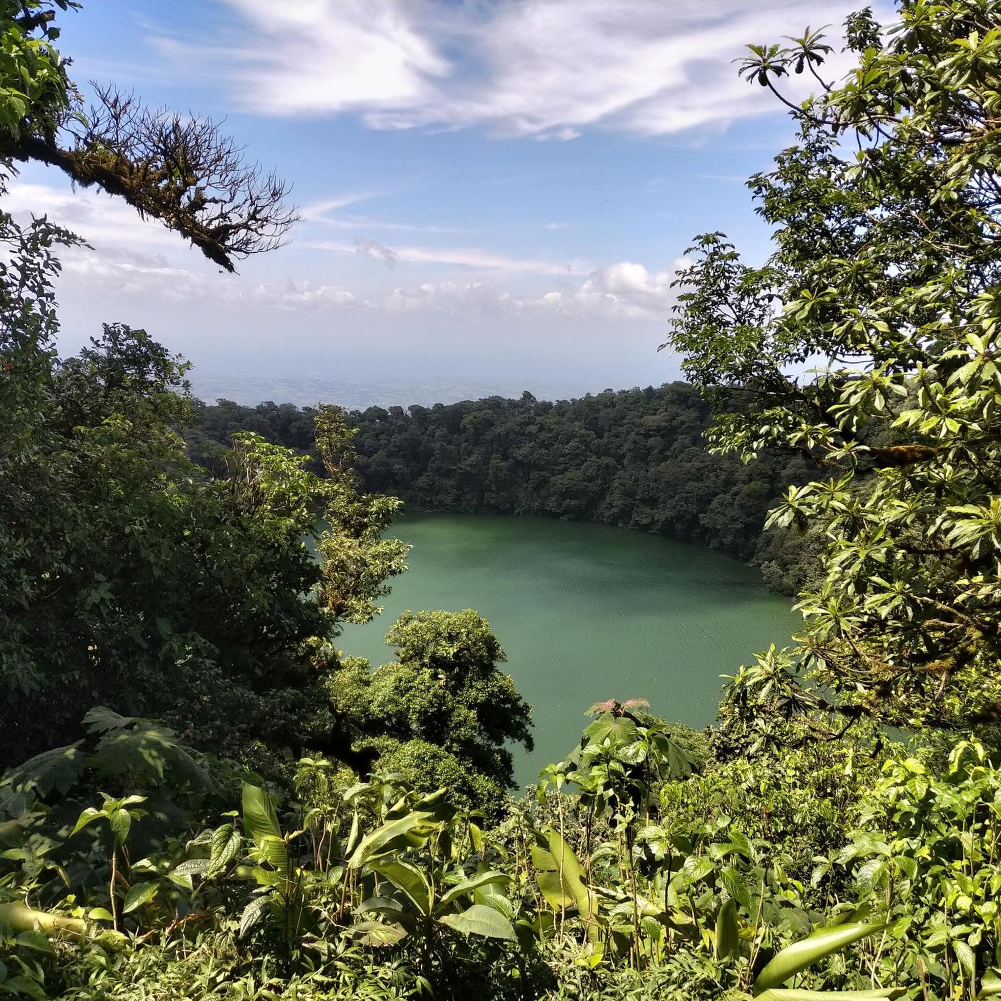
Mountain biking in La Tigra National Park offers routes through a unique cloud forest ecosystem and diverse mountainous landscapes. The region is characterized by high altitudes, towering oak trees, and an abundance of plant life, including lianas, vines, and ferns. Numerous streams with rocky rapids and several waterfalls add to the scenic beauty, with the highest point reaching 2,290 meters above sea level. The park's extensive trail system provides varied terrain for mountain bikers.
Best mountain bike trails in La…
Last updated: July 3, 2026
4
riders
61.8km
04:18
1,130m
1,130m
Hard mountain bike ride. Very good fitness required. Suitable for all skill levels.
2
riders
38.8km
02:58
940m
940m
Hard mountain bike ride. Very good fitness required. Suitable for all skill levels.

Sign up for free
3
riders
43.9km
03:12
790m
790m
Moderate mountain bike ride. Good fitness required. Suitable for all skill levels.
12
riders
66.1km
05:30
1,490m
1,490m
Hard mountain bike ride. Very good fitness required. Suitable for all skill levels.
Our route recommendations are based on thousands of hikes, rides, and runs completed by other people on komoot.
Start today with a free account
Your next adventure awaits.
Login or Signup
Popular around La Tigra

Frequently Asked Questions
What kind of terrain can I expect on mountain bike trails in La Tigra National Park?
Mountain biking in La Tigra National Park takes you through a unique cloud forest ecosystem and diverse mountainous landscapes. You'll encounter high altitudes, towering oak trees, and an abundance of plant life. The trails often feature streams with rocky rapids, and some routes, like the old mining road, can become challenging with rocks after rains. The highest point in the park, La Peña de Andino, reaches 2,290 meters above sea level, indicating significant elevation changes.
Are there any waterfalls or scenic viewpoints accessible by mountain bike in La Tigra?
Yes, the region is known for its scenic beauty, including numerous streams with rocky rapids and several sizable waterfalls. While specific mountain bike routes directly to all waterfalls aren't detailed, the La Fortuna Waterfall and another Waterfall are notable natural attractions in the area. The high-altitude cloud forest also offers many opportunities for scenic views across the mountainous landscape.
What is the best time of year for mountain biking in La Tigra National Park?
La Tigra National Park's cloud forest environment means conditions can vary. Generally, the dry season (roughly November to May) offers more predictable weather and firmer trails. During the rainy season, trails, especially those on old mining roads, can become rocky streams, adding to the challenge. Always check local weather conditions before heading out.
Are there any family-friendly or beginner mountain bike trails in La Tigra?
While La Tigra National Park offers an extensive trail system, many of the mountain biking routes are categorized as difficult. For instance, Embalse San Lorenzo loop from Paja de Agua and Embalse San Lorenzo loop from Salida Eco-TEC are both difficult routes with significant elevation changes. The park's trail network does include options for different ability levels, but beginners should seek out specific recommendations for easier sections or consider the park's hiking trails like Sendero Granadillas (1km) for a less strenuous experience.
Can I find circular mountain bike routes in La Tigra National Park?
Yes, several popular mountain bike routes in La Tigra are designed as loops. Examples include the challenging Embalse San Lorenzo loop from Paja de Agua (64.2 km) and the Represa Relleno loop from Restaurante La Hacienda (39.2 km), which is rated as moderate. These loops allow you to start and finish at the same point, making logistics easier.
What are the typical distances and elevation gains for mountain bike trails in La Tigra?
Mountain bike trails in La Tigra vary in length and elevation. For example, the Embalse San Lorenzo loop from Salida Eco-TEC covers 66.1 km with an elevation gain of 1485 meters. Another route, Embalse Chocosuela 2 – Emablase Chocosuela 1 loop from CTEC, is 38.8 km long with 942 meters of ascent. These figures highlight the challenging nature of many routes in the park.
Are there any places to eat or stay near the mountain biking trails in La Tigra?
La Tigra National Park has visitor facilities at its entrances, including Jutiapa and El Rosario. Jutiapa offers dormitories and limited camping facilities. While specific cafes or restaurants directly on the trails are not common, you might find options near the park entrances or in nearby towns. For a unique experience, consider the La Tigra Rainforest Lodge.
What kind of wildlife can I expect to see while mountain biking in La Tigra?
La Tigra is a sanctuary of biodiversity, making it an excellent spot for wildlife observation. The park is home to over 350 species of birds, including quetzals, blue and white mockingbirds, and various hummingbirds. Mammals such as ocelots, pumas, peccaries, white-tailed deer, armadillos, opossums, and agoutis also inhabit the park, though they are often more elusive.
Do I need a permit or is there parking available for mountain biking in La Tigra National Park?
La Tigra National Park has multiple entrances, including Jutiapa and El Rosario, both of which have visitor centers. It is advisable to check with the park authorities regarding current permit requirements and available parking facilities at these entrances before your visit. For more general information about the park, you can consult Wikivoyage.
Are there any specific landmarks or points of interest along the mountain bike routes?
The mountain bike routes in La Tigra traverse a landscape rich in natural beauty. While specific landmarks directly on the bike trails aren't always highlighted, the park itself is a significant point of interest due to its cloud forest ecosystem. You might pass by the Tree Planting Site or the Pocosol Station, which are points of interest within the park.
How many mountain bike trails are available in La Tigra National Park?
La Tigra National Park offers an extensive trail system for mountain biking. The region features approximately 73 kilometers (45 miles) of trails, with at least four recommended routes catering to different skill levels, from intermediate to difficult. These routes provide varied terrain through the park's unique cloud forest.
Most popular routes in La Tigra
Most popular attractions in La Tigra

Get inspired with the komoot mobile app


Explore more
Browse the best MTB trails in other regions.
