The best road cycling routes in Honda
5.0
(8)
433
riders
4
rides
Road cycling in Honda features routes with significant elevation changes, indicating a mountainous or hilly landscape. The region offers challenging climbs and descents, with some routes reaching over 4,900 meters of ascent. Distances vary, providing options for both moderate and long-distance rides. The terrain includes varied surfaces suitable for road bikes, often passing through areas with notable natural features.
Best road cycling routes in Honda
- The most popular road cycling route is Alto de Letras – Alto de Letras loop…
Last updated: July 1, 2026
208
riders
161km
10:30
4,940m
4,940m
Hard road ride. Very good fitness required. Some segments of this route may be unpaved and difficult to ride.
62
riders
81.2km
04:08
1,340m
1,340m
Hard road ride. Very good fitness required. Mostly well-paved surfaces and easy to ride.

Sign up for free
5.0
(4)
51
riders
37.6km
02:00
720m
720m
Moderate road ride. Good fitness required. Mostly well-paved surfaces and easy to ride.
5.0
(1)
22
riders
83.4km
04:41
1,800m
1,800m
Hard road ride. Very good fitness required. Mostly well-paved surfaces and easy to ride.
5.0
(2)
18
riders
43.9km
02:38
1,040m
1,040m
Hard road ride. Very good fitness required. Mostly well-paved surfaces and easy to ride.
Our route recommendations are based on thousands of hikes, rides, and runs completed by other people on komoot.
Start today with a free account
Your next adventure awaits.
Login or Signup

Tips from the Community

To reach this point, you must have trained sufficiently, or the altitude can take its toll. Always have excellent equipment, because no matter where we come from, little by little, we'll need clothing to maintain our body heat. Not to mention excellent hydration and nutrition before, during, and after to help us recover.
0
0

This is the site of the Armero Tragedy. A village destroyed by the 1985 eruption of volcán Nevado del Ruiz. Lots of ruins and buildings still visible and partially buried.
0
0

Good shelter, waterproof, hydration and adequate nutrition
0
0
Excellent route, demanding route, worth doing. Good preparation. Of the two routes, Mariquita-Letras and Lebanon-nevado-Letras, without hesitation I prefer the route through the snowy mountain, more demanding, but more rewarding, spectacular, the most beautiful route in Colombia.
0
0

The goal of many amateur cyclists, more because of how media it is, than because of its hardness. It is easily done in 6 hours, with a good accompaniment that provides water and adequate food on a scheduled basis. Save energy for the last 20 km (from Delgaditas), the steepest and highest masl. Ideal in the summer months, to see the Nevado del Ruiz, in an epic landscape.
3
1

Train three judicious months, go up regulated, feed on cyclist gels, but they don't like a little salt, remember to regulate yourself, don't push from Mariquita to Fresno, remember that they have Cerro Bravos left where they find S at 27%, and good hydration
0
0

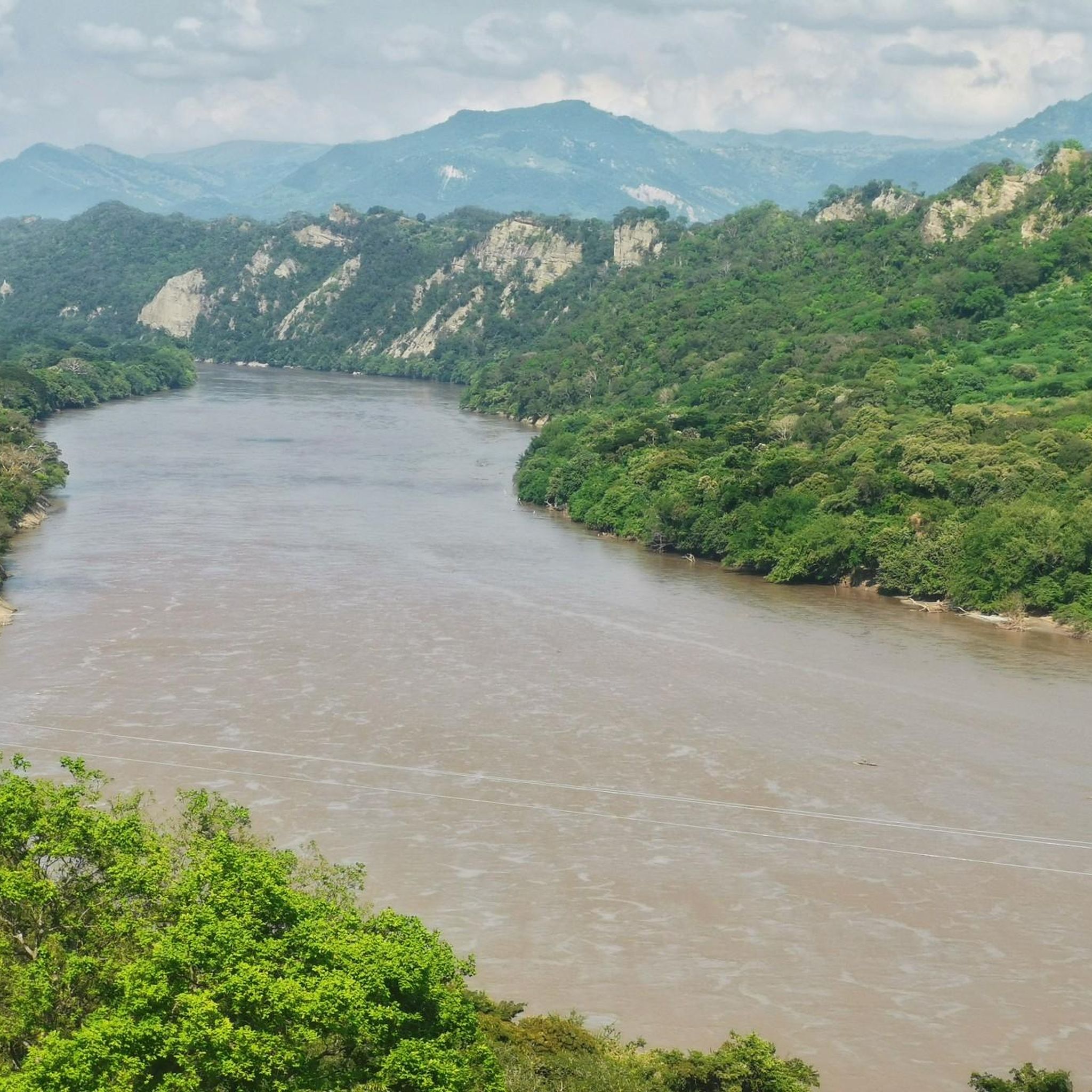
Stunning view over the Río Magdalena valley while cycling down to Honda!
0
0
Frequently Asked Questions
How many road cycling routes are available in Honda?
Komoot features over 4 road cycling routes in Honda. These routes offer a variety of experiences, from moderate to very challenging, catering to different skill levels.
What kind of terrain can I expect on road cycling routes in Honda?
Road cycling in Honda is characterized by significant elevation changes, indicating a mountainous or hilly landscape. You'll encounter challenging climbs and descents, with some routes featuring over 4,900 meters of ascent. The terrain includes varied surfaces suitable for road bikes, often passing through areas with notable natural features.
Are there routes suitable for beginners or less experienced road cyclists?
While many routes in Honda are quite challenging, there are options for those seeking a more moderate experience. For example, the Time trial loop from Mariquita is a 23.3-mile (37.6 km) trail with rolling hills, often completed in about 2 hours, making it a good choice for those looking for a less strenuous ride.
What are some of the more challenging road cycling routes in Honda?
For experienced cyclists seeking a significant challenge, the Alto de Letras – Alto de Letras loop from Mariquita is a demanding 100.1-mile (161.2 km) route with over 4,900 meters of elevation gain. Another difficult option is the Magdalena loop from Mariquita, which covers 50.3 miles (80.9 km) and includes over 1,300 meters of climbing.
When is the best time of year to go road cycling in Honda?
The optimal time for cycling in Honduras, including the Honda region, is generally during the dry season, which runs from November to April. During these months, you can expect more favorable weather conditions for your rides.
Can I find scenic viewpoints or natural attractions along the routes?
While specific highlights are not detailed for these routes, the broader region of Honduras offers diverse landscapes. You might encounter routes through lush neighborhoods, pine forests, and areas with rolling hills. The country's natural beauty, from Pacific lowlands to mountainous regions, provides a scenic backdrop for your rides.
Are there any loop routes for road cyclists in Honda?
Yes, several popular road cycling routes in Honda are designed as loops. Examples include the challenging Alto de Letras – Alto de Letras loop from Mariquita, the Magdalena loop from Mariquita, and the more moderate Time trial loop from Mariquita.
What do other cyclists say about road cycling in Honda?
The road cycling routes in Honda are highly rated by the komoot community, with an average score of 5.0 stars from over 8 reviews. Cyclists often praise the challenging climbs and diverse terrain that make for a rewarding experience.
Are there options for long-distance road cycling in Honda?
Absolutely. Honda offers routes suitable for long-distance road cycling. The Alto de Letras – Alto de Letras loop from Mariquita, for instance, is a substantial 100.1-mile (161.2 km) ride, perfect for those looking to cover significant distances and elevation.
What facilities like cafes or stores are available along the routes?
While specific cafes are not listed for these routes, cyclists on longer tours in Honduras have noted the presence of modern convenience stores. These can provide convenient stops for hydration and rest, especially given the often-hot climate.
What unique landscapes can I experience while cycling in Honda?
Road cycling in Honda allows you to experience a range of Honduran landscapes. You might ride through areas with flat Pacific lowlands, featuring dry forests and pastures, or venture into mountainous regions with lush vegetation and challenging ascents. The diverse scenery provides a dynamic backdrop for your rides.
Is it possible to access road cycling routes using public transport or find parking?
The provided routes generally start from towns like Mariquita or Guayabal. While specific public transport connections to trailheads or dedicated parking facilities are not detailed, these towns typically offer local transport options and parking availability. It's advisable to check local information for the most current details on accessing starting points.
Most popular routes in Honda

Get inspired with the komoot mobile app


Explore more
Browse the best Road cycling routes in other regions.
