Attractions and Places To See in Balboa - Top 12
Attractions and places to see in Balboa are primarily found in the mountainous terrain of the central and western Andes mountain range in Colombia's Risaralda department. This region is characterized by coffee plantations, river valleys, and challenging trails. Visitors can explore quiet towns and natural features, offering opportunities for outdoor activities. The area provides a blend of cultural experiences in its settlements and scenic routes through its diverse landscapes.
Best attractions and places to see in Balboa
- The most popular…
Last updated: July 4, 2026
La Celia Town Square
Highlight • Settlement
In homage to a well-known …
Translated by Google •
Tip by

Peralonso to Alto del Cielo Trail
Highlight (Segment) • Trail
Translated by Google •
Tip by
Sign up now to discover places like this
Get recommendations on the best single tracks, peaks, & plenty of other exciting outdoor places.
Sign up for free
Totuí Canyon and Peralonso
Highlight • Canyon
Translated by Google •
Tip by
Nápoles (Comehombres) Climb
Highlight (Segment) • Climb
Translated by Google •
Tip by
Main Road-Sabaletas
Highlight (Segment) • Other
Showing Translation
Tip by
Sign up for free to discover even more attractions in Balboa.
Sign up for free
Already have an account?
Start today with a free account
Your next adventure awaits.
Login or Signup
Popular around Balboa
Tips from the Community

Trail for MTB, distance of 8.98 kms, to get there, you deviate from the main road through a canebrake until you reach the Cañaveral river, here begins the most interesting part, to continue you have to cross the river, it is not very deep, but it requires care, on the other side we find a path somewhat hidden among the bushes, and following it will lead us to the road to the Esparta village. the landscapes here are spectacular, just for that it is worth coming to do this route.
0
0
This 4.3 km MTB section has an average gradient of 13%. The trail is in very good condition and has beautiful views of the Mapa River and its surroundings. At the end, there are four difficult climbs with gradients exceeding 25%. The advantage is that several sections are paved. If you ask me, I'd say the other man-eater called Cocohondo is much tougher, steeper, more technical, and longer.
0
0
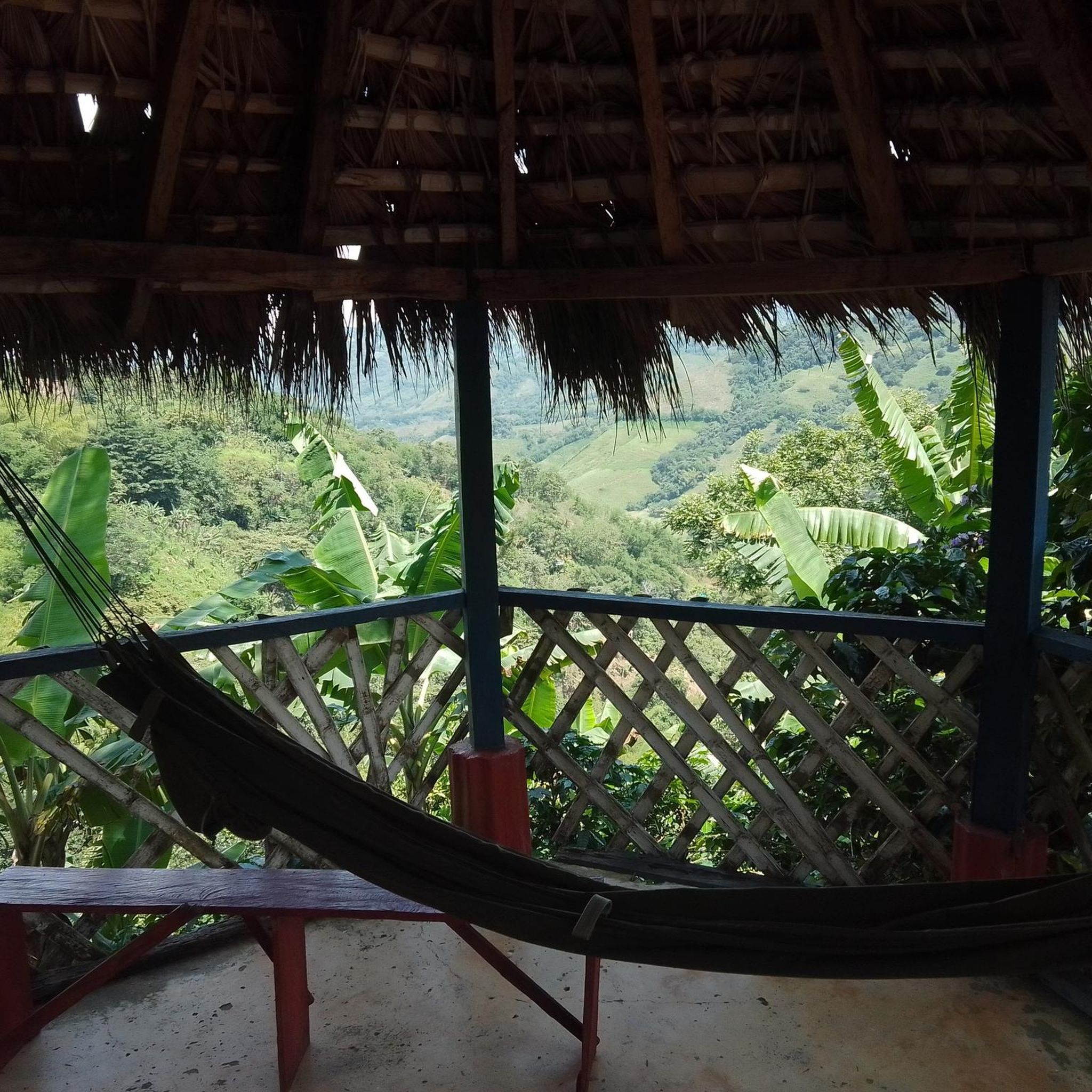
MTB section, Peralonso is the only district of the municipality of Santuario, approximately 100 whitewashed houses on the narrow ridge of a mountain range, in the middle of coffee plantations and a landscape with a lot of green, along this road we can find mountainous terrain, of the central and western Andes mountain range, it was founded in 1907 by Mr. Fernando A. Pérez, in its beginnings it was called La Fonda, this road was of great importance, since it connected Santuario with Portobelo, a port on the Cauca River. About the route it has a good ascent, on this occasion it went up the Alto del Cielo and in a hamlet called La Quiebra take the road to the right from there everything was downhill, on the left side you can see the municipality of Santuario finally you come out in front of a fishing site called Possopolis in what is called La Bretaña
0
0
La Celia is a Colombian municipality located in the department of Risaralda. It is located 64 kilometers northwest of Pereira, the capital of the department. In homage to a well-known merchant and leader named Celia, in 1915 the township of Barcelona changed its name to La Celia, which in 1959 was recognized as a municipality. Some places of interest are: The temple of Our Lady of Carmen, La Laguna, the jets, the monkey corridor, etc. In addition to its municipal seat, Celia has a populated center under its jurisdiction: Patio Bonito. The history of this municipality was not always calm, years ago it was considered a quite dangerous town, its violence rates exceeded that of other nearby municipalities and people were warned not to travel to it. One of the factors that caused La Celia to be violent at that time was a bipartisan war between several families in the town at the end of the 80s, which culminated in the total extermination of these families and the constant presence of groups outside the law. . In past years, the FARC guerrillas had runners along several paths in the municipality, until the paramilitaries arrived in the area and gradually expelled them from La Celia. Only after the demobilization with the government of Álvaro Uribe Vélez did the paramilitaries not return to the town. Today it is a very quiet and pleasant town to visit, especially its plaza with several booths where you can taste the region's coffee, or spend a relaxing afternoon. The road that goes from Balboa, although it already has parts with new roads, is not yet there. It is good in its entirety and you should be careful when descending because it has some very dangerous gaps.
0
0
The initial route is following the river, but as it progresses there is a strong ascent with a good slope leaving the totui canyon, later there is a detour to go down to Peralonso
0
0
The initial route is following the river, but as it progresses there is a strong ascent with a good slope leaving the totui canyon, later on there is a detour to go down to Peralonso
0
0
Frequently Asked Questions
What kind of attractions can I expect to find in Balboa, Colombia?
Balboa, located in Colombia's Risaralda department, is known for its mountainous terrain, coffee plantations, and river valleys. You'll find attractions centered around challenging trails, scenic viewpoints, and tranquil settlements. Key highlights include Totuí Canyon and Peralonso, and the peaceful La Celia Town Square.
What outdoor activities are popular in Balboa?
Balboa is ideal for outdoor enthusiasts, particularly those interested in cycling and hiking. The region offers challenging trails with significant ascents, such as the Peralonso to Alto del Cielo Trail and the Nápoles (Comehombres) Climb. There are also paved cycling routes like the Anserma Nuevo–Argelia Cycling Route.
Are there any specific trails recommended for cycling or mountain biking?
Yes, Balboa offers several routes for cycling and mountain biking. For a challenging experience, consider the Nápoles (Comehombres) Climb, which features an average gradient of 13% over 4.3 km with beautiful views. For a longer ride, the Anserma Nuevo–Argelia Cycling Route is a 25 km paved road with gentle slopes. You can find more MTB trails in the area on the MTB Trails in Balboa guide.
What are the best places to experience the local culture in Balboa?
To experience local culture, visit La Celia Town Square. This settlement is known for its quiet atmosphere and pleasant plaza, where you can taste regional coffee at various booths and enjoy a relaxing afternoon. The town itself offers insights into the local way of life in Risaralda.
What kind of natural landscapes can I see in Balboa?
Balboa is rich in natural beauty, characterized by the central and western Andes mountain range. You can explore river valleys and canyons, such as Totuí Canyon, which offers a challenging trail experience. The region is also dotted with extensive coffee plantations, providing scenic views along many of its trails.
Are there any viewpoints offering panoramic scenery?
Many trails in Balboa offer excellent viewpoints. For instance, the Peralonso to Alto del Cielo Trail provides mountainous terrain views and vistas of coffee plantations, eventually leading to a downhill section with views of the municipality of Santuario. The Nápoles (Comehombres) Climb also boasts beautiful views of the Mapa River and its surroundings.
What is the difficulty level of the trails in Balboa?
The trails in Balboa range from intermediate to challenging. Many feature significant ascents and steep slopes, such as the Totuí Canyon and Peralonso trail, which has a strong ascent after following the river. Mountain biking routes, like the Ansermanuevo Sign loop, are rated as difficult, while others like the Anserma Nuevo–Argelia Cycling Route are intermediate.
What do visitors say about Balboa's attractions?
Visitors appreciate Balboa for its challenging trails and scenic beauty. For example, the Totuí Canyon and Peralonso is noted for its strong ascent and the option to detour to Peralonso. La Celia Town Square is highlighted as a very quiet and pleasant town to visit, especially for its regional coffee.
Can I find family-friendly activities in Balboa?
While many trails are challenging, the settlements like La Celia Town Square offer a relaxed atmosphere suitable for families to enjoy local coffee and the quiet plaza. The overall region provides opportunities for appreciating nature, though specific 'family-friendly' designated activities are less prominent than the adventure-oriented trails.
Are there any specific tips for navigating the trails in Balboa?
When tackling trails like Totuí Canyon and Peralonso, be prepared for strong ascents and good slopes. For the Peralonso to Alto del Cielo Trail, expect mountainous terrain. Some sections, like parts of the Nápoles (Comehombres) Climb, are paved, which can be an advantage on steep gradients. Always be careful when descending, as some roads may have dangerous gaps.
What is the best way to explore the coffee plantations in Balboa?
The best way to explore the coffee plantations is by traversing the region's trails. Routes such as the Peralonso to Alto del Cielo Trail wind through coffee-growing areas, offering picturesque views of the plantations and the surrounding mountainous landscape.
Most popular routes in Balboa
Most popular attractions in Balboa

Get inspired with the komoot mobile app


Explore more
Still not found the Highlight you’re looking for? See guides of the top attractions in other regions:
