The best walks and hikes in Aipe
4.8
(24)
183
hikers
7
hikes
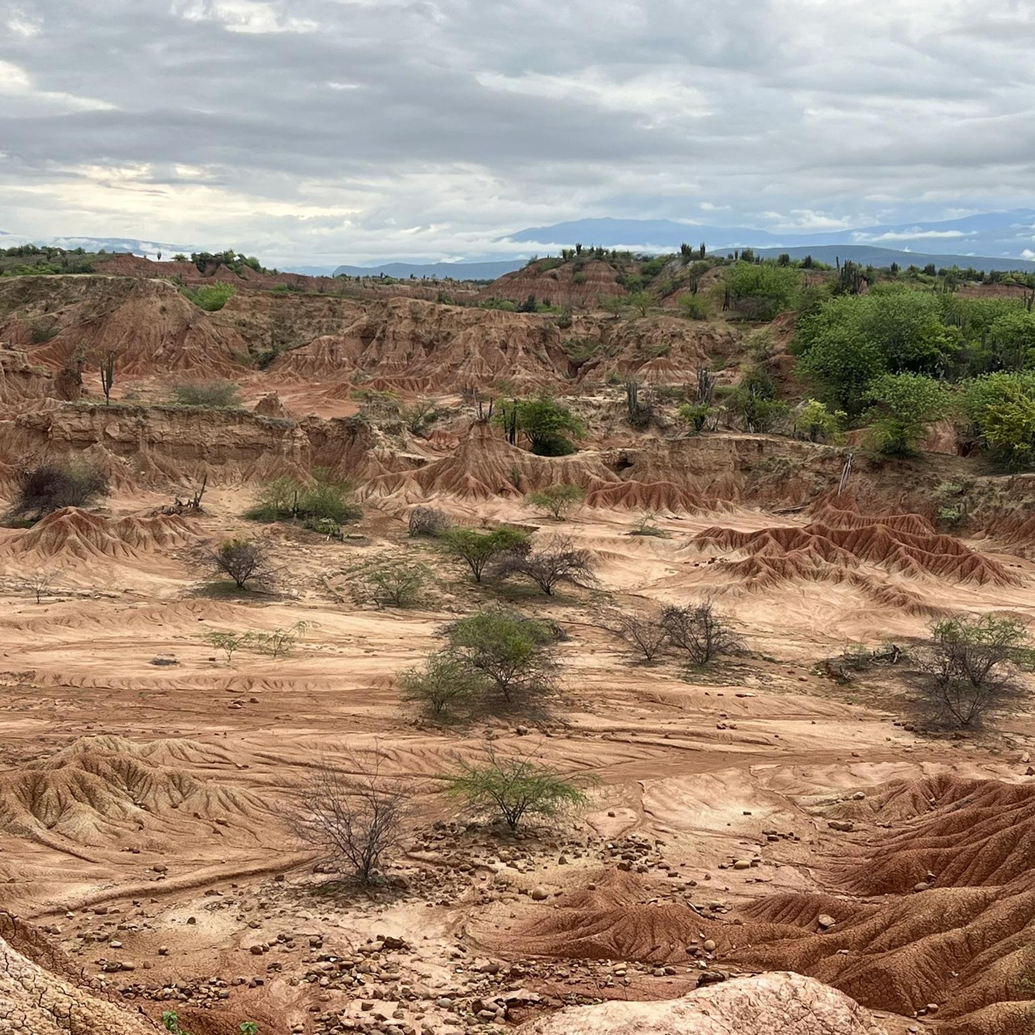
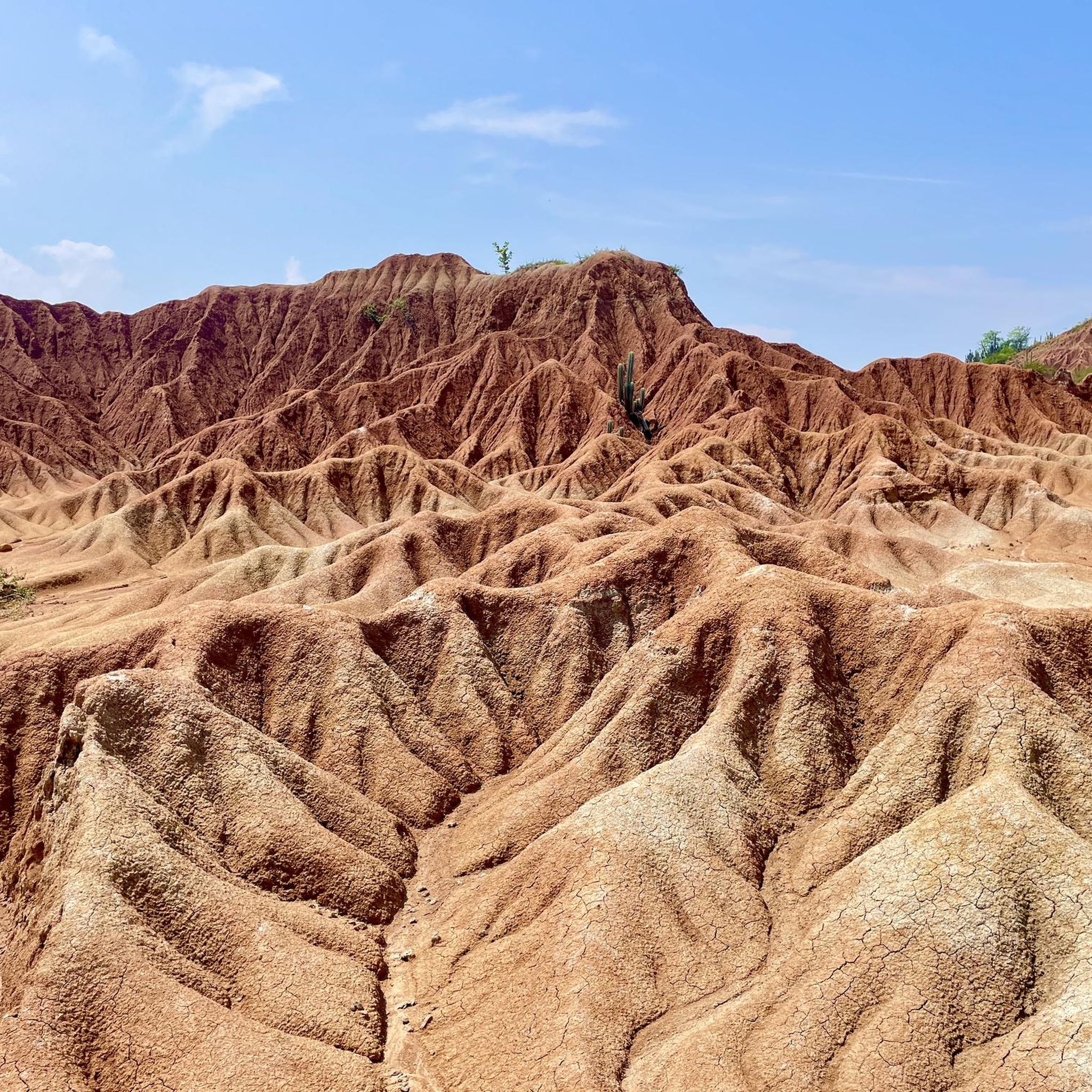
Hiking in Aipe offers access to the unique landscapes of the Tatacoa Desert, characterized by its distinctive geological formations and arid environment. This region, often described as a tropical dry forest, features striking red sandstone cliffs and intricate mud formations. Hikers can explore dry canyons and eroded rock formations that define the terrain. The area provides a variety of routes through its varied and compelling natural features.
Best hiking trails in Aipe
- The most popular hiking route is Los Hoyos…
Last updated: June 29, 2026
4.3
(3)
44
hikers
Moderate hike. Good fitness required. Easily-accessible paths. Suitable for all skill levels.
5.0
(2)
20
hikers
Moderate hike. Good fitness required. Easily-accessible paths. Suitable for all skill levels.

Sign up for free
5.0
(4)
22
hikers
15.6km
04:12
190m
190m
Moderate hike. Good fitness required. Easily-accessible paths. Suitable for all skill levels.
4.7
(3)
19
hikers
Hard hike. Very good fitness required. Easily-accessible paths. Suitable for all skill levels.
6
hikers
Easy hike. Great for any fitness level. Easily-accessible paths. Suitable for all skill levels.
Get access to more routes and recommendations from other explorers.
Sign up for free
Already have an account?
Our route recommendations are based on thousands of hikes, rides, and runs completed by other people on komoot.
Start today with a free account
Your next adventure awaits.
Login or Signup
Popular around Aipe
Tips from the Community

After the dusty bike ride from Villavieja past the red Tatacoa to the gray, the pool and kiosk invite you to take a refreshing dip and rest. It feels like an oasis in the desert.
0
0
The Tatacoa Desert (Spanish: Desierto de la Tatacoa) is an approximately 330 km² desert in Colombia. It is located in the northern part of the Departamento del Huila in the valley of the Río Magdalena in the municipality of Villavieja, about 40 km north of the department capital Neiva and only about 3° north of the equator. The average temperature is over 28 °C. The Tatacoa Desert owes its existence to the special geographic location between the two mountain ranges of the Central and Eastern Cordillera in a dry basin at the foot of the Eastern Cordillera. As a result, it lies in the double rain shadow and usually remains low in precipitation even in the rainy season. Due to the high average temperature, the amount of precipitation of around 1000 mm per year is not sufficient to compensate for evaporation. The name Tatacoa comes from a species of snake originally native to the desert but now extinct. Source: https://de.wikipedia.org/wiki/Tatacoa-W%C3%BCste
2
0
Incredible to discover such a refreshing swimming pool in the middle of the unreal hot desert. Vendors sell cool drinks, snacks, and ice cream.
0
0

The Tatacoa Desert is a unique landscape and is an extraordinary experience in Colombia.
2
0
Frequently Asked Questions
How many hiking trails are available in Aipe and the Tatacoa Desert?
There are approximately 7 hiking routes available in the Aipe region, primarily exploring the unique landscapes of the Tatacoa Desert. These trails cater to various fitness levels, from easy walks to more challenging routes.
What kind of landscapes can I expect to see while hiking in the Tatacoa Desert?
The Tatacoa Desert, despite its name, is a tropical dry forest known for its distinctive geological formations. You'll encounter striking red sandstone cliffs in areas like the Red Desert of Tatacoa, and unique gray mud formations resembling a lunar surface, particularly along routes like Los Hoyos – The Gray Tatacoa. The area is also rich in dry canyons and intricate rock formations.
Are there any easy hiking routes suitable for beginners in Aipe?
Yes, there are easy hiking options available. For instance, the Red Desert of Tatacoa – Tatacoa Desert loop from El rincón del cabrito is an easy 3.4 km trail that can be completed in just over an hour, offering a great introduction to the desert's unique scenery.
What is the best time of year to go hiking in the Tatacoa Desert?
While the Tatacoa Desert is hot year-round, the dry season, particularly from June onwards, is generally recommended for visiting. This period offers the most favorable conditions for hiking and exploring the trails.
What do other hikers enjoy most about the trails in Aipe?
The trails in Aipe are highly rated by the komoot community, with an average score of 4.8 stars from over 24 reviews. Hikers often praise the unique and otherworldly landscapes, especially the striking red and gray desert formations, and the opportunity to explore diverse geological features.
Are there any circular hiking routes in the Tatacoa Desert?
Yes, many of the trails in the Tatacoa Desert are designed as loops, allowing you to experience different aspects of the landscape without retracing your steps. Examples include the Tatacoa Desert – Red Desert of Tatacoa loop from Villavieja, which offers a diverse journey through the desert.
What are some notable attractions or points of interest near the hiking trails?
Beyond the trails themselves, the entire Tatacoa Desert is a major attraction. You can also visit Villavieja, a nearby town that serves as a gateway to the desert. Other points of interest include the Tatacoa Desert Railway Bridge and Tunnels and various viewpoints offering panoramic vistas of the desert.
How long do the hikes in Aipe typically take?
Hike durations vary depending on the route and your pace. For example, a moderate trail like the Los Hoyos – The Gray Tatacoa loop, which is about 16.7 km, typically takes around 4 hours and 23 minutes to complete. Shorter, easy routes can be completed in just over an hour.
Is public transportation available to reach the hiking areas in the Tatacoa Desert?
Aipe is conveniently located as a base for exploring the Tatacoa Desert. While direct public transport to specific trailheads might be limited, the desert is a short drive from Villavieja, which itself is about an hour from Neiva. Local transport options like taxis or mototaxis are common for getting around the desert area from Villavieja.
Are there any particularly challenging hikes in the Aipe region?
Yes, for those seeking a more strenuous experience, there are difficult routes available. The Tatacoa Desert Eroded Cliffs – Los Hoyos – The Gray Tatacoa loop from El rincón del cabrito is a challenging 20.3 km trail that requires very good fitness and sure-footedness, typically taking over 5 hours to complete.
Can I go stargazing after hiking in the Tatacoa Desert?
Absolutely! The Tatacoa Desert is renowned as an excellent location for stargazing due to its clear skies and minimal light pollution. Many visitors combine daytime hiking with nighttime astronomical observations, making it a unique dual experience.
Are permits required for hiking in the Tatacoa Desert?
Generally, formal permits are not required for general hiking on the established trails within the Tatacoa Desert. However, it's always advisable to check with local information centers or guides in Villavieja for any specific regulations or guided tour requirements, especially if you plan to explore less-traveled areas.
Most popular routes in Aipe
Most popular attractions in Aipe

Get inspired with the komoot mobile app


Explore more
Browse the best Hikes in other regions.
