The best road cycling routes in Pasca
4.8
(8)
256
riders
14
rides
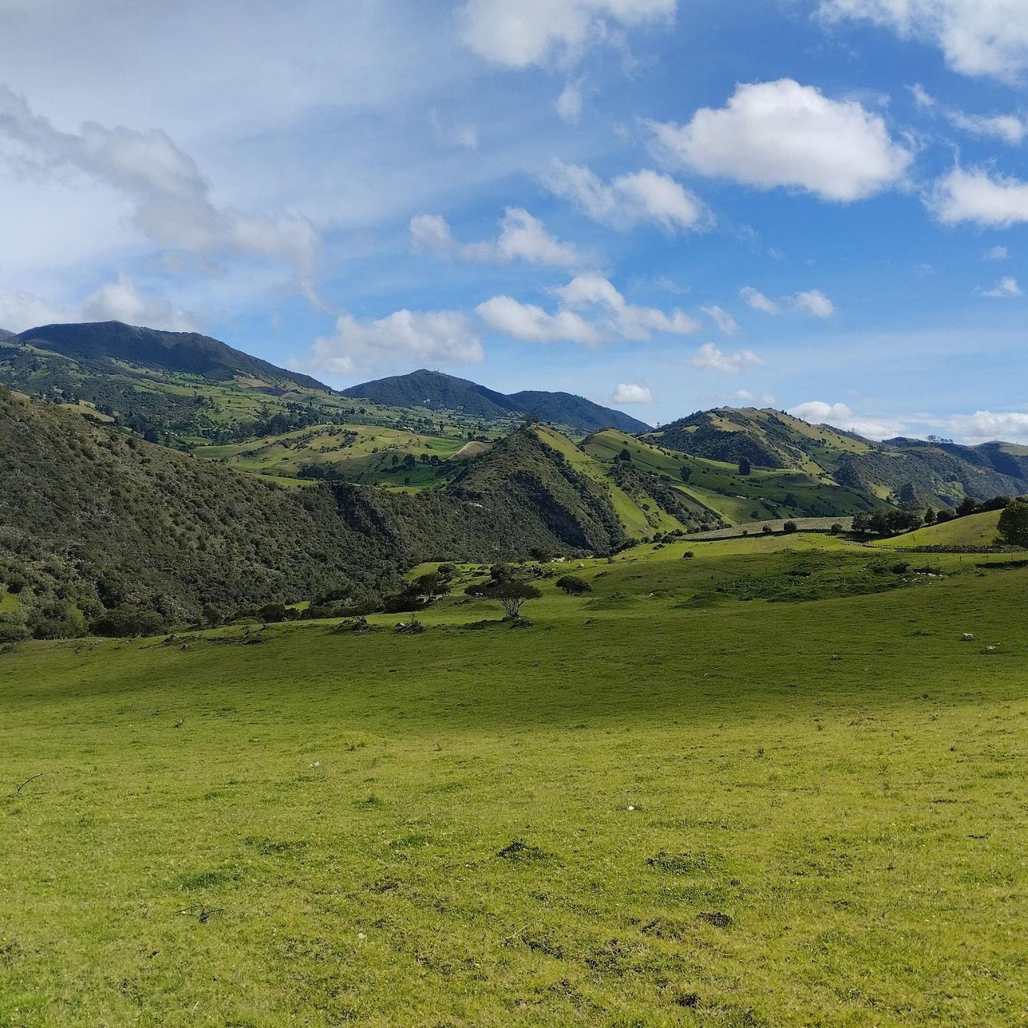
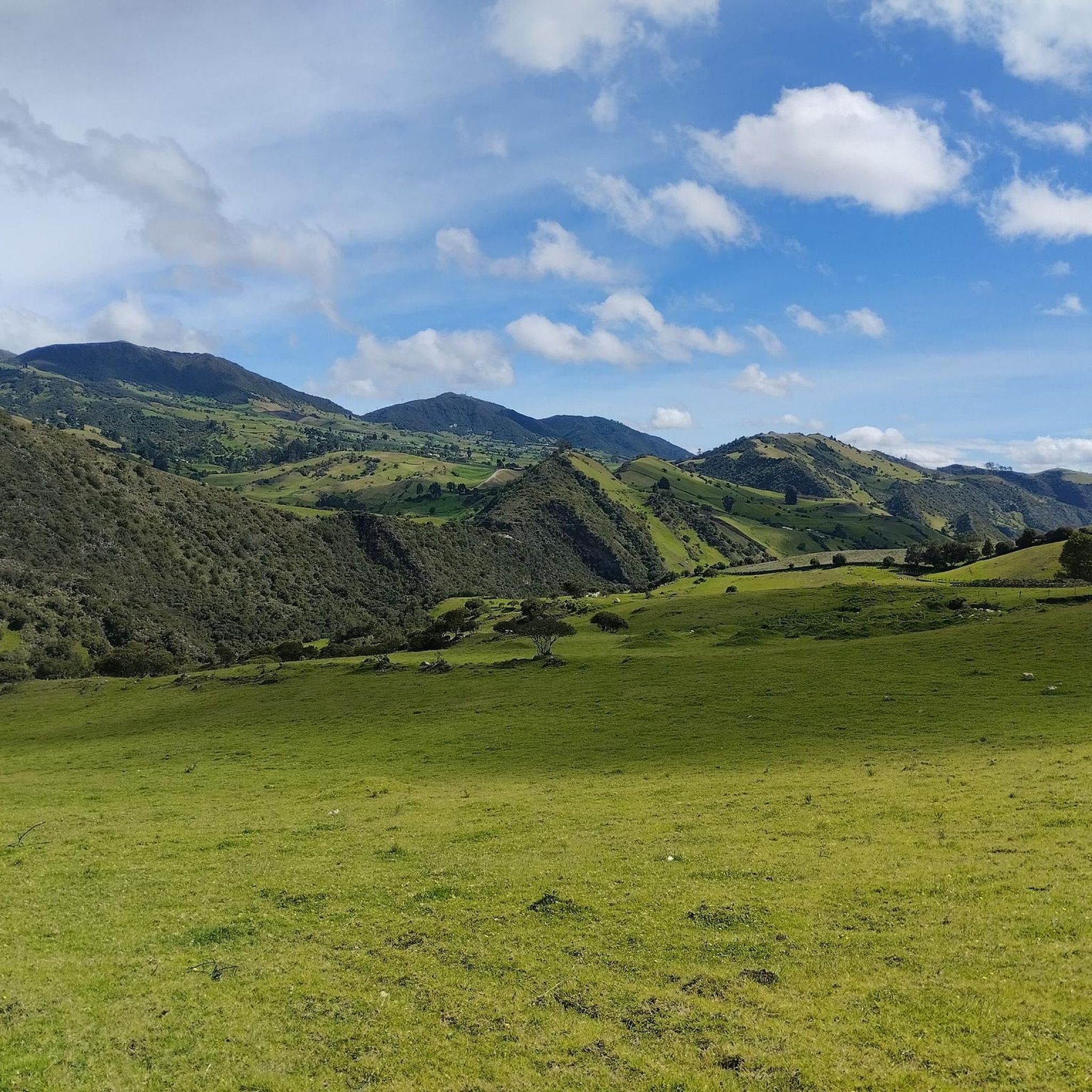
Road cycling routes in Pasca are situated in the Andes mountains of Colombia, characterized by significant elevation changes and high-altitude terrain. The region offers challenging climbs and descents, with elevations ranging from 2,000 meters (6,600 ft) to 3,500 meters (11,500 ft). This mountainous landscape provides a dynamic environment for road cyclists, featuring winding roads and panoramic views. The area's proximity to the Páramo del Sumapaz contributes to its unique natural features.
Best road cycling routes in Pasca
- The most popular…
Last updated: June 28, 2026
4.7
(3)
81
riders
89.3km
05:24
2,330m
2,330m
Hard road ride. Very good fitness required. Mostly well-paved surfaces and easy to ride.
32
riders
83.1km
06:01
2,180m
2,180m
Hard road ride. Very good fitness required. Some segments of this route may be unpaved and difficult to ride.

Sign up for free
5.0
(1)
30
riders
34.3km
01:54
720m
720m
Moderate road ride. Good fitness required. Mostly well-paved surfaces and easy to ride.
21
riders
31.8km
01:47
620m
620m
Moderate road ride. Good fitness required. Some segments of this route may be unpaved and difficult to ride.
4.3
(3)
17
riders
44.0km
02:43
1,080m
1,080m
Hard road ride. Very good fitness required. Mostly well-paved surfaces and easy to ride.
Get access to more routes and recommendations from other explorers.
Sign up for free
Already have an account?
Our route recommendations are based on thousands of hikes, rides, and runs completed by other people on komoot.
Start today with a free account
Your next adventure awaits.
Login or Signup
Popular around Pasca
Tips from the Community


Don't forget to bring moisturizer.
0
0

It's a tough route. You need to be in good shape. Those who say it's a walk in the park or an easy climb are the ones who drive cars or ride motorcycles. They sit comfortably, sleep, and don't feel a thing.
0
0

Alto de San Miguel distance from Sibate to the toll 7Km moderate climb. On weekends, the road is very busy so be very careful with vehicles. There are safer alternative routes for making the journey by MTB.
0
0
Weekend very busy no bad early on the morning. To much traffic now a days.
0
0

Beautiful landscapes and delicious desserts
0
0
be careful with the cars now a days is a high busy road.
0
0

It is a good RIDE to go to start shooting and with the family
0
0
Frequently Asked Questions
What kind of terrain can I expect on road cycling routes in Pasca?
Road cycling in Pasca, situated in the Andes mountains of Colombia, is characterized by significant elevation changes and high-altitude terrain. You'll encounter challenging climbs and descents, with elevations ranging from 2,000 meters (6,600 ft) to 3,500 meters (11,500 ft). The routes feature winding mountain roads and offer panoramic views of the Andean landscape.
Are there road cycling routes suitable for beginners in Pasca?
While many routes in Pasca are considered moderate to difficult due to the mountainous terrain and significant elevation changes, there are some options that are less demanding. For example, the Casa Fusa – Fusagasugá loop from Fusagasugá is a moderate 21.7-mile (34.9 km) trail leading through rolling hills, which might be a good starting point for those newer to high-altitude cycling.
How challenging are the road cycling routes in Pasca generally?
The road cycling routes in Pasca are generally considered challenging, with ability levels ranging from moderate to difficult. This is due to the region's high-altitude Andean climbs and substantial elevation gains. For instance, routes like the Alto de San Miguel – Alto de San Miguel loop from Fusagasugá involve over 2,000 meters of elevation gain.
Are there long-distance road cycling options in Pasca?
Yes, Pasca offers several long-distance road cycling routes. Many of these are loops that provide extensive rides through the mountainous landscape. The Alto de San Miguel – Alto de San Miguel loop from Comuneros, for example, is a difficult 51.6-mile (83.1 km) path, offering significant mileage and elevation.
Are there circular road cycling routes available in Pasca?
Yes, many of the popular road cycling routes in Pasca are circular loops, allowing you to start and end your ride in the same location. Examples include the Alto de San Miguel – Alto de San Miguel loop from Fusagasugá and the Fusagasugá loop from Fusagasugá.
What natural attractions or landmarks can I see while road cycling in Pasca?
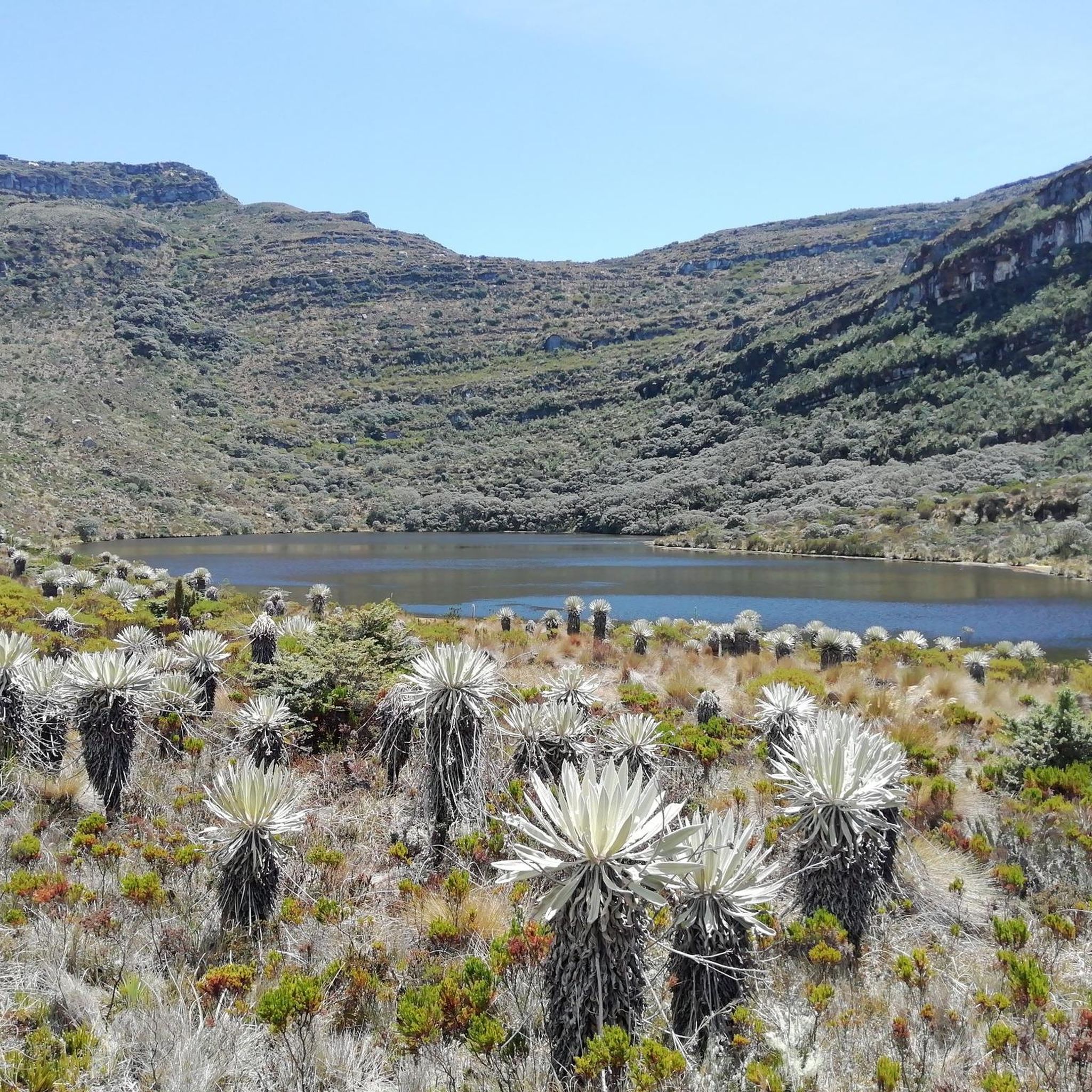
While cycling in Pasca, you'll be close to the unique Páramo del Sumapaz, the world's largest high-altitude wetland ecosystem. You might encounter stunning natural features like the Chisacá Lagoon or the La Regadera Reservoir. The region is also known for its unique flora, such as the frailejón, which can be seen in areas like the Frailejones Valley between Media Naranja and Pasca.
Are there specific viewpoints offering panoramic views along the routes?
Given Pasca's location in the Andes mountains, many road cycling routes offer breathtaking panoramic views of the surrounding landscapes. The winding mountain roads frequently open up to vistas of the high-altitude páramo ecosystem and the valleys below. The Frailejones Valley is specifically noted as a viewpoint.
What is the best time of year for road cycling in Pasca?
Pasca experiences a mild climate with consistent temperatures throughout the year due to its high-altitude Andean location. This means road cycling is generally possible year-round. However, it's always advisable to check local weather forecasts for specific conditions, as mountain weather can be unpredictable, and misty conditions are common in the páramo.
Are there facilities like cafes or restaurants along the road cycling routes?
While specific cafes directly on every route are not detailed, the region has settlements like Pasca and Fusagasugá where you can find amenities. For example, La Aguadita is a restaurant highlighted in the area, and towns like Pasca itself offer places to refuel.
What do other road cyclists enjoy most about road cycling in Pasca?
The road cycling experience in Pasca is highly rated by the komoot community, with an average score of 4.65 stars from 9 reviews. Cyclists often praise the challenging high-altitude Andean climbs, the significant elevation changes, and the stunning panoramic views offered by the winding mountain roads. The unique natural environment, especially the proximity to the Páramo del Sumapaz, is also a significant draw.
How many road cycling routes are available in Pasca?
There are over 10 road cycling routes available in Pasca, offering a variety of distances and difficulty levels. These routes cater to different preferences, from moderate rides through rolling hills to difficult, long-distance loops with substantial elevation gains.
Can I find routes that pass through specific towns or settlements?
Yes, some routes are designed to pass through or start from local towns. For instance, the Lucho Herrera Monument – Fusagasugá loop from Universidad de Cundinamarca starts near a university and includes the town of Fusagasugá, allowing for access to local amenities and a glimpse into the regional life.
Most popular routes in Pasca
Most popular attractions in Pasca

Get inspired with the komoot mobile app


Explore more
Browse the best Road cycling routes in other regions.
