The best MTB trails in Carmen De Carupa
5.0
(8)
110
riders
37
rides
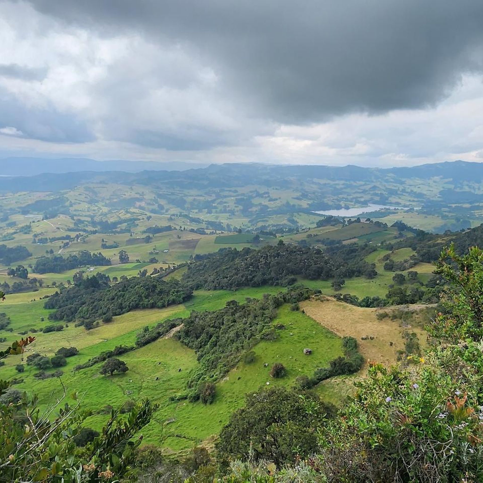
Mountain biking in Carmen De Carupa offers routes through high-altitude mountainous terrain, with elevations close to 3,000 meters above sea level. The region is characterized by Andean peaks and páramos, providing challenging ascents and panoramic views. Natural features like Embalse El Hato and Cerro Chegua, which reaches 3,600 meters, contribute to varied landscapes for mountain bike exploration.
Best mountain bike trails in Carmen De Carupa
- The most popular mountain bike trail is Laguna de Cucunubá loop from Ubaté, an…
Last updated: June 28, 2026
12
riders
32.8km
02:44
700m
700m
Moderate mountain bike ride. Good fitness required. Suitable for all skill levels.
5.0
(1)
9
riders
29.9km
02:06
320m
320m
Moderate mountain bike ride. Good fitness required. Suitable for all skill levels.

Sign up for free
5.0
(1)
6
riders
18.8km
01:56
580m
580m
Moderate mountain bike ride. Good fitness required. Suitable for all skill levels.
5.0
(2)
8
riders
44.6km
02:52
580m
580m
Moderate mountain bike ride. Good fitness required. Suitable for all skill levels.
5.0
(1)
6
riders
30.2km
02:12
540m
540m
Moderate mountain bike ride. Good fitness required. Suitable for all skill levels.
Get access to more routes and recommendations from other explorers.
Sign up for free
Already have an account?
Our route recommendations are based on thousands of hikes, rides, and runs completed by other people on komoot.
Start today with a free account
Your next adventure awaits.
Login or Signup
Popular around Carmen De Carupa

Tips from the Community

Carmen de Carupa and the path of Charquira connect with the footprint plate to the town and you can go towards Simijaca and Piedra Colgada in Susa.
0
0
perfect place for endurance training
0
0
Frequently Asked Questions
What kind of terrain can I expect when mountain biking in Carmen De Carupa?
Carmen De Carupa offers high-altitude mountainous terrain, with elevations reaching close to 3,000 meters above sea level. You'll encounter challenging ascents and descents through Andean peaks and páramos, often providing spectacular panoramic views. The region also features natural landmarks like the tranquil Embalse El Hato and the commanding Cerro Chegua, which reaches 3,600 meters, adding varied landscapes to your rides.
Are there mountain bike trails suitable for beginners in Carmen De Carupa?
Yes, Carmen De Carupa has options for various skill levels. While many routes involve significant elevation changes, there are 2 easy mountain bike trails available. These routes offer a gentler introduction to the region's beautiful landscapes.
How many mountain bike trails are available in Carmen De Carupa?
There are 39 mountain bike trails documented in Carmen De Carupa. These routes range from moderate to difficult, offering diverse experiences for riders.
What are some notable natural features or viewpoints I can see along the mountain bike trails?
Many routes offer stunning views of the region's natural beauty. You can find viewpoints like Sucre Viewpoint, Piedra Colgada Viewpoint, and views of the Neusa Reservoir. The Embalse El Hato is also a significant natural attraction, offering a serene environment amidst the mountains.
What do other mountain bikers enjoy most about the trails in Carmen De Carupa?
The mountain bike trails in Carmen De Carupa are highly rated by the komoot community, with an average score of 5.0 stars from more than 5 reviews. Riders often praise the challenging high-altitude terrain, the incredible and lively landscapes, and the panoramic views offered by routes that explore areas like the Laguna de Cucunubá and feature significant elevation changes.
Are there any circular mountain bike routes in the area?
Yes, many of the mountain bike trails in Carmen De Carupa are designed as loops. For example, the Laguna de Cucunubá loop from Ubaté is a popular choice, as is the Chivos Climb – Charquira Placa Huella loop from Ubaté, offering varied surfaces and elevation changes.
What is the typical duration for mountain bike trails in Carmen De Carupa?
The duration of mountain bike trails varies depending on their length and difficulty. For instance, a moderate route like the Laguna de Cucunubá loop from Ubaté, which is 29.9 km, typically takes around 2 hours and 5 minutes to complete. Longer routes, such as the Viewpoint – Fuquene Viewpoint loop from Ubaté (44.5 km), can take over 2 hours and 50 minutes.
Are there any family-friendly mountain bike trails in Carmen De Carupa?
While many trails in Carmen De Carupa are moderate to difficult due to the mountainous terrain, there are 2 easy routes that might be more suitable for families or those looking for a less strenuous ride. It's always recommended to check the specific trail details for elevation and surface conditions to ensure it matches your family's skill level.
What is the best time of year to go mountain biking in Carmen De Carupa?
Carmen De Carupa, being at a high altitude close to 3,000 meters, experiences a cool climate year-round. While specific seasonal recommendations aren't detailed, the region's 'between clouds' characteristic suggests that weather can be variable. It's advisable to check local weather forecasts before heading out, especially considering potential changes in high-altitude conditions.
Are there any advanced mountain biking routes for experienced riders?
Yes, Carmen De Carupa offers 17 difficult mountain bike routes designed for experienced riders. These trails often feature significant elevation gains and challenging terrain, providing a rewarding experience for those seeking a demanding ride in the high Andes.
Are there any trails that offer views of the Laguna de Fúquene?
Yes, some routes provide views of the broader region, including the Laguna de Fúquene. For example, the Viewpoint – Fuquene Viewpoint loop from Ubaté is a moderate trail that offers scenic vistas, including the View of Laguna de Fúquene from Monroy.
What are the typical elevation changes on mountain bike trails in Carmen De Carupa?
Due to its high-altitude mountainous terrain, mountain bike trails in Carmen De Carupa feature significant elevation changes. For instance, a moderate route like the Chivos Climb loop from Ubaté involves over 580 meters of ascent and descent, while the Chivos Climb – Charquira Placa Huella loop from Ubaté has nearly 700 meters of elevation gain and loss.
Most popular routes in Carmen De Carupa
Most popular attractions in Carmen De Carupa

Get inspired with the komoot mobile app


Explore more
Browse the best MTB trails in other regions.
