The best MTB trails in Chiquinquirá
4.5
(14)
97
riders
22
rides
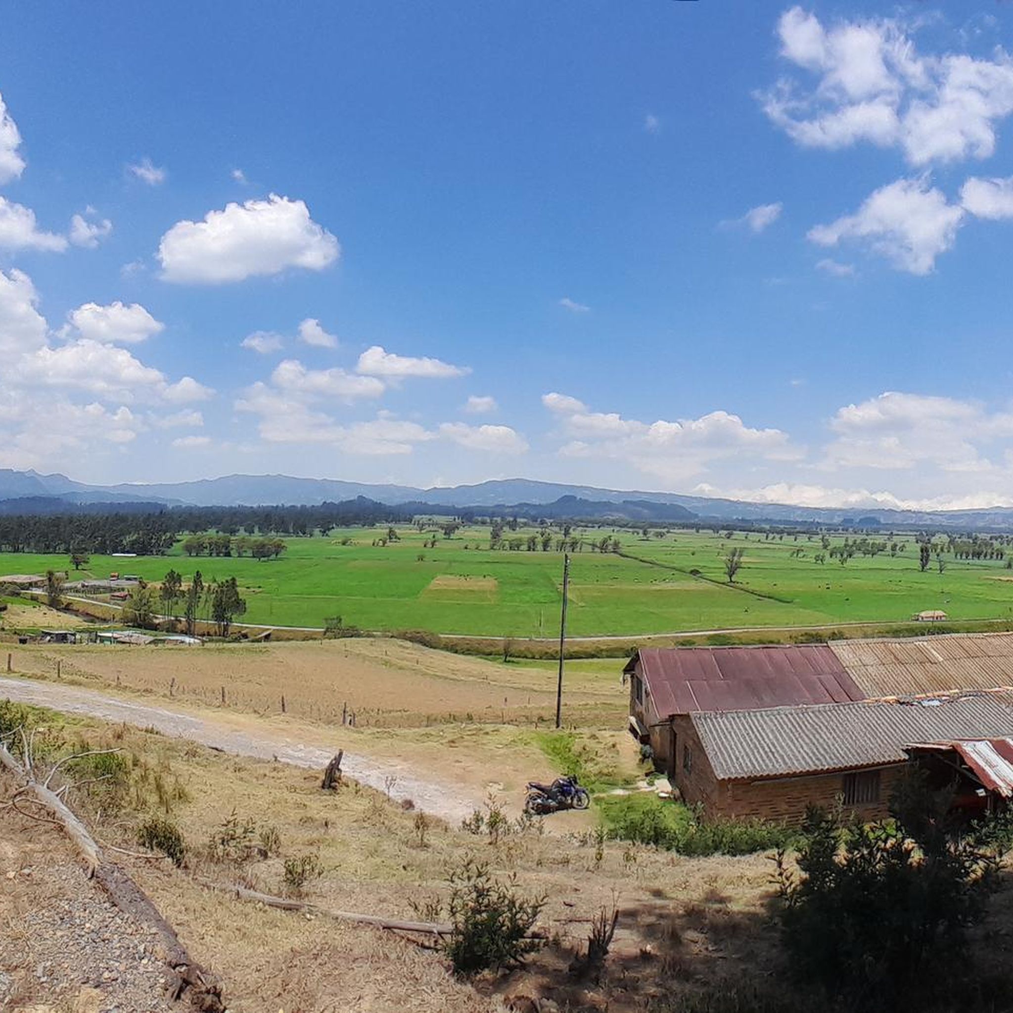
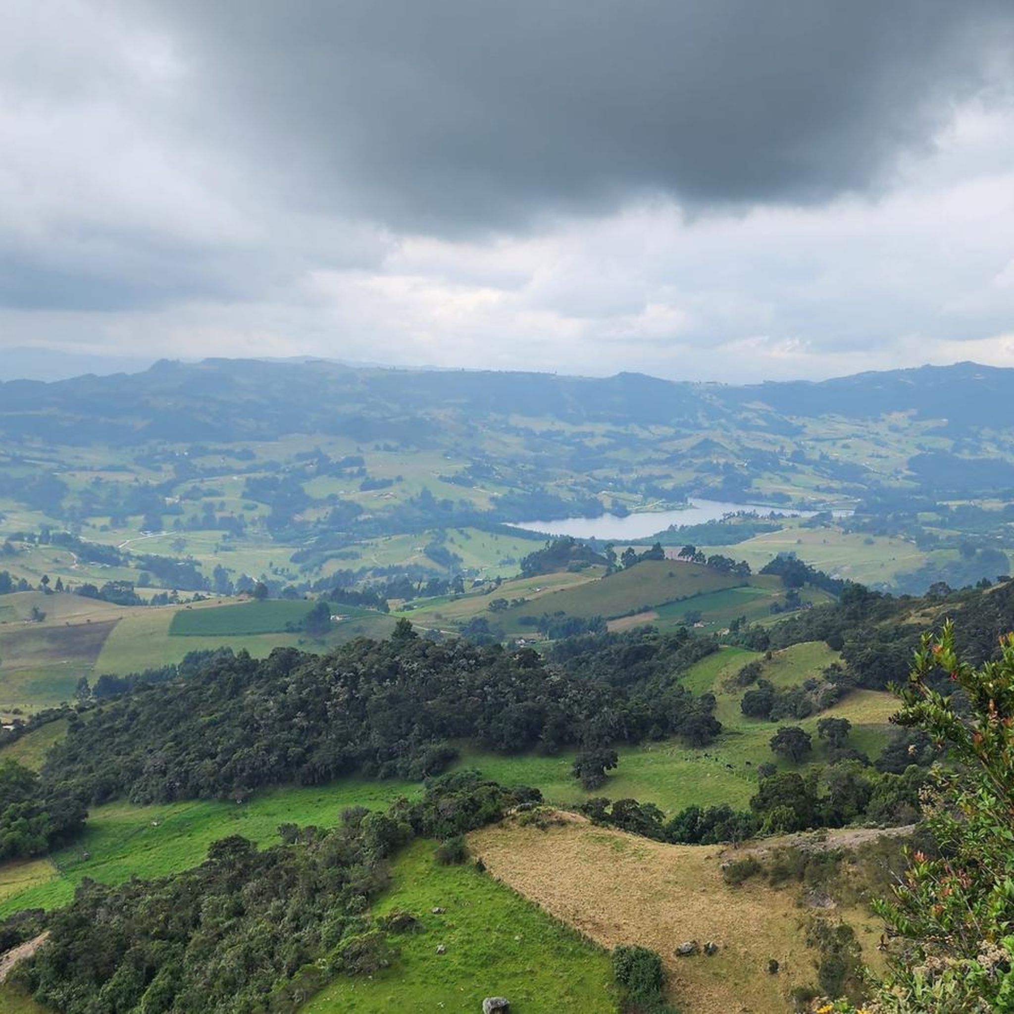
Mountain biking in Chiquinquirá, located in the Colombian Department of Boyacá, offers diverse topography within the Andean Highlands. The region is characterized by green hills, agricultural fields, and varied terrain, including paved and unpaved roads and trails. Situated at an elevation of 8,386 feet (2,556 meters) above sea level, the area provides a range of routes suitable for different skill levels.
Best mountain bike trails in Chiquinquirá
- The most popular mountain bike trail is Villa de Leyva – Villa de Leyva loop from Sutamarchán, a 22.5 miles (36.2 km) trail that takes 2 hours 7 minutes to complete. This moderate route traverses challenging elevations through the Andean landscape.
- Another top favourite among local mountain bikers is Piedra Colgada Viewpoint – Piedra Colgada Mountain loop from Simijaca, a difficult 30.3 miles (48.7 km) path. This route features a significant elevation gain, demanding very good fitness.
- Local mountain bikers also love the SUTAMERCHAN – Ecce Homo Sanctuary loop from Sutamarchán, a 12.9 miles (20.8 km) trail leading through agricultural fields and the serene Andean environment, often completed in about 1 hour 40 minutes.
- Mountain biking in Chiquinquirá is defined by green hills, agricultural fields, and varied terrain. The network offers options for moderate to difficult ability levels.
- The routes in Chiquinquirá are highly rated by the komoot community with an average score of 4.3 stars from more than 10 reviews. More than 100 mountain bikers have used komoot to explore Chiquinquirá's varied terrain.
Last updated: July 1, 2026
5.0
(3)
18
riders
34.9km
02:06
280m
280m
Moderate mountain bike ride. Good fitness required. Suitable for all skill levels.
4.5
(4)
14
riders
36.2km
02:07
340m
340m
Moderate mountain bike ride. Good fitness required. Suitable for all skill levels.

Sign up for free
8
riders
48.6km
03:59
1,100m
1,100m
Hard mountain bike ride. Very good fitness required. Suitable for all skill levels.
10
riders
40.3km
02:59
910m
910m
Hard mountain bike ride. Very good fitness required. Suitable for all skill levels.
5.0
(2)
7
riders
22.3km
01:48
400m
400m
Moderate mountain bike ride. Good fitness required. Suitable for all skill levels.
Get access to more routes and recommendations from other explorers.
Sign up for free
Already have an account?
Our route recommendations are based on thousands of hikes, rides, and runs completed by other people on komoot.
Start today with a free account
Your next adventure awaits.
Login or Signup
Popular around Chiquinquirá
Tips from the Community

Casa Terracota, often described as the „world's largest ceramic artwork". It is located just outside the historic colonial town of Villa de Leyva. The 500-square-meter house was designed by Colombian architect and environmentalist Octavio Mendoza Morales and built almost entirely by hand. It is made entirely of fired clay (terracotta), without additional supporting materials such as concrete or steel beams. Like a giant clay pot, the entire structure was "fired" at high temperatures to make it resistant to water and earthquakes.
0
0

The food is delicious. Known for its sausages.
0
0

Hard route... very good
0
0

A place that, although full of tourists, is pleasant for its architecture and its options for rest and visits.
0
0
Unique and unusual architect built house with entertaining tour guide
1
0

Main square of Villa de Leyva. Completely paved. It is not highly recommended for biking. It is better to get off and walk.
0
0

Ideal in MTB or GRAVEL, route if it is raining a lot, it is not recommended. BRING GOOD MOSQUITO REPELLENT, because in five seconds they drive you crazy.
0
0

walk along the edge of the hanging stone Susa, bring sunscreen, a jacket for the wind and suddenly the rain.
0
0
Frequently Asked Questions
How many mountain bike trails are available in Chiquinquirá?
Chiquinquirá offers a network of over 25 mountain bike trails. These routes cater to various skill levels, with a good mix of moderate and difficult options for exploration.
What is the typical difficulty level of mountain bike trails in Chiquinquirá?
The mountain bike trails in Chiquinquirá are predominantly rated as moderate to difficult. There are 13 moderate routes and 12 difficult routes, often featuring significant elevation gains and varied terrain, including unpaved roads and stony sections.
Are there any easy mountain bike trails for beginners in Chiquinquirá?
Currently, the komoot guide for Chiquinquirá does not list any trails specifically rated as 'easy'. Most routes are moderate to difficult, suggesting that a basic level of fitness and mountain biking experience is recommended for the area.
What kind of terrain can I expect on mountain bike trails around Chiquinquirá?
You can expect diverse terrain, ranging from green hills and agricultural fields to unpaved roads and stony sections. The routes often traverse challenging elevations within the Andean Highlands, providing a mix of natural landscapes and rural paths.
Are there any circular mountain bike routes in Chiquinquirá?
Yes, many of the mountain bike routes in Chiquinquirá are designed as loops. Examples include the Villa de Leyva – Villa de Leyva loop from Sutamarchán, a moderate 36.2 km ride, and the more challenging Piedra Colgada Viewpoint – Piedra Colgada Mountain loop from Simijaca, which covers 48.7 km with significant elevation.
What are some longer, more challenging mountain bike routes in the region?
For experienced riders seeking a challenge, the Piedra Colgada Viewpoint – Piedra Colgada Mountain loop from Simijaca is a difficult 48.7 km route with over 1,100 meters of elevation gain. Another demanding option is the Boquemonte loop from Estacion Chiquinquira, a difficult 40.3 km ride with over 900 meters of ascent.
What is the best time of year for mountain biking in Chiquinquirá?
Chiquinquirá experiences a cool mountain climate with an average yearly temperature of 14°C (58°F). This makes it comfortable for sustained physical activity throughout much of the year. However, it's always advisable to check local weather forecasts before heading out, especially during rainy seasons.
What do other mountain bikers enjoy most about the trails in Chiquinquirá?
The trails in Chiquinquirá are highly rated by the komoot community, with an average score of 4.3 stars from over 14 reviews. Riders often praise the diverse topography, the scenic green hills, agricultural fields, and the varied terrain that offers both moderate and challenging experiences.
Are there any notable natural features or landmarks to see along the mountain bike routes?
While specific attractions along every route aren't detailed, the region itself is known for its natural beauty. You'll encounter green hills, agricultural fields, and serene Andean environments. The area's name, 'Place of swamps covered with fog,' hints at its mystical natural surroundings, including mist-clad marshes. Juan Pablo II Park also offers trails and panoramic views.
What is the elevation of Chiquinquirá and how does it affect mountain biking?
Chiquinquirá is situated at an elevation of 2,556 meters (8,386 feet) above sea level. This high altitude means that routes often involve significant elevation gains, demanding good to very good fitness levels. Riders should be prepared for thinner air and cooler temperatures compared to lower elevations.
Can I find routes that pass through different towns or offer diverse landscapes?
Yes, some routes offer extensive journeys through the Cundiboyacense high plateau, passing through various towns and showcasing diverse landscapes. For example, the 'Zipa – Chiquinquirá by mountain' route, though not detailed in this guide, is known to be a challenging 100 km journey through towns like Cogua, Tausa, Carmen de Carupa, Susa, and Simijaca, featuring unpaved roads and stony sections.
Most popular routes in Chiquinquirá

Get inspired with the komoot mobile app


Explore more
Browse the best MTB trails in other regions.
