The 4 Most Amazing Peaks around Sasbach am Kaiserstuhl
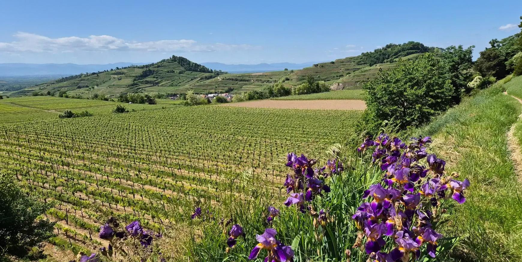
Best mountain peaks around Sasbach am Kaiserstuhl are found within the Kaiserstuhl mountain range, a region of volcanic origin characterized by prominent elevations and hills. This area offers panoramic views, historical insights, and unique natural features. The landscape provides a combination of natural beauty and recreational opportunities for visitors.
Best mountain peaks around Sasbach am Kaiserstuhl
- The most popular mountain peaks is Neunlinden Tower, a viewpoint that is an observation tower offering panoramic views across the Rhine plain, Black…
Last updated: May 19, 2026
Neunlinden Tower
Highlight • Viewpoint
Translated by Google •
Tip by

Eichelspitz Tower
Highlight • Viewpoint
Translated by Google •
Tip by

Sign up now to discover places like this
Get recommendations on the best single tracks, peaks, & plenty of other exciting outdoor places.
Sign up for free
Mondhalde Pavilion and Viewpoint
Highlight • Viewpoint
Translated by Google •
Tip by

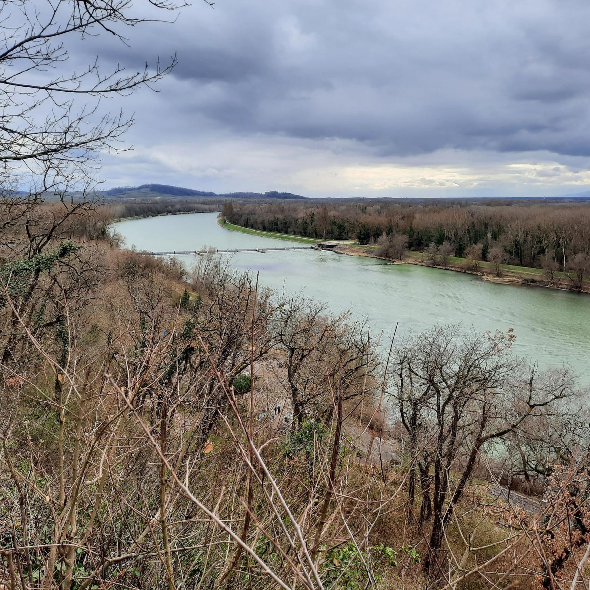
Schlossberg Pavilion and the Höhingen Castle Ruins
Highlight • Castle
Translated by Google •
Tip by

Totenkopf Summit
Highlight • Summit
Translated by Google •
Tip by

Sign up for free to discover even more peaks around Sasbach am Kaiserstuhl.
Sign up for free
Already have an account?
Start today with a free account
Your next adventure awaits.
Login or Signup
Popular around Sasbach am Kaiserstuhl
Aktiv in die längeren Tage – Frühlingsradeln rund um den Kaiserstuhl
Cycling around Sasbach am Kaiserstuhl
Hiking around Sasbach am Kaiserstuhl
Road Cycling Routes around Sasbach am Kaiserstuhl
MTB Trails around Sasbach am Kaiserstuhl
Running Trails around Sasbach am Kaiserstuhl
Gravel biking around Sasbach am Kaiserstuhl
Mountain Hikes around Sasbach am Kaiserstuhl
Other adventures around Sasbach am Kaiserstuhl

Tips from the Community

The actual summit of the Totenkopf is located just above the Neulindenturm tower, accessible via a narrow, slightly overgrown path from the main trail. The summit is completely wooded, so it offers no view. A boundary stone (?) marks the highest point. You can walk there, but you don't have to...
2
0

Nice rest area, nice view. Well attended.
0
0

Insect hotel
0
0

It's the summit! We had to build the summit cross ourselves
3
0

Castle type: hilltop castle, hilltop location Today: only remains of ruins Date of origin: before 1064, first documented mention in 1259 Not much is known for sure about the beginning of the castle complex on the Schlossberg. However, castles are said to have existed as early as 1064 when Achkarren was first mentioned in writing on the occasion of the transfer to the Ottmarsheim monastery by King Heinrich IV. These were then expanded several times in the following centuries. After the family castle of the Lords of Üsenberg, Üsenberg Castle on the Üsenberg near Breisach, was probably destroyed by the Breisach family in the 1240s, they are said to have made Höhingen Castle available to the Üsenbergers as a replacement. It was first explicitly mentioned in writing in 1259. Around 1353 the castle was briefly pledged to the Schnewlin im Hof. In 1392, Margrave Hesso von Hachberg bought Werner von Hornberg's share in Höhingen Castle, and he already owned the other part. In 1415 the castle, together with the Margraviate of Baden-Hachberg, came to Margrave Bernhard I of Baden, who bought it from Margrave Otto II of Hachberg, the last of this branch of Baden. Otto was allowed to use Höhingen Castle until the end of his life in 1418. ... After centuries of existence, the castle itself was burned down for the first time in May 1525 during the peasant uprising with the participation of Achkarr farmers. This made Höhingen Castle one of only two margravial castles destroyed by the peasants, although a number of them had been occupied by the peasants. Long-standing disputes between the village of Achkarren and the Margraves over the use of the forest are suspected to be the motive. The farmers later had to compensate Margrave Ernst I of Baden-Durlach for the damage. ... In 1620, Margrave Georg Friedrich von Baden-Durlach rebuilt the castle as a defensive structure and put it into a state of defense, since the events of the war in the Rhine Valley and the Breisach Fortress could be observed well from here. In a contemporary report from the mayor of Breisach to the imperial governor of the Austrian provinces in Waldshut, Höhingen Castle, often referred to as a castle, is described as follows: “Its position was excellent, as it stood in the middle of the mountain's crest on hard rock, which because of its height had difficult access, and could not be commanded from any of the surrounding places. The building was surrounded by strong masonry, on the one hand with a deep ditch, on the other hand it encountered an inaccessible praecipitium [= abyss], which is used from below for a stone pit. The castle had a good cistern.” In 1633 there was an attack from Breisach. The Imperial Catholic troops captured and sacked the castle currently held by the Swedes and supported by the Protestants of Ihring. According to records at the time, the spoils included around 15,000 liters of wine. Property of Ihringen citizens stored in the castle was also lost. There are even reports of the loss of 200 horses and 300 head of cattle, which allows conclusions to be drawn about the dimensions of the facility. After several subsequent disputes about the castle, it was finally set on fire by the now imperial garrison in 1638, when it could no longer be held militarily. (Excerpt from Wikipedia)
0
0

The top of the skull. Unfortunately no view. Just this landmark. What remains, you can see the radio tower on the skull
1
0

This summit is very inconspicuous compared to the Neunlindenturm right next door
2
0

The Neunlindenturm stands on the Totenkopf, the highest mountain in the Kaiserstuhl. The tower is 14m high and offers a great view of the Kaiserstuhl, the Black Forest, the Vosges and the Rhine plain.
8
0
Frequently Asked Questions
What are the most prominent elevations and viewpoints around Sasbach am Kaiserstuhl?
The Kaiserstuhl region, where Sasbach am Kaiserstuhl is located, features several prominent elevations and viewpoints. The highest point is Totenkopf, at 556 meters, home to the Neunlinden Tower, which offers panoramic views of the Rhine plain, Black Forest, and Vosges mountains. Other notable viewpoints include Mondhalde Pavilion and Viewpoint and Eichelspitz Tower, both providing excellent vistas of the surrounding Kaiserstuhl landscape.
Are there historical sites or ruins to explore on the peaks near Sasbach am Kaiserstuhl?
Yes, the region is rich in history. Limberg, a 272-meter-high mountain northwest of Sasbach, was a strategically important location in prehistoric, Roman, and early medieval times and is home to the ruins of the "Limburg" fortress. You can also visit the Schlossberg Pavilion and the Höhingen Castle Ruins, which offer insights into the area's past, including its role during the peasant uprising and the Thirty Years' War.
What kind of natural features can I expect to see on these elevations?
The Kaiserstuhl region is known for its unique volcanic origin, which shapes its landscape. You'll find diverse flora and fauna, especially along the scientific nature trail on Limberg. The prominent hills are often covered with vineyards and woodlands, offering scenic beauty. From viewpoints like the Neunlinden Tower, you can observe the vast Rhine plain, the Black Forest, and even the Vosges mountains.
What are the best hiking opportunities around Sasbach am Kaiserstuhl's peaks?
The area offers numerous hiking opportunities. The Totenkopf is a popular destination for hikers, with routes like the 17-kilometer Neunlindenpfad leading over it and other high elevations. The Limberg features a 6.5 km scientific nature trail. For more options, you can explore various trails listed in the Hiking around Sasbach am Kaiserstuhl guide, which includes routes like the 'Burg Limberg Ruins – View of the Vosges loop'.
Are there family-friendly walks or activities on the peaks?
Many of the trails through vineyards and woodlands, especially around Litzelberg, are suitable for families. The scientific nature trail on Limberg, with its numerous information boards, can be an engaging educational experience for children. The viewpoints, such as Mondhalde Pavilion and Viewpoint, often have seating areas perfect for a family break.
Can I bring my dog on the hiking trails around the Kaiserstuhl peaks?
Yes, the hiking trails in the Kaiserstuhl region are generally dog-friendly. Many visitors enjoy exploring the vineyards and woodlands with their canine companions. Always ensure your dog is on a leash where required and respect local wildlife and other hikers.
What is the best time of year to visit the Kaiserstuhl peaks?
The Kaiserstuhl region is beautiful year-round, but spring and autumn are particularly popular. In spring, the vineyards and orchards are in bloom, while autumn offers stunning colors and the grape harvest season. Summer is also pleasant, though it can be warmer, and winter can provide a unique, quiet experience, especially on clear days with views of snow-capped mountains in the distance.
What other outdoor activities are available near these mountain peaks?
Beyond hiking, the Kaiserstuhl region is excellent for cycling. You can find numerous routes for road cycling and mountain biking. Check out the Road Cycling Routes around Sasbach am Kaiserstuhl guide and the MTB Trails around Sasbach am Kaiserstuhl guide for detailed routes, including options like the 'View from Limburg Ruins – Rhine View Kiosk loop'.
Are there any specific challenges or difficulties on the trails to the peaks?
While the Kaiserstuhl features hills rather than towering mountains, some paths can be steep or narrow. For instance, the path to the Totenkopf Summit can be quite steep and narrow. Always check the difficulty ratings of specific routes before you go. Many trails are moderate, but easier options are also available for a more relaxed experience.
What do visitors enjoy most about the peaks around Sasbach am Kaiserstuhl?
Visitors consistently praise the stunning panoramic views from various viewpoints, especially from the Neunlinden Tower on Totenkopf. The combination of natural beauty, historical intrigue, and the opportunity for active recreation like hiking and cycling are also highly valued. Many appreciate the well-maintained trails and the unique volcanic landscape.
Is there parking available near the main viewpoints and trailheads?
Yes, many popular viewpoints and trailheads, such as the Mondhalde Pavilion and Viewpoint, offer parking facilities. It's advisable to check specific location details for parking availability before your visit, especially during peak seasons.
Most popular routes around Sasbach am Kaiserstuhl
Most popular attractions around Sasbach am Kaiserstuhl

Get inspired with the komoot mobile app


Explore more
See even more amazing summits around Sasbach am Kaiserstuhl with these guides:
