The best walks and hikes around Harpstedt
4.6
(3367)
12,744
hikers
87
hikes
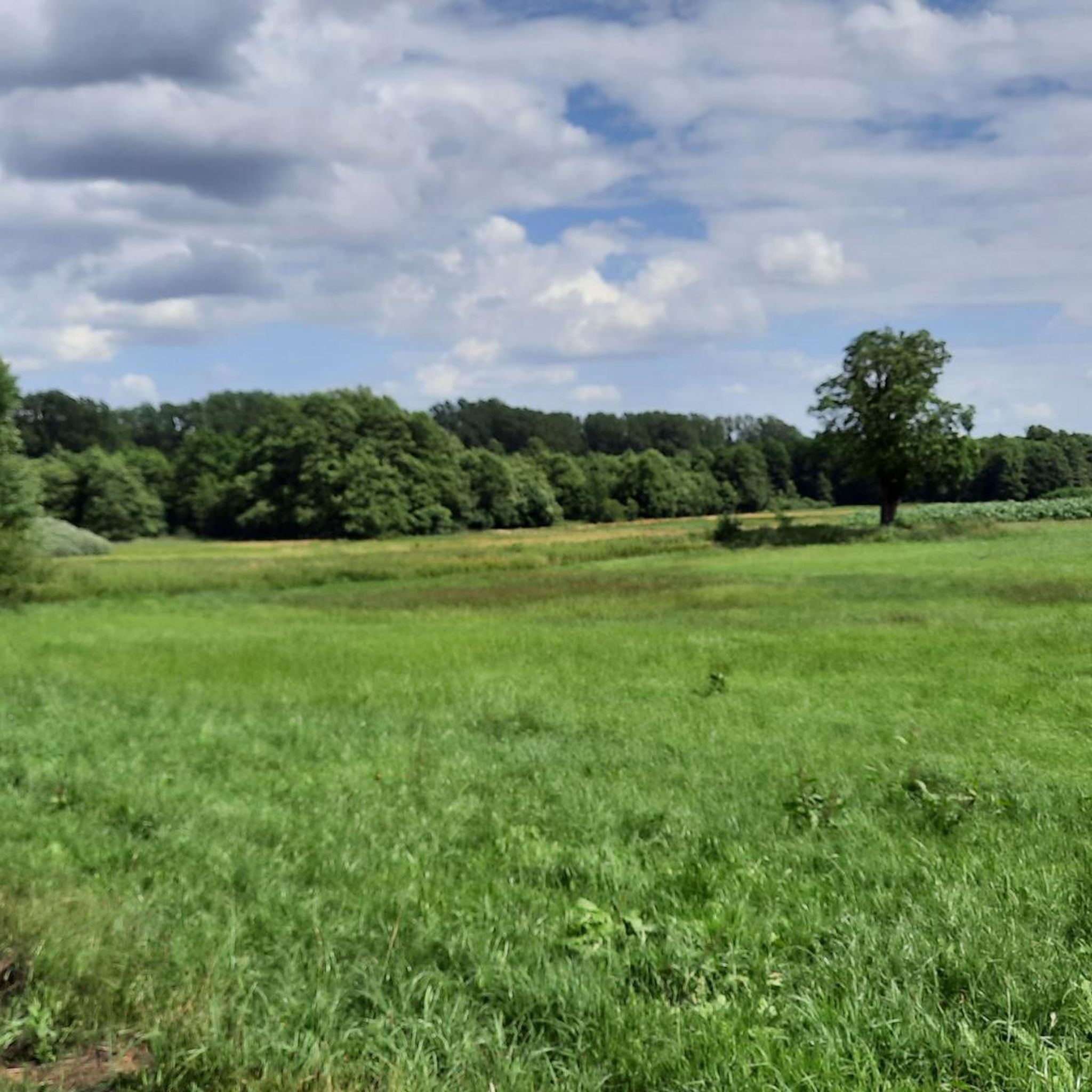
Hiking around Harpstedt offers diverse landscapes within the Wildeshauser Geest Nature Park, characterized by a blend of forests, meadows, and riverine environments. The region's terrain is shaped by sandy soils, heath, and woodlands, with the Delme River influencing many trails. The Harpstedt Forest provides well-marked routes through varied flora and fauna, including small streams and ponds. A notable feature is the "Ocean Bridge," a wooden structure crossing the marshy Delmetal.
Best hiking trails around Harpstedt
- The most popular hiking route is Forest Kindergarten Harpstedt – Ozeanbrücke (Ocean Bridge) Over the Moor loop from Harpstedt, a 3.6 miles (5.7 km) trail that takes 1 hour 29 minutes to complete, featuring the unique wooden Ocean Bridge.
- Another top favourite among local hikers is Harpstedt Manor – Ozeanbrücke (Ocean Bridge) Over the Moor loop from Samtgemeinde Harpstedt, an easy 4.3 miles (6.9 km) path that winds through the landscape towards the Ocean Bridge.
- Local hikers also love the Ozeanbrücke (Ocean Bridge) Over the Moor – Mooshütte, Harpstedt Forest loop from Harpstedt, a 3.4 miles (5.5 km) trail leading through the Harpstedt Forest and across the Ocean Bridge, often completed in about 1 hour 26 minutes.
- Hiking around Harpstedt is defined by its diverse forests, riverine landscapes along the Delme, and the unique marshy Delmetal, offering options for various ability levels.
- The routes in Harpstedt are highly rated by the komoot community with an average score of 4.7 stars from over 500 reviews. More than 1900 hikers have used komoot to explore Harpstedt's varied terrain.
Last updated: May 16, 2026
4.7
(158)
400
hikers
Easy hike. Great for any fitness level. Easily-accessible paths. Suitable for all skill levels.
4.7
(101)
339
hikers
Easy hike. Great for any fitness level. Easily-accessible paths. Suitable for all skill levels.

Sign up for free
4.7
(93)
294
hikers
Easy hike. Great for any fitness level. Easily-accessible paths. Suitable for all skill levels.
4.0
(5)
46
hikers
6.82km
01:44
20m
20m
Easy hike. Great for any fitness level. Easily-accessible paths. Suitable for all skill levels.
4.9
(15)
62
hikers
Easy hike. Great for any fitness level. Easily-accessible paths. Suitable for all skill levels.
Get access to more routes and recommendations from other explorers.
Sign up for free
Already have an account?
Our route recommendations are based on thousands of hikes, rides, and runs completed by other people on komoot.
Start today with a free account
Your next adventure awaits.
Login or Signup
Other adventures around Harpstedt

Tips from the Community

With all important information about the surroundings.
0
0
1 of 3 carvings
0
0

Trolls are causing trouble in the forest😄, I have discovered 4 of them
1
0

The Ocean Bridge in Harpstedt, Lower Saxony, leads to Little America. The 99-year-old connection originated as a guesthouse, and is now popular with hikers and cyclists. Of course, this doesn't mean the United States, and "ocean" doesn't mean the Atlantic. Rather, this historic structure is a pedestrian and bicycle bridge located in the Wildeshausen Geest region of Lower Saxony. The "Ocean Bridge" is the only way to cross the Delmetal River between the Harpstedt Forest and the Harpstedt district of Little America. Or, as the nature park's website puts it: "The wooden bridge connects the village of Little America with the rest of the world." Source: https://www.kreiszeitung.de/lokales/niedersachsen/seit-99-jahren-ueber-die-ozeanbruecke-geht-es-nach-amerika-92823288.html
4
0
The grounds of the Amtshof, bordered by an extensive moat, boast a long and interesting history: Originally, a moated castle stood here. After a devastating fire around 1740, it was demolished, and the inner system of ramparts and ditches was leveled. Only the surrounding moat, which widened to form a pond in the west and southwest, survived. Only a short time later, between 1741 and 1744, the present Amtshof was built on this site. Based on the castle's foundations, partly made of bricks and partly of boulders, a large, angled, two-story half-timbered building with a distinctive ridge turret was constructed. The building was extensively restored in 1980/81. A half-timbered west wing was added, so that the Harpstedt Amtshof now appears to the viewer as a three-wing complex. Source: https://www.wildegeest.de/kultur-erleben/amtshofe-und-gutshauser/amtshof-harpstedt/index.html
3
0
Frequently Asked Questions
How many hiking trails are available around Harpstedt?
There are over 90 hiking routes around Harpstedt, catering to various preferences. Most of these, about 57, are considered easy, with 32 moderate and a few more challenging options.
What kind of landscapes can I expect to see while hiking in Harpstedt?
Harpstedt is situated within the Wildeshauser Geest Nature Park, offering a diverse mix of landscapes. You'll find picturesque forests, open meadows, and riverine environments shaped by the Delme and Hunte rivers. The terrain often features sandy soils, heath, and woodlands, providing varied scenery for your hikes.
Are there any unique natural features to look out for on the trails?
Yes, a prominent natural feature is the "Ocean Bridge" (Ozeanbrücke), an over 170-meter-long wooden bridge that crosses the marshy Delmetal. Many hiking routes incorporate this distinctive landmark. You can experience it on routes like the Forest Kindergarten Harpstedt – Ozeanbrücke (Ocean Bridge) Over the Moor loop from Harpstedt or the Harpstedt Manor – Ozeanbrücke (Ocean Bridge) Over the Moor loop from Samtgemeinde Harpstedt.
Are there family-friendly hiking options in Harpstedt?
Many of the trails around Harpstedt are suitable for families, particularly the numerous easy routes that wind through the forests and along the riverbanks. The Mooshütte, Harpstedt Forest – Small Pond Harpstedt loop from Harpstedt is a shorter, easy option that could be enjoyable for families.
What historical or cultural attractions can I find near the hiking trails?
Beyond natural beauty, Harpstedt offers cultural insights. You can explore the historic half-timbered houses in Harpstedt's old town. Further afield, near Dötlingen, are the ancient Megalithic Tombs (Glaner Braut), which provide a fascinating historical point of interest for hikers.
Are there circular hiking routes available?
Yes, Harpstedt is well-suited for circular walks. The Harpstedt Forest, for example, offers well-marked circular routes. The Ozeanbrücke (Ocean Bridge) Over the Moor – Mooshütte, Harpstedt Forest loop from Harpstedt is a popular circular trail that takes you through the forest and across the Ocean Bridge.
What do other hikers enjoy most about the trails in Harpstedt?
The hiking trails in Harpstedt are highly rated by the komoot community, with an average score of 4.7 stars from over 500 reviews. Hikers often praise the diverse forests, the unique experience of crossing the Ocean Bridge, and the well-maintained paths that make for enjoyable walks.
Are there any places to rest or find shelter along the routes?
Yes, there are several shelters and rest areas available. For instance, you can find a shelter and rest area at the Beerenlehrpfad, or the Dünsen Rest Area and Shelter. There are also huts like the Lehmpotten Shelter and a Hunting Lodge in Staatsforst Birkenbusch.
Can I combine my hike with a visit to a lake or river?
Absolutely. The region is characterized by its riverine landscapes, particularly along the Delme and Hunte rivers. You can explore highlights like Steller See or the Hunte River and its oxbow lakes, which offer scenic views and diverse ecosystems.
Are there any trails that offer a unique experience beyond typical hiking?
Yes, the historic railway "Jan Harpstedt" runs through the diverse forest and geest landscape. While not a hiking trail itself, its presence adds a unique charm to the region, and on specific days, you can even take a ride on this old steam locomotive, offering a different perspective of the area.
What is the general difficulty level of hikes in Harpstedt?
Most hikes in Harpstedt are considered easy, with 57 out of 90 routes falling into this category. There are also 32 moderate trails and only one difficult route, making the area very accessible for hikers of all experience levels.
Are there any trails that pass through significant forest areas?
Yes, the Harpstedt Forest is a central feature of the region. Trails like the Ozeanbrücke (Ocean Bridge) Over the Moor – Mooshütte, Harpstedt Forest loop from Harpstedt and the Mooshütte, Harpstedt Forest – Small Pond Harpstedt loop from Harpstedt take you through this diverse forest area, which includes varied flora and fauna, small streams, and ponds.
Most popular routes around Harpstedt
Most popular attractions around Harpstedt

Get inspired with the komoot mobile app


Explore more
Browse the best Hikes in other regions.
