The best running trails in Calimaya
4.5
(6)
232
runners
15
runs
Jogging in Calimaya offers diverse terrain, from relatively flat sections to challenging inclines, within a varied topography ranging from 2,600 to 4,578 meters above sea level. The region is characterized by its location on the slopes of the Nevado de Toluca and the presence of Tepemaxalco Mountain, providing elevated routes and scenic backdrops. Several streams and remaining forests of oyamel fir, holm oak, and pine contribute to natural and refreshing running environments. This combination of varied elevation, natural water features,…
Last updated: May 20, 2026
36
runners
Hard run. Very good fitness required. Mostly paved surfaces. Suitable for all skill levels.
25
runners
14.8km
02:09
620m
620m
Hard run. Very good fitness required. Mostly paved surfaces. Suitable for all skill levels.

Sign up for free
5.0
(1)
22
runners
18.9km
02:47
810m
810m
Hard run. Very good fitness required. Mostly paved surfaces. Suitable for all skill levels.
17
runners
15.8km
02:46
1,040m
1,040m
Hard run. Very good fitness required. Mostly paved surfaces. Suitable for all skill levels.
23
runners
11.7km
01:30
270m
270m
Moderate run. Good fitness required. Mostly paved surfaces. Suitable for all skill levels.
9
runners
4.26km
00:31
80m
80m
Easy run. Great for any fitness level. Mostly paved surfaces. Suitable for all skill levels.
5.0
(2)
6
runners
19.7km
02:02
90m
90m
Hard run. Very good fitness required. Mostly paved surfaces. Suitable for all skill levels.
7
runners
13.4km
01:25
80m
80m
Moderate run. Good fitness required. Mostly paved surfaces. Suitable for all skill levels.
5.0
(1)
5
runners
13.1km
01:21
50m
50m
Moderate run. Good fitness required. Mostly paved surfaces. Suitable for all skill levels.
5
runners
7.28km
00:45
20m
20m
Moderate run. Good fitness required. Mostly paved surfaces. Suitable for all skill levels.
Get access to more routes and recommendations from other explorers.
Sign up for free
Already have an account?
Our route recommendations are based on thousands of hikes, rides, and runs completed by other people on komoot.
Start today with a free account
Your next adventure awaits.
Login or Signup
Popular around Calimaya
Tips from the Community

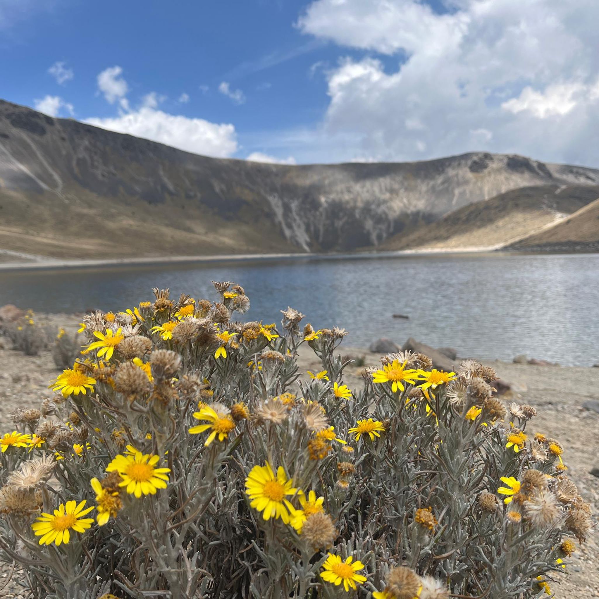
A wonderful place to visit, it's currently easier to access by vehicle (to a certain extent) and with parking. However, if you're someone who enjoys climbing mountains over 4,000 meters from the bottom, I'm sure you'll love the challenge. Don't forget that these are mountains, and weather changes can happen at unexpected times, so it's best to be prepared for anything, bringing hydration and food necessary for the effort and the weather. In the craters, you'll find two bodies of fresh water that form the Laguna del Sol and Laguna de la Luna. In the 1990s, you could dive at altitude in the icy waters. Visibility is very low, so it was done with instruments and good orientation, a dry suit, or a wetsuit for icy waters. Currently, only research personnel can do so with a special permit, as it is an ecological and archaeological reserve. Admission is fee-based, and on weekends, it's very crowded, so be patient and always respect the place. Leave it better than you found it, and enjoy! You can also get there by gravel bike or mountain bike, but achieving this requires good training due to the incline and altitude. Always remember: Respect the Mountain.
2
0


We hiked this summit early November, the view was spectacular, temperatures were just around freezing at the summit, bring warm clothes. Getting there from the east is quite a climb, you will need your hands but it’s definitely doable. (rocks were mostly not covered in snow). We did the route from the parking then lake la Luna, summit, down by the steep path and then lake del sol in 6h tops, lots of pauses included. I would definitely recommend ! This is the recording we made: https://www.komoot.com/tour/551042236?ref=itd&share_token=aPotckuQ28XBpZ7rYokFekbIm64W95bMizIMSrVssC6FisSpS4
2
0

This is simply one of the best mountains out there and it is one of my favourites anywhere I have been. If you are from the UK think the Snowdon Horseshoe at 4,700m with 99% less visitors, permanent sun and a proper confined narrow summit. It has quaint lakes, nice easy scrambling and great views. All within two hours or so from Mexico City. I have a lot of information on this mountain and if you want it as well as route information (standard and the complete rim traverse) please click here: https://www.komoot.com/tour/285726687
6
0
Frequently Asked Questions
How many running routes are available in Calimaya?
There are over 15 running routes available in Calimaya, offering a variety of experiences for different fitness levels. These include easy loops, moderate paths, and more challenging mountain trails.
Are there easy running routes suitable for beginners in Calimaya?
Yes, Calimaya offers several easy running routes perfect for beginners or those looking for a relaxed jog. An example is the Chapel loop from Metepec, which is 4.3 km long and has minimal elevation gain.
What kind of terrain can I expect on Calimaya's running trails?
Calimaya's running trails feature diverse terrain, from relatively flat sections to challenging inclines. The region is situated on the slopes of the Nevado de Toluca and includes Tepemaxalco Mountain, offering varied elevations between 2,600 and 4,578 meters above sea level. You'll find paths through forests of oyamel fir, holm oak, and pine, as well as routes near streams.
Are there any circular running routes in Calimaya?
Yes, many of the running routes in Calimaya are circular, allowing you to start and end at the same point. For instance, the Calvary of Metepec loop from Estacinamiento IMSS Hospital General Regional N. 251 is a popular circular option, as is the La Luna loop from Cabina de Peaje.
What is the best time of year to go jogging in Calimaya?
Calimaya generally experiences a temperate, rainy climate, making it conducive for outdoor activities like jogging for much of the year. Spring offers mild and agreeable temperatures, while autumn brings cooler weather and colorful landscapes, both ideal for running. Even during the rainy season, many streams become more active, adding to the natural beauty.
Are there any running routes with scenic views or landmarks in Calimaya?
Absolutely. Given Calimaya's location on the slopes of the Nevado de Toluca and near Tepemaxalco Mountain, many routes offer breathtaking views of the surrounding landscape. The La Luna loop from Nevado de Toluca, for example, leads through the scenic slopes of the volcano. The area also features natural water springs and dense forests.
What do other runners say about the jogging routes in Calimaya?
The running routes in Calimaya are highly rated by the komoot community, with an average score of 4.5 stars from over 6 reviews. Runners often praise the varied terrain, the natural beauty of the forested areas, and the opportunities for both challenging and relaxed runs.
Are there family-friendly running trails in Calimaya?
While specific 'family-friendly' designations aren't always explicit, routes with lower difficulty grades and shorter distances are generally suitable for families. The Chapel loop from Metepec is an easy option that could be enjoyed by families. The green spaces around Parque Ecológico Zacango also offer opportunities for light jogging or walks.
Can I find routes that offer altitude training opportunities?
Yes, Calimaya's varied topography, with elevations ranging up to 4,578 meters above sea level, especially on the slopes of the Nevado de Toluca, provides excellent opportunities for altitude training. Routes like the Del Sol – Pico del Fraile loop from Cabina de Peaje offer significant elevation gain.
Are there any running routes that pass by natural water features?
Yes, Calimaya is home to several streams, including Las Cruces, Los Temascales, Las Palmas, and El Ojo de Agua. Many of these streams, some seasonal and some year-round, are found within the forested areas on the Nevado de Toluca's slopes, offering refreshing natural settings for your run. The slopes of the Nevado also boast fresh water springs.
What are some longer, more challenging running routes in Calimaya?
For experienced runners seeking a challenge, Calimaya offers several difficult routes with significant elevation gain. The Del Sol – La Luna loop from Cabina de Peaje is a demanding 18.9 km route, and the Estanque de Patos – El Calvario loop from Toluca covers nearly 20 km with notable elevation changes.

Get inspired with the komoot mobile app


Explore more
Browse the best Running Trails & Routes in other regions.
