The best road cycling routes in Tláhuac
4.7
(38)
667
riders
27
rides
Road cycling routes in Tláhuac offer diverse terrain, from volcanic landscapes to tranquil waterways. The region is situated on the edge of the Teuhtli volcano, providing varied elevations and scenic backdrops. Cyclists can also explore the unique chinampas, ancient floating farm fields crisscrossed by canals, which create distinctive routes. Green spaces like the Bosque de Tláhuac further enhance the cycling experience with serene environments.
Best road cycling routes in Tláhuac
- The most popular road cycling route is La Loma Viewpoint…
Last updated: July 1, 2026
5.0
(1)
109
riders
139km
06:53
2,120m
2,110m
Hard road ride. Very good fitness required. Mostly well-paved surfaces and easy to ride.
5.0
(2)
110
riders
142km
07:28
2,380m
2,380m
Hard road ride. Very good fitness required. Mostly well-paved surfaces and easy to ride.

Sign up for free
4.3
(4)
68
riders
54.7km
02:37
730m
730m
Moderate road ride. Good fitness required. Mostly well-paved surfaces and easy to ride.
4.9
(7)
57
riders
52.5km
02:31
740m
740m
Moderate road ride. Good fitness required. Mostly well-paved surfaces and easy to ride.
4.6
(5)
13
riders
32.9km
01:37
400m
400m
Moderate road ride. Good fitness required. Mostly well-paved surfaces and easy to ride.
4.6
(7)
11
riders
31.0km
01:36
550m
550m
Moderate road ride. Good fitness required. Mostly well-paved surfaces and easy to ride.
13
riders
30.2km
01:10
40m
40m
Easy road ride. Great for any fitness level. Mostly well-paved surfaces and easy to ride.
5.0
(1)
7
riders
41.1km
02:09
710m
710m
Moderate road ride. Good fitness required. Mostly well-paved surfaces and easy to ride.
5.0
(1)
6
riders
Moderate road ride. Good fitness required. Mostly well-paved surfaces and easy to ride.
5.0
(1)
5
riders
46.8km
02:15
530m
530m
Moderate road ride. Good fitness required. Mostly well-paved surfaces and easy to ride.
Get access to more routes and recommendations from other explorers.
Sign up for free
Already have an account?
Our route recommendations are based on thousands of hikes, rides, and runs completed by other people on komoot.
Start today with a free account
Your next adventure awaits.
Login or Signup
Popular around Tláhuac

Tips from the Community

Ideal for a final uphill sprint and a break or as a meeting point for the group. 🚴
0
0
Ideal for taking a break with the group and spending some quality time in the shop. 🙌🏼✨
0
0

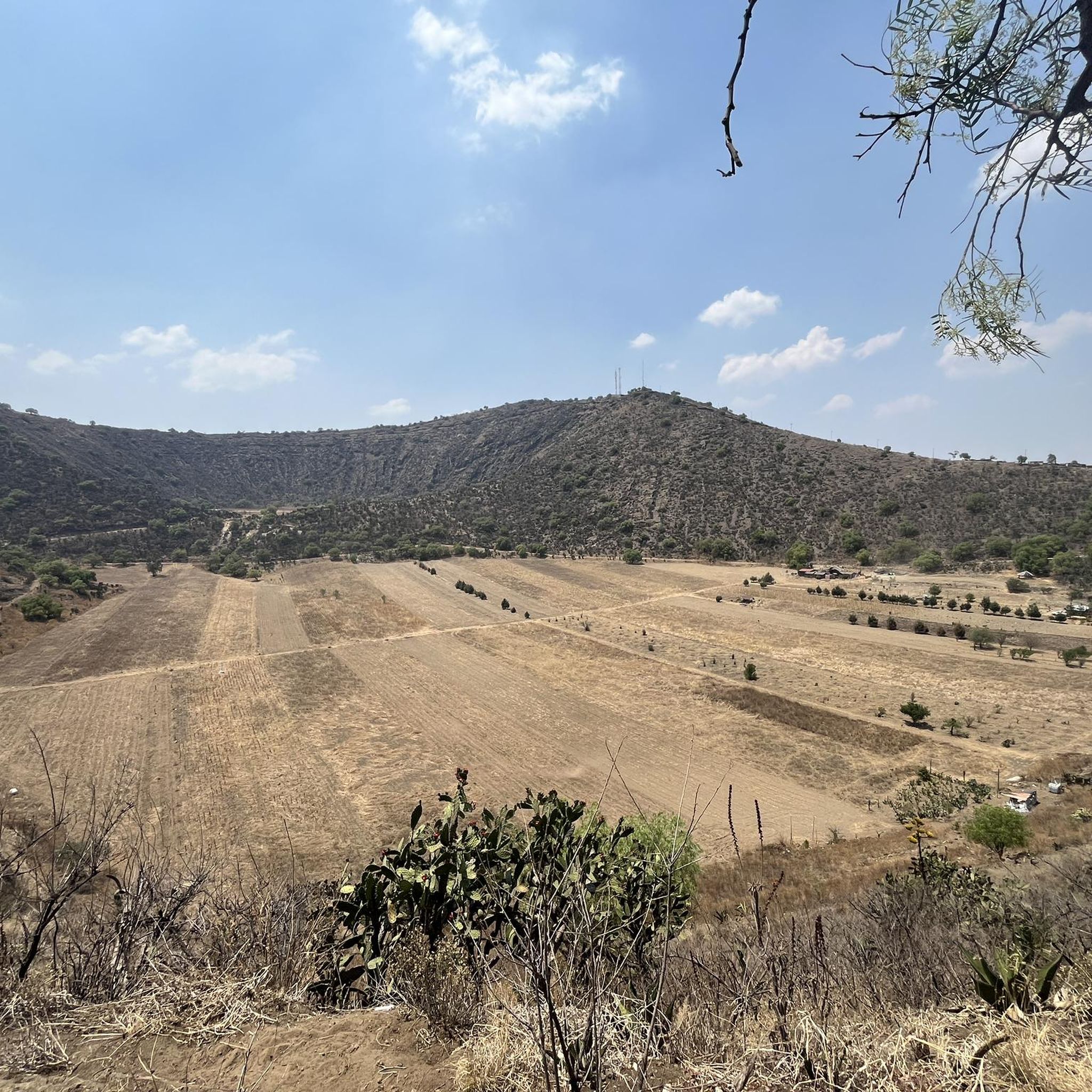
La Loma, a classic cycling spot where the climb from San Gregorio ends (if you're coming from Xochimilco), is also the crowning glory when coming from Tlayacapan (30 km, almost all uphill, 1,200 m total climb) or Juchitepec (8 km, 350 m total climb). You can enjoy the panoramic view with quesadillas, coffee, beer, pulque, etc. Weather permitting, you'll be able to see the volcanoes in the distance. Whether you're heading elsewhere, a stop here is definitely a must. Enjoy the view and have a safe trip to your destination!
2
0
Here, at the point where a state ends and begins, there's a place to eat before descending toward Tlayacapan or continuing uphill toward La Loma, where you can take a break and have some quesadillas on the side of the road before Felipe Neri. On this road with panoramic views of the volcanoes, you can enjoy the descent or ascent (depending on your direction) and the rural landscapes of the area. Fun fact: According to the sign, this is where Mexico City ends, and according to the maps, the State of Mexico.
2
0
a very panoramic view ideal for taking a short break, there are stalls where you can eat with the group.
0
0
This colorful arch welcomes you to Xochimilco (or bids you farewell). It's currently in poor condition but still noticeable. At this point on the climb toward La Loma, you can stop for refreshments if necessary, or simply continue on to your destination or training goal. Fun fact: There's almost always a man at his stall at this point with his dogs and loud music.
2
0
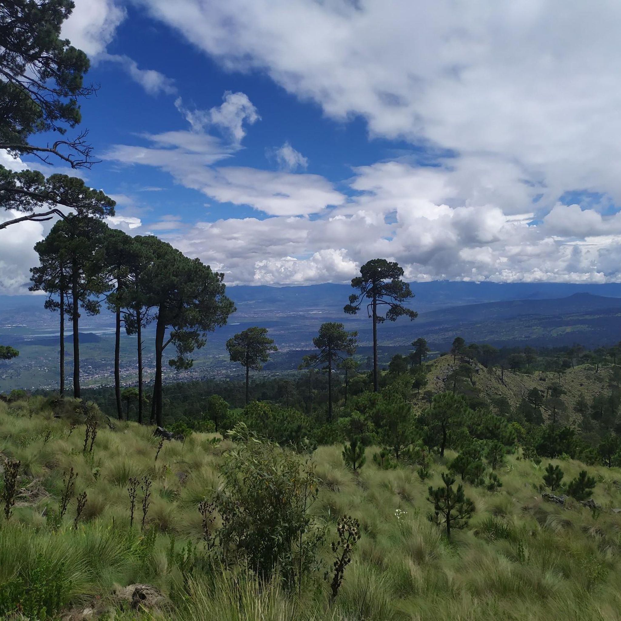
A descent to enjoy the beautiful panoramic view of the volcanoes or an 8km climb to La Loma, which means the route is almost at the end of its climbs. If you're going downhill, the asphalt has some potholes and sections in poor condition, but overall the pavement is good, and the curves are both respectable and enjoyable at good speeds. On the slope, you can enjoy your maximum speed. If you're going uphill, don't forget to carry fluids because the heat can be intense at times, and the maximum incline of 12% will be a nightmare without hydration or carbohydrates. There's plenty of supplies in Juchitepec.
3
0
Frequently Asked Questions
How many road cycling routes are available in Tláhuac?
Tláhuac offers a wide variety of road cycling routes. The komoot community has created over 200 cycling routes in the region, with 28 specifically curated for road biking in this guide. These routes vary significantly in length and elevation, catering to different skill levels.
What kind of terrain can I expect on road cycling routes in Tláhuac?
Road cycling in Tláhuac features diverse terrain. You can expect routes with varied elevations due to the region's proximity to the Teuhtli volcano and the Sierra de Santa Catarina. Additionally, many routes traverse the unique chinampas, ancient floating farm fields crisscrossed by canals, offering tranquil, flatter sections. Green spaces like the Bosque de Tláhuac also provide serene environments for cycling.
Are there easy road cycling routes suitable for beginners in Tláhuac?
Yes, Tláhuac has several easy road cycling routes perfect for beginners. For instance, the Cafetería Moon loop from Xochimilco is an easy 30.2 km trail that takes you through the chinampa waterways with minimal elevation gain, typically completed in about 1 hour 9 minutes.
Where can I find challenging road cycling routes in Tláhuac?
For experienced cyclists seeking a challenge, Tláhuac offers difficult routes with significant elevation gains. An example is the San Lorenzo Viewpoint – La Loma Viewpoint loop from Lomas Estrella, which covers 139.2 km with over 2,100 meters of elevation gain, taking approximately 6 hours 53 minutes to complete.
What scenic views or natural features can I see while road cycling in Tláhuac?
Tláhuac's road cycling routes offer stunning natural beauty. You'll encounter dramatic backdrops from the Teuhtli volcano and picturesque scenery from the Sierra de Santa Catarina. Many routes also wind through the unique chinampas and wetlands, including areas around the Lake of the Aztec Kings, providing tranquil views of historical agricultural landscapes and abundant flora. The Bosque de Tláhuac offers serene rides amidst pirul, eucalyptus, and oak trees.
Are there any cultural or historical landmarks accessible by road bike in Tláhuac?
While road cycling, you can experience the historical agricultural landscape of the chinampas, which are ancient floating farm fields. The Bosque de Tláhuac also hosts FARO Tláhuac, a cultural center, which can be a point of interest during your ride.
Are there any circular road cycling routes in Tláhuac?
Yes, many road cycling routes in Tláhuac are designed as loops, allowing you to start and end at the same point. Examples include the San Lorenzo Viewpoint – La Loma Viewpoint loop from Xochimilco, a moderate 54.7 km ride, and the San Lorenzo Viewpoint – La Loma Viewpoint loop from Tláhuac, a 52.5 km moderate route.
What do other road cyclists enjoy most about the routes in Tláhuac?
The road cycling routes in Tláhuac are highly rated by the komoot community, with an average score of 4.75 stars from over 30 reviews. Cyclists often praise the diverse terrain, from challenging volcanic landscapes to the unique and tranquil chinampa waterways, and the well-maintained green spaces like the Bosque de Tláhuac.
Are there family-friendly road cycling options in Tláhuac?
Yes, Tláhuac offers family-friendly cycling options, particularly within the Bosque de Tláhuac. This significant forest park features dedicated bike trails and a serene environment, making it suitable for families. The park also has additional facilities like a petting zoo, enhancing the overall family experience.
Is parking available near road cycling routes in Tláhuac?
While specific parking details for every route vary, major recreational areas like the Bosque de Tláhuac typically offer parking facilities. When planning your ride, it's advisable to check the starting point of your chosen route for nearby parking options.
Can I reach road cycling routes in Tláhuac using public transport?
Tláhuac is part of Mexico City's metropolitan area, and public transport options are generally available. Depending on your starting point, you may be able to reach various route access points via local buses or the Mexico City Metro system. It's recommended to research specific public transport connections to your desired route's starting location.
Are there places to eat or drink near the road cycling routes?
Yes, as a vibrant part of Mexico City, Tláhuac has various cafes and eateries. Routes passing through urbanized areas or near popular parks like the Bosque de Tláhuac will likely have options for refreshments. For example, the Cafetería Moon loop from Xochimilco suggests a cafe in its name, indicating such amenities are available.

Get inspired with the komoot mobile app


Explore more
Browse the best Road cycling routes in other regions.
