The best walks and hikes in Patzicía
4.9
(63)
1,804
hikers
6
hikes
Hiking trails in Patzicía are situated within the Guatemalan Highlands, an area characterized by mountainous terrain, dramatic valleys, and extensive agricultural lands. The region features traditional adobe villages and natural elements like the Río Xayá and Montaña El Soco nature reserve. Patzicía serves as a point of interest for multi-day treks, integrating into broader regional hiking networks. These routes often involve varied terrains and cultural immersion through local communities.
Best hiking trails in Patzicía
- The most popular hiking route is…
Last updated: July 5, 2026
4.8
(19)
731
hikers
12.8km
07:20
1,340m
1,340m
Hard hike. Very good fitness required. Sure-footedness, sturdy shoes and alpine experience required.
4.8
(19)
320
hikers
13.2km
08:02
1,550m
1,550m
Hard hike. Very good fitness required. Sure-footedness, sturdy shoes and alpine experience required.

Sign up for free
4.8
(20)
694
hikers
13.2km
06:56
1,150m
1,150m
Hard hike. Very good fitness required. Mostly accessible paths. Sure-footedness required.
5.0
(4)
36
hikers
13.3km
08:00
1,540m
1,540m
Hard hike. Very good fitness required. Sure-footedness, sturdy shoes and alpine experience required.
4
hikers
19.8km
11:38
2,270m
2,270m
Hard hike. Very good fitness required. Sure-footedness, sturdy shoes and alpine experience required.
Our route recommendations are based on thousands of hikes, rides, and runs completed by other people on komoot.
Start today with a free account
Your next adventure awaits.
Login or Signup
Popular around Patzicía

Tips from the Community


hike without any difficulty, just a little more elevation after a big climb before but worth the detour
0
0
Perfect place to sleep! A few places to put up the tent and admire the view without being in the boxes with everyone else.
1
0

Just self-guided Acatenango with three friends (overnight). We didn't find much of the critical information out there but we think there is some stuff you should know before self-guiding it. It's too much for this comment so check out the comments I posted on my completed hike: https://www.komoot.es/tour/1968201751?ref=aso (If that link doesn't lead you anywhere, check under my completed trails for the Acatenango one of november 2024.)
2
1

For the evening and night, it is definitely advisable to bring warm clothing and gloves, as it gets very cold at night at this altitude. In exposed places like the summit, it can also be quite windy.
3
0
The eruptions occur every few minutes and usually last only a few seconds.
2
0
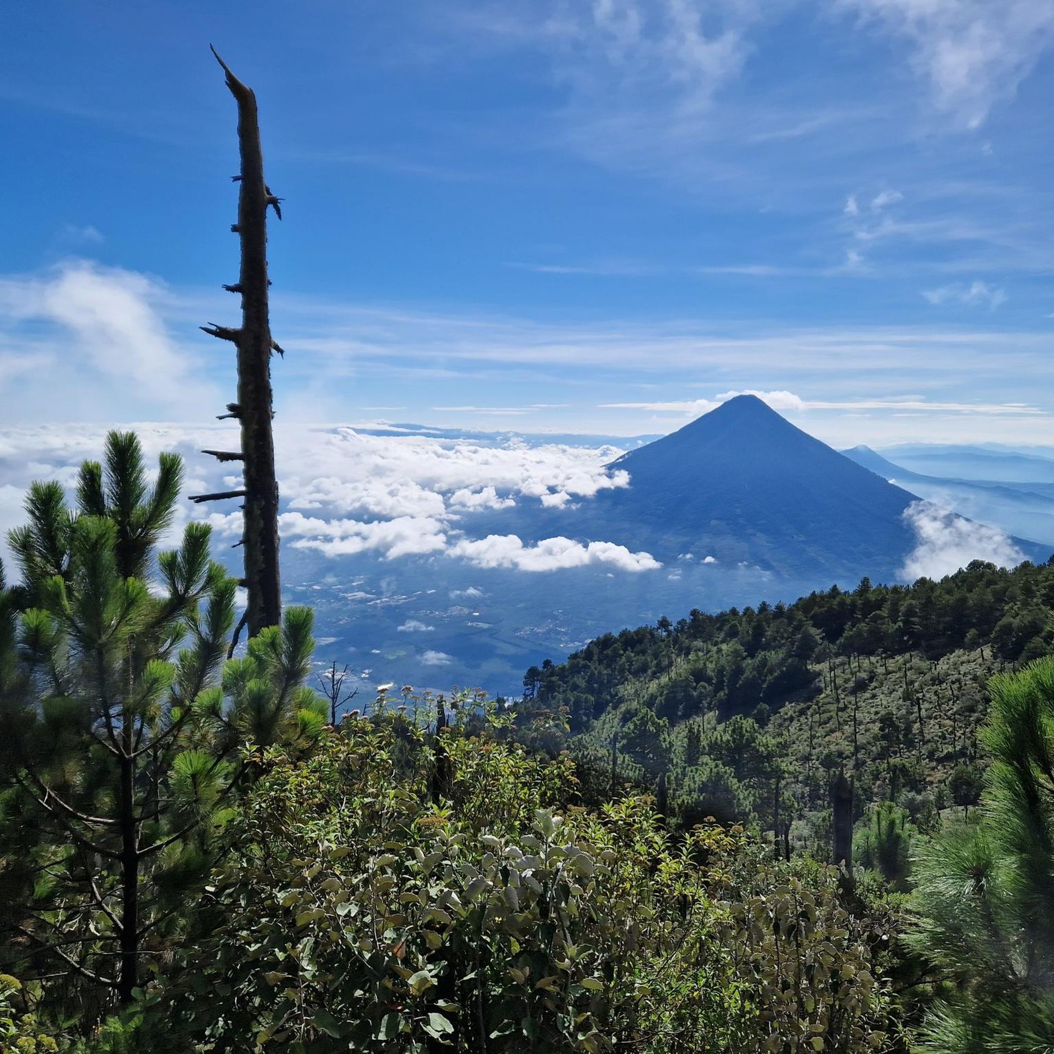
If you stand on the slope of Fuego and look across to Acatenango, you can see several "campamentos" on its flanks. At night, the eruptions of Fuego are even more spectacular because you can see the glowing red lava fountains.
3
0

The 2-day tour on the Acatenango is quite exhausting but a unique experience. During the day you can see the ash clouds and at night the spraying lava. Don't go too fast on the hike up, the thin air at almost 4,000 meters shouldn't be underestimated.
2
1
Frequently Asked Questions
What is the general difficulty level of hiking trails around Patzicía?
Hiking trails in the Patzicía area are generally considered challenging. All routes listed are rated as difficult, often involving significant elevation gains and longer durations. For example, the Summit of Volcán de Acatenango – Acatenango Base Camps loop from Miratenango is a difficult 7.6-mile trail with over 1,300 meters of ascent.
Are there any easy or family-friendly hiking options in Patzicía?
The hiking routes directly associated with Patzicía, particularly those around Volcán de Acatenango, are rated as difficult and involve high altitudes and strenuous climbs. There are no easy or moderate trails listed in the immediate vicinity, suggesting that these routes may not be suitable for young children or those seeking a leisurely walk.
What kind of natural landscapes can I expect to see while hiking near Patzicía?
Hiking near Patzicía offers a diverse experience within the Guatemalan Highlands. You'll traverse mountainous terrain, dramatic valleys, and extensive agricultural lands. The region is also home to natural features such as the Río Xayá and the Montaña El Soco nature reserve, providing opportunities to experience local flora and fauna amidst traditional adobe villages.
Are there any circular hiking routes available?
Yes, several routes in the area are circular loops. For instance, the challenging View of Volcán de Fuego – Summit of Volcán de Acatenango loop from la Soledad offers a full circuit, providing continuous scenic views during your ascent and descent.
What is the best time of year to go hiking in Patzicía?
The Guatemalan Highlands generally experience a dry season from November to April and a rainy season from May to October. For hiking, the dry season is often preferred for more stable weather conditions and clearer views, especially when tackling high-altitude routes like those around Volcán de Acatenango.
What should I wear or bring for hiking in Patzicía?
Given the mountainous terrain and high altitudes, it's crucial to be prepared. Layers of clothing are recommended to adapt to changing temperatures, especially at higher elevations. Sturdy hiking boots, rain gear (even in the dry season, as mountain weather can be unpredictable), sun protection, and sufficient water and snacks are essential. For routes like the Start of the Acatenango hike – End of the Trail loop from la Soledad, which involves volcanic landscapes, appropriate footwear is particularly important.
Do I need any special permits to hike the trails around Patzicía?
While specific permits for general hiking in the immediate Patzicía area are not broadly required, some multi-day treks or guided expeditions, especially those involving volcano ascents, may have entry fees or require registration with local authorities or tour operators. It's advisable to check with local guides or information centers if you plan a multi-day or high-altitude trek.
What do other hikers enjoy most about the trails in Patzicía?
The trails in Patzicía are highly rated by the komoot community, with an average score of 5.0 stars from over 40 reviews. Hikers frequently praise the dramatic volcanic landscapes, the challenging yet rewarding ascents, and the unique cultural immersion experienced when passing through local communities. The views of active volcanoes like Fuego are often highlighted as a major draw.
Are there opportunities for wildlife spotting along the hiking trails?
While specific wildlife sightings are not guaranteed, the diverse ecosystems of the Guatemalan Highlands, including areas like the Montaña El Soco nature reserve, offer potential for observing local bird species and other small animals. The blend of agricultural lands and natural forests provides varied habitats.
Can I find parking or specific trailheads for these hikes?
Many of the prominent hikes, particularly those leading to Volcán de Acatenango, often start from villages like La Soledad. These villages typically have designated areas for parking or serve as common drop-off points for guided tours. It's recommended to confirm specific trailhead access and parking arrangements with local guides or tour operators, especially for longer or more remote routes like the Acatenango Volcano – Summit of Volcán de Acatenango loop from la Soledad.
Are there any multi-day trekking opportunities that include Patzicía?
Yes, Patzicía serves as a strategic point within broader regional hiking networks. It is often included as a stop on multi-day treks through the Guatemalan Highlands, such as routes connecting Antigua to Lake Atitlán. These longer treks offer a deep cultural immersion and a comprehensive experience of the region's varied terrains.
What makes hiking in Patzicía a unique cultural experience?
Hiking in Patzicía offers a unique blend of natural beauty and cultural immersion. Routes often traverse through traditional adobe villages and extensive crop fields, allowing hikers to witness authentic Guatemalan life. The region's mountainous agrarian culture provides a rich backdrop to your outdoor adventure, distinguishing it from purely wilderness treks.
Are there any hikes that offer views of Volcán de Fuego?
Absolutely. Several challenging routes provide stunning views of the active Volcán de Fuego. The Volcán de Fuego – Acatenango Base Camps loop from la Soledad is a prime example, offering hikers a unique perspective of this impressive natural landmark during their ascent to Acatenango's base camps.
Most popular routes in Patzicía

Get inspired with the komoot mobile app


Didn’t find what you were looking for?
Check out more Hikes throughout Patzicía below and find the perfect route in your destination.
Explore more
Browse the best Hikes in other regions.
