The best road cycling routes in Aibonito
3.2
(6)
219
riders
27
rides
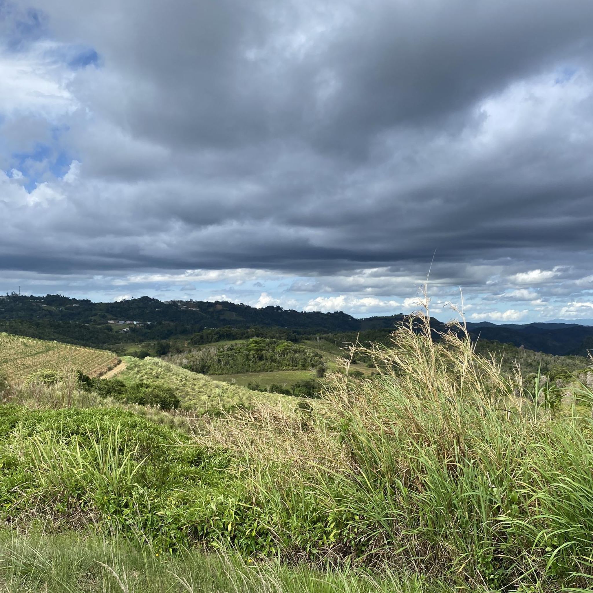
Road cycling in Aibonito, located in Puerto Rico's Central Mountain Range, offers routes through elevated landscapes. The region is characterized by mountainous terrain with significant elevation gains, winding roads, and lush, verdant hills. Aibonito is situated at an altitude of approximately 2,401 feet above sea level, providing a cooler environment for cycling. The landscape features rolling hills and diverse flora, creating varied backdrops for rides.
Best road cycling routes in Aibonito
- The most popular road cycling route is El Torito – Great Sight loop from Servidumbre Escénica Montes Oscuros, a 42.4 miles (68.3 km) trail that takes 3 hours 48 minutes to complete. This difficult route features challenging climbs and panoramic views across the mountainous terrain.
- Another top favourite among local road cyclists is Mirador La Plata – Casilla Caminero loop from Aibonito, a moderate 29.8 miles (48.0 km) path. This route winds through the central mountains, offering varied terrain and elevation changes.
- Local road cyclists also love the Gianos loop from Aibonito, a 7.6 miles (12.2 km) trail leading through rolling hills and lush greenery, often completed in about 38 minutes.
- Road cycling in Aibonito is defined by mountainous terrain, winding roads, and lush, verdant hills. The network offers options for different ability levels, from easy loops to challenging climbs.
- The routes in Aibonito are highly rated by the komoot community with an average score of 3.2 stars from over 5 reviews. More than 180 road cyclists have used komoot to explore Aibonito's varied terrain.
Last updated: June 25, 2026
3.0
(1)
30
riders
69.5km
03:49
1,440m
1,440m
Hard road ride. Very good fitness required. Mostly well-paved surfaces and easy to ride.
29
riders
52.0km
02:51
960m
960m
Hard road ride. Very good fitness required. Mostly well-paved surfaces and easy to ride.

Sign up for free
9
riders
74.0km
03:56
1,270m
1,270m
Hard road ride. Very good fitness required. Mostly well-paved surfaces and easy to ride.
3.0
(1)
23
riders
46.5km
02:23
770m
770m
Moderate road ride. Good fitness required. Mostly well-paved surfaces and easy to ride.
12
riders
40.3km
02:15
860m
860m
Moderate road ride. Good fitness required. Some segments of this route may be unpaved and difficult to ride.
10
riders
40.0km
02:45
310m
310m
Moderate road ride. Good fitness required. Some segments of this route may be unpaved and difficult to ride.
4.0
(2)
9
riders
31.1km
01:33
480m
480m
Moderate road ride. Good fitness required. Mostly well-paved surfaces and easy to ride.
8
riders
49.1km
02:03
130m
130m
Moderate road ride. Good fitness required. Mostly well-paved surfaces and easy to ride.
3.0
(1)
9
riders
25.8km
01:19
450m
450m
Moderate road ride. Good fitness required. Mostly well-paved surfaces and easy to ride.
11
riders
59.8km
03:38
1,440m
1,440m
The El Torito loop from Cayey plunges you into the mountainous heart of Puerto Rico, offering a road cycling experience defined by its dramatic elevation changes and sweeping vistas. As you navigate the winding roads, you'll be treated to panoramic viewpoints overlooking lush green hills and valleys, with the occasional river or stream adding to the scenic beauty. This 37.2-mile (59.8 km) route, with its 4726 feet (1440 metres) of climbing, is a difficult undertaking that promises both a physical test and stunning natural scenery over approximately 3 hours and 37 minutes.
Planning your ride means preparing for a challenging day. Starting from Cayey, you'll find the roads mostly well-paved, but be aware that some segments might be unpaved and quite difficult to ride, potentially requiring you to push your bike. The higher elevation around Cayey means a cooler climate than the coast, which can make for a more pleasant ride, especially if you set out early in the day.
This loop is highly regarded among local road cyclists, known as a hard road ride that demands very good fitness. It's not just about the challenge; the El Torito loop is celebrated for its notable scenic areas and its reputation as an excellent route for endurance training and enhancing overall cycling performance. It truly stands out as one of the best road cycling routes in the Cayey area for experienced riders.
Get access to more routes and recommendations from other explorers.
Sign up for free
Already have an account?
Our route recommendations are based on thousands of hikes, rides, and runs completed by other people on komoot.
Start today with a free account
Your next adventure awaits.
Login or Signup




Tips from the Community

Visit this spot to get one of the best views of southern Puerto Rico
0
0
Frequently Asked Questions
What kind of terrain can I expect when road cycling in Aibonito?
Aibonito, known as the "Switzerland of Puerto Rico," offers predominantly mountainous terrain with significant elevation gains. You'll encounter winding roads through lush, verdant hills, providing both challenging climbs and panoramic views. The town itself is situated at approximately 2,401 feet above sea level, ensuring a consistently elevated cycling experience.
Are there road cycling routes suitable for beginners in Aibonito?
Yes, Aibonito offers a few easier road cycling options. For instance, the Gianos loop from Aibonito is an easy 7.9-mile (12.7 km) trail with around 218 meters of elevation gain, typically completed in about 42 minutes. Another accessible option is the Roadbike loop from Servidumbre Escénica Montes Oscuros, which is 37.3 km long with 263 meters of elevation gain.
What are the most challenging road cycling routes in Aibonito?
For experienced cyclists seeking a challenge, Aibonito has several difficult routes. The Mirador Lago de Cidra – Casilla Caminero loop from Cayey is one of the longest and most demanding, covering 89.3 km with over 1500 meters of elevation gain. Another difficult option is the Great Sight loop from Cayey, a 71.9 km route featuring challenging climbs and panoramic views.
What is the best time of year to go road cycling in Aibonito?
Aibonito experiences a mild tropical rainforest climate due to its elevation, making it one of Puerto Rico's coolest towns. This cooler, often foggy weather provides comfortable conditions for road cycling throughout the year, especially when compared to the warmer coastal areas. However, the annual Festival de las Flores in summer showcases the town's vibrant flora, adding a colorful backdrop to rides during that season.
Are there any scenic viewpoints along the road cycling routes in Aibonito?
Yes, Aibonito's mountainous landscape is dotted with scenic viewpoints. While specific routes may pass by them, the region is known for spots like Mirador La Piedra Degetau, which offers panoramic views of the lush valleys and mountains. Many routes, such as the Great Sight loop from Cayey, are specifically noted for their panoramic vistas across the mountainous terrain.
What natural features can I expect to see while cycling in Aibonito?
Aibonito is rich in natural beauty. You'll cycle through verdant landscapes, rolling hills, and diverse flora, especially prominent during the Festival de las Flores. The region is also close to the breathtaking Cañón de San Cristóbal, which features natural pools and stunning waterfalls like Salto La Vaca, the island's highest. While the canyon itself is more for hiking, roads leading to and around it offer dramatic views.
How long do road cycling routes in Aibonito typically take to complete?
Route durations vary significantly based on distance and difficulty. Easy routes, like the Gianos loop from Aibonito (12.7 km), can be completed in under an hour. Moderate routes, such as the Mirador La Plata – Casilla Caminero loop from El Coquí (48.0 km), typically take around 2.5 hours. The most difficult and longest routes, like the Mirador Lago de Cidra – Casilla Caminero loop from Cayey (89.3 km), can take over 4.5 hours.
Are there any circular road cycling routes available in Aibonito?
Yes, many of the road cycling routes in Aibonito are designed as loops, allowing you to start and end in the same location. Examples include the Gianos loop from Aibonito, the Mirador La Plata – Casilla Caminero loop from El Coquí, and the Gianos – Great Sight loop from Barrio Sabana Llana, among others.
What do other road cyclists say about their experience in Aibonito?
The road cycling routes in Aibonito are highly rated by the komoot community, with an average score of 3.25 stars from 5 reviews. Over 170 road cyclists have used komoot to explore the varied terrain, often praising the challenging climbs, panoramic views, and the refreshing, cooler climate of the region.
How many road cycling routes are available in Aibonito?
There are 25 road cycling routes available in Aibonito, catering to various fitness levels. This includes 2 easy routes, 11 moderate routes, and 12 difficult routes, ensuring options for both casual riders and experienced cyclists seeking a challenge.
Can I find routes that combine different areas or landmarks in Aibonito?
Absolutely. Many routes are designed to traverse multiple areas, offering a diverse experience. For example, the Gianos – Great Sight loop from Barrio Sabana Llana combines two distinct areas, providing a comprehensive tour of the region's landscapes and viewpoints.
Are there any specific routes that offer a good workout with significant elevation gain?
Aibonito is ideal for cyclists looking for significant elevation gain. Routes like the Mirador Lago de Cidra – Casilla Caminero loop from Cayey feature over 1500 meters of ascent, while the Great Sight loop from Cayey includes nearly 1500 meters of climbing, ensuring a challenging and rewarding workout.
Most popular routes in Aibonito

Get inspired with the komoot mobile app


Didn’t find what you were looking for?
Check out more Road cycling routes throughout Aibonito below and find the perfect route in your destination.
Explore more
Browse the best Road cycling routes in other regions.
